2 AM:
Southwestern Caribbean Sea:
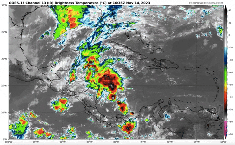
A large area of disorganized showers and thunderstorms over the
southwestern Caribbean Sea is associated with a broad trough of low
pressure. Environmental conditions appear marginally conducive for
development of this system, and a tropical depression could form
late this week while the system begins moving northeastward across
the western and central portions of the Caribbean Sea. Interests in
Jamaica, Cuba, Haiti, the Dominican Republic, the southeastern
Bahamas, and the Turks and Caicos Islands should monitor the
progress of this system. Regardless of development, this system has
the potential to produce heavy rains over portions of the Caribbean
coast of Central America and the Greater Antilles through the end of
this week.
* Formation chance through 48 hours...low...30 percent.
* Formation chance through 7 days...medium...50 percent.
8 AM:
Southwestern Caribbean Sea:
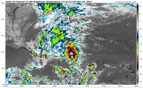
A broad area of disorganized showers and thunderstorms over the
southwestern Caribbean Sea is associated with a trough of low
pressure. Environmental conditions appear marginally conducive for
development of this system, and a tropical depression could still
form by the weekend while the system begins moving northeastward
across the western and central portions of the Caribbean Sea.
Interests in Jamaica, Cuba, Haiti, the Dominican Republic, the
southeastern Bahamas, and the Turks and Caicos Islands should
monitor the progress of this system. Regardless of development, this
system has the potential to produce heavy rains over portions of the
Caribbean coast of Central America and the Greater Antilles through
the weekend.
* Formation chance through 48 hours...low...30 percent.
* Formation chance through 7 days...medium...50 percent.