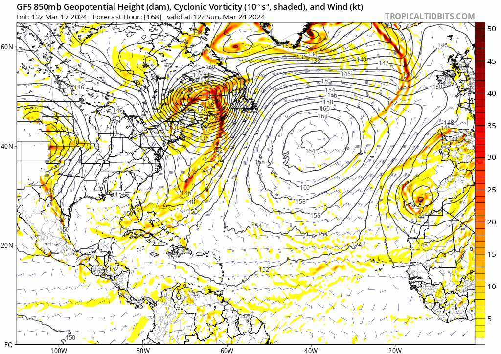
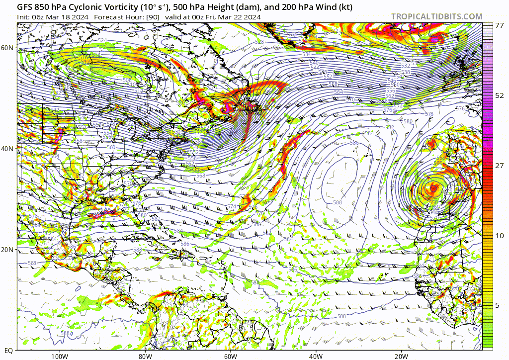
kevin wrote:12z GFS has a subtropical-esque system of the coast of Florida at +200 hrs. There are also some other model runs which show some weak subtropical activity in the long range, albeit all from different origins and thus not really consistent. Almost certainly not gonna happen considering the time range, but the fact that stuff like this occurs in some model runs does show how anomalously high the SSTs already are (especially taking into account that there has only been a single TC in the month of March since 1851).
https://i.imgur.com/GjtfyO7.png
At this range, there's fairly decent consensus among the deterministic and ensemble guidance that throughout next week the subtropical jet will be roaring across the Gulf due to a blocking ridge setting up over the western U.S. this weekend. As one might expect, a few upper level shortwave troughs are probably going to speed along that jet, and with the comparatively reduced atmospheric stability over the Gulf (especially over the >25C waters of the Loop Current), that might help ignite some localized areas of stronger rising motion and convection when a subtle trough swings by, as depicted in that particular GFS run for example.
That might produce localized areas of heavier precipitation and gusty or potentially damaging winds, but would probably not lead to something particularly noteworthy from a tropical or even subtropical perspective. Any vortex that develops in that sort of environment is going to fly across the Gulf in 24 hours (or less) and would be subjected to more than 80 kt of shear (and that's low-balling it; model outputs right now depict over
100 kt of deep-layer wind shear across the region).