ENSO Updates (2007 thru 2023)
Moderator: S2k Moderators
Forum rules

The posts in this forum are NOT official forecasts and should not be used as such. They are just the opinion of the poster and may or may not be backed by sound meteorological data. They are NOT endorsed by any professional institution or STORM2K. For official information, please refer to products from the National Hurricane Center and National Weather Service.
-
weeniepatrol

- Category 3

- Posts: 857
- Joined: Sat Aug 22, 2020 5:30 pm
- Location: WA State
Re: ENSO Updates
November pdo came in at -2.52. This is the coolest the pdo has been since 1961.
3 likes
-
Category5Kaiju

- Category 5

- Posts: 3352
- Age: 22
- Joined: Thu Dec 24, 2020 12:45 pm
- Location: Seattle
Re: ENSO Updates
weeniepatrol wrote:November pdo came in at -2.52. This is the coolest the pdo has been since 1961.
Looking back at the ENSO year database, 1962 was a cool neutral year. I know historical comparisons do not tell the story of future ENSO states/years, but something tells me that next year is going to likely be some kind of neutral, and the warming won't be significant and rapid enough for an El Nino to come back
0 likes
Unless explicitly stated, all information covered in my posts is based on my opinions and observations. Please refer to a professional meteorologist or an accredited weather research agency otherwise, especially if serious decisions must be made in the event of a potentially life-threatening tropical storm or hurricane.

Re: ENSO Updates
weeniepatrol wrote:November pdo came in at -2.52. This is the coolest the pdo has been since 1961.
What impact on Southeastern winter could this have?
0 likes
The above post is not official and should not be used as such. It is the opinion of the poster and may or may not be backed by sound meteorological data. It is not endorsed by any professional institution or storm2k.org. For official information, please refer to the NHC and NWS products.
-
Yellow Evan

- Professional-Met

- Posts: 15951
- Age: 25
- Joined: Fri Jul 15, 2011 12:48 pm
- Location: Henderson, Nevada/Honolulu, HI
- Contact:
Re: ENSO Updates
Hammy wrote:weeniepatrol wrote:November pdo came in at -2.52. This is the coolest the pdo has been since 1961.
What impact on Southeastern winter could this have?
IIRC -PDO leads to drier/warmer Southeastern United States.
0 likes
-
DorkyMcDorkface

- Category 2

- Posts: 694
- Age: 26
- Joined: Mon Sep 30, 2019 1:32 pm
- Location: Mid-Atlantic
Re: ENSO Updates
I should stop abandoning this place, lol
Wondering if the Nina will peak soon...
https://twitter.com/webberweather/status/1473352691451633669
With that being said I'm not sure how plausible a Nino would be given the -PDO as previously mentioned. You'd think it would serve to handicap any stronger +ENSO event. Perhaps a weaker one could occur though (warm-neutral/weak El Nino). Obviously too early to speculate any of that really, wait for the Spring Predictability Barrier to start making more definitive claims.
1 likes
Floyd 1999 | Isabel 2003 | Hanna 2008 | Irene 2011 | Sandy 2012 | Isaias 2020
-
cycloneye

- Admin

- Posts: 139049
- Age: 67
- Joined: Thu Oct 10, 2002 10:54 am
- Location: San Juan, Puerto Rico
Re: ENSO Updates
SOI tanked today but will it be a trend down or is a one day thing?

0 likes
Visit the Caribbean-Central America Weather Thread where you can find at first post web cams,radars
and observations from Caribbean basin members Click Here
and observations from Caribbean basin members Click Here
-
Yellow Evan
- Professional-Met
- Posts: 15951
- Age: 25
- Joined: Fri Jul 15, 2011 12:48 pm
- Location: Henderson, Nevada/Honolulu, HI
- Contact:
-
cycloneye
- Admin
- Posts: 139049
- Age: 67
- Joined: Thu Oct 10, 2002 10:54 am
- Location: San Juan, Puerto Rico
Re: ENSO Updates
0 likes
Visit the Caribbean-Central America Weather Thread where you can find at first post web cams,radars
and observations from Caribbean basin members Click Here
and observations from Caribbean basin members Click Here


Re: ENSO Updates
DorkyMcDorkface wrote:I should stop abandoning this place, lol
Wondering if the Nina will peak soon...
https://twitter.com/webberweather/status/1473352691451633669
With that being said I'm not sure how plausible a Nino would be given the -PDO as previously mentioned. You'd think it would serve to handicap any stronger +ENSO event. Perhaps a weaker one could occur though (warm-neutral/weak El Nino). Obviously too early to speculate any of that really, wait for the Spring Predictability Barrier to start making more definitive claims.
https://twitter.com/WorldClimateSvc/status/1473679683774558223
After looking at recent tweets such as these, the westerly wind burst events that are already starting, and the massive downwelling Kelvin Wave already brewing in the western Pacific.....I smell an oncoming El Nino.
0 likes
-
Kingarabian

- S2K Supporter

- Posts: 15434
- Joined: Sat Aug 08, 2009 3:06 am
- Location: Honolulu, Hawaii
Re: ENSO Updates
Yellow Evan wrote::uarrow: SOI is really noisy and probably an outdated ENSO metric at this point.
Only if you look at the daily. 30 day average is very good for MJO tracking. 90 day cannot be beat for ENSO. SOI is still the most reliable ENSO tool to date.
0 likes
RIP Kobe Bryant
-
Kingarabian
- S2K Supporter
- Posts: 15434
- Joined: Sat Aug 08, 2009 3:06 am
- Location: Honolulu, Hawaii
Re: ENSO Updates
La Nina is peaking for sure. It reaching below -1.0C was always a stretch considering the subsurface anomalies. But we do need more PDO, PMM and even SOI support starting in late January through February for there to be any shot of +ENSO in the summer.
2 likes
RIP Kobe Bryant
-
weeniepatrol
- Category 3
- Posts: 857
- Joined: Sat Aug 22, 2020 5:30 pm
- Location: WA State
Re: ENSO Updates
Kingarabian wrote:La Nina is peaking for sure. It reaching below -1.0C was always a stretch considering the subsurface anomalies. But we do need more PDO, PMM and even SOI support starting in late January through February for there to be any shot of +ENSO in the summer.
huh? Subsurface is and has been colder than last year, with another upwelling kelvin wave pushing east now. In fact the entire thermocline is much cooler than last year at this time
0 likes
-
Kingarabian
- S2K Supporter
- Posts: 15434
- Joined: Sat Aug 08, 2009 3:06 am
- Location: Honolulu, Hawaii
Re: ENSO Updates
weeniepatrol wrote:Kingarabian wrote:La Nina is peaking for sure. It reaching below -1.0C was always a stretch considering the subsurface anomalies. But we do need more PDO, PMM and even SOI support starting in late January through February for there to be any shot of +ENSO in the summer.
huh? Subsurface is and has been colder than last year, with another upwelling kelvin wave pushing east now. In fact the entire thermocline is much cooler than last year at this time
Depending on the chart you're looking at. There's a lot of offline buoy sensors that are playing a role in GODAS/PENTAD overcooking those cooler than normal anomalies.
If you look at La Nina's that were actually moderate strength, the TAO buoy subsurface profiles were cooler than what is currently present and what was observed. -5C at the subsurface shouldve resulted in ateast -1.5C readings over Nino 3.4 which never occurred.
1 likes
RIP Kobe Bryant
-
Yellow Evan
- Professional-Met
- Posts: 15951
- Age: 25
- Joined: Fri Jul 15, 2011 12:48 pm
- Location: Henderson, Nevada/Honolulu, HI
- Contact:
Re: ENSO Updates
Kingarabian wrote:Yellow Evan wrote::uarrow: SOI is really noisy and probably an outdated ENSO metric at this point.
Only if you look at the daily. 30 day average is very good for MJO tracking. 90 day cannot be beat for ENSO. SOI is still the most reliable ENSO tool to date.
Equatorial SOI - the pressure difference Indonesia and the 80-130W at the equator is better as the SOI is also influenced by the IOD and the SPMM.
0 likes
-
Category5Kaiju
- Category 5
- Posts: 3352
- Age: 22
- Joined: Thu Dec 24, 2020 12:45 pm
- Location: Seattle
Re: ENSO Updates
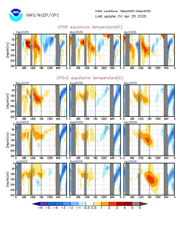
Obviously I know this is not set in stone, but in order for an El Nino to happen next winter wouldn't there have to be a continuously rising pool of warm water throughout the mid to later parts of next year? It looks like Cfv2 sees a warmup but with this warmup not being quite strong and persistent enough to trigger an El Nino. As of now I personally see a very low chance of a La Nina, a moderate chance of El Nino, but a high chance of neutral.
2 likes
Unless explicitly stated, all information covered in my posts is based on my opinions and observations. Please refer to a professional meteorologist or an accredited weather research agency otherwise, especially if serious decisions must be made in the event of a potentially life-threatening tropical storm or hurricane.
-
Yellow Evan
- Professional-Met
- Posts: 15951
- Age: 25
- Joined: Fri Jul 15, 2011 12:48 pm
- Location: Henderson, Nevada/Honolulu, HI
- Contact:
Re: ENSO Updates
With the current -TNH/PNA and ridging over the Aleutian Islands, we’re likely to remain near record -PDO territory for the foreseeable future. Given that plus the fact that a La Niña is of moderate intensity already exists, and the presence of the WAM that halts serious ENSO movement during the boreal summer, I’m almost comfortable completely ruling out a Niño at this point for 2022.
5 likes
-
DorkyMcDorkface
- Category 2
- Posts: 694
- Age: 26
- Joined: Mon Sep 30, 2019 1:32 pm
- Location: Mid-Atlantic
Re: ENSO Updates
WiscoWx02 wrote:DorkyMcDorkface wrote:I should stop abandoning this place, lol
Wondering if the Nina will peak soon...
https://twitter.com/webberweather/status/1473352691451633669
With that being said I'm not sure how plausible a Nino would be given the -PDO as previously mentioned. You'd think it would serve to handicap any stronger +ENSO event. Perhaps a weaker one could occur though (warm-neutral/weak El Nino). Obviously too early to speculate any of that really, wait for the Spring Predictability Barrier to start making more definitive claims.
https://twitter.com/WorldClimateSvc/status/1473679683774558223
After looking at recent tweets such as these, the westerly wind burst events that are already starting, and the massive downwelling Kelvin Wave already brewing in the western Pacific.....I smell an oncoming El Nino.
The more fluid MJO propagation will definitely serve to chip away at the Niña and warm the ENSO regions, but again, we'll have to watch how the NEPac evolves with the PDO (and PMM to an extent). It's a factor we really haven't had to consider over the past few years regardless of the ENSO state (we've were in a consistently +PDO regime from 2014-2019 hence why the EPAC had such an amazing active streak within those years). It's definitely something to keep an eye on, especially if it maintains itself by the time the WAM/ASW comes swooping in by the summer to complicate things. The two most recent Niño events (2018-19 and 2019-20) were relatively weak in nature and late-developing, and part of the reason as to why is the current dominant -VP regime over Africa slowing down the process until late fall/winter and thus limiting the window for it to really bloom.
With that being said, given prior history with second year Niñas I honestly would lean towards a positive-biased ENSO state later on in 2022. It's just that it's hard to gauge how strong it will become thanks to Africa's dominance over the global Walker Circulation since 2017 or so, but as stated previously, that's something that really cannot be determined until the SPB anyway.
2 likes
Floyd 1999 | Isabel 2003 | Hanna 2008 | Irene 2011 | Sandy 2012 | Isaias 2020
-
cycloneye
- Admin
- Posts: 139049
- Age: 67
- Joined: Thu Oct 10, 2002 10:54 am
- Location: San Juan, Puerto Rico
Re: ENSO Updates
Let's wait until the Spring Barrier is over and then we will see where the ENSO state will be at that point.
0 likes
Visit the Caribbean-Central America Weather Thread where you can find at first post web cams,radars
and observations from Caribbean basin members Click Here
and observations from Caribbean basin members Click Here

Re: ENSO Updates
With ENSO being self terminate (the more it asserts, the more it loads up fuel the other way) I'd say the odds in the coming years to an El Nino will increase. It may not happen in 2022 especially with the strong -PDO but perhaps we could see a Nino head-fake like 2012. The longer the MJO stalls around the 6-8 will eventually help push the WPAC warm pool east slowly. But then of course it's dependent also if WWBs happen.
6 likes
The above post and any post by Ntxw is NOT an official forecast and should not be used as such. It is just the opinion of the poster and may or may not be backed by sound meteorological data. It is NOT endorsed by any professional institution including Storm2k. For official information, please refer to NWS products.
Help support Storm2K!
-
Category5Kaiju
- Category 5
- Posts: 3352
- Age: 22
- Joined: Thu Dec 24, 2020 12:45 pm
- Location: Seattle
Re: ENSO Updates
Ntxw wrote:With ENSO being self terminate (the more it asserts, the more it loads up fuel the other way) I'd say the odds in the coming years to an El Nino will increase. It may not happen in 2022 especially with the strong -PDO but perhaps we could see a Nino head-fake like 2012. The longer the MJO stalls around the 6-8 will eventually help push the WPAC warm pool east slowly. But then of course it's dependent also if WWBs happen.
If 2022 is not an El Nino year but rather neutral, I would be inclined to say that 2023 will be an El Nino year. But again, this is just based on logical trend rather than actuality. Anyhow, we can worry about 2023 in a future thread, so focusing on 2022, assuming the Atlantic stays relatively warm and no weird 2013-like event occurs, I would not be surprised if we again end up with a seventh above average hurricane season. The WAM's strength will also be something worth watching given that seems to impact El Nino capability as well.
1 likes
Unless explicitly stated, all information covered in my posts is based on my opinions and observations. Please refer to a professional meteorologist or an accredited weather research agency otherwise, especially if serious decisions must be made in the event of a potentially life-threatening tropical storm or hurricane.
Who is online
Users browsing this forum: Bing [Bot], cainjamin, KirbyDude25, mixedDanilo.E, wxman57, zzzh and 94 guests