ATL: Ex INVEST 97L - Discussion
Moderator: S2k Moderators
Re: ATL: INVEST 97L - Discussion
Even if 97L doesn't develop within the MDR (not suggesting it won't), I wouldn't rule out a scenario like Gert 2017, where it develops when approaching or past the islands. The timing is very similar, too.
A track further west than Gert would make it even more concerning for possible CONUS impacts.
0 likes
-
- Category 5
- Posts: 7287
- Age: 38
- Joined: Thu Jul 06, 2017 1:51 am
Re: ATL: INVEST 97L - Discussion
0 likes
- cycloneye
- Admin
- Posts: 139168
- Age: 67
- Joined: Thu Oct 10, 2002 10:54 am
- Location: San Juan, Puerto Rico
Re: ATL: INVEST 97L - Discussion
Tropical Weather Outlook
NWS National Hurricane Center Miami FL
800 PM EDT Mon Aug 8 2022
For the North Atlantic...Caribbean Sea and the Gulf of Mexico:
1. Eastern Tropical Atlantic:
A tropical wave continues to produce a large area of disorganized
showers and thunderstorms over the eastern tropical Atlantic a few
hundred miles south-southwest of the Cabo Verde Islands. Gradual
development of this system is possible and a tropical depression
could form by the middle or latter portion of the week before
environmental conditions become less favorable by this weekend.
This system is expected to move westward to west-northwestward at 15
to 20 mph across the tropical Atlantic during the next several days.
* Formation chance through 48 hours...low...20 percent.
* Formation chance through 5 days...medium...40 percent.
Forecaster Cangialosi
0 likes
Visit the Caribbean-Central America Weather Thread where you can find at first post web cams,radars
and observations from Caribbean basin members Click Here
- cycloneye
- Admin
- Posts: 139168
- Age: 67
- Joined: Thu Oct 10, 2002 10:54 am
- Location: San Juan, Puerto Rico
Re: ATL: INVEST 97L - Discussion
AL, 97, 2022080900, , BEST, 0, 119N, 249W, 25, 1010, DB
0 likes
Visit the Caribbean-Central America Weather Thread where you can find at first post web cams,radars
and observations from Caribbean basin members Click Here
Re: ATL: INVEST 97L - Discussion
97L moving swiftly across the ocean, will that limit any potential development somewhat?
0 likes
- Blown Away
- S2K Supporter
- Posts: 9863
- Joined: Wed May 26, 2004 6:17 am
Re: ATL: INVEST 97L - Discussion
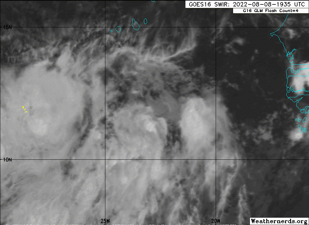
underthwx wrote:97L moving swiftly across the ocean, will that limit any potential development somewhat?
Agree, 97L’s narrative will be if the LLC slows down and stops racing ahead of its convection it could develop. It’s climo for early August. JMHO
1 likes
Hurricane Eye Experience: David 79, Irene 99, Frances 04, Jeanne 04, Wilma 05...
Hurricane Brush Experience: Andrew 92, Erin 95, Floyd 99, Matthew 16, Irma 17, Ian 22, Nicole 22…
Re: ATL: INVEST 97L - Discussion
Invest 97L is very disorganized this morning. Mid level center and low level center are not staked one bit…this still has a lonngggg ways to go until it becomes a tropical cyclone, if at all.
2 likes
- Blown Away
- S2K Supporter
- Posts: 9863
- Joined: Wed May 26, 2004 6:17 am
Re: ATL: INVEST 97L - Discussion
NHC backing off 97L a bit.
2 likes
Hurricane Eye Experience: David 79, Irene 99, Frances 04, Jeanne 04, Wilma 05...
Hurricane Brush Experience: Andrew 92, Erin 95, Floyd 99, Matthew 16, Irma 17, Ian 22, Nicole 22…
- Blown Away
- S2K Supporter
- Posts: 9863
- Joined: Wed May 26, 2004 6:17 am
Re: ATL: INVEST 97L - Discussion
NHC 8am position was 12.0N/27.5W, not much rotation there IMO, broad circulation near10.5N/30.4W.
Not looking to good for 97L, but there seems to be more going on farther WSW from the area they are tracking. JMHO
Last edited by Blown Away on Tue Aug 09, 2022 9:06 am, edited 2 times in total.
2 likes
Hurricane Eye Experience: David 79, Irene 99, Frances 04, Jeanne 04, Wilma 05...
Hurricane Brush Experience: Andrew 92, Erin 95, Floyd 99, Matthew 16, Irma 17, Ian 22, Nicole 22…
Re: ATL: INVEST 97L - Discussion
Blown Away wrote:https://i.imgur.com/dR79cl4.jpg
https://i.imgur.com/UZC532f.jpg
NHC backing off 97L a bit.
About time too. Bye bye 97L. Never really had a shot anyways IMHO.
0 likes
- cycloneye
- Admin
- Posts: 139168
- Age: 67
- Joined: Thu Oct 10, 2002 10:54 am
- Location: San Juan, Puerto Rico
Re: ATL: INVEST 97L - Discussion
AL, 97, 2022080912, , BEST, 0, 120N, 275W, 25, 1010, DB
0 likes
Visit the Caribbean-Central America Weather Thread where you can find at first post web cams,radars
and observations from Caribbean basin members Click Here
- ElectricStorm
- Category 5
- Posts: 4593
- Age: 23
- Joined: Tue Aug 13, 2019 11:23 pm
- Location: Skiatook, OK / Norman, OK
Re: ATL: INVEST 97L - Discussion
Yeah probably not much of a chance this develops but we may need to watch it anyways as it moves further west. Probably unlikely though.
0 likes
I am in no way a professional. Take what I say with a grain of salt as I could be totally wrong. Please refer to the NHC, NWS, or SPC for official information.
Boomer Sooner!
Boomer Sooner!
- ConvergenceZone
- Category 5
- Posts: 4833
- Joined: Fri Jul 29, 2005 1:40 am
- Location: Northern California
Re: ATL: INVEST 97L - Discussion
WiscoWx02 wrote:Blown Away wrote:https://i.imgur.com/dR79cl4.jpg
https://i.imgur.com/UZC532f.jpg
NHC backing off 97L a bit.
About time too. Bye bye 97L. Never really had a shot anyways IMHO.
We should start to get some stronger waves I would think by the first part of September............
0 likes
Re: ATL: INVEST 97L - Discussion
ConvergenceZone wrote:WiscoWx02 wrote:Blown Away wrote:https://i.imgur.com/dR79cl4.jpg
https://i.imgur.com/UZC532f.jpg
NHC backing off 97L a bit.
About time too. Bye bye 97L. Never really had a shot anyways IMHO.
We should start to get some stronger waves I would think by the first part of September............
Yeah one would think but we’ll see
0 likes
- MGC
- S2K Supporter
- Posts: 5792
- Joined: Sun Mar 23, 2003 9:05 pm
- Location: Pass Christian MS, or what is left.
Re: ATL: INVEST 97L - Discussion
Appears the SAL and dry air is winning out. Tough road ahead for 97L.....MGC
0 likes
- Blown Away
- S2K Supporter
- Posts: 9863
- Joined: Wed May 26, 2004 6:17 am
Re: ATL: INVEST 97L - Discussion
AL, 97, 2022080912, , BEST, 0, 120N, 275W, 25, 1010, DB, 34, NEQ,
At 2pm the NHC says 12.0N/27.5W, but there is a nice circulation with convection popping near 10.6N/31W.
Last edited by Blown Away on Tue Aug 09, 2022 3:32 pm, edited 1 time in total.
1 likes
Hurricane Eye Experience: David 79, Irene 99, Frances 04, Jeanne 04, Wilma 05...
Hurricane Brush Experience: Andrew 92, Erin 95, Floyd 99, Matthew 16, Irma 17, Ian 22, Nicole 22…
- captainbarbossa19
- Category 5
- Posts: 1039
- Joined: Wed Aug 21, 2019 11:09 pm
- Location: Starkville, MS
Re: ATL: INVEST 97L - Discussion
Teban54 wrote:Even if 97L doesn't develop within the MDR (not suggesting it won't), I wouldn't rule out a scenario like Gert 2017, where it develops when approaching or past the islands. The timing is very similar, too.
A track further west than Gert would make it even more concerning for possible CONUS impacts.
https://upload.wikimedia.org/wikipedia/commons/thumb/a/a1/Gert_2017_track.png/1920px-Gert_2017_track.png
Yep. Gert failed to develop in the MDR, but found more favorable conditions further west. I don't remember models really showing much happening until Gert started organizing near the Turks and Caicos Islands. I believe Gert is also the storm the GFS refused to show even though it was a cyclone.
3 likes
- weeniepatrol
- Category 3
- Posts: 859
- Joined: Sat Aug 22, 2020 5:30 pm
- Location: WA State
Re: ATL: INVEST 97L - Discussion
18z TWD:
An eastern Atlantic tropical wave is west of the Cabo Verde
Islands near 27W from 20N southward through a 1010 mb low at
12N27W, and moving west around 15 kt. Scattered moderate
convection is occurring from 08N to 15N between 25W and 32W.
Some gradual development of this system is possible and there is a
slight chance that a tropical depression could form over the next
couple of days. Afterward, environmental conditions will become
less favorable.
0 likes
- Kingarabian
- S2K Supporter
- Posts: 15439
- Joined: Sat Aug 08, 2009 3:06 am
- Location: Honolulu, Hawaii
Re: ATL: INVEST 97L - Discussion
18z GFS continues to close it off. Could see a name out of this.
0 likes
RIP Kobe Bryant
- cycloneye
- Admin
- Posts: 139168
- Age: 67
- Joined: Thu Oct 10, 2002 10:54 am
- Location: San Juan, Puerto Rico
Re: ATL: INVEST 97L - Discussion
Tropical Weather Outlook
NWS National Hurricane Center Miami FL
800 PM EDT Tue Aug 9 2022
For the North Atlantic...Caribbean Sea and the Gulf of Mexico:
1. Eastern Tropical Atlantic:
A tropical wave located several hundred miles west-southwest of the
Cabo Verde Islands continues to produce disorganized showers and
thunderstorms. While some gradual development of this system is
possible over the next few days, environmental conditions are
forecast to become less favorable by this weekend. This system is
expected to move westward to west-northwestward at 15 to 20 mph
across the tropical Atlantic during the next several days.
* Formation chance through 48 hours...low...20 percent.
* Formation chance through 5 days...low...30 percent.
Forecaster Cangialosi
0 likes
Visit the Caribbean-Central America Weather Thread where you can find at first post web cams,radars
and observations from Caribbean basin members Click Here
Who is online
Users browsing this forum: No registered users and 52 guests