


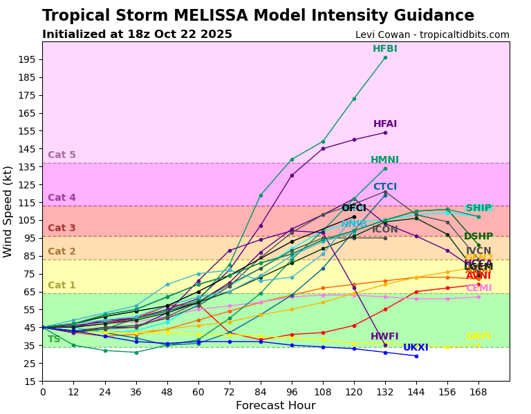
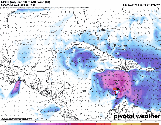
BobHarlem wrote:12z Euro ravages Jamaica then has a cat 4/5 landfall on Guantanamo Bay
https://i.postimg.cc/FKjLPctw/floop-ecmwf-full-2025102212-sfcwind-mslp-caribbean.gif
After this it manages to slip in the gap between Nova Scotia and newfoundland and hit in upper Quebec.
The fact that we now have two models curving this back into mainland north america is not great. Both CMC and Euro have the north turn at about hour 144, its just that the CMC has it drift west faster (almost reaching Honduras by that time).


