EPAC: BONNIE - Post-Tropical - Discussion
Moderator: S2k Moderators
-
Category5Kaiju

- Category 5

- Posts: 3354
- Age: 22
- Joined: Thu Dec 24, 2020 12:45 pm
- Location: Seattle
Re: ATL: INVEST 94L - Discussion
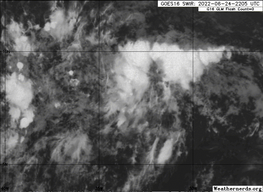
What are we seeing here again? The storm gaining more spin? Just wanted to make sure
0 likes
Unless explicitly stated, all information covered in my posts is based on my opinions and observations. Please refer to a professional meteorologist or an accredited weather research agency otherwise, especially if serious decisions must be made in the event of a potentially life-threatening tropical storm or hurricane.
-
cycloneye

- Admin

- Posts: 139055
- Age: 67
- Joined: Thu Oct 10, 2002 10:54 am
- Location: San Juan, Puerto Rico
Re: ATL: INVEST 94L - Discussion
AL, 94, 2022062500, , BEST, 0, 80N, 333W, 20, 1011, DB
0 likes
Visit the Caribbean-Central America Weather Thread where you can find at first post web cams,radars
and observations from Caribbean basin members Click Here
and observations from Caribbean basin members Click Here
-
Sciencerocks
- Category 5
- Posts: 7285
- Age: 38
- Joined: Thu Jul 06, 2017 1:51 am
-
ElectricStorm

- Category 5
- Posts: 4526
- Age: 23
- Joined: Tue Aug 13, 2019 11:23 pm
- Location: Skiatook, OK / Norman, OK
Re: ATL: INVEST 94L - Discussion
I'm still skeptical that this becomes anything crazy, but some of these model runs are pretty concerning. Strong June/July systems are rare but not impossible so this will be one to watch for sure.
1 likes
I am in no way a professional. Take what I say with a grain of salt as I could be totally wrong. Please refer to the NHC, NWS, or SPC for official information.
Boomer Sooner!
Boomer Sooner!
-
cycloneye
- Admin
- Posts: 139055
- Age: 67
- Joined: Thu Oct 10, 2002 10:54 am
- Location: San Juan, Puerto Rico
Re: ATL: INVEST 94L - Discussion
0 likes
Visit the Caribbean-Central America Weather Thread where you can find at first post web cams,radars
and observations from Caribbean basin members Click Here
and observations from Caribbean basin members Click Here
-
wxman57

- Moderator-Pro Met

- Posts: 22480
- Age: 66
- Joined: Sat Jun 21, 2003 8:06 pm
- Location: Houston, TX (southwest)
Re: ATL: INVEST 94L - Discussion
It is behaving precisely as I expected. Convection is decreasing as it accelerates westward. Best chance of development is west of 70W, though I wouldn't rule out a TD/TS as it approaches the islands.
3 likes
-
Category5Kaiju
- Category 5
- Posts: 3354
- Age: 22
- Joined: Thu Dec 24, 2020 12:45 pm
- Location: Seattle
Re: ATL: INVEST 94L - Discussion

Looks like it's definitely taking a shot at trying to "spin" per se
4 likes
Unless explicitly stated, all information covered in my posts is based on my opinions and observations. Please refer to a professional meteorologist or an accredited weather research agency otherwise, especially if serious decisions must be made in the event of a potentially life-threatening tropical storm or hurricane.
-
Kingarabian

- S2K Supporter

- Posts: 15434
- Joined: Sat Aug 08, 2009 3:06 am
- Location: Honolulu, Hawaii
Re: ATL: INVEST 94L - Discussion
cycloneye wrote:https://twitter.com/AndyHazelton/status/1540507978276769809
Yeah usually curved cloud lines on these MW passes is indicative of a formed LLC. Probably a TD already.
3 likes
RIP Kobe Bryant
-
Sciencerocks
- Category 5
- Posts: 7285
- Age: 38
- Joined: Thu Jul 06, 2017 1:51 am

Re: ATL: INVEST 94L - Discussion

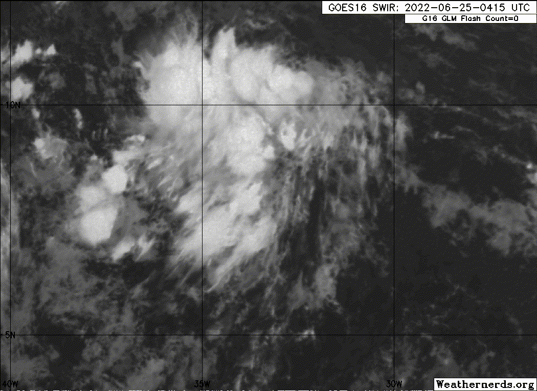
starting to look pretty healthy, good looking Axis
0 likes
Once I see the REDS and GREENS Converge on a Base Velocity. ... I'm There!!
This is NOT an Official Forecast....Just my Opinion. For official information, please refer to the NHC and NWS products.
HIGHLIGHTS : '13 El Reno Tornado : 2013 Storm Chaser Tour, Joaquin; SC flood event, Matthew '16, Lowcountry Snow storm Jan '18
This is NOT an Official Forecast....Just my Opinion. For official information, please refer to the NHC and NWS products.
HIGHLIGHTS : '13 El Reno Tornado : 2013 Storm Chaser Tour, Joaquin; SC flood event, Matthew '16, Lowcountry Snow storm Jan '18
-
TallyTracker
- Category 2

- Posts: 584
- Joined: Thu Oct 11, 2018 2:46 pm
Re: ATL: INVEST 94L - Discussion
NHC is seeing some improvement to the convective structure. Still 60% in the 5 day timeline.
543
ABNT20 KNHC 251131
TWOAT
Tropical Weather Outlook
NWS National Hurricane Center Miami FL
800 AM EDT Sat Jun 25 2022
For the North Atlantic...Caribbean Sea and the Gulf of Mexico:
Tropical Atlantic:
Cloudiness and showers have become a little more concentrated near a
tropical wave located over the central tropical Atlantic Ocean.
Environmental conditions appear conducive for development of this
system over the next few days, and a tropical depression could form
during the early to middle part of next week. This system is
forecast to move westward at 15 to 20 mph over the tropical
Atlantic, approach the Windward Islands on Tuesday, and move into
the southeastern Caribbean Sea by Wednesday.
* Formation chance through 48 hours...low...30 percent.
* Formation chance through 5 days...medium...60 percent.
0 likes
Fran '96, Georges '98, Gordon '00, Gabrielle '01, Charley '04, Frances '04, Jeanne '04, Barry '07, Fay '08, Debby '12, Matthew '16, Emily '17, Irma '17, Michael ‘18, Elsa ‘21, Fred ‘21, Mindy ‘21, Nicole ‘22, Idalia ‘23

Re: ATL: INVEST 94L - Discussion
Satellite loop of 94L from Meteosat-11, 94L is the one in the middle I say that as it looks like the next wave that came off Africa behind it is also starting to curl up.
Source - https://col.st/AyNp1
Source - https://col.st/AyNp1
4 likes
-
wxman57
- Moderator-Pro Met
- Posts: 22480
- Age: 66
- Joined: Sat Jun 21, 2003 8:06 pm
- Location: Houston, TX (southwest)
Re: ATL: INVEST 94L - Discussion
All models are trending south (toward Nicaragua), including GFS & EC ensembles. Not many members taking it into the Gulf now (good). I'd say development chances within 5 days are at least 80% and 90-95% just past 5 days.
2 likes
-
cycloneye
- Admin
- Posts: 139055
- Age: 67
- Joined: Thu Oct 10, 2002 10:54 am
- Location: San Juan, Puerto Rico
Re: ATL: INVEST 94L - Discussion
T number dvorak SSD 1.0.
A. TROPICAL DISTURBANCE (94L)
B. 25/1130Z
C. 8.6N
D. 35.2W
E. FIVE/GOES-E
F. T1.0/1.0
G. IR/EIR/VIS
H. REMARKS...GREATER THAN 2/10 BANDING RESULTS IN DT OF 1.0. MET IS
1.0 AND PT AGREES. FT IS BASED ON DT.
I. ADDL POSITIONS
NIL
...BROWN
B. 25/1130Z
C. 8.6N
D. 35.2W
E. FIVE/GOES-E
F. T1.0/1.0
G. IR/EIR/VIS
H. REMARKS...GREATER THAN 2/10 BANDING RESULTS IN DT OF 1.0. MET IS
1.0 AND PT AGREES. FT IS BASED ON DT.
I. ADDL POSITIONS
NIL
...BROWN
0 likes
Visit the Caribbean-Central America Weather Thread where you can find at first post web cams,radars
and observations from Caribbean basin members Click Here
and observations from Caribbean basin members Click Here
-
cycloneye
- Admin
- Posts: 139055
- Age: 67
- Joined: Thu Oct 10, 2002 10:54 am
- Location: San Juan, Puerto Rico
Re: ATL: INVEST 94L - Discussion
12z Best Track:
AL, 94, 2022062512, , BEST, 0, 83N, 353W, 20, 1011, DB
0 likes
Visit the Caribbean-Central America Weather Thread where you can find at first post web cams,radars
and observations from Caribbean basin members Click Here
and observations from Caribbean basin members Click Here

Re: ATL: INVEST 94L - Discussion
Dmin is doing its work, but I can see some kind of spin in there. It isn’t a closed circulation yet, just a step on the way there.
0 likes
Irene '11 Sandy '12 Hermine '16 5/15/2018 Derecho Fay '20 Isaias '20 Elsa '21 Henri '21 Ida '21
I am only a meteorology enthusiast who knows a decent amount about tropical cyclones. Look to the professional mets, the NHC, or your local weather office for the best information.
I am only a meteorology enthusiast who knows a decent amount about tropical cyclones. Look to the professional mets, the NHC, or your local weather office for the best information.

Re: ATL: INVEST 94L - Discussion
aspen wrote:Dmin is doing its work, but I can see some kind of spin in there. It isn’t a closed circulation yet, just a step on the way there.
Kinda hard to tell where the actual main circulation is. Looks like there are two potential candidates but because you have the displaced convection to the north this makes sense. This convection is dying out though, which may give the dominant vorticity center a chance to fire new convection and take over tonight or tomorrow. We shall see.
EDIT: Actually, I’m almost positive Bret in 2017 or the wave that would form Bret did the exact same thing. Struggled with deep convection and was very anemic until it reached 55W west roughly.
0 likes
-
cycloneye
- Admin
- Posts: 139055
- Age: 67
- Joined: Thu Oct 10, 2002 10:54 am
- Location: San Juan, Puerto Rico
Re: ATL: INVEST 94L - Discussion
Great thread.
https://twitter.com/DCAreaWx/status/1540701296377749505
https://twitter.com/DCAreaWx/status/1540701305668239360
https://twitter.com/DCAreaWx/status/1540701296377749505
https://twitter.com/DCAreaWx/status/1540701305668239360
0 likes
Visit the Caribbean-Central America Weather Thread where you can find at first post web cams,radars
and observations from Caribbean basin members Click Here
and observations from Caribbean basin members Click Here
-
UTSARoadrunner4
- Tropical Storm

- Posts: 163
- Age: 27
- Joined: Wed Aug 26, 2020 11:19 pm
Re: ATL: INVEST 94L - Discussion
One thing I haven’t seen mentioned on here is that there’s a “cold front” that is scheduled to come through Texas between Sunday & Monday. I assume that this would at least move the ridge a bit to the East or even weaken it a little bit, allowing for a little bit of an alleyway to the NW. Is it possible that the TUTT is the reason why future Bonnie may go into Central America instead of picking up some significant latitude?
0 likes
Who is online
Users browsing this forum: No registered users and 21 guests