
EPAC: BONNIE - Post-Tropical - Discussion
Moderator: S2k Moderators
-
cycloneye

- Admin

- Posts: 139065
- Age: 67
- Joined: Thu Oct 10, 2002 10:54 am
- Location: San Juan, Puerto Rico
Re: ATL: INVEST 94L - Discussion
4 likes
Visit the Caribbean-Central America Weather Thread where you can find at first post web cams,radars
and observations from Caribbean basin members Click Here
and observations from Caribbean basin members Click Here
-
InfernoFlameCat

- Category 5

- Posts: 1966
- Age: 21
- Joined: Mon Dec 14, 2020 10:52 am
- Location: Buford, GA
Re: ATL: INVEST 94L - Discussion
Healthy wave axis. If it does remain convectively active during dmin, then cyclogenesis will have likely begun. 5knots of shear should help with that along with a moist environment left behind by the wave in front of 94L. Looks better than Hurricane Barry. 
0 likes
I am by no means a professional. DO NOT look at my forecasts for official information or make decisions based on what I post.
Goal: to become a registered expert over tropical and subtropical cyclones.
Goal: to become a registered expert over tropical and subtropical cyclones.
-
Hypercane_Kyle

- Category 5
- Posts: 2899
- Joined: Sat Mar 07, 2015 7:58 pm
- Location: Cape Canaveral, FL
Re: ATL: INVEST 94L - Discussion
Still looks pretty blobby to me. I think we're a while away from TC genesis.
0 likes
My posts are my own personal opinion, defer to the National Hurricane Center (NHC) and other NOAA products for decision making during hurricane season.
-
ScottNAtlanta

- Category 5
- Posts: 1998
- Joined: Sat May 25, 2013 3:11 pm
- Location: Atlanta, GA
Re: ATL: INVEST 94L - Discussion
The LLC looks a little farther north than it did last night (last I looked). That might be because it is a little more stretched out though.
0 likes
The posts in this forum are NOT official forecast and should not be used as such. They are just the opinion of the poster and may or may not be backed by sound meteorological data. They are NOT endorsed by any professional institution or storm2k.org. For official information, please refer to the NHC and NWS products.
-
Sciencerocks
- Category 5
- Posts: 7286
- Age: 38
- Joined: Thu Jul 06, 2017 1:51 am

Re: ATL: INVEST 94L - Discussion
wxman57 wrote:I don't think there is any threat to the GoM from 94L. It has a better chance of moving inland into South America than into the Gulf. The one thing that the weakened ridge over the Gulf may do is to keep 94L from burying itself into South America. Best chance of development will be west of 70W after passing the ABC Islands. The environment in the SW Caribbean should be quite favorable for development. For now, the rapid westerly motion is limiting low-level convergence.
We shall see.
1 likes
-
Weatherwatcher2018
- Tropical Depression

- Posts: 65
- Joined: Wed Sep 26, 2018 4:30 pm
Re: ATL: INVEST 94L - Discussion
It looks like it’s staying well south of Barbados am I wrong ?
0 likes

-
cycloneye
- Admin
- Posts: 139065
- Age: 67
- Joined: Thu Oct 10, 2002 10:54 am
- Location: San Juan, Puerto Rico
Re: ATL: INVEST 94L - Discussion
2 PM.
Central Tropical Atlantic:
Shower and thunderstorm activity associated with a tropical wave
located about 1000 miles east-southeast of the Windward Islands
continues to show signs of organization. Environmental conditions
appear conducive for further development, and a tropical depression
is likely to form during the early to the middle part of this week.
This system is forecast to move westward to west-northwestward at
15 to 20 mph over the tropical Atlantic, approach the Windward
Islands on Tuesday, and move across the southeastern Caribbean Sea
on Wednesday and Thursday. Interests in the Windward Islands
should monitor the progress of this system.
* Formation chance through 48 hours...medium...40 percent.
* Formation chance through 5 days...high...70 percent.
0 likes
Visit the Caribbean-Central America Weather Thread where you can find at first post web cams,radars
and observations from Caribbean basin members Click Here
and observations from Caribbean basin members Click Here
Re: ATL: INVEST 94L - Discussion
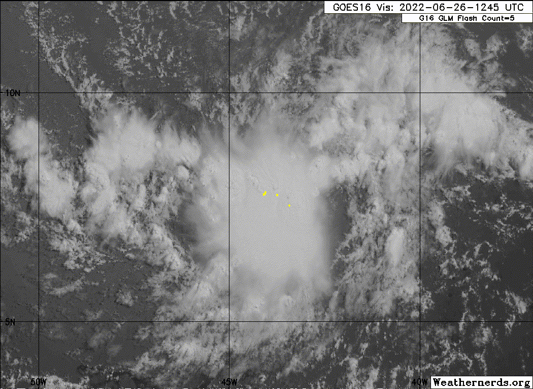
This a wide angle loop of 94L. and the 2 waves behind it in Snow/Ice band to show the motion of the clouds, the white clouds are the low level clouds.
Source - https://col.st/kt9lK
Source - https://col.st/kt9lK
1 likes
-
Kingarabian

- S2K Supporter

- Posts: 15434
- Joined: Sat Aug 08, 2009 3:06 am
- Location: Honolulu, Hawaii
Re: ATL: INVEST 94L - Discussion
Overall its been doing better since it passed 40W. It's been able to sustain convection today through DMIN. DMAX is like 7 hours away so IF IT maintains then we'll probably have a TD by tomorrow morning.
Models will probably have to adjust some if this approaches the island as a TS instead of a open wave.
Models will probably have to adjust some if this approaches the island as a TS instead of a open wave.
5 likes
RIP Kobe Bryant
-
wxman57

- Moderator-Pro Met

- Posts: 22480
- Age: 66
- Joined: Sat Jun 21, 2003 8:06 pm
- Location: Houston, TX (southwest)
Re: ATL: INVEST 94L - Discussion
Still on-track today. May not do much until it passes the ABC Islands on Thursday. Most likely a TS into Nicaragua Friday night or Saturday. 12Z GFS looks way too slow, taking it inland 12Z Sunday.
0 likes
-
cycloneye
- Admin
- Posts: 139065
- Age: 67
- Joined: Thu Oct 10, 2002 10:54 am
- Location: San Juan, Puerto Rico
Re: ATL: INVEST 94L - Discussion
AL, 94, 2022062618, , BEST, 0, 79N, 448W, 30, 1007, DB
0 likes
Visit the Caribbean-Central America Weather Thread where you can find at first post web cams,radars
and observations from Caribbean basin members Click Here
and observations from Caribbean basin members Click Here
-
Kingarabian
- S2K Supporter
- Posts: 15434
- Joined: Sat Aug 08, 2009 3:06 am
- Location: Honolulu, Hawaii
Re: ATL: INVEST 94L - Discussion
cycloneye wrote:AL, 94, 2022062618, , BEST, 0, 79N, 448W, 30, 1007, DB
They could go straight to TS at this point whenever they think its ready.
3 likes
RIP Kobe Bryant
Re: ATL: INVEST 94L - Discussion
wxman57 wrote:Still on-track today. May not do much until it passes the ABC Islands on Thursday. Most likely a TS into Nicaragua Friday night or Saturday. 12Z GFS looks way too slow, taking it inland 12Z Sunday.
Some long term ensemble models are showing a northerly trend. Maybe more into the northern Yucatan.
0 likes
Re: ATL: INVEST 94L - Discussion
These super low riders are always interesting and rare...especially this time of year. It's probably going to be tough for this thing to end up north of Cabo Gracias a dios...Looks Nicaragua bound long term
0 likes
-
wxman57
- Moderator-Pro Met
- Posts: 22480
- Age: 66
- Joined: Sat Jun 21, 2003 8:06 pm
- Location: Houston, TX (southwest)
Re: ATL: INVEST 94L - Discussion
3090 wrote:wxman57 wrote:Still on-track today. May not do much until it passes the ABC Islands on Thursday. Most likely a TS into Nicaragua Friday night or Saturday. 12Z GFS looks way too slow, taking it inland 12Z Sunday.
Some long term ensemble models are showing a northerly trend. Maybe more into the northern Yucatan.
Fewer ensemble members with each model cycle are indicating any Gulf threat. Looks like only 3 of the EC's 51 members take it north of Belize. Same number of GFS ensemble members (out of 30). The trend in these outlier members is farther south with each run. This is not a central Gulf threat.
0 likes
-
Sciencerocks
- Category 5
- Posts: 7286
- Age: 38
- Joined: Thu Jul 06, 2017 1:51 am

-
Blown Away

- S2K Supporter
- Posts: 9861
- Joined: Wed May 26, 2004 6:17 am
Re: ATL: INVEST 94L - Discussion
wxman57 wrote:3090 wrote:wxman57 wrote:Still on-track today. May not do much until it passes the ABC Islands on Thursday. Most likely a TS into Nicaragua Friday night or Saturday. 12Z GFS looks way too slow, taking it inland 12Z Sunday.
Some long term ensemble models are showing a northerly trend. Maybe more into the northern Yucatan.
.
Fewer ensemble members with each model cycle are indicating any Gulf threat. Looks like only 3 of the EC's 51 members take it north of Belize. Same number of GFS ensemble members (out of 30). The trend in these outlier members is farther south with each run. This is not a central Gulf threat.
Intensity guidance trending down over past few runs.
0 likes
Hurricane Eye Experience: David 79, Irene 99, Frances 04, Jeanne 04, Wilma 05...
Hurricane Brush Experience: Andrew 92, Erin 95, Floyd 99, Matthew 16, Irma 17, Ian 22, Nicole 22…
Hurricane Brush Experience: Andrew 92, Erin 95, Floyd 99, Matthew 16, Irma 17, Ian 22, Nicole 22…

Re: ATL: INVEST 94L - Discussion
Blown Away wrote:wxman57 wrote:3090 wrote:
Some long term ensemble models are showing a northerly trend. Maybe more into the northern Yucatan.
.
Fewer ensemble members with each model cycle are indicating any Gulf threat. Looks like only 3 of the EC's 51 members take it north of Belize. Same number of GFS ensemble members (out of 30). The trend in these outlier members is farther south with each run. This is not a central Gulf threat.
Intensity guidance trending down over past few runs.
Not that much though. The only models with noteworthy intensity estimate decreases are the Euro (only a TS in today’s 12z run) and SHIPS (low C3 instead of a low C4). The GFS, CMC, ICON, HWRF, and HMON still agree on a strong TS or C1 hurricane in the SWCar and/or at landfall; I don’t expect anything more than a C2.
0 likes
Irene '11 Sandy '12 Hermine '16 5/15/2018 Derecho Fay '20 Isaias '20 Elsa '21 Henri '21 Ida '21
I am only a meteorology enthusiast who knows a decent amount about tropical cyclones. Look to the professional mets, the NHC, or your local weather office for the best information.
I am only a meteorology enthusiast who knows a decent amount about tropical cyclones. Look to the professional mets, the NHC, or your local weather office for the best information.
Who is online
Users browsing this forum: No registered users and 49 guests