NDG wrote:Definitely a surface closed circulation now present NNE of Caracas.
https://i.imgur.com/3oOmhJP.gif
We will get observations from Aruba / Curazao to see if the LLC moves thru them.
Moderator: S2k Moderators


NDG wrote:Definitely a surface closed circulation now present NNE of Caracas.
https://i.imgur.com/3oOmhJP.gif
underthwx wrote:aspen wrote:underthwx wrote:PTC2 doing the latitude limbo with the current forecast track. How low can you go. On satellite, it looks a bit higher in latitude. I assume it will eventually cross into the Epac, and may be renamed?
If it makes it into the EPac intact and formed before then, it would keep the name Bonnie, like like Otto remained Otto when it crossed over in 2016.
PTC2 is already decently close to being a TC, and it’ll have 36-42 hours over the SW Caribbean before landfall. That should be long enough for it to become at least a moderate TS, raising its chances of surviving the crossover and maybe becoming an even stronger storm in the EPac.
Thanks for your reply. What exactly is keeping the system so low in latitude?


aspen wrote:underthwx wrote:aspen wrote:If it makes it into the EPac intact and formed before then, it would keep the name Bonnie, like like Otto remained Otto when it crossed over in 2016.
PTC2 is already decently close to being a TC, and it’ll have 36-42 hours over the SW Caribbean before landfall. That should be long enough for it to become at least a moderate TS, raising its chances of surviving the crossover and maybe becoming an even stronger storm in the EPac.
Thanks for your reply. What exactly is keeping the system so low in latitude?
A combination of it coming off at a pretty low latitude and strong ridging preventing it from gaining too much latitude. The ridging and typical strong June/July trades are responsible for its very fast forward speed, although it’ll slow down in the last 24-36 hours before landfall.
TheProfessor wrote:Bout to fly out to Cabo this morning for vacation, but I'll give a short explanation what's going on with this storm.
It's very likely we have a developing llc under the convection probably somewhere around 12.5N and 66W. This is roughly 75 miles north of the current fix by NHC. This will have a significant impact on the track of the storm. 75 miles may not seem like much, but this is where the butterfly effecting comes in. To put it simply, a small change in the near term can lead drastic changes in the long term. A few good examples of this was the GFS being too far east in the short term with the tropical wave that became Agatha and Alex and thus was blowing up the storm in the Gulf. Another one was hurricane Nicholas when an old vort got spit out and moved southward and erroneously got fixed by NHC and sent the models east towards southeast Louisiana. In reality the center was further north and the storm made it's first landfall along the upper Texas coast. Finally, the probably most drastic example was Dorian's reformation to the north that changed the path from a sure death over Hispaniola to a track north of the Greater Antilles. As of now, short term steering will be dictated by old circulation to the south acting as a pseudo gyre. That circulation should die over land over the next day or two. From there the rest depends on the strength of the storm. The strong PTC 2 gets, the more it will feel the weakness. A further north PTC 2 will have more opportunity to get stronger. If that occurs this will lead to more corrections northward over time. Anyone that's confident in the current forecast shouldn't be. Model consensus is useless if it's consistently receiving bad data. Until a dominant llc has developed and been fixed and fed for at least 2 to 3 model cycles, everything is on the table now. That includes places as far east as Jamaica and western Cuba.
What to watch going forward is how satellite behaves. As of now I'm looking for what I like to call a storm awakening it's Sharingan for you Naruto fans out there. In this case a tomoe in the Sharingan is a rotating hot tower in a tropical cyclone. In this case I'm looking for a 2 tomoe awakening as 2 rotating hot towers will clue me in that this storm is approaching hurricane status. Once that northern llc takes over, I don't think it will take long as long as convection persists.
[url]https://i.ibb.co/9gLYz5w/Sharigan-Awakening.gif [/url]

Hypercane_Kyle wrote:InfernoFlameCat wrote:Hypercane_Kyle wrote:
I have seen TC's form a closed circulation over land more times than I can count.
Over South America?? Without trades to help it? Without the natural effect of the earths spin at such a low latitude? It would be very difficult for PTC2 to accomplish that.
Didn't say it would be easy, but we've seen storms somehow overcome such barriers and surpass them.

WiscoWx02 wrote:Am seriously beginning to doubt this develops in the Atlantic. Best bet this tracks into the eastern Pacific and develops there.


aspen wrote:What’s going on with recon? Are they not allowed to fly south of 15N due to Venezuelan airspace restrictions?
Sciencerocks wrote:https://imagizer.imageshack.com/img924/6229/QmwqQu.gif

wxman57 wrote:aspen wrote:What’s going on with recon? Are they not allowed to fly south of 15N due to Venezuelan airspace restrictions?
That is most likely the reason. ABC islands are reporting ENE wind 5-10 kts. Winds appear lower than yesterday. This will have a hard time developing an LLC until tomorrow evening in the SW Caribbean. It's still not a Gulf threat...
wxman57 wrote:Sciencerocks wrote:https://imagizer.imageshack.com/img924/6229/QmwqQu.gif
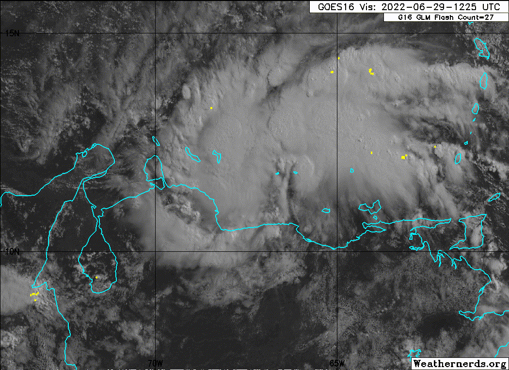
I've been watching a little swirl almost on the coast of Venezuela, south of all the squalls. It's on track to move ashore in the next hour. Nothing well-defined, just a swirl.


NDG wrote:https://i.imgur.com/3KHKuJf.gif
MississippiWx wrote:NDG wrote:https://i.imgur.com/3KHKuJf.gif
Looks classifiable to me now.
The low is just north of the coast. Land is interfering with the inflow, so not much in the way of thunderstorms on the south side.
Users browsing this forum: No registered users and 57 guests


