ATL: IAN - Post-Tropical - Discussion

Moderator: S2k Moderators

Message
Author
User avatar
Jr0d
S2K Supporter
S2K Supporter
Posts: 1173
Joined: Tue Aug 27, 2019 10:52 am
Location: Cayo Hueso

Re: ATL: IAN - Hurricane - Discussion

#5961 Postby Jr0d » Fri Sep 30, 2022 11:59 am

galaxy401 wrote:Death toll is up to 30 now in Florida. With that and the missing migrants from that boat that sunk, this may go way higher...


Unfortunately this undoubtedly has been the deadliest Florida hurricane since the 1935 Labor Storm. I never thought I would say this, but it could possibly exceed that storm.

While I lost a lot, so many others lost everything. Truly a catastrophe.
4 likes   

User avatar
cycloneye
Admin
Admin
Posts: 139027
Age: 67
Joined: Thu Oct 10, 2002 10:54 am
Location: San Juan, Puerto Rico

Re: ATL: IAN - Hurricane - Discussion

#5962 Postby cycloneye » Fri Sep 30, 2022 12:03 pm

galaxy401 wrote:Death toll is up to 30 now in Florida. With that and the missing migrants from that boat that sunk, this may go way higher...


Any source to that info? To have a archive about that in this thread.
1 likes   
Visit the Caribbean-Central America Weather Thread where you can find at first post web cams,radars
and observations from Caribbean basin members Click Here

User avatar
wxman57
Moderator-Pro Met
Moderator-Pro Met
Posts: 22480
Age: 66
Joined: Sat Jun 21, 2003 8:06 pm
Location: Houston, TX (southwest)

Re: ATL: IAN - Hurricane - Discussion

#5963 Postby wxman57 » Fri Sep 30, 2022 12:05 pm

Charleston is the only station reporting TS winds (standard airport obs). NW at 39 gusting 53 kts in the heaviest squalls NW of the center.
3 likes   

User avatar
galaxy401
Category 5
Category 5
Posts: 2298
Age: 28
Joined: Sat Aug 25, 2012 9:04 pm
Location: Casa Grande, Arizona

Re: ATL: IAN - Hurricane - Discussion

#5964 Postby galaxy401 » Fri Sep 30, 2022 12:09 pm

cycloneye wrote:
galaxy401 wrote:Death toll is up to 30 now in Florida. With that and the missing migrants from that boat that sunk, this may go way higher...


Any source to that info? To have a archive about that in this thread.


Sure thing, here is a link I found:

https://twitter.com/ElijahWeather/status/1575850450384875522

Not the most reliable admittedly, but everyone is still assessing damage so it will probably bounce around more.
1 likes   
Got my eyes on moving right into Hurricane Alley: Florida.

SecondBreakfast
Tropical Depression
Tropical Depression
Posts: 68
Joined: Sun Sep 10, 2017 7:14 am
Location: NYC/LI

Re: ATL: IAN - Hurricane - Discussion

#5965 Postby SecondBreakfast » Fri Sep 30, 2022 12:13 pm

cycloneye wrote:
galaxy401 wrote:Death toll is up to 30 now in Florida. With that and the missing migrants from that boat that sunk, this may go way higher...


Any source to that info? To have a archive about that in this thread.


Haven’t seen 30, but have seen 20-25, and I think that’s with only two reported deaths from Lee county, which we know will go up. This link has “more than 21”

https://www.sun-sentinel.com/news/weath ... story.html
0 likes   
Biologist by training, weather enthusiast for life.

User avatar
cycloneye
Admin
Admin
Posts: 139027
Age: 67
Joined: Thu Oct 10, 2002 10:54 am
Location: San Juan, Puerto Rico

Re: ATL: IAN - Hurricane - Discussion

#5966 Postby cycloneye » Fri Sep 30, 2022 12:13 pm

galaxy401 wrote:
cycloneye wrote:
galaxy401 wrote:Death toll is up to 30 now in Florida. With that and the missing migrants from that boat that sunk, this may go way higher...


Any source to that info? To have a archive about that in this thread.


Sure thing, here is a link I found:

https://twitter.com/ElijahWeather/status/1575850450384875522

Not the most reliable admittedly, but everyone is still assessing damage so it will probably bounce around more.


Thank you. If there are more updates on the number of fatalities, post them.
0 likes   
Visit the Caribbean-Central America Weather Thread where you can find at first post web cams,radars
and observations from Caribbean basin members Click Here

User avatar
MetsIslesNoles
S2K Supporter
S2K Supporter
Posts: 47
Joined: Thu Jul 07, 2005 10:42 pm
Location: Tallahassee, FL

Re: ATL: IAN - Hurricane - Discussion

#5967 Postby MetsIslesNoles » Fri Sep 30, 2022 12:14 pm

Listening to FEMA / Governor's press conference in Lee county right now, and I have to agree with the posters that have said we need something different than the cone in the future. Both FEMA and the Governor were quick to talk about Lee county not even being in the cone 72 hours before landfall. First, Lee was on the border of the cone 72 hours before. Second, it's obvious even the officials can't message the point that the cone is just for the center of the storm. Maybe we should go back to a 3 day cone plus a potential impact map? I wish I had answers. The NHC did a good job with a very tough forecast, but there needs to be a change in messaging.
4 likes   

Sciencerocks
Category 5
Category 5
Posts: 7282
Age: 38
Joined: Thu Jul 06, 2017 1:51 am

Re: ATL: IAN - Hurricane - Discussion

#5968 Postby Sciencerocks » Fri Sep 30, 2022 12:18 pm

Image
0 likes   

User avatar
GCANE
S2K Supporter
S2K Supporter
Posts: 10787
Joined: Mon Oct 22, 2007 8:03 am

Re: ATL: IAN - Hurricane - Discussion

#5969 Postby GCANE » Fri Sep 30, 2022 12:18 pm

Latest VDM has it a few miles off shore.
Drop measure 100% RH at 850 mb
Rain rate near 60 mm/hr.
Definitely potential to ramp up if had more time over water.
Another I storm to retire.
6 likes   

User avatar
tropicwatch
Category 5
Category 5
Posts: 3205
Age: 60
Joined: Sat Jun 02, 2007 10:01 am
Location: Panama City Florida
Contact:

Re: ATL: IAN - Hurricane - Discussion

#5970 Postby tropicwatch » Fri Sep 30, 2022 12:24 pm

GCANE wrote:Latest VDM has it a few miles off shore.
Drop measure 100% RH at 850 mb
Rain rate near 60 mm/hr.
Definitely potential to ramp up if had more time over water.
Another I storm to retire.


Sure looks like it has put on the breaks refusing to go inland. :roll:
2 likes   
Tropicwatch


Agnes 72', Eloise 75, Elena 85', Kate 85', Charley 86', Florence 88', Beryl 94', Dean 95', Erin 95', Opal 95', Earl 98', Georges 98', Ivan 2004', Arlene 2005', Dennis 2005', Ida 2009' Debby 2012' Irma 2017' Michael 2018'

tolakram
Admin
Admin
Posts: 19165
Age: 60
Joined: Sun Aug 27, 2006 8:23 pm
Location: Florence, KY (name is Mark)

Re: ATL: IAN - Hurricane - Discussion

#5971 Postby tolakram » Fri Sep 30, 2022 12:25 pm

1 likes   
M a r k
- - - - -
Join us in chat: Storm2K Chatroom Invite. Android and IOS apps also available.

The posts in this forum are NOT official forecasts and should not be used as such. Posts are NOT endorsed by any professional institution or STORM2K.org. For official information and forecasts, please refer to NHC and NWS products.

User avatar
wxman57
Moderator-Pro Met
Moderator-Pro Met
Posts: 22480
Age: 66
Joined: Sat Jun 21, 2003 8:06 pm
Location: Houston, TX (southwest)

Re: ATL: IAN - Hurricane - Discussion

#5972 Postby wxman57 » Fri Sep 30, 2022 12:27 pm

MetsIslesNoles wrote:Listening to FEMA / Governor's press conference in Lee county right now, and I have to agree with the posters that have said we need something different than the cone in the future. Both FEMA and the Governor were quick to talk about Lee county not even being in the cone 72 hours before landfall. First, Lee was on the border of the cone 72 hours before. Second, it's obvious even the officials can't message the point that the cone is just for the center of the storm. Maybe we should go back to a 3 day cone plus a potential impact map? I wish I had answers. The NHC did a good job with a very tough forecast, but there needs to be a change in messaging.


Agree that the cone is absolutely meaningless as far as indicating a threat or possible impacts. The general accuracy of forecasts over the past 5 seasons (current cone) likely bears no resemblance to current uncertainty or possible impacts. In this case, the cone did not include Lee County because landfall uncertainty here was higher than the 5 season average. Cone never changes, though. It's always the same for every advisory with every storm, all season long.

What's needed is a probabilistic cone based on current storm wind field size and ensemble data. Trouble with that is the ensemble data for 8am EDT, for example, isn't all available until around 5pm EDT. Takes too long to get the ensemble data from the European run after the deterministic run is in. Forecasts were good. Hurricane into the coast near Ft. Myers from 24 hours out. Just minor heading changes were the difference between Tampa and Ft. Myers, same as with Charley.

Forecasts would have been shifted southward to Ft. Myers more quickly if the GFS had not been pulling the consensus model well northward across the peninsula. We ignored the GFS and compensated by adjusting the track farther south than the NHC. In the heat of battle, so to speak, it's hard to identify what model to trust. I knew that the GFS would be too slow and too far west, as it always is with a westerly sheared storm in the Gulf. But how much farther east/south would it track? That's the hard part.
14 likes   

User avatar
Teban54
Category 5
Category 5
Posts: 1952
Joined: Sat May 19, 2018 1:19 pm

Re: ATL: IAN - Hurricane - Discussion

#5973 Postby Teban54 » Fri Sep 30, 2022 12:29 pm

MetsIslesNoles wrote:Listening to FEMA / Governor's press conference in Lee county right now, and I have to agree with the posters that have said we need something different than the cone in the future. Both FEMA and the Governor were quick to talk about Lee county not even being in the cone 72 hours before landfall. First, Lee was on the border of the cone 72 hours before. Second, it's obvious even the officials can't message the point that the cone is just for the center of the storm. Maybe we should go back to a 3 day cone plus a potential impact map? I wish I had answers. The NHC did a good job with a very tough forecast, but there needs to be a change in messaging.

One thing that I think hasn't been stressed enough is that, based on historic data, there's a 1/3 chance of the track falling outside the cone.
5 likes   

User avatar
wxman57
Moderator-Pro Met
Moderator-Pro Met
Posts: 22480
Age: 66
Joined: Sat Jun 21, 2003 8:06 pm
Location: Houston, TX (southwest)

Re: ATL: IAN - Hurricane - Discussion

#5974 Postby wxman57 » Fri Sep 30, 2022 12:33 pm

Center appears to be just offshore to the ESE of Myrtle Beach. No TS winds in Myrtle Beach yet. Charleston peak gust was 54 kts. Still looking for sustained TS winds along the coast except for Charleston.
0 likes   

User avatar
wxman57
Moderator-Pro Met
Moderator-Pro Met
Posts: 22480
Age: 66
Joined: Sat Jun 21, 2003 8:06 pm
Location: Houston, TX (southwest)

Re: ATL: IAN - Hurricane - Discussion

#5975 Postby wxman57 » Fri Sep 30, 2022 12:35 pm

Teban54 wrote:
MetsIslesNoles wrote:Listening to FEMA / Governor's press conference in Lee county right now, and I have to agree with the posters that have said we need something different than the cone in the future. Both FEMA and the Governor were quick to talk about Lee county not even being in the cone 72 hours before landfall. First, Lee was on the border of the cone 72 hours before. Second, it's obvious even the officials can't message the point that the cone is just for the center of the storm. Maybe we should go back to a 3 day cone plus a potential impact map? I wish I had answers. The NHC did a good job with a very tough forecast, but there needs to be a change in messaging.

One thing that I think hasn't been stressed enough is that, based on historic data, there's a 1/3 chance of the track falling outside the cone.


That's worthless, though. The cone represents that 66.7% of the time the center was within the cone over the past 5 seasons. If the cone was based upon true current uncertainty and included wind field size, then it would be of some value (as I mentioned above). I deal with people every day that think they're safe if their location is outside the cone. People just do not understand.
2 likes   

typhoonty
Tropical Depression
Tropical Depression
Posts: 94
Age: 29
Joined: Wed May 31, 2017 10:37 pm
Location: Fort Myers / Tallahassee, FL
Contact:

Re: ATL: IAN - Hurricane - Discussion

#5976 Postby typhoonty » Fri Sep 30, 2022 12:36 pm

wxman57 wrote:
MetsIslesNoles wrote:Listening to FEMA / Governor's press conference in Lee county right now, and I have to agree with the posters that have said we need something different than the cone in the future. Both FEMA and the Governor were quick to talk about Lee county not even being in the cone 72 hours before landfall. First, Lee was on the border of the cone 72 hours before. Second, it's obvious even the officials can't message the point that the cone is just for the center of the storm. Maybe we should go back to a 3 day cone plus a potential impact map? I wish I had answers. The NHC did a good job with a very tough forecast, but there needs to be a change in messaging.


Agree that the cone is absolutely meaningless as far as indicating a threat or possible impacts. The general accuracy of forecasts over the past 5 seasons (current cone) likely bears no resemblance to current uncertainty or possible impacts. In this case, the cone did not include Lee County because landfall uncertainty here was higher than the 5 season average. Cone never changes, though. It's always the same for every advisory with every storm, all season long.

What's needed is a probabilistic cone based on current storm wind field size and ensemble data. Trouble with that is the ensemble data for 8am EDT, for example, isn't all available until around 5pm EDT. Takes too long to get the ensemble data from the European run after the deterministic run is in. Forecasts were good. Hurricane into the coast near Ft. Myers from 24 hours out. Just minor heading changes were the difference between Tampa and Ft. Myers, same as with Charley.

Forecasts would have been shifted southward to Ft. Myers more quickly if the GFS had not been pulling the consensus model well northward across the peninsula. We ignored the GFS and compensated by adjusting the track farther south than the NHC. In the heat of battle, so to speak, it's hard to identify what model to trust. I knew that the GFS would be too slow and too far west, as it always is with a westerly sheared storm in the Gulf. But how much farther east/south would it track? That's the hard part.


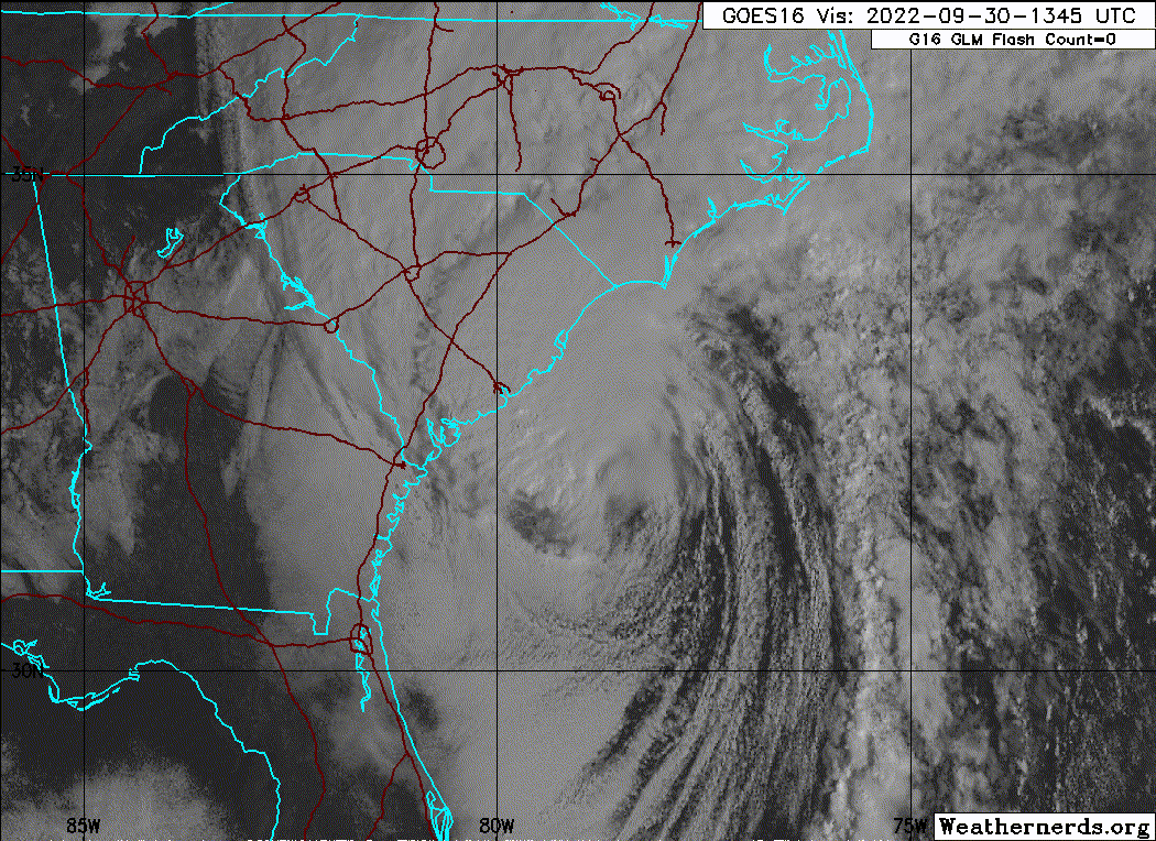
There were 3 days of consecutive shifts southeast. No one took it seriously, 90% of people who were supposed to evacuate stayed. The cone should include Hurricane wind radii to the edge at least. Too many people think not in cone = no danger. We were both on the same page Sunday and Monday that it would settle further south than the center of the cone.

When I do analysis, the number one thing I do is go to tropical tidbits, look at 500 mb chart, and see if there is ANY deviation in ANY direction with troughs and ridges between the analysis and previous T+6 using the trend feature. I noticed during Irma the ridge was constantly being forecast too weak at T+6 vs analysis 5 days before and warned my folks to evacuate because the threat was higher to southwest Florida than was portrayed.

During Ian, I did the same thing and noticed the trough being under amplified since Sunday. That, combined with it's lack of organization on Sunday allowed it to gain just enough latitude to produce this catastrophic result.
4 likes   
FSU Meteorology student, opinions are mine, 18 years experience covering TC's, consult NHC/Local officials when making decisions.

Gabrielle '01, Michelle '01, Charley '04, Frances '04, Dennis '05, Katrina '05, Rita '05, Wilma '05, Fay '08, Isaac '12 Hermine '16, Irma '17, Gordon '18, Michael '18, Eta '20 IAN '22

Nuno
Category 2
Category 2
Posts: 529
Joined: Fri Aug 30, 2019 8:35 am
Location: Coral Gables, FL

Re: ATL: IAN - Hurricane - Discussion

#5977 Postby Nuno » Fri Sep 30, 2022 12:36 pm

wxman57 wrote:
MetsIslesNoles wrote:Listening to FEMA / Governor's press conference in Lee county right now, and I have to agree with the posters that have said we need something different than the cone in the future. Both FEMA and the Governor were quick to talk about Lee county not even being in the cone 72 hours before landfall. First, Lee was on the border of the cone 72 hours before. Second, it's obvious even the officials can't message the point that the cone is just for the center of the storm. Maybe we should go back to a 3 day cone plus a potential impact map? I wish I had answers. The NHC did a good job with a very tough forecast, but there needs to be a change in messaging.


Agree that the cone is absolutely meaningless as far as indicating a threat or possible impacts. The general accuracy of forecasts over the past 5 seasons (current cone) likely bears no resemblance to current uncertainty or possible impacts. In this case, the cone did not include Lee County because landfall uncertainty here was higher than the 5 season average. Cone never changes, though. It's always the same for every advisory with every storm, all season long.

What's needed is a probabilistic cone based on current storm wind field size and ensemble data. Trouble with that is the ensemble data for 8am EDT, for example, isn't all available until around 5pm EDT. Takes too long to get the ensemble data from the European run after the deterministic run is in. Forecasts were good. Hurricane into the coast near Ft. Myers from 24 hours out. Just minor heading changes were the difference between Tampa and Ft. Myers, same as with Charley.

Forecasts would have been shifted southward to Ft. Myers more quickly if the GFS had not been pulling the consensus model well northward across the peninsula. We ignored the GFS and compensated by adjusting the track farther south than the NHC. In the heat of battle, so to speak, it's hard to identify what model to trust. I knew that the GFS would be too slow and too far west, as it always is with a westerly sheared storm in the Gulf. But how much farther east/south would it track? That's the hard part.


But even amateurs here were insistent that GFS was out to lunch, what mechanism prevented the NHC from adding less weight to the GFS and its ensembles leading up to landfall? You could ignore the GFS in your professional setting, why couldn't the NHC? Is this also why watches were so delayed?

It does seem in recent years the NHC is far more cautious in issuing watches all around. I noticed many times in SEFL that we get TS watches for what would've been a hurricane watch in the past. Great, we have better forecasting capabilities now, but when it comes time to actually pull the trigger for a watch (and also for PTC's as I have noticed) it comes off as somewhat arbitrary when matched up to potential impacts? Like at what point does the NHC issue a TS watch, when the probability exceeds >40%? >75%? I am genuinely curious as I do not know this aspect of how the NHC operates.
4 likes   
Andrew (1992), Irene (1999), Frances (2004), Katrina (2005), Wilma (2005), Fay (2008), Irma (2017), Eta (2020), Ian (2022)

User avatar
wxman57
Moderator-Pro Met
Moderator-Pro Met
Posts: 22480
Age: 66
Joined: Sat Jun 21, 2003 8:06 pm
Location: Houston, TX (southwest)

Re: ATL: IAN - Hurricane - Discussion

#5978 Postby wxman57 » Fri Sep 30, 2022 12:41 pm

Myrtle Beach wind just shifted from the east at 15 gusting 29 kts. Was from the NE. Peak gust past 3 hrs was 42 kts. Peak sustained wind only 28 kts. Center is on the coast just south of Myrtle Beach.

KMYR 301728Z AUTO 09015G29KT 2 1/2SM -RA BR SCT006 OVC013 24/23 A2927 RMK AO2 PK WND 08029/1725 WSHFT 1714 PRESFR P0005
KMYR 301702Z AUTO 03016G24KT 3SM RA BR BKN006 OVC012 20/20 A2930 RMK AO2 CIG 004V009 PRESFR P0003
KMYR 301656Z AUTO 05012G23KT 1 1/2SM +RA BR BKN006 OVC012 19/19 A2932 RMK AO2 PK WND 01037/1558 CIG 004V009 SLP929 P0134 T01940194
KMYR 301608Z AUTO 02028G35KT 1 3/4SM +RA BR BKN009 BKN015 OVC021 19/18 A2935 RMK AO2 PK WND 01037/1558 CIG 005V011 P0013
KMYR 301601Z AUTO 02018G39KT 2SM +RA BR SCT009 BKN012 OVC030 19/18 A2937 RMK AO2 PK WND 01037/1558 P0006
KMYR 301556Z AUTO 01026G39KT 3SM RA BR BKN009 BKN022 OVC032 18/18 A2936 RMK AO2 PK WND 02042/1529 CIG 005V012 SLP942 P0046 T01830183
KMYR 301456Z AUTO 01024G35KT 2 1/2SM RA BR BKN009 OVC012 18/18 A2946 RMK AO2 PK WND 04040/1415 VIS 2V4 PRESFR SLP974 P0032 60053 T01780178 56056
KMYR 301452Z AUTO 01022G35KT 2 1/2SM +RA BR BKN009 OVC012 18/18 A2946 RMK AO2 PK WND 04040/1415 VIS 2V4 PRESFR P0030
0 likes   

tolakram
Admin
Admin
Posts: 19165
Age: 60
Joined: Sun Aug 27, 2006 8:23 pm
Location: Florence, KY (name is Mark)

Re: ATL: IAN - Hurricane - Discussion

#5979 Postby tolakram » Fri Sep 30, 2022 12:49 pm

0 likes   
M a r k
- - - - -
Join us in chat: Storm2K Chatroom Invite. Android and IOS apps also available.

The posts in this forum are NOT official forecasts and should not be used as such. Posts are NOT endorsed by any professional institution or STORM2K.org. For official information and forecasts, please refer to NHC and NWS products.

User avatar
Old-TimeCane
Tropical Storm
Tropical Storm
Posts: 139
Age: 43
Joined: Tue Aug 31, 2004 10:01 pm
Location: Myrtle Beach, SC

Re: ATL: IAN - Hurricane - Discussion

#5980 Postby Old-TimeCane » Fri Sep 30, 2022 12:50 pm

Just had a gust to 26mph here in Conway. Pressure is down to 991.7mb.
1 likes   
The above post is NOT an official forecast and should not be used as such. It is just the opinion of the poster and may or may not be backed by sound meteorological data. It is NOT endorsed by any professional institution or storm2k.org. For official information, please refer to the NHC and NWS products.


Return to “2022”

Who is online

Users browsing this forum: No registered users and 44 guests