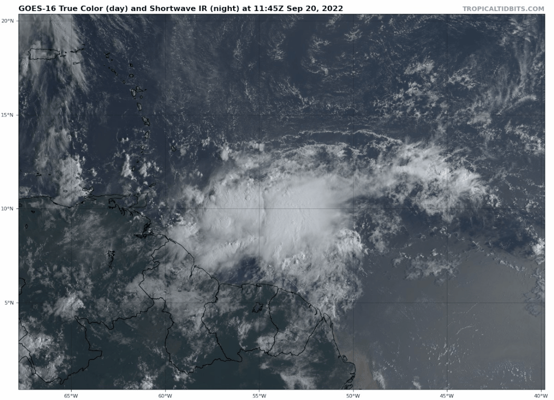
SFLcane wrote:https://i.postimg.cc/J06H5Mqh/98L.gif
That sure "looks" like it wants to run right into SA
Moderator: S2k Moderators


SFLcane wrote:https://i.postimg.cc/J06H5Mqh/98L.gif


SFLcane wrote:
That is quite impressive to the point i could see a special TWO issued by the NHC.

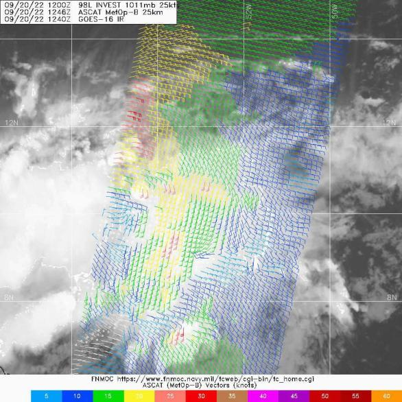

SFLcane wrote:Are those some 30kt wind barbs i see? Classification is not far away.
https://i.postimg.cc/63JYRJ6R/gfs.png
MississippiWx wrote:SFLcane wrote:Are those some 30kt wind barbs i see? Classification is not far away.
https://i.postimg.cc/63JYRJ6R/gfs.png
Has a good ways to go from a structural standpoint. Just a wave-for now.
Subtrop wrote:Special Tropical Weather Outlook
NWS National Hurricane Center Miami FL
1055 AM EDT Tue Sep 20 2022
For the North Atlantic...Caribbean Sea and the Gulf of Mexico:
Active Systems:
The National Hurricane Center is issuing advisories on Hurricane
Fiona, located near the Turks and Caicos islands, and on newly
formed Tropical Depression Eight, located over the north-central
Atlantic Ocean.
Central Tropical Atlantic:
Updated: Satellite data indicate that the tropical wave located
several hundred miles east of the Windward Islands has become better
organized this morning. Additional development is expected, and a
tropical depression is likely to form within the next few days as
the system moves westward to west-northwestward at 15 to 20 mph
across the eastern and central Caribbean Sea. Interests in the
Windward Islands should closely monitor the progress of this system
as heavy rainfall and gusty winds could affect these islands
beginning on Wednesday.
* Formation chance through 48 hours...medium...40 percent.
* Formation chance through 5 days...high...70 percent.


Hurricaneman wrote:Unless something unforeseen happens this will probably be Hermine and probably within the next 48 to 72 hrs based on presentation
jfk08c wrote:Hurricaneman wrote:Unless something unforeseen happens this will probably be Hermine and probably within the next 48 to 72 hrs based on presentation
What happened to Gaston?
Users browsing this forum: No registered users and 24 guests


