ATL: IAN - Models
Moderator: S2k Moderators
-
Kazmit

- Category 5

- Posts: 1915
- Age: 21
- Joined: Mon Jul 25, 2016 8:49 am
- Location: Williamsburg VA for college, Bermuda otherwise
Re: ATL: IAN - Models
Next GFS run will show a depression into Houston 
9 likes
Igor 2010, Sandy 2012, Fay 2014, Gonzalo 2014, Joaquin 2015, Nicole 2016, Humberto 2019
I am only a tropical weather enthusiast. My predictions are not official and may or may not be backed by sound meteorological data. For official information, please refer to the NHC and NWS products.
I am only a tropical weather enthusiast. My predictions are not official and may or may not be backed by sound meteorological data. For official information, please refer to the NHC and NWS products.

Re: ATL: IAN - Models
Now the big wait for the 12z Euro to see if it also keeps trending west like the rest of the models.
See you guys here in 1.5 hrs
See you guys here in 1.5 hrs
3 likes
-
SEASON_CANCELED

- Category 3

- Posts: 887
- Joined: Mon Jul 06, 2009 5:17 am
- Location: 8 Bit Charlie Sheen
Re: ATL: IAN - Models
NDG wrote:Now the big wait for the 12z Euro to see if it also keeps trending west like the rest of the models.
See you guys here in 1.5 hrs
As a tampa resident, Ill say the wait is unbearable. Best go to walmart and top off preps i guess. Gonna use the water and Chef boyardee anyway
6 likes
i am a big stupid ugly moron with an ugly face and a big butt and my butt stinks and i like to kiss my own butt


Re: ATL: IAN - Models
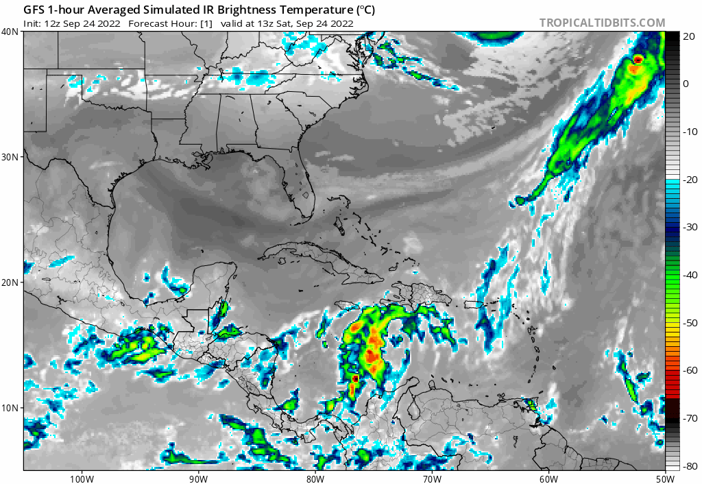
gatorcane wrote:12Z GFS IR loop, a monster but way out in the Gulf. Looks to start weakening at the end some:
https://i.postimg.cc/T3jwtGwB/gfs-ir-watl-fh1-109.gif
I'd imagine that to be a significant flood threat for northern FL S. GA and SC
1 likes
Once I see the REDS and GREENS Converge on a Base Velocity. ... I'm There!!
This is NOT an Official Forecast....Just my Opinion. For official information, please refer to the NHC and NWS products.
HIGHLIGHTS : '13 El Reno Tornado : 2013 Storm Chaser Tour, Joaquin; SC flood event, Matthew '16, Lowcountry Snow storm Jan '18
This is NOT an Official Forecast....Just my Opinion. For official information, please refer to the NHC and NWS products.
HIGHLIGHTS : '13 El Reno Tornado : 2013 Storm Chaser Tour, Joaquin; SC flood event, Matthew '16, Lowcountry Snow storm Jan '18
-
StPeteMike

- Category 1

- Posts: 359
- Joined: Thu Jun 07, 2018 11:26 pm
Re: ATL: IAN - Models
NDG wrote:Now the big wait for the 12z Euro to see if it also keeps trending west like the rest of the models.
See you guys here in 1.5 hrs
Watch it be back to SWFL
I don’t feel like they’ll budge much, maybe align with the NHC track.
1 likes
The above post is not official and should not be used as such. It is the opinion of the poster and may or may not be backed by sound meteorological data. It is not endorsed by any professional institution or storm2k.org. For official information, please refer to the NHC and NWS products.
-
Craters
- Category 1
- Posts: 349
- Joined: Sat Aug 24, 2013 2:34 pm
- Location: Alvin, TX (south of Houston)
Re: ATL: IAN - Models
jlauderdal wrote:FLWeatherX wrote:Michele B wrote:
But even TWC mets are "warning" of shifts more to the west. I think they're setting up to adjust the cone westward a bit.
Setting up the cone westward but not the track necessarily. Maybe slightly north near Tampa. 5pm update will really be important
The cone follows the track, they don't set the cone, they set the track and the cone is nothing more than error over the last 5 years.
https://www.nhc.noaa.gov/aboutcone.shtml
It's actually only 67% of the error over the last five years. Probably a standard deviation to either side. Assuming it is a standard deviation, if they wanted to represent 95% of the error over the last five years, the cone would be twice as wide.
3 likes
Nothing that I post here should ever be treated as a forecast or anything resembling one. Please check with your local NWS office or the NHC for forecasts, watches, and warnings.
-
ConvergenceZone
.gif)
- Category 5
- Posts: 4833
- Joined: Fri Jul 29, 2005 1:40 am
- Location: Northern California
Re: ATL: IAN - Models
Kohlecane wrote:gatorcane wrote:12Z GFS IR loop, a monster but way out in the Gulf. Looks to start weakening at the end some:
https://i.postimg.cc/T3jwtGwB/gfs-ir-watl-fh1-109.gif
I'd imagine that to be a significant flood threat for northern FL S. GA and SC
Any significant flooding threat just depends on how fast it moves.......If it moves really fast, then probably not....
1 likes
-
skyline385

- Category 5
- Posts: 2448
- Age: 33
- Joined: Wed Aug 26, 2020 11:15 pm
- Location: Houston TX
Re: ATL: IAN - Models
Kinda funny how some of the models are playing catchup to the GFS, ICON has it now in the big bend where the GFS was yesterday. Before that, ICON and CMC were around Tampa where the GFS was 2-3 days ago.
1 likes

Re: ATL: IAN - Models
I was pretty much in the Euro camp but now it seems Euro might be playing catchup to the GFS/CMC. NHC alluded to the wide spread in guidance in 11am disc and said significant shifts in guidance might occur from 72-120 hrs.
1 likes

Re: ATL: IAN - Models
Fancy1001 wrote:HWRF is running, show me what you've got.
So far .4'S / 1.0'W
1 likes
-
chris_fit

- Category 5
- Posts: 3078
- Joined: Wed Sep 10, 2003 11:58 pm
- Location: Tampa Bay Area, FL
- Contact:
Re: ATL: IAN - Models
Javlin wrote:Fancy1001 wrote:HWRF is running, show me what you've got.
So far .4'S / 1.0'W
You sure? I'm showing it's almost a full degree N - Here are the last 3 runs @ 30hours

Last edited by chris_fit on Sat Sep 24, 2022 11:59 am, edited 1 time in total.
1 likes
-
Blown Away

- S2K Supporter

- Posts: 9863
- Joined: Wed May 26, 2004 6:17 am
Re: ATL: IAN - Models
Javlin wrote:Fancy1001 wrote:HWRF is running, show me what you've got.
So far .4'S / 1.0'W
Degree NE of 06z
1 likes
Hurricane Eye Experience: David 79, Irene 99, Frances 04, Jeanne 04, Wilma 05...
Hurricane Brush Experience: Andrew 92, Erin 95, Floyd 99, Matthew 16, Irma 17, Ian 22, Nicole 22…
Hurricane Brush Experience: Andrew 92, Erin 95, Floyd 99, Matthew 16, Irma 17, Ian 22, Nicole 22…
Re: ATL: IAN - Models
chris_fit wrote:Anyone have 12z UKMET?
12Z UKMET: strongest run yet and SW of prior run with LF near Tampa area:
TROPICAL STORM IAN ANALYSED POSITION : 14.7N 74.5W
ATCF IDENTIFIER : AL092022
LEAD CENTRAL MAXIMUM WIND
VERIFYING TIME TIME POSITION PRESSURE (MB) SPEED (KNOTS)
-------------- ---- -------- ------------- -------------
1200UTC 24.09.2022 0 14.7N 74.5W 1007 26
0000UTC 25.09.2022 12 14.2N 77.0W 1005 25
1200UTC 25.09.2022 24 14.9N 79.2W 1004 27
0000UTC 26.09.2022 36 15.4N 81.4W 1003 25
1200UTC 26.09.2022 48 17.0N 82.8W 1002 30
0000UTC 27.09.2022 60 18.9N 84.2W 1001 30
1200UTC 27.09.2022 72 20.9N 85.1W 998 34
0000UTC 28.09.2022 84 23.0N 85.6W 996 42
1200UTC 28.09.2022 96 24.5N 85.8W 994 42
0000UTC 29.09.2022 108 25.6N 85.1W 993 51
1200UTC 29.09.2022 120 26.6N 84.1W 991 55
0000UTC 30.09.2022 132 27.0N 83.2W 986 54
1200UTC 30.09.2022 144 28.3N 82.5W 987 47
3 likes
Personal Forecast Disclaimer:
The posts in this forum are NOT official forecasts and should not be used as such. They are just the opinion of the poster and may or may not be backed by sound meteorological data. They are NOT endorsed by any professional institution or storm2k.org. For official information, please refer to the NHC and NWS products.
The posts in this forum are NOT official forecasts and should not be used as such. They are just the opinion of the poster and may or may not be backed by sound meteorological data. They are NOT endorsed by any professional institution or storm2k.org. For official information, please refer to the NHC and NWS products.
-
chris_fit
- Category 5
- Posts: 3078
- Joined: Wed Sep 10, 2003 11:58 pm
- Location: Tampa Bay Area, FL
- Contact:
Re: ATL: IAN - Models
LarryWx wrote:chris_fit wrote:Anyone have 12z UKMET?
12Z UKMET: strongest run yet and SW of prior run with LF near Tampa area:
TROPICAL STORM IAN ANALYSED POSITION : 14.7N 74.5W
ATCF IDENTIFIER : AL092022
LEAD CENTRAL MAXIMUM WIND
VERIFYING TIME TIME POSITION PRESSURE (MB) SPEED (KNOTS)
-------------- ---- -------- ------------- -------------
1200UTC 24.09.2022 0 14.7N 74.5W 1007 26
0000UTC 25.09.2022 12 14.2N 77.0W 1005 25
1200UTC 25.09.2022 24 14.9N 79.2W 1004 27
0000UTC 26.09.2022 36 15.4N 81.4W 1003 25
1200UTC 26.09.2022 48 17.0N 82.8W 1002 30
0000UTC 27.09.2022 60 18.9N 84.2W 1001 30
1200UTC 27.09.2022 72 20.9N 85.1W 998 34
0000UTC 28.09.2022 84 23.0N 85.6W 996 42
1200UTC 28.09.2022 96 24.5N 85.8W 994 42
0000UTC 29.09.2022 108 25.6N 85.1W 993 51
1200UTC 29.09.2022 120 26.6N 84.1W 991 55
0000UTC 30.09.2022 132 27.0N 83.2W 986 54
1200UTC 30.09.2022 144 28.3N 82.5W 987 47
Thanks Larry. Where was the previous LF?
1 likes

Re: ATL: IAN - Models
12z HWRF is already much stronger than the 06z run so far. It has an organized Cat 1 hurricane with a pressure of 981mb on 00z Monday, while the previous run was only 992mb.
1 likes
Irene '11 Sandy '12 Hermine '16 5/15/2018 Derecho Fay '20 Isaias '20 Elsa '21 Henri '21 Ida '21
I am only a meteorology enthusiast who knows a decent amount about tropical cyclones. Look to the professional mets, the NHC, or your local weather office for the best information.
I am only a meteorology enthusiast who knows a decent amount about tropical cyclones. Look to the professional mets, the NHC, or your local weather office for the best information.
Re: ATL: IAN - Models
chris_fit wrote:LarryWx wrote:chris_fit wrote:Anyone have 12z UKMET?
12Z UKMET: strongest run yet and SW of prior run with LF near Tampa area:
TROPICAL STORM IAN ANALYSED POSITION : 14.7N 74.5W
ATCF IDENTIFIER : AL092022
LEAD CENTRAL MAXIMUM WIND
VERIFYING TIME TIME POSITION PRESSURE (MB) SPEED (KNOTS)
-------------- ---- -------- ------------- -------------
1200UTC 24.09.2022 0 14.7N 74.5W 1007 26
0000UTC 25.09.2022 12 14.2N 77.0W 1005 25
1200UTC 25.09.2022 24 14.9N 79.2W 1004 27
0000UTC 26.09.2022 36 15.4N 81.4W 1003 25
1200UTC 26.09.2022 48 17.0N 82.8W 1002 30
0000UTC 27.09.2022 60 18.9N 84.2W 1001 30
1200UTC 27.09.2022 72 20.9N 85.1W 998 34
0000UTC 28.09.2022 84 23.0N 85.6W 996 42
1200UTC 28.09.2022 96 24.5N 85.8W 994 42
0000UTC 29.09.2022 108 25.6N 85.1W 993 51
1200UTC 29.09.2022 120 26.6N 84.1W 991 55
0000UTC 30.09.2022 132 27.0N 83.2W 986 54
1200UTC 30.09.2022 144 28.3N 82.5W 987 47
Thanks Larry. Where was the previous LF?
0Z UKMET was also Tampa area but a day earlier. So, the 12Z run is SW of 0Z but ends up with LF near same spot and stronger.
4 likes
Personal Forecast Disclaimer:
The posts in this forum are NOT official forecasts and should not be used as such. They are just the opinion of the poster and may or may not be backed by sound meteorological data. They are NOT endorsed by any professional institution or storm2k.org. For official information, please refer to the NHC and NWS products.
The posts in this forum are NOT official forecasts and should not be used as such. They are just the opinion of the poster and may or may not be backed by sound meteorological data. They are NOT endorsed by any professional institution or storm2k.org. For official information, please refer to the NHC and NWS products.
Re: ATL: IAN - Models
Quick summary 12z cmc and gfs Destin, shift west. Icon and ukmet shift right. To cedar key and Tampa Bay respectively.
Euro?
Clear as mud.
Euro?
Clear as mud.
6 likes
Who is online
Users browsing this forum: No registered users and 30 guests