
ATL: IAN - Models
Moderator: S2k Moderators

Re: ATL: IAN - Models
If it turns more NE before landfall, it might negate some of the shear as it moves parallel to the sheer vectors. Obviously given how strong the shear is it'll still weaken, but on a NE heading it might not decouple as quickly.
6 likes
-
eastcoastFL

- Category 5

- Posts: 3437
- Age: 42
- Joined: Thu Apr 12, 2007 12:29 pm
- Location: Palm City, FL
Re: ATL: IAN - Models
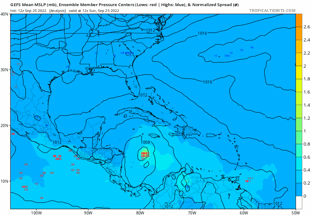
Looking at these model overlays it looks like they’re all to the right of the current NHC track right now
2 likes
Personal Forecast Disclaimer:
The posts in this forum are NOT official forecast and should not be used as such. They are just the opinion of the poster and may or may not be backed by sound meteorological data. They are NOT endorsed by any professional institution or storm2k.org. For official information, please refer to the NHC and NWS products.
The posts in this forum are NOT official forecast and should not be used as such. They are just the opinion of the poster and may or may not be backed by sound meteorological data. They are NOT endorsed by any professional institution or storm2k.org. For official information, please refer to the NHC and NWS products.
-
Blown Away

- S2K Supporter

- Posts: 9861
- Joined: Wed May 26, 2004 6:17 am
Re: ATL: IAN - Models
eastcoastFL wrote:toad strangler wrote:CMC into the armpit of the Big Bend
What’s also kinda scary is they all seem to go from a NE heading to a N or NNE. So depending on how far it comes into the state it could potentially run right up the center of the state when it turns back to the north.
Yeah that N then NE turn near the coast is weird. Models keep pushing the stall, N, and NE turn farther SE. I think the result will be Ian moving a little faster and a smoother NE recurve over the peninsula into the Atlantic.
4 likes
Hurricane Eye Experience: David 79, Irene 99, Frances 04, Jeanne 04, Wilma 05...
Hurricane Brush Experience: Andrew 92, Erin 95, Floyd 99, Matthew 16, Irma 17, Ian 22, Nicole 22…
Hurricane Brush Experience: Andrew 92, Erin 95, Floyd 99, Matthew 16, Irma 17, Ian 22, Nicole 22…
Re: ATL: IAN - Models
12Z UKMET initialized one degree further north (15.3 N vs 14.3 N at same time on 0Z run). It ends up ~20 miles north of the Port Charlotte 0Z landfall point, which is Venice. Another difference vs 0Z is that it never goes offshore N FL/S GA as it stays a little inland:
MET OFFICE TROPICAL CYCLONE GUIDANCE FOR NORTH-EAST PACIFIC AND ATLANTIC
GLOBAL MODEL DATA TIME 1200UTC 25.09.2022
TROPICAL STORM IAN ANALYSED POSITION : 15.3N 79.2W
ATCF IDENTIFIER : AL092022
LEAD CENTRAL MAXIMUM WIND
VERIFYING TIME TIME POSITION PRESSURE (MB) SPEED (KNOTS)
-------------- ---- -------- ------------- -------------
1200UTC 25.09.2022 0 15.3N 79.2W 1003 29
0000UTC 26.09.2022 12 16.7N 80.8W 1001 31
1200UTC 26.09.2022 24 18.7N 82.8W 998 35
0000UTC 27.09.2022 36 20.8N 83.9W 995 38
1200UTC 27.09.2022 48 22.9N 84.4W 994 40
0000UTC 28.09.2022 60 24.7N 84.1W 992 45
1200UTC 28.09.2022 72 26.2N 83.7W 989 55
0000UTC 29.09.2022 84 26.9N 82.9W 990 53
1200UTC 29.09.2022 96 26.9N 82.7W 991 49
0000UTC 30.09.2022 108 27.5N 82.1W 993 42
1200UTC 30.09.2022 120 29.1N 82.5W 991 42
0000UTC 01.10.2022 132 30.1N 81.8W 993 36
1200UTC 01.10.2022 144 32.8N 81.3W 996 35
1 likes
Personal Forecast Disclaimer:
The posts in this forum are NOT official forecasts and should not be used as such. They are just the opinion of the poster and may or may not be backed by sound meteorological data. They are NOT endorsed by any professional institution or storm2k.org. For official information, please refer to the NHC and NWS products.
The posts in this forum are NOT official forecasts and should not be used as such. They are just the opinion of the poster and may or may not be backed by sound meteorological data. They are NOT endorsed by any professional institution or storm2k.org. For official information, please refer to the NHC and NWS products.
-
Blown Away
- S2K Supporter
- Posts: 9861
- Joined: Wed May 26, 2004 6:17 am
Re: ATL: IAN - Models
LarryWx wrote:12Z UKMET initialized one degree further north (15.3 N vs 14.3 N at same time on 0Z run). It ends up ~20 miles north of the Port Charlotte 0Z landfall point, which is Venice. Another difference vs 0Z is that it never goes offshore N FL/S GA as it stays a little inland:
MET OFFICE TROPICAL CYCLONE GUIDANCE FOR NORTH-EAST PACIFIC AND ATLANTIC
GLOBAL MODEL DATA TIME 1200UTC 25.09.2022
TROPICAL STORM IAN ANALYSED POSITION : 15.3N 79.2W
ATCF IDENTIFIER : AL092022
LEAD CENTRAL MAXIMUM WIND
VERIFYING TIME TIME POSITION PRESSURE (MB) SPEED (KNOTS)
-------------- ---- -------- ------------- -------------
1200UTC 25.09.2022 0 15.3N 79.2W 1003 29
0000UTC 26.09.2022 12 16.7N 80.8W 1001 31
1200UTC 26.09.2022 24 18.7N 82.8W 998 35
0000UTC 27.09.2022 36 20.8N 83.9W 995 38
1200UTC 27.09.2022 48 22.9N 84.4W 994 40
0000UTC 28.09.2022 60 24.7N 84.1W 992 45
1200UTC 28.09.2022 72 26.2N 83.7W 989 55
0000UTC 29.09.2022 84 26.9N 82.9W 990 53
1200UTC 29.09.2022 96 26.9N 82.7W 991 49
0000UTC 30.09.2022 108 27.5N 82.1W 993 42
1200UTC 30.09.2022 120 29.1N 82.5W 991 42
0000UTC 01.10.2022 132 30.1N 81.8W 993 36
1200UTC 01.10.2022 144 32.8N 81.3W 996 35
15.3N is the current location, so that’s a good start.
3 likes
Hurricane Eye Experience: David 79, Irene 99, Frances 04, Jeanne 04, Wilma 05...
Hurricane Brush Experience: Andrew 92, Erin 95, Floyd 99, Matthew 16, Irma 17, Ian 22, Nicole 22…
Hurricane Brush Experience: Andrew 92, Erin 95, Floyd 99, Matthew 16, Irma 17, Ian 22, Nicole 22…
-
eastcoastFL
- Category 5
- Posts: 3437
- Age: 42
- Joined: Thu Apr 12, 2007 12:29 pm
- Location: Palm City, FL
Re: ATL: IAN - Models
Blown Away wrote:eastcoastFL wrote:toad strangler wrote:CMC into the armpit of the Big Bend
What’s also kinda scary is they all seem to go from a NE heading to a N or NNE. So depending on how far it comes into the state it could potentially run right up the center of the state when it turns back to the north.
Yeah that N then NE turn near the coast is weird. Models keep pushing the stall, N, and NE turn farther SE. I think the result will be Ian moving a little faster and a smoother NE recurve over the peninsula into the Atlantic.
Yah that seems more like a set up with an east coast approach. Typically from what I can remember storms hitting the peninsula from the west usually keep chugging into the Atlantic. But this doesn’t seem to be a typical set up. I guess we normally get storms from this angle either early or late season so the set ups are different. Now we’re in that weird transition time from summer to fall but not squarely in either yet.
1 likes
Personal Forecast Disclaimer:
The posts in this forum are NOT official forecast and should not be used as such. They are just the opinion of the poster and may or may not be backed by sound meteorological data. They are NOT endorsed by any professional institution or storm2k.org. For official information, please refer to the NHC and NWS products.
The posts in this forum are NOT official forecast and should not be used as such. They are just the opinion of the poster and may or may not be backed by sound meteorological data. They are NOT endorsed by any professional institution or storm2k.org. For official information, please refer to the NHC and NWS products.
-
toad strangler

- S2K Supporter
- Posts: 4162
- Joined: Sun Jul 28, 2013 3:09 pm
- Location: Earth
- Contact:
-
toad strangler
- S2K Supporter
- Posts: 4162
- Joined: Sun Jul 28, 2013 3:09 pm
- Location: Earth
- Contact:
-
Blown Away
- S2K Supporter
- Posts: 9861
- Joined: Wed May 26, 2004 6:17 am
Re: ATL: IAN - Models
12z GFS Trend… Continues SE trend and recurve is more of a smoother NE path over stall, loop, etc.
1 likes
Hurricane Eye Experience: David 79, Irene 99, Frances 04, Jeanne 04, Wilma 05...
Hurricane Brush Experience: Andrew 92, Erin 95, Floyd 99, Matthew 16, Irma 17, Ian 22, Nicole 22…
Hurricane Brush Experience: Andrew 92, Erin 95, Floyd 99, Matthew 16, Irma 17, Ian 22, Nicole 22…

Re: ATL: IAN - Models
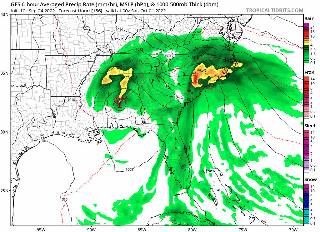
This is starting to have slow moving rainmaking sheared mess written all over it. Given the euro spaghettis and the general slow movement on the other models wouldn’t be surprised to see it collapse and spin anywhere in the big bend of offshore or Tampa. Obviously still time and I wouldn’t be amazed to see it bomb tomorrow, just seems things are trending toward the right sided weaker slow moving solutions.
3 likes
Re: ATL: IAN - Models
That would be an Elena redo. If the trough catches him he’ll keep moving. If not 
1 likes
-
ScottNAtlanta

- Category 5
- Posts: 1998
- Joined: Sat May 25, 2013 3:11 pm
- Location: Atlanta, GA
Re: ATL: IAN - Models
Was looking at Windy.com to see what the trough looks like and I believe it is just a bit stronger than what the GFS was showing. We have had some drizzle/light rain in the Atlanta area that was not supposed to happen. If it dries out later today that will be a sign of drier air punching down.
1 likes
The posts in this forum are NOT official forecast and should not be used as such. They are just the opinion of the poster and may or may not be backed by sound meteorological data. They are NOT endorsed by any professional institution or storm2k.org. For official information, please refer to the NHC and NWS products.
-
Coolcruiseman
- Tropical Depression

- Posts: 71
- Age: 50
- Joined: Wed Sep 21, 2022 8:10 pm
- Location: Melbourne, FL
Re: ATL: IAN - Models
ConvergenceZone wrote:I know that the flooding can be really bad, but I think we should all be grateful of the amount of shear that's forecasted to be in the northern gulf.... I can't even imagine how horrible this situation would have been if the conditions were great for intensification, rather than weakening. Cat 1 to maybe Cat 2 seems the most likely strength at landfall... .. I'm not really concerned about the wind as much though, except on the coast... I'm concerned about the rain/surge, especially if the EURO wins out and there's more of a stall over Florida......
Cat 1/2 at landfall would be if it was a Panhandle landfall. Farther south (say Tampa area) landfall is more in line with a Cat 3 or stronger is it not?
2 likes
-
StPeteMike

- Category 1

- Posts: 357
- Joined: Thu Jun 07, 2018 11:26 pm
Re: ATL: IAN - Models
Coolcruiseman wrote:ConvergenceZone wrote:I know that the flooding can be really bad, but I think we should all be grateful of the amount of shear that's forecasted to be in the northern gulf.... I can't even imagine how horrible this situation would have been if the conditions were great for intensification, rather than weakening. Cat 1 to maybe Cat 2 seems the most likely strength at landfall... .. I'm not really concerned about the wind as much though, except on the coast... I'm concerned about the rain/surge, especially if the EURO wins out and there's more of a stall over Florida......
Cat 1/2 at landfall would be if it was a Panhandle landfall. Farther south (say Tampa area) landfall is more in line with a Cat 3 or stronger is it not?
Further south means less impact by shear, but will still likely weaken some. But still, it will have the power of surge comparable to a Cat 3 even if it drops down below Major strength.
Still want to see if the models stay on the the whole slowing down scenario on the next rollout, that’s my biggest concern.
8 likes
The above post is not official and should not be used as such. It is the opinion of the poster and may or may not be backed by sound meteorological data. It is not endorsed by any professional institution or storm2k.org. For official information, please refer to the NHC and NWS products.
-
toad strangler
- S2K Supporter
- Posts: 4162
- Joined: Sun Jul 28, 2013 3:09 pm
- Location: Earth
- Contact:
-
tolakram
- Admin

- Posts: 19165
- Age: 60
- Joined: Sun Aug 27, 2006 8:23 pm
- Location: Florence, KY (name is Mark)
Re: ATL: IAN - Models
eastcoastFL wrote:Looking at these model overlays it looks like they’re all to the right of the current NHC track right now
http://tropic.ssec.wisc.edu/real-time/temp/tccapture.gif
Stop direct linking to that image, it's temporary and only shows what you see for a few minutes.
5 likes
M a r k
- - - - -
Join us in chat: Storm2K Chatroom Invite. Android and IOS apps also available.
The posts in this forum are NOT official forecasts and should not be used as such. Posts are NOT endorsed by any professional institution or STORM2K.org. For official information and forecasts, please refer to NHC and NWS products.

Re: ATL: IAN - Models
12z HWRF initializes Ian very well.


By tomorrow morning, Ian's multiple bands have wrapped into an eyewall and it has become a hurricane. Despite this delayed start to its RI, the HWRF still makes Ian a 930s Cat 4 in the Gulf.


By tomorrow morning, Ian's multiple bands have wrapped into an eyewall and it has become a hurricane. Despite this delayed start to its RI, the HWRF still makes Ian a 930s Cat 4 in the Gulf.
3 likes
Irene '11 Sandy '12 Hermine '16 5/15/2018 Derecho Fay '20 Isaias '20 Elsa '21 Henri '21 Ida '21
I am only a meteorology enthusiast who knows a decent amount about tropical cyclones. Look to the professional mets, the NHC, or your local weather office for the best information.
I am only a meteorology enthusiast who knows a decent amount about tropical cyclones. Look to the professional mets, the NHC, or your local weather office for the best information.
Re: ATL: IAN - Models
NDG wrote:Not until I see the Euro start trending to the left towards the official track will I say that the NHC track is good in the 3-5 day range.
I admire the loyalty of the NHC to the GFS, but at some.point you have to pay serious attention to the rock solid Euro. Euro has seemingly been locked on for several days now, while GFS has been on a grand tour of the gulf coast. It looks today like the GFS is starting to fold to the Euro solution, which we have seen happen before as we get into the 3 to 5 day range. I think the NHC will have to shift the track east now, even if they expand the cone to take the gfs swings into consideration. Bottom line is, over 2/3 of the gulf coast of Florida, as well as Alabama and Mississippi better be watching closely and ready to act fast.
2 likes
Ginger-(eye),Dennis,Diana,Kate,Gloria,Charley-(eye),Allison,Arthur,Bertha,Fran,Josephine,Bonnie,Earl,Dennis-(twice),Floyd, Isabel-(eye),Charley,Ophelia-(eyewall),Ernesto,Barry,Hanna,Irene-(eye),Arthur-(eye), Florence, Dorian, and countless depressions, storms, and nor'easters.
-
tolakram
- Admin
- Posts: 19165
- Age: 60
- Joined: Sun Aug 27, 2006 8:23 pm
- Location: Florence, KY (name is Mark)
Re: ATL: IAN - Models
capepoint wrote:NDG wrote:Not until I see the Euro start trending to the left towards the official track will I say that the NHC track is good in the 3-5 day range.
I admire the loyalty of the NHC to the GFS, but at some.point you have to pay serious attention to the rock solid Euro. Euro has seemingly been locked on for several days now, while GFS has been on a grand tour of the gulf coast. It looks today like the GFS is starting to fold to the Euro solution, which we have seen happen before as we get into the 3 to 5 day range. I think the NHC will have to shift the track east now, even if they expand the cone to take the gfs swings into consideration. Bottom line is, over 2/3 of the gulf coast of Florida, as well as Alabama and Mississippi better be watching closely and ready to act fast.
The cone never changes in size during the year, it's a simple calculated error circle around a forecast point. You make a couple of false statements here so please don't assume you understand how their forecasting works. The technique they use has been responsible for steadily increasing accuracy. Sometimes it doesn't work out, but right now the storm isn't even a hurricane yet so I think it might be a little soon to jump the gun.
13 likes
M a r k
- - - - -
Join us in chat: Storm2K Chatroom Invite. Android and IOS apps also available.
The posts in this forum are NOT official forecasts and should not be used as such. Posts are NOT endorsed by any professional institution or STORM2K.org. For official information and forecasts, please refer to NHC and NWS products.
- - - - -
Join us in chat: Storm2K Chatroom Invite. Android and IOS apps also available.
The posts in this forum are NOT official forecasts and should not be used as such. Posts are NOT endorsed by any professional institution or STORM2K.org. For official information and forecasts, please refer to NHC and NWS products.
Who is online
Users browsing this forum: No registered users and 69 guests