06z ECENS

Current Position
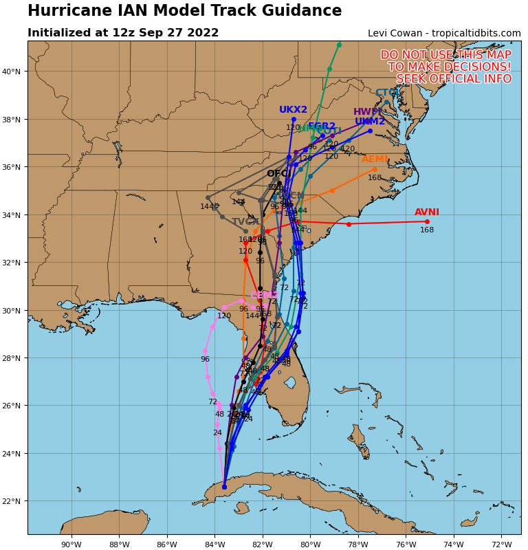
Ian again is already on the E side of the 06z ECENS.
Noticed 5am was at 23.6N, already E component.
TIme to watch the radar/satellite, clear any E of the track moves landfall farther down SWFL coast.
Moderator: S2k Moderators


Blown Away wrote:
06z ECENS
Current Position
Ian again is already on the E side of the 06z ECENS.
Noticed 5am was at 23.6N, already E component.
TIme to watch the radar/satellite, clear any E of the track moves landfall farther down SWFL coast.
skyline385 wrote:Blown Away wrote:https://i.imgur.com/xLvy02r.png
06z ECENS
https://i.imgur.com/Bpwef96.png
Current Position
Ian again is already on the E side of the 06z ECENS.
Noticed 5am was at 23.6N, already E component.
TIme to watch the radar/satellite, clear any E of the track moves landfall farther down SWFL coast.
Just fyi those are 0Z EPS, 06Z isn’t out yet
Sent from my iPhone using Tapatalk

SecondBreakfast wrote:I know we are all watching Florida, with half an eye on the Carolinas, but do we know anything about the steering patterns for further up the NE coast? I was so transfixed by Ida hitting in the gulf last year that I was not ready for the devastating flooding in NY…


SFLcane wrote:Tcvn shifts east again!
https://i.postimg.cc/GmMkYWjF/B63-C7-A9-B-5-A60-45-BC-A44-E-CCAE9-ADFF6-D9.png
SFLcane wrote:Tcvn shifts east again! Now south of nhc track
https://i.postimg.cc/GmMkYWjF/B63-C7-A9-B-5-A60-45-BC-A44-E-CCAE9-ADFF6-D9.png


Users browsing this forum: No registered users and 22 guests