EPAC: JULIA - Remnants - Discussion
Moderator: S2k Moderators
-
Iceresistance

- Category 5

- Posts: 8910
- Age: 20
- Joined: Sat Oct 10, 2020 9:45 am
- Location: Tecumseh, OK/Norman, OK
Re: ATL: JULIA - Tropical Storm - Discussion
We now have TS Julia
0 likes
Bill 2015 & Beta 2020
Winter 2020-2021
All observations are in Tecumseh, OK unless otherwise noted.
Winter posts are focused mainly for Oklahoma & Texas.
Take any of my forecasts with a grain of salt, refer to the NWS, SPC, and NHC for official information
Never say Never with weather! Because ANYTHING is possible!
Winter 2020-2021
All observations are in Tecumseh, OK unless otherwise noted.
Winter posts are focused mainly for Oklahoma & Texas.
Take any of my forecasts with a grain of salt, refer to the NWS, SPC, and NHC for official information
Never say Never with weather! Because ANYTHING is possible!
-
cheezyWXguy

- Category 5
- Posts: 5528
- Joined: Mon Feb 13, 2006 12:29 am
- Location: Dallas, TX
Re: ATL: JULIA - Tropical Storm - Discussion
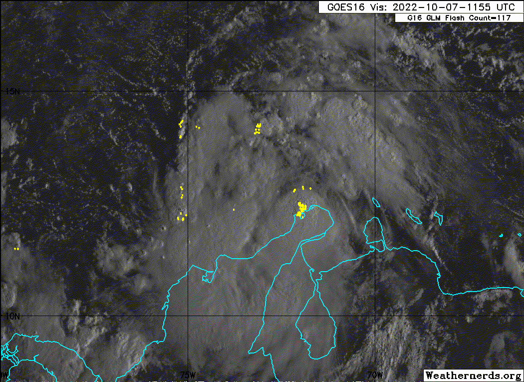
Looks like that center recon found is becoming exposed, but it also looks like there’s some turning out west under that deeper convection. Center relocation?
0 likes

Re: ATL: JULIA - Tropical Storm - Discussion
I’m getting the feeling that Julia is going to be one of those storms where the effects of shear are way more pronounced than excepted. We’ll see if shear does drop throughout the day like the NHC thinks is going to.
1 likes
Irene '11 Sandy '12 Hermine '16 5/15/2018 Derecho Fay '20 Isaias '20 Elsa '21 Henri '21 Ida '21
I am only a meteorology enthusiast who knows a decent amount about tropical cyclones. Look to the professional mets, the NHC, or your local weather office for the best information.
I am only a meteorology enthusiast who knows a decent amount about tropical cyclones. Look to the professional mets, the NHC, or your local weather office for the best information.
-
Sciencerocks
- Category 5
- Posts: 7282
- Age: 38
- Joined: Thu Jul 06, 2017 1:51 am


Re: ATL: JULIA - Tropical Storm - Discussion
aspen wrote:I’m getting the feeling that Julia is going to be one of those storms where the effects of shear are way more pronounced than excepted. We’ll see if shear does drop throughout the day like the NHC thinks is going to.
Yeah I'm not expecting much at all, doubt it becomes a hurricane, Bonnie 2.0 IMO. That doesn't change the fact that catastrophic flooding is possible in central America unfortunately.
1 likes
-
cheezyWXguy
- Category 5
- Posts: 5528
- Joined: Mon Feb 13, 2006 12:29 am
- Location: Dallas, TX
Re: ATL: JULIA - Tropical Storm - Discussion
WiscoWx02 wrote:aspen wrote:I’m getting the feeling that Julia is going to be one of those storms where the effects of shear are way more pronounced than excepted. We’ll see if shear does drop throughout the day like the NHC thinks is going to.
Yeah I'm not expecting much at all, doubt it becomes a hurricane, Bonnie 2.0 IMO. That doesn't change the fact that catastrophic flooding is possible in central America unfortunately.
What’s your reasoning on this?
4 likes
-
ElectricStorm

- Category 5
- Posts: 4523
- Age: 23
- Joined: Tue Aug 13, 2019 11:23 pm
- Location: Skiatook, OK / Norman, OK
Re: ATL: JULIA - Tropical Storm - Discussion
Well considering it's already a TS and not a struggling PTC, you can go ahead and throw those Bonnie comparisons right out the window. Bonnie didn't develop until right before landfall so I'm not sure how that would apply here...
8 likes
I am in no way a professional. Take what I say with a grain of salt as I could be totally wrong. Please refer to the NHC, NWS, or SPC for official information.
Boomer Sooner!
Boomer Sooner!
-
Hurricane Mike
- Category 2

- Posts: 562
- Joined: Tue Apr 10, 2018 7:44 am
Re: ATL: JULIA - Tropical Storm - Discussion
Here's a morning video on Julia for anyone interested
https://www.youtube.com/watch?v=ZtWd1s4fm_g
https://www.youtube.com/watch?v=ZtWd1s4fm_g
0 likes

Re: ATL: JULIA - Tropical Storm - Discussion
Looks like the sweet spot for it to ramp up is in about 12 hrs where it will be close to a pool of high OHC water.
After that, will track into lower OHC water.
After that, will track into lower OHC water.
0 likes
Re: ATL: JULIA - Tropical Storm - Discussion
Pretty much getting a cutoff of high TPW air due to mountains of Columbia at this time.
Once it gets more west, may pick up moisture from the EPAC since Panama is relatively flat.
Once it gets more west, may pick up moisture from the EPAC since Panama is relatively flat.
1 likes
-
cheezyWXguy
- Category 5
- Posts: 5528
- Joined: Mon Feb 13, 2006 12:29 am
- Location: Dallas, TX
Re: ATL: JULIA - Tropical Storm - Discussion
Won’t be exposed for too long. You can see moisture being pulled in at the surface through the inflow “bands”. A few more hours, then the Bonnie references will stop. Remember, intensification is not linear. We saw how people’s downcasts on Ian aged like milk less than 2 weeks ago
12 likes

-
tropicwatch

- Category 5
- Posts: 3205
- Age: 60
- Joined: Sat Jun 02, 2007 10:01 am
- Location: Panama City Florida
- Contact:
Re: ATL: JULIA - Tropical Storm - Discussion
Seems to be maintaining right now. Not up or down 
0 likes
Tropicwatch
Agnes 72', Eloise 75, Elena 85', Kate 85', Charley 86', Florence 88', Beryl 94', Dean 95', Erin 95', Opal 95', Earl 98', Georges 98', Ivan 2004', Arlene 2005', Dennis 2005', Ida 2009' Debby 2012' Irma 2017' Michael 2018'
Agnes 72', Eloise 75, Elena 85', Kate 85', Charley 86', Florence 88', Beryl 94', Dean 95', Erin 95', Opal 95', Earl 98', Georges 98', Ivan 2004', Arlene 2005', Dennis 2005', Ida 2009' Debby 2012' Irma 2017' Michael 2018'
-
Category5Kaiju

- Category 5
- Posts: 3351
- Age: 22
- Joined: Thu Dec 24, 2020 12:45 pm
- Location: Seattle
Re: ATL: JULIA - Tropical Storm - Discussion
How does this compare to Iota? Very similar starting positions location-wise, but in terms of structure, I am not quite sure
0 likes
Unless explicitly stated, all information covered in my posts is based on my opinions and observations. Please refer to a professional meteorologist or an accredited weather research agency otherwise, especially if serious decisions must be made in the event of a potentially life-threatening tropical storm or hurricane.
Re: ATL: JULIA - Tropical Storm - Discussion
Extrapolated pressure down to 1000.7. Dropped about 2.6mb since last pass (35 mins ago). It's weird considering that it's just a naked swirl
0 likes
-
AtlanticWind

- S2K Supporter

- Posts: 1805
- Age: 65
- Joined: Sun Aug 08, 2004 9:57 pm
- Location: Plantation,Fla
Re: ATL: JULIA - Tropical Storm - Discussion
No reason to believe this wont be at or very near hurricane strength before landfall.
1 likes
-
Iceresistance
- Category 5
- Posts: 8910
- Age: 20
- Joined: Sat Oct 10, 2020 9:45 am
- Location: Tecumseh, OK/Norman, OK
Re: ATL: JULIA - Tropical Storm - Discussion
Category5Kaiju wrote:
How does this compare to Iota? Very similar starting positions location-wise, but in terms of structure, I am not quite sure
Iota had a terrible structure before bombing out into a monster.
1 likes
Bill 2015 & Beta 2020
Winter 2020-2021
All observations are in Tecumseh, OK unless otherwise noted.
Winter posts are focused mainly for Oklahoma & Texas.
Take any of my forecasts with a grain of salt, refer to the NWS, SPC, and NHC for official information
Never say Never with weather! Because ANYTHING is possible!
Winter 2020-2021
All observations are in Tecumseh, OK unless otherwise noted.
Winter posts are focused mainly for Oklahoma & Texas.
Take any of my forecasts with a grain of salt, refer to the NWS, SPC, and NHC for official information
Never say Never with weather! Because ANYTHING is possible!
-
Hurricane2022

- Category 4

- Posts: 911
- Joined: Tue Aug 23, 2022 11:38 pm
- Location: Araçatuba, Brazil
Re: ATL: JULIA - Tropical Storm - Discussion
Category5Kaiju wrote:
How does this compare to Iota? Very similar starting positions location-wise, but in terms of structure, I am not quite sure
One important difference I see between Julia and Iota is the speed of movement. Iota has moved slowly for much of its life and has had enough time to become something perhaps stronger than a 155 mph major hurricane. While Julia this year is moving faster and will likely make landfall in less than 40 hours from now, it's also possible that Julia won't even make it to Category 1.
...However, as Julia is in a very favorable environment for rapid intensification, I think there is uncertainty here about her future peak intensity. In a way, we can see both a Bonnie 2.0 and a Noru 2.0 in their approach to Nicaragua.
1 likes
Sorry for the bad English sometimes...!
For reliable and detailed information for any meteorological phenomenon, please consult the National Hurricane Center, Joint Typhoon Warning Center , or your local Meteo Center.
--------
Una cvm Christo, pro Christo, et in Christo. Sit nomen Domini benedictvm.
For reliable and detailed information for any meteorological phenomenon, please consult the National Hurricane Center, Joint Typhoon Warning Center , or your local Meteo Center.
--------
Una cvm Christo, pro Christo, et in Christo. Sit nomen Domini benedictvm.
Who is online
Users browsing this forum: No registered users and 24 guests