GCANE wrote:Looks like chances are increasing that something in the GoM may come out of this.
Why are you saying this?
Moderator: S2k Moderators


GCANE wrote:Looks like chances are increasing that something in the GoM may come out of this.
cycloneye wrote:GCANE wrote:Looks like chances are increasing that something in the GoM may come out of this.
Why are you saying this?


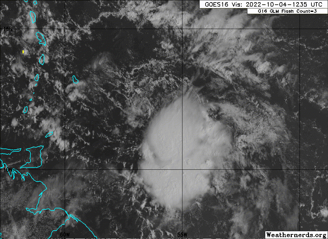
cycloneye wrote:Special Tropical Weather OutlookEast of the Windward Islands:
Updated: Visible satellite images and recent satellite-derived
wind data suggest that a broad low-level circulation could be
forming in association with the tropical wave located a few hundred
miles east of the southern Windward Islands. Although the wave
is currently being affected by strong upper-level winds, conditions
could become more conducive for a tropical depression to form while
moving westward at about 15 mph, crossing the Windward Islands
tonight and early Wednesday. Conditions appear to become more
conducive for development later this week when the system reaches
the central and western Caribbean Sea. Regardless of development,
locally heavy rainfall and gusty winds are expected over portions of
the Windward Islands tonight and Wednesday. Interests in the
Windward Islands, the ABC Islands, and the northern coast of
Venezuela should monitor the progress of this system. An Air Force
Reserve Hurricane Hunter aircraft is currently enroute to
investigate this system.
* Formation chance through 48 hours...medium...40 percent.
* Formation chance through 5 days...medium...60 percent.
Users browsing this forum: No registered users and 21 guests