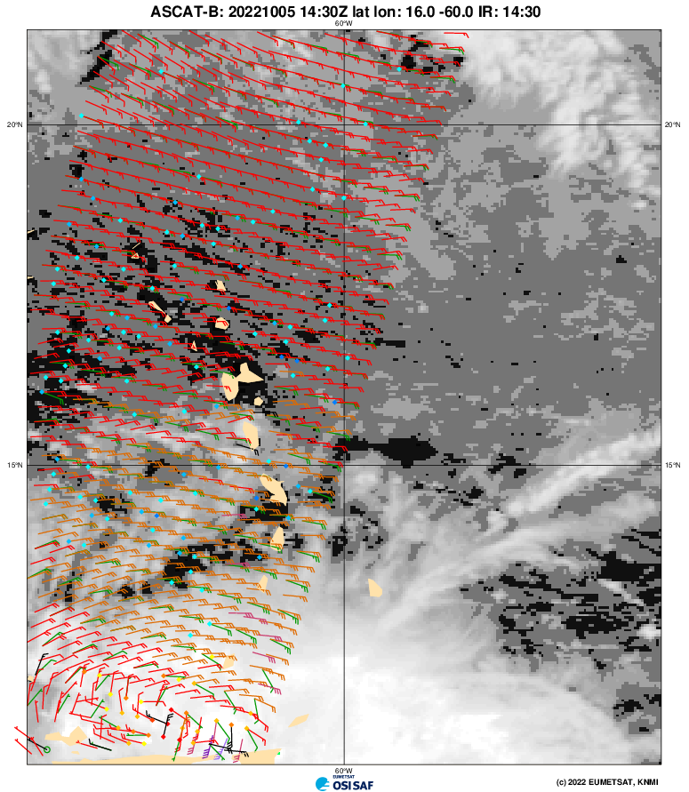
tropicwatch wrote:cycloneye wrote:Iceresistance wrote:ASCAT has made a direct hit, still no LLC.
Where is the graphic?
https://tropicwatch.info/ascat1430z.png
Looks closed to me.
Moderator: S2k Moderators

tropicwatch wrote:cycloneye wrote:Iceresistance wrote:ASCAT has made a direct hit, still no LLC.
Where is the graphic?
https://tropicwatch.info/ascat1430z.png

wxman57 wrote:Nuno wrote:Would a PTC designation have been appropriate in this situation? Flooding looks very concerning.
Heavy rain and wind gusts to tropical storm strength are common with just about every moderate tropical wave. That's not enough to begin advisories.


ThunderForce wrote:If 91L already has a closed low-level circulation, does that mean it is more likely to strengthen more and/or get into the Gulf?
Hurricaneman wrote:ThunderForce wrote:If 91L already has a closed low-level circulation, does that mean it is more likely to strengthen more and/or get into the Gulf?
Nope, too much ridging to the north and little to no weakness to pick it up so anywhere from Nicaragua to Belize
Hurricaneman wrote:ThunderForce wrote:If 91L already has a closed low-level circulation, does that mean it is more likely to strengthen more and/or get into the Gulf?
Nope, too much ridging to the north and little to no weakness to pick it up so anywhere from Nicaragua to Belize
ThunderForce wrote:Hurricaneman wrote:ThunderForce wrote:If 91L already has a closed low-level circulation, does that mean it is more likely to strengthen more and/or get into the Gulf?
Nope, too much ridging to the north and little to no weakness to pick it up so anywhere from Nicaragua to Belize
I'm hoping this having a closed LLC already doesn't mean that Nicaragua and Belize are more likely to get a major hurricane.
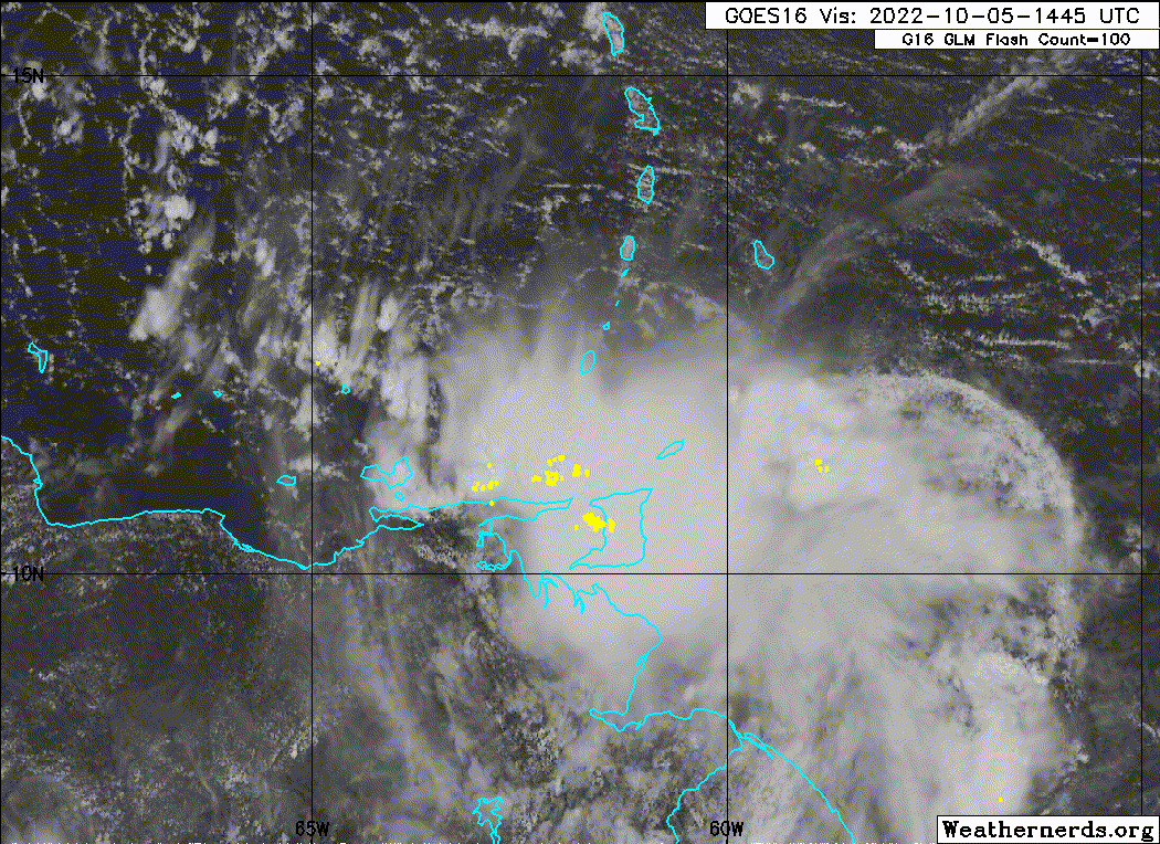
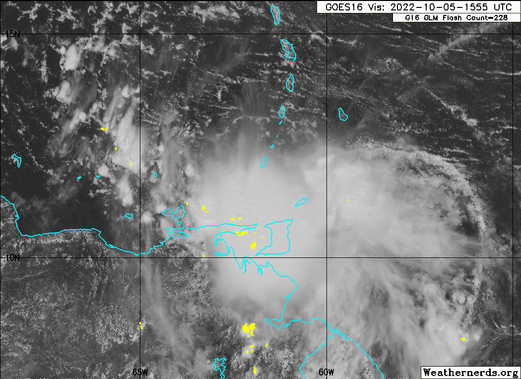
Teban54 wrote:Even more evidence supporting TCG:
https://twitter.com/cyclonicwx/status/1577773102397853698?s=20&t=rxpA65swa2QlZGcd_84Q2g
cycloneye wrote:Teban54 wrote:Even more evidence supporting TCG:
https://twitter.com/cyclonicwx/status/1577773102397853698?s=20&t=rxpA65swa2QlZGcd_84Q2g
There was a plane for this evening but was postponed for Thursday at 5:45 PM EDT. It would have been great to have it now.

cycloneye wrote:Teban54 wrote:Even more evidence supporting TCG:
https://twitter.com/cyclonicwx/status/1577773102397853698?s=20&t=rxpA65swa2QlZGcd_84Q2g
There was a plane for this evening but was postponed for Thursday at 5:45 PM EDT. It would have been great to have it now.
Users browsing this forum: No registered users and 9 guests


