

000
WTNT41 KNHC 281847
TCDAT1
TROPICAL STORM NOEL SPECIAL DISCUSSION NUMBER 4
NWS TPC/NATIONAL HURRICANE CENTER MIAMI FL AL162007
215 PM EDT SUN OCT 28 2007
THIS SPECIAL ADVISORY IS BEING ISSUED TO REFLECT CHANGES IN THE
INITIAL AND FORECAST POSITION AND INTENSITY FOR TROPICAL STORM
NOEL. THE INITIAL INTENSITY IS SET TO 45 KT BASED ON 1000-FT
FLIGHT-LEVEL WINDS OF ABOUT 55 KT...AND SFMR ESTIMATES BETWEEN 45
AND 50 KT. INTENSITY FORECAST HAS ALSO BEEN ADJUSTED SLIGHTLY
UPWARD. THE AIRCRAFT LOCATED THE CIRCULATION CENTER ABOUT 45 N MI
NORTHEAST OF THE PREVIOUS ADVISORY POSITION. THE OFFICIAL TRACK
FORECAST HAS BEEN ADJUSTED SLIGHTLY NORTHWARD AND EASTWARD TO
ACCOUNT FOR THE RELOCATION.
PLEASE NOTE THAT THE PRONUNCIATION FOR THE THIS STORM'S NAME IS
NOL...WITH A LONG O SOUND AND JUST ONE SYLLABLE...OR EXACTLY LIKE
THE WORD KNOLL.
FORECAST POSITIONS AND MAX WINDS
INITIAL 28/1815Z 16.9N 72.1W 45 KT
12HR VT 29/0000Z 17.6N 72.7W 50 KT
24HR VT 29/1200Z 18.7N 74.2W 55 KT
36HR VT 30/0000Z 19.9N 75.5W 60 KT
48HR VT 30/1200Z 21.1N 76.6W 50 KT...INLAND OVER CUBA
72HR VT 31/1200Z 22.5N 77.5W 55 KT
96HR VT 01/1200Z 23.5N 77.5W 55 KT
120HR VT 02/1200Z 25.5N 75.5W 50 KT
$$
FORECASTER KNABB
Hurricane NOEL : Discussions & Images
Moderator: S2k Moderators
-
Evil Jeremy

- S2K Supporter

- Posts: 5463
- Age: 32
- Joined: Mon Apr 10, 2006 2:10 pm
- Location: Los Angeles, CA
Re: Tropical Storm Noel : Discussions & Images
000
WTNT41 KNHC 281847
TCDAT1
TROPICAL STORM NOEL SPECIAL DISCUSSION NUMBER 4
NWS TPC/NATIONAL HURRICANE CENTER MIAMI FL AL162007
215 PM EDT SUN OCT 28 2007
THIS SPECIAL ADVISORY IS BEING ISSUED TO REFLECT CHANGES IN THE
INITIAL AND FORECAST POSITION AND INTENSITY FOR TROPICAL STORM
NOEL. THE INITIAL INTENSITY IS SET TO 45 KT BASED ON 1000-FT
FLIGHT-LEVEL WINDS OF ABOUT 55 KT...AND SFMR ESTIMATES BETWEEN 45
AND 50 KT. INTENSITY FORECAST HAS ALSO BEEN ADJUSTED SLIGHTLY
UPWARD. THE AIRCRAFT LOCATED THE CIRCULATION CENTER ABOUT 45 N MI
NORTHEAST OF THE PREVIOUS ADVISORY POSITION. THE OFFICIAL TRACK
FORECAST HAS BEEN ADJUSTED SLIGHTLY NORTHWARD AND EASTWARD TO
ACCOUNT FOR THE RELOCATION.
PLEASE NOTE THAT THE PRONUNCIATION FOR THE THIS STORM'S NAME IS
NOL...WITH A LONG O SOUND AND JUST ONE SYLLABLE...OR EXACTLY LIKE
THE WORD KNOLL.
FORECAST POSITIONS AND MAX WINDS
INITIAL 28/1815Z 16.9N 72.1W 45 KT
12HR VT 29/0000Z 17.6N 72.7W 50 KT
24HR VT 29/1200Z 18.7N 74.2W 55 KT
36HR VT 30/0000Z 19.9N 75.5W 60 KT
48HR VT 30/1200Z 21.1N 76.6W 50 KT...INLAND OVER CUBA
72HR VT 31/1200Z 22.5N 77.5W 55 KT
96HR VT 01/1200Z 23.5N 77.5W 55 KT
120HR VT 02/1200Z 25.5N 75.5W 50 KT
$$
FORECASTER KNABB
0 likes
-
CrazyC83
- Professional-Met

- Posts: 34315
- Joined: Tue Mar 07, 2006 11:57 pm
- Location: Deep South, for the first time!
URNT12 KNHC 281853
VORTEX DATA MESSAGE AL162007
A. 28/17:57:30Z
B. 16 deg 33 min N
071 deg 45 min W
C. NA mb NA m
D. 53 kt
E. 315 deg 044 nm
F. 039 deg 050 kt
G. 315 deg 044 nm
H. EXTRAP 996 mb
I. 25 C/ 305 m
J. 26 C/ 270 m
K. 0 C/ NA
L. NA
M. NA
N. 1345 /1
O. 0.02 / 2 nm
P. AF303 0116A CYCLONE1 OB 07
MAX FL WIND 50 KT NW QUAD 17:24:00 Z
SLP EXTRAP FROM 1500 FT
;
0 likes

Re: Tropical Storm Noel : Discussions & Images
southerngale wrote:Vortex wrote:Updated guidance in line with CMC/GFDL/HWRF
Will remain well east of Florida. Looks like the US made it through '07
Florida wasn't hit by a hurricane, but the one that hit Texas doesn't count, I guess.
My apologies to those in Texas.
0 likes
-
Stratosphere747
- Category 5

- Posts: 3772
- Joined: Thu Sep 11, 2003 8:34 pm
- Location: Surfside Beach/Freeport Tx
- Contact:
Re: Tropical Storm Noel : Discussions & Images
southerngale wrote:Vortex wrote:Updated guidance in line with CMC/GFDL/HWRF
Will remain well east of Florida. Looks like the US made it through '07
Florida wasn't hit by a hurricane, but the one that hit Texas doesn't count, I guess.
Not only is the Golden Triangle not part of Texas, the US has stopped claiming it.
When did yall secede?
0 likes
-
CrazyC83
- Professional-Met
- Posts: 34315
- Joined: Tue Mar 07, 2006 11:57 pm
- Location: Deep South, for the first time!
URNT15 KNHC 281857
AF303 0116A CYCLONE1 HDOB 11 20071028
184430 1647N 07202W 9769 00195 9988 +239 +220 051032 036 042 000 00
184500 1647N 07203W 9768 00195 9989 +234 +220 058040 042 042 002 00
184530 1648N 07205W 9775 00187 9990 +212 +212 057048 051 045 005 00
184600 1648N 07207W 9773 00191 9992 +206 +206 056051 053 048 001 00
184630 1649N 07209W 9766 00201 9995 +209 +209 051053 054 047 000 00
184700 1649N 07210W 9770 00199 9997 +216 +216 049054 054 050 000 00
184730 1650N 07212W 9771 00202 9998 +227 +220 051056 058 051 000 00
184800 1650N 07214W 9773 00199 9999 +231 +220 054054 055 049 000 00
184830 1651N 07215W 9772 00204 0005 +221 +220 050049 052 046 000 00
184900 1652N 07217W 9769 00212 0010 +215 +215 050051 052 045 003 00
184930 1653N 07218W 9764 00215 0008 +225 +220 053049 051 046 002 00
185000 1654N 07220W 9776 00208 0014 +211 +211 046044 047 048 000 00
185030 1654N 07222W 9769 00214 0014 +213 +213 045039 040 044 004 03
185100 1655N 07223W 9768 00217 0014 +230 +220 042036 037 039 000 00
185130 1656N 07224W 9770 00216 0014 +236 +220 041038 039 039 002 00
185200 1658N 07225W 9769 00217 0015 +235 +220 039037 039 041 000 00
185230 1659N 07225W 9767 00222 0016 +237 +220 044040 041 042 000 00
185300 1700N 07226W 9773 00217 0017 +240 +220 045039 040 045 000 00
185330 1701N 07227W 9770 00220 0018 +240 +220 044038 039 043 000 00
185400 1702N 07228W 9764 00225 0020 +239 +220 041036 037 040 000 00
$$
;
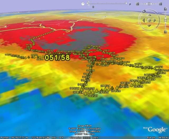
58 kt FL, 51 kt SFMR...
AF303 0116A CYCLONE1 HDOB 11 20071028
184430 1647N 07202W 9769 00195 9988 +239 +220 051032 036 042 000 00
184500 1647N 07203W 9768 00195 9989 +234 +220 058040 042 042 002 00
184530 1648N 07205W 9775 00187 9990 +212 +212 057048 051 045 005 00
184600 1648N 07207W 9773 00191 9992 +206 +206 056051 053 048 001 00
184630 1649N 07209W 9766 00201 9995 +209 +209 051053 054 047 000 00
184700 1649N 07210W 9770 00199 9997 +216 +216 049054 054 050 000 00
184730 1650N 07212W 9771 00202 9998 +227 +220 051056 058 051 000 00
184800 1650N 07214W 9773 00199 9999 +231 +220 054054 055 049 000 00
184830 1651N 07215W 9772 00204 0005 +221 +220 050049 052 046 000 00
184900 1652N 07217W 9769 00212 0010 +215 +215 050051 052 045 003 00
184930 1653N 07218W 9764 00215 0008 +225 +220 053049 051 046 002 00
185000 1654N 07220W 9776 00208 0014 +211 +211 046044 047 048 000 00
185030 1654N 07222W 9769 00214 0014 +213 +213 045039 040 044 004 03
185100 1655N 07223W 9768 00217 0014 +230 +220 042036 037 039 000 00
185130 1656N 07224W 9770 00216 0014 +236 +220 041038 039 039 002 00
185200 1658N 07225W 9769 00217 0015 +235 +220 039037 039 041 000 00
185230 1659N 07225W 9767 00222 0016 +237 +220 044040 041 042 000 00
185300 1700N 07226W 9773 00217 0017 +240 +220 045039 040 045 000 00
185330 1701N 07227W 9770 00220 0018 +240 +220 044038 039 043 000 00
185400 1702N 07228W 9764 00225 0020 +239 +220 041036 037 040 000 00
$$
;
58 kt FL, 51 kt SFMR...
0 likes
-
CourierPR

- Category 5
- Posts: 1336
- Age: 72
- Joined: Tue Aug 31, 2004 7:53 pm
- Location: Pompano Beach, Florida
Re: Tropical Storm Noel : Discussions & Images
Some additional strengthening is forecast during the next 24 hours says the NHC. I will go with their expertise.MiamiensisWx wrote:Additionally, it looks like cloud tops are warming per recent satellite data. The center's current motion and location further ENE implies more land interaction with Hispaniola. I think this may be Noel's peak, and it was likely a TS much earlier than indicated by the TPC. I hate to say, "It's done!" but recent trends suggest this is the case. Additionally, it looks like UL shear is affecting the western quadrant via an adjacent upper low. Noel may eventually make a direct strike on Hispaniola. Although this may (emphasis added to reflect uncertainties) diminish the United States risk, I feel terrible that heavy precipitation will affect Haiti and the DR. This may cause numerous deaths because of deforestation and economic quagmires. Remember Jeanne '04 - it killed more than 3,000 people in Haiti. It is very sad that this system will probably cross Hispaniola. We should be concerned about these folks.
0 likes
-
MiamiensisWx
Re: Tropical Storm Noel : Discussions & Images
CourierPR wrote:Some additional strengthening is forecast during the next 24 hours says the NHC. I will go with their expertise.MiamiensisWx wrote:Additionally, it looks like cloud tops are warming per recent satellite data. The center's current motion and location further ENE implies more land interaction with Hispaniola. I think this may be Noel's peak, and it was likely a TS much earlier than indicated by the TPC. I hate to say, "It's done!" but recent trends suggest this is the case. Additionally, it looks like UL shear is affecting the western quadrant via an adjacent upper low. Noel may eventually make a direct strike on Hispaniola. Although this may (emphasis added to reflect uncertainties) diminish the United States risk, I feel terrible that heavy precipitation will affect Haiti and the DR. This may cause numerous deaths because of deforestation and economic quagmires. Remember Jeanne '04 - it killed more than 3,000 people in Haiti. It is very sad that this system will probably cross Hispaniola. We should be concerned about these folks.
Well, I'm going with wxman57's thoughts.
0 likes
-
Derek Ortt
-
storms in NC

- S2K Supporter
- Posts: 2338
- Joined: Thu Jul 28, 2005 2:58 pm
- Location: Wallace,NC 40 miles NE of Wilm
- Contact:
Re: Tropical Storm Noel : Discussions & Images
CourierPR wrote:Oh, really? I think the season ends on November 30, officially.Vortex wrote:Updated guidance in line with CMC/GFDL/HWRF
Will remain well east of Florida. Looks like the US made it through '07
If I remember right we had one to go into Tx this year. A cat 1 but it counts. But over all we didn't really have much of a Hurricanes season to me that is. Dean and Felix was the storms of the year of 2007 in my book. But has any one looked at all the cat scats on the season map? Every one should be thankful in the US.
0 likes

-
MiamiensisWx
Re: Tropical Storm Noel : Discussions & Images
"Every one should be thankful in the US."
The key word is "US". People in Hispaniola will not be very satisfied with Noel. The Bahamas should monitor the TC, too. The degree of land interaction with Hispaniola may partially determine the storm's eventual intensity when it re-emerges over water. Additionally, I slightly disagree about Humberto. Its impact was locally significant, although the United States was generally spared in other regions.
The key word is "US". People in Hispaniola will not be very satisfied with Noel. The Bahamas should monitor the TC, too. The degree of land interaction with Hispaniola may partially determine the storm's eventual intensity when it re-emerges over water. Additionally, I slightly disagree about Humberto. Its impact was locally significant, although the United States was generally spared in other regions.
0 likes
-
CrazyC83
- Professional-Met
- Posts: 34315
- Joined: Tue Mar 07, 2006 11:57 pm
- Location: Deep South, for the first time!
URNT15 KNHC 281907
AF303 0116A CYCLONE1 HDOB 12 20071028
185430 1704N 07229W 9770 00220 0020 +236 +220 040035 036 042 000 00
185500 1705N 07230W 9770 00222 0021 +235 +220 042037 038 041 000 00
185530 1706N 07230W 9767 00225 0021 +231 +220 043037 038 042 000 00
185600 1707N 07231W 9768 00222 0022 +230 +220 042038 039 043 000 00
185630 1709N 07232W 9767 00225 0022 +230 +220 045040 041 043 000 00
185700 1710N 07233W 9770 00224 0023 +231 +220 046039 040 042 000 00
185730 1711N 07234W 9771 00222 0025 +232 +220 042038 040 042 000 00
185800 1712N 07234W 9769 00225 0025 +234 +220 041038 038 042 000 00
185830 1714N 07235W 9772 00223 0025 +235 +220 043037 039 040 000 00
185900 1715N 07236W 9771 00224 0026 +237 +220 043038 039 040 000 00
185930 1716N 07237W 9771 00227 0027 +238 +220 042036 038 041 000 00
190000 1717N 07237W 9772 00225 0028 +239 +220 042038 040 042 000 00
190030 1719N 07238W 9775 00224 0028 +241 +220 042037 039 040 000 00
190100 1720N 07239W 9770 00230 0028 +244 +220 043037 039 042 000 00
190130 1721N 07240W 9764 00233 0028 +245 +220 044029 033 039 000 00
190200 1722N 07240W 9774 00225 0029 +245 +220 036027 028 035 000 00
190230 1724N 07241W 9769 00231 0029 +246 +220 032025 025 034 000 00
190300 1725N 07242W 9767 00235 0029 +248 +220 036024 026 032 000 00
190330 1726N 07243W 9772 00228 0033 +242 +212 032023 024 032 000 00
190400 1727N 07244W 9770 00230 0031 +250 +220 029021 022 031 000 00
$$
;
0 likes
-
MiamiensisWx
Re:
HURAKAN wrote::uarrow: I'm not thankful because we need the rain really bad. Noel could have saved us from more strict water rules as the dry season gets hold.
Again, I strongly concur with this post. Noel will cause needless deaths in Hispaniola via "misplaced" precipitation.
0 likes
-
emeraldislencguy
- S2K Supporter
- Posts: 207
- Joined: Sun Aug 27, 2006 4:35 pm
- Location: emerald isle nc
- Contact:
Re: Tropical Storm Noel : Discussions & Images
our prayers and concerns should go to the people of Haiti and DR--the rain totals will cause major problems and deaths are a possibility--lets ur pray for them.
0 likes
-
CrazyC83
- Professional-Met
- Posts: 34315
- Joined: Tue Mar 07, 2006 11:57 pm
- Location: Deep South, for the first time!
URNT12 KNHC 281910
VORTEX DATA MESSAGE AL162007
A. 28/18:38:40Z
B. 16 deg 39 min N
071 deg 45 min W
C. NA mb NA m
D. 39 kt
E. 157 deg 027 nm
F. 320 deg 033 kt
G. 157 deg 027 nm
H. EXTRAP 996 mb
I. 25 C/ 304 m
J. 26 C/ 305 m
K. C/ NA
L. NA
M. NA
N. 1345 /1
O. 0.02 / 4 nm
P. AF303 0116A CYCLONE1 OB 10
MAX FL WIND 58 KT NW QUAD 18:47:30Z
SLP EXTRAP FROM 1500 FT.
;
0 likes
-
MiamiensisWx
Re: Tropical Storm Noel : Discussions & Images
Unfortunately, recent precipitation displaced more than 4,000 people in Haiti, so Noel may enhance the situation. Additionally, the system is moving very slowly (~5 mph per NHC), and mountainous terrain will support flash flooding in the region. Can anyone post some good links for local obs and reports from Hispaniola? Thanks in advance. Noel is situated under weak steering currents, thus leading to concerns about locally heavy rainfall.
0 likes
-
CrazyC83
- Professional-Met
- Posts: 34315
- Joined: Tue Mar 07, 2006 11:57 pm
- Location: Deep South, for the first time!
URNT15 KNHC 281917
AF303 0116A CYCLONE1 HDOB 13 20071028
190430 1728N 07246W 9769 00235 0032 +251 +220 029017 018 029 000 00
190500 1729N 07247W 9769 00235 0034 +250 +220 033012 014 029 000 00
190530 1730N 07248W 9771 00233 0034 +248 +220 023010 011 028 000 00
190600 1731N 07249W 9771 00234 0034 +249 +220 021009 011 028 000 00
190630 1732N 07251W 9773 00231 0034 +248 +220 351006 009 027 000 00
190700 1733N 07252W 9765 00237 0034 +250 +220 010008 008 029 000 00
190730 1734N 07253W 9774 00231 0034 +249 +220 339007 008 028 000 00
190800 1734N 07254W 9770 00233 0033 +250 +220 316007 008 028 000 00
190830 1735N 07256W 9770 00233 0033 +250 +220 308007 008 028 000 03
190900 1736N 07257W 9764 00237 0033 +250 +220 310008 009 999 999 03
190930 1734N 07258W 9767 00235 0033 +250 +220 312011 011 025 000 03
191000 1733N 07257W 9772 00231 0032 +250 +220 312012 013 028 000 00
191030 1731N 07257W 9773 00231 0033 +251 +220 318013 014 029 000 00
191100 1729N 07256W 9767 00237 0033 +249 +220 320012 013 028 000 00
191130 1728N 07256W 9773 00231 0034 +250 +220 336012 013 028 000 00
191200 1726N 07256W 9769 00234 0032 +251 +220 340012 013 028 000 00
191230 1724N 07255W 9777 00228 0033 +249 +220 350011 012 027 000 00
191300 1723N 07255W 9768 00235 0033 +249 +220 357011 012 028 000 00
191330 1721N 07255W 9759 00243 0033 +246 +220 004014 016 028 000 00
191400 1719N 07254W 9768 00237 0035 +249 +220 015018 020 030 000 00
$$
;
0 likes
Who is online
Users browsing this forum: No registered users and 47 guests