TROPICAL WEATHER OUTLOOK
NWS TPC/NATIONAL HURRICANE CENTER MIAMI FL
1030 PM EDT THU AUG 30 2007
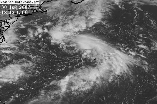
A SMALL AREA OF LOW PRESSURE ABOUT 250 MILES SOUTHEAST OF ATLANTIC
CITY NEW JERSEY IS MOVING NORTH-NORTHWESTWARD...AND IS EXPECTED TO
BEGIN MOVING NORTHEASTWARD AHEAD OF AN APPROACHING FRONTAL SYSTEM.
WHILE THIS SYSTEM HAS CHANGED LITTLE IN ORGANIZATION DURING THE
EVENING...THERE IS STILL SOME POTENTIAL FOR IT TO BECOME A TROPICAL
CYCLONE BEFORE BEING OVERTAKEN BY THE FRONT.
ELSEWHERE...TROPICAL CYCLONE FORMATION IS NOT EXPECTED DURING THE
NEXT 48 HOURS.
$$
FORECASTER BEVEN
Invest 96L,North Atlantic-Discussions
Moderator: S2k Moderators


I sure hope that the NHC DOES NOT upgrade this to a named system for a lifespan of like 24 hours or less.
Of course that would please those who have a bogry to hit in the # of named storms prediction game; but.... give me a break.
Although that would describe this season; named storms; except for Dean that did not amount to much. Even Erin was not much and for the type of havoc she reeked; she could have just been a TD.
0 likes

-
Matt-hurricanewatcher

- Category 5

- Posts: 11649
- Age: 38
- Joined: Fri Nov 26, 2004 11:09 pm
- Location: Portland,OR
- Contact:
Re: Invest 96L,North Atlantic-Discussions-Analysis & Imagery
If its a tropcal depression or tropical storm the nhc will need to upgrade it. Its there job. It does look like its at least a depression.
0 likes
-
Coredesat
Re:
fci wrote:I sure hope that the NHC DOES NOT upgrade this to a named system for a lifespan of like 24 hours or less.
Monitoring tropical cyclones is the NHC's job, and you cannot tell the NHC how to do its job. If they feel a system is a tropical storm, they'll upgrade it regardless of how long it might last (look at Chantal).
Some of the posts I've seen about the season being "dead" are just terrible and this is one of those. I've seen others about people saying they'd upgrade four systems a day if they ran the NHC. People just want to see storms (or storms that do things) without regard to anything. I'm tired of rebutting it.
0 likes

Re: Invest 96L,North Atlantic-Discussions-Analysis & Imagery
552
WHXX01 KWBC 310705
CHGHUR
TROPICAL CYCLONE GUIDANCE MESSAGE
NWS TPC/NATIONAL HURRICANE CENTER MIAMI FL
0705 UTC FRI AUG 31 2007
DISCLAIMER...NUMERICAL MODELS ARE SUBJECT TO LARGE ERRORS.
PLEASE REFER TO NHC OFFICIAL FORECASTS FOR TROPICAL CYCLONE
AND SUBTROPICAL CYCLONE INFORMATION.
ATLANTIC OBJECTIVE AIDS FOR
DISTURBANCE INVEST (AL962007) 20070831 0600 UTC
...00 HRS... ...12 HRS... ...24 HRS. .. ...36 HRS...
070831 0600 070831 1800 070901 0600 070901 1800
LAT LON LAT LON LAT LON LAT LON
BAMS 37.7N 71.0W 38.7N 71.0W 38.9N 69.6W 38.2N 66.7W
BAMD 37.7N 71.0W 39.7N 69.7W 42.6N 65.9W 46.1N 60.9W
BAMM 37.7N 71.0W 39.1N 70.7W 40.7N 67.8W 42.5N 62.6W
LBAR 37.7N 71.0W 39.4N 69.6W 42.0N 66.6W 45.6N 61.4W
SHIP 25KTS 29KTS 35KTS 41KTS
DSHP 25KTS 29KTS 35KTS 41KTS
...48 HRS... ...72 HRS... ...96 HRS. .. ..120 HRS...
070902 0600 070903 0600 070904 0600 070905 0600
LAT LON LAT LON LAT LON LAT LON
BAMS 36.8N 63.2W 33.4N 59.3W 33.0N 59.4W 34.9N 57.7W
BAMD 49.5N 56.0W 56.4N 45.7W 62.1N 33.1W 66.2N 12.9W
BAMM 44.3N 57.2W 47.6N 47.0W 49.9N 39.8W 54.3N 35.0W
LBAR 49.9N 53.1W .0N .0W .0N .0W .0N .0W
SHIP 50KTS 43KTS 42KTS 33KTS
DSHP 50KTS 43KTS 42KTS 33KTS
...INITIAL CONDITIONS...
LATCUR = 37.7N LONCUR = 71.0W DIRCUR = 345DEG SPDCUR = 7KT
LATM12 = 36.2N LONM12 = 70.0W DIRM12 = 357DEG SPDM12 = 8KT
LATM24 = 35.5N LONM24 = 70.2W
WNDCUR = 25KT RMAXWD = 60NM WNDM12 = 25KT
CENPRS = 1009MB OUTPRS = 1012MB OUTRAD = 120NM SDEPTH = D
RD34NE = 0NM RD34SE = 0NM RD34SW = 0NM RD34NW = 0NM
$$
NNNN
6z Models still a 25kt disturbance
0 likes
Re: Invest 96L,North Atlantic-Discussions-Analysis & Imagery
6z Ship report of south winds up to 26kts, east of the center:
SHIP S 0600 39.20 -68.20 96 144 190 26.0
SHIP S 0600 39.20 -68.20 96 144 190 26.0
0 likes
-
Coredesat
-
HURAKAN

- Professional-Met

- Posts: 46086
- Age: 37
- Joined: Thu May 20, 2004 4:34 pm
- Location: Key West, FL
- Contact:
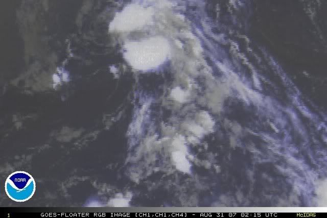
http://www.ssd.noaa.gov/goes/flt/t2/sloop-vis.html
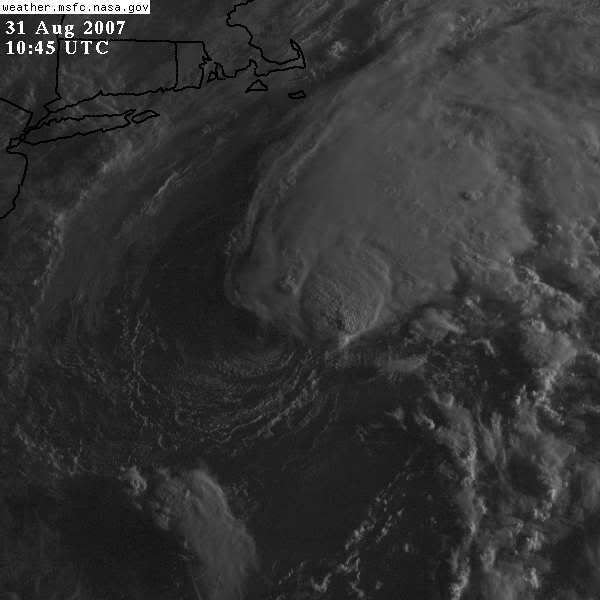
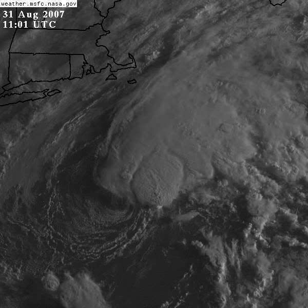
Latest loop shows that 96L is not exposed, but under the SW side of the convection.
Latest loop shows that 96L is not exposed, but under the SW side of the convection.
0 likes
Re: Invest 96L,North Atlantic-Discussions-Analysis & Imagery
000
ABNT20 KNHC 310930
TWOAT
TROPICAL WEATHER OUTLOOK
NWS TPC/NATIONAL HURRICANE CENTER MIAMI FL
530 AM EDT FRI AUG 31 2007
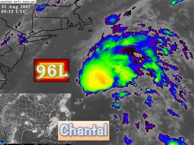
A SMALL AREA OF LOW PRESSURE LOCATED ABOUT 200 MILES EAST-SOUTHEAST
OF ATLANTIC CITY NEW JERSEY IS MOVING SLOWLY NORTHWARD...AND IS
EXPECTED TO TURN NORTHEASTWARD LATER TODAY AHEAD OF AN APPROACHING
FRONT. ASSOCIATED SHOWER ACTIVITY HAS INCREASED SOMEWHAT THIS
MORNING...AND THERE IS STILL SOME POTENTIAL FOR THIS SYSTEM TO
BECOME A TROPICAL CYCLONE BEFORE IT REACHES COOLER WATERS.
REGARDLESS...IT COULD STRENGTHEN AS A NON-TROPICAL LOW PRESSURE
SYSTEM DURING THE NEXT COUPLE OF DAYS AS IT MOVES NEAR OR OVER THE
CANADIAN MARITIMES.
FORECASTER KNABB
ABNT20 KNHC 310930
TWOAT
TROPICAL WEATHER OUTLOOK
NWS TPC/NATIONAL HURRICANE CENTER MIAMI FL
530 AM EDT FRI AUG 31 2007
A SMALL AREA OF LOW PRESSURE LOCATED ABOUT 200 MILES EAST-SOUTHEAST
OF ATLANTIC CITY NEW JERSEY IS MOVING SLOWLY NORTHWARD...AND IS
EXPECTED TO TURN NORTHEASTWARD LATER TODAY AHEAD OF AN APPROACHING
FRONT. ASSOCIATED SHOWER ACTIVITY HAS INCREASED SOMEWHAT THIS
MORNING...AND THERE IS STILL SOME POTENTIAL FOR THIS SYSTEM TO
BECOME A TROPICAL CYCLONE BEFORE IT REACHES COOLER WATERS.
REGARDLESS...IT COULD STRENGTHEN AS A NON-TROPICAL LOW PRESSURE
SYSTEM DURING THE NEXT COUPLE OF DAYS AS IT MOVES NEAR OR OVER THE
CANADIAN MARITIMES.
FORECASTER KNABB
0 likes

Re:
HURAKAN wrote:http://www.ssd.noaa.gov/goes/flt/t2/sloop-vis.html
Latest loop shows that 96L is not exposed, but under the SW side of the convection.
It does look partly exposed to me. The convection right near the center has weakened in the past a few hours, while some new convection is firing to the east now.
0 likes

Re: Invest 96L,North Atlantic-Discussions-Analysis & Imagery
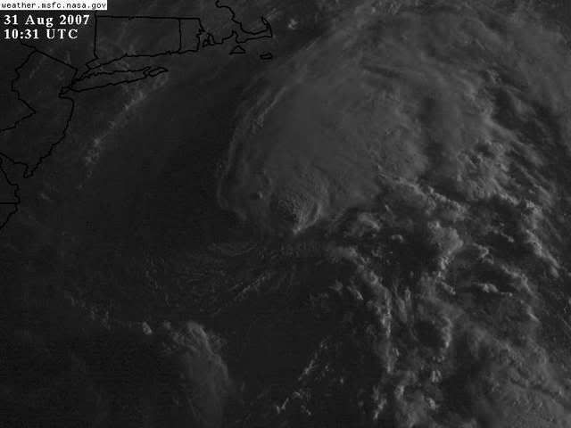
By the way, will somebody tell TWC mets this morning, that the system NHC is watching for developing is system off east of NJ and not the mess further south off the SE coast. They are just plain awful in the tropics without Dr. Lyons there to guide them.
0 likes
Who is online
Users browsing this forum: No registered users and 110 guests