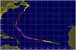
Invest 98L,Central Atlantic

Moderator: S2k Moderators

Message
Author
CrazyC83
Professional-Met
Professional-Met
Posts: 33393
Joined: Tue Mar 07, 2006 11:57 pm
Location: Deep South, for the first time!

Re: Invest 98L,Atlantic-Discussions-10:30 PM TWO at page 18

#361 Postby CrazyC83 » Mon Sep 03, 2007 12:20 am

ConvergenceZone wrote:
Patrick99 wrote:Let's say 98L develops into something...who's to say it wouldn't take a similar path as Dean and Felix? This was once at a relatively high latitude and has drifted to a very low latitude, getting very near to where both D&F got their start.


because that high pressure system can't last forever and it's way overdue to show a weakness...I just can't fathom 3 storms following the exact same path due to a high protecting the gulf for this long..Something has to give and it will give soon...the US can only be protected for so long.


But that high seems to be going nowhere fast...unless that low in the Gulf Stream off the GA coast can quickly develop and weaken the ridge, this will be an evil trifecta (Dean, Felix, Gabrielle?)
0 likes   

User avatar
NONAME
Category 1
Category 1
Posts: 372
Age: 34
Joined: Sat Mar 18, 2006 8:15 am
Location: Where the Wind Blows

#362 Postby NONAME » Mon Sep 03, 2007 12:21 am

231
WHXX01 KWBC 030053
CHGHUR
TROPICAL CYCLONE GUIDANCE MESSAGE
NWS TPC/NATIONAL HURRICANE CENTER MIAMI FL
0053 UTC MON SEP 3 2007

DISCLAIMER...NUMERICAL MODELS ARE SUBJECT TO LARGE ERRORS.
PLEASE REFER TO NHC OFFICIAL FORECASTS FOR TROPICAL CYCLONE
AND SUBTROPICAL CYCLONE INFORMATION.

ATLANTIC OBJECTIVE AIDS FOR

DISTURBANCE INVEST (AL982007) 20070903 0000 UTC

...00 HRS... ...12 HRS... ...24 HRS. .. ...36 HRS...
070903 0000 070903 1200 070904 0000 070904 1200

LAT LON LAT LON LAT LON LAT LON
BAMS 11.4N 39.2W 11.3N 40.3W 11.1N 41.1W 10.7N 42.1W
BAMD 11.4N 39.2W 11.3N 41.1W 11.3N 43.1W 11.4N 45.0W
BAMM 11.4N 39.2W 11.3N 40.8W 11.3N 42.3W 11.3N 43.8W
LBAR 11.4N 39.2W 11.2N 40.8W 11.2N 42.4W 11.3N 44.2W
SHIP 25KTS 25KTS 25KTS 26KTS
DSHP 25KTS 25KTS 25KTS 26KTS

...48 HRS... ...72 HRS... ...96 HRS. .. ..120 HRS...
070905 0000 070906 0000 070907 0000 070908 0000

LAT LON LAT LON LAT LON LAT LON
BAMS 10.6N 42.9W 11.3N 43.6W 13.1N 44.3W 16.0N 47.6W
BAMD 11.5N 46.9W 11.9N 50.6W 12.6N 54.3W 13.5N 57.6W
BAMM 11.5N 45.1W 12.3N 47.9W 13.3N 50.7W 14.6N 53.6W
LBAR 11.7N 46.0W 12.7N 49.7W 13.7N 53.8W 14.2N 57.3W
SHIP 28KTS 35KTS 37KTS 39KTS
DSHP 28KTS 35KTS 37KTS 39KTS

...INITIAL CONDITIONS...
LATCUR = 11.4N LONCUR = 39.2W DIRCUR = 240DEG SPDCUR = 5KT
LATM12 = 11.9N LONM12 = 38.7W DIRM12 = 245DEG SPDM12 = 6KT
LATM24 = 12.7N LONM24 = 37.5W
WNDCUR = 25KT RMAXWD = 40NM WNDM12 = 25KT
CENPRS = 1010MB OUTPRS = 1012MB OUTRAD = 150NM SDEPTH = S
RD34NE = 0NM RD34SE = 0NM RD34SW = 0NM RD34NW = 0NM

$$
NNNN

http://twister.sbs.ohio-state.edu/text/ ... s/07090300
0 likes   

User avatar
Fego
S2K Supporter
S2K Supporter
Posts: 767
Age: 64
Joined: Sun Apr 18, 2004 7:58 pm
Location: San Juan, Puerto Rico
Contact:

Re: Invest 98L,Central Atlantic-Discussions-Analysis & Imagery

#363 Postby Fego » Mon Sep 03, 2007 12:25 am

I'm tired... may be that is the reason why I see a west movement.
http://www.ssd.noaa.gov/goes/flt/t2/loop-vis.html
edited to add image loop.
Image
Last edited by Fego on Mon Sep 03, 2007 12:53 am, edited 1 time in total.
0 likes   

User avatar
Windspeed
Tropical Storm
Tropical Storm
Posts: 129
Joined: Thu Jun 10, 2004 11:38 am

Re: Invest 98L,Central Atlantic-Discussions-Analysis & Imagery

#364 Postby Windspeed » Mon Sep 03, 2007 12:40 am

From the recon discussion thread:

Matt-hurricanewatcher wrote:The cloud tops are warmer=less able to transport the winds down.


Wanted to bring it here to avoid getting off topic over there. Sorry, hope my reply of "staying on topic" didn't sound obtuse. To be clear, the cloud tops are plenty cool to represent an intense eyewall. I can assure you winds are getting down to the surface. Yes, the difference between a large band of -65 and a large band of -75ºC cloud tops are certainly negligible, but not to the point of missrepresenting the intensity of convection in the eyewall. The idea is we have also not had a new AVN image since 3:45utc, so the -75C tops may have expanded again, but point on, it's not as if the CDO is falling apart. Winds are getting to the surface. I suspect we will see 145+kt winds in the NE eyewall represented at the surface once they penetrate it.

EDIT: *IF* they penetrate it....
0 likes   

User avatar
Fego
S2K Supporter
S2K Supporter
Posts: 767
Age: 64
Joined: Sun Apr 18, 2004 7:58 pm
Location: San Juan, Puerto Rico
Contact:

Re: Invest 98L,Central Atlantic-Discussions-Analysis & Imagery

#365 Postby Fego » Mon Sep 03, 2007 12:52 am

Windspeed wrote:From the recon discussion thread:

Matt-hurricanewatcher wrote:The cloud tops are warmer=less able to transport the winds down.


Wanted to bring it here to avoid getting off topic over there. Sorry, hope my reply of "staying on topic" didn't sound obtuse. To be clear, the cloud tops are plenty cool to represent an intense eyewall. I can assure you winds are getting down to the surface. Yes, the difference between a large band of -65 and a large band of -75ºC cloud tops are certainly negligible, but not to the point of missrepresenting the intensity of convection in the eyewall. The idea is we have also not had a new AVN image since 3:45utc, so the -75C tops may have expanded again, but point on, it's not as if the CDO is falling apart. Winds are getting to the surface. I suspect we will see 145+kt winds in the NE eyewall represented at the surface once they penetrate it.

EDIT: *IF* they penetrate it....

Are you sure that you wanted to post that comment here? (Invest 98L )
0 likes   

RL3AO
Moderator-Pro Met
Moderator-Pro Met
Posts: 16308
Joined: Thu Jun 14, 2007 10:03 pm
Location: NC

Re: Invest 98L,Central Atlantic-Discussions-Analysis & Imagery

#366 Postby RL3AO » Mon Sep 03, 2007 12:54 am

Windspeed wrote:From the recon discussion thread:

Matt-hurricanewatcher wrote:The cloud tops are warmer=less able to transport the winds down.


Wanted to bring it here to avoid getting off topic over there. Sorry, hope my reply of "staying on topic" didn't sound obtuse. To be clear, the cloud tops are plenty cool to represent an intense eyewall. I can assure you winds are getting down to the surface. Yes, the difference between a large band of -65 and a large band of -75ºC cloud tops are certainly negligible, but not to the point of missrepresenting the intensity of convection in the eyewall. The idea is we have also not had a new AVN image since 3:45utc, so the -75C tops may have expanded again, but point on, it's not as if the CDO is falling apart. Winds are getting to the surface. I suspect we will see 145+kt winds in the NE eyewall represented at the surface once they penetrate it.

EDIT: *IF* they penetrate it....


Image

Anyway, I think you have the wrong thread.
0 likes   

User avatar
Windspeed
Tropical Storm
Tropical Storm
Posts: 129
Joined: Thu Jun 10, 2004 11:38 am

Re: Invest 98L,Central Atlantic-Discussions-Analysis & Imagery

#367 Postby Windspeed » Mon Sep 03, 2007 12:57 am

*sigh*....seems I need to go to sleep.

Yes, that was a total screw up. I'll copy and paste that in the correct thread and call it an evening. :roll:
0 likes   

User avatar
Epsilon_Fan
Category 1
Category 1
Posts: 353
Joined: Fri Jan 13, 2006 1:03 pm
Location: Charleston, SC

Re: Invest 98L,Central Atlantic-Discussions-Analysis & Imagery

#368 Postby Epsilon_Fan » Mon Sep 03, 2007 1:38 am

Quagmire... that gave me a laugh right there :lol: I can imagine a Family Guy...

Peter: "Quagmire, have you slept with everyone you've met?"
Quagmire: "Not everytime Peter... remember that time I tried to penetrate Invest 98L?"
<insert flashback here> :D
0 likes   

User avatar
windstorm99
S2K Supporter
S2K Supporter
Posts: 1578
Age: 46
Joined: Sat May 26, 2007 8:10 am
Location: Miami, Florida
Contact:

Re: Invest 98L,Central Atlantic-Discussions-Analysis & Imagery

#369 Postby windstorm99 » Mon Sep 03, 2007 4:06 am

Convection still fireing up....

Image
0 likes   

User avatar
windstorm99
S2K Supporter
S2K Supporter
Posts: 1578
Age: 46
Joined: Sat May 26, 2007 8:10 am
Location: Miami, Florida
Contact:

Re: Invest 98L,Central Atlantic-Discussions-Analysis & Imagery

#370 Postby windstorm99 » Mon Sep 03, 2007 4:34 am

NHC-530am

SHOWER ACTIVITY ASSOCIATED WITH AN AREA OF LOW PRESSURE ABOUT
HALFWAY BETWEEN AFRICA AND THE LESSER ANTILLES REMAINS LIMITED AND
DISORGANIZED. ALTHOUGH UPPER-LEVEL WINDS ARE NOT PARTICULARLY
FAVORABLE FOR DEVELOPMENT...THE CIRCULATION REMAINS WELL-DEFINED
AND THERE IS STILL SOME POTENTIAL FOR THIS SYSTEM TO BECOME A
TROPICAL DEPRESSION DURING THE NEXT COUPLE OF DAYS.
0 likes   

User avatar
Matt-hurricanewatcher
Category 5
Category 5
Posts: 11649
Age: 38
Joined: Fri Nov 26, 2004 11:09 pm
Location: Portland,OR
Contact:

Re: Invest 98L,Central Atlantic-Discussions-Analysis & Imagery

#371 Postby Matt-hurricanewatcher » Mon Sep 03, 2007 5:20 am

The shear is down to 8-11 knots over this system. With 5-10 knot decreases every 24 hours....So it is becoming favorable.
0 likes   

caneman

Re: Invest 98L,Central Atlantic-Discussions-Analysis & Imagery

#372 Postby caneman » Mon Sep 03, 2007 5:26 am

Looks more impressive this AM. Hope this isn't a trifecta for some of the same hard hit areas.
0 likes   

User avatar
cycloneye
Admin
Admin
Posts: 139081
Age: 67
Joined: Thu Oct 10, 2002 10:54 am
Location: San Juan, Puerto Rico

Re: Invest 98L,Central Atlantic-Discussions-Analysis & Imagery

#373 Postby cycloneye » Mon Sep 03, 2007 5:32 am

Image

The low center still is not beneath ther convection.If you look to the right of the cloud mass,the swirl can be seen.
0 likes   

caneman

Re: Invest 98L,Central Atlantic-Discussions-Analysis & Imagery

#374 Postby caneman » Mon Sep 03, 2007 5:34 am

Cyc,

Yeah but convection is once again building and in a circular fashion nearer to the LLc as oppossed to yesterday where is was more linear. I think shear has decreased and it may now have a chance.
0 likes   

User avatar
Matt-hurricanewatcher
Category 5
Category 5
Posts: 11649
Age: 38
Joined: Fri Nov 26, 2004 11:09 pm
Location: Portland,OR
Contact:

Re: Invest 98L,Central Atlantic-Discussions-Analysis & Imagery

#375 Postby Matt-hurricanewatcher » Mon Sep 03, 2007 5:36 am

Yeah it has to deal with eastly shear from the base of the subtropical high pressure. In which case if it wents to develop it will have to start moving at least as fast as Dean and Felix did.
0 likes   

User avatar
Roswell_Atup
Tropical Low
Tropical Low
Posts: 21
Joined: Sat Sep 01, 2007 11:57 am

Re: Invest 98L,Central Atlantic-Discussions-Analysis & Imagery

#376 Postby Roswell_Atup » Mon Sep 03, 2007 5:55 am

I now give it a 50% to becoming Gabrielle....
0 likes   

User avatar
punkyg
Category 2
Category 2
Posts: 770
Joined: Mon Apr 23, 2007 7:37 pm
Location: sanford florida

#377 Postby punkyg » Mon Sep 03, 2007 6:56 am

I think today 98L will show signs of development
now that the shear has relaxed. oh and i hope the high starts to break down so the storm can move more northward. those people in central america need a break.
0 likes   

User avatar
Roswell_Atup
Tropical Low
Tropical Low
Posts: 21
Joined: Sat Sep 01, 2007 11:57 am

Re:

#378 Postby Roswell_Atup » Mon Sep 03, 2007 7:03 am

punkyg wrote:I think today 98L will show signs of development
now that the shear has relaxed. oh and i hope the high starts to break down so the storm can move more northward. those people in central america need a break.


i second the motion
0 likes   

User avatar
cycloneye
Admin
Admin
Posts: 139081
Age: 67
Joined: Thu Oct 10, 2002 10:54 am
Location: San Juan, Puerto Rico

Re: Invest 98L,Central Atlantic-Discussions-Analysis & Imagery

#379 Postby cycloneye » Mon Sep 03, 2007 7:11 am

A 1012 MB LOW PRES SYSTEM IS CENTERED NEAR 11N40W MOVING
GENERALLY SW NEAR 5 KT. THE SYSTEM REMAINS DISORGANIZED WITH
CLUSTERS OF SCATTERED MODERATE/ISOLATED STRONG CONVECTION
DISPLACED W OF THE LOW FROM 10N-12N BETWEEN 41W-44W. THE LOW
LEVEL CIRCULATION REMAINS WELL-DEFINED ALTHOUGH UPPER-LEVEL
WINDS ARE NOT PARTICULARLY FAVORABLE FOR DEVELOPMENT AT THIS
TIME BUT THERE IS STILL SOME POTENTIAL FOR THIS SYSTEM TO BECOME
A TROPICAL DEPRESSION DURING THE NEXT COUPLE OF DAYS.

$$
WALLACE

8 AM discussion.
0 likes   

User avatar
HURAKAN
Professional-Met
Professional-Met
Posts: 46086
Age: 37
Joined: Thu May 20, 2004 4:34 pm
Location: Key West, FL
Contact:

#380 Postby HURAKAN » Mon Sep 03, 2007 7:13 am

:uarrow: COPY & PASTE. SAME STORY. :uarrow:
0 likes   


Return to “2007”

Who is online

Users browsing this forum: No registered users and 113 guests