http://www.nrlmry.navy.mil/tc_pages/tc_home.html
Finnally that wave has the invest tag.
TD INGRID: Discussions & Images - Last Advisory
Moderator: S2k Moderators


-
Tampa Bay Hurricane

- Category 5

- Posts: 5594
- Age: 36
- Joined: Fri Jul 22, 2005 7:54 pm
- Location: St. Petersburg, FL
Re: Invest 91L East Atlantic-Discussions & Images
FWIW, the series of cold fronts and troughs expected
to dig into the GOM should protect Central America from
anything bad. We no longer will have that strong ridge.
Instead we will have a trough exerting northerly
influence.
to dig into the GOM should protect Central America from
anything bad. We no longer will have that strong ridge.
Instead we will have a trough exerting northerly
influence.
0 likes

Re: Invest 91L East Atlantic-Discussions & Images
so is there any chance this could be a west tracker like Dean and Felix?
0 likes
-
Tampa Bay Hurricane
- Category 5
- Posts: 5594
- Age: 36
- Joined: Fri Jul 22, 2005 7:54 pm
- Location: St. Petersburg, FL
Re: Invest 91L East Atlantic-Discussions & Images
HollynLA wrote:so is there any chance this could be a west tracker like Dean and Felix?
I doubt it, multiple cold fronts will dip well into the gulf of
mexico this week, and significantly weaken the ridge,
so I think central america is protected.
0 likes
Re: Invest 91L East Atlantic-Discussions & Images
Tampa Bay Hurricane wrote:HollynLA wrote:so is there any chance this could be a west tracker like Dean and Felix?
I doubt it, multiple cold fronts will dip well into the gulf of
mexico this week, and significantly weaken the ridge,
so I think central america is protected.
good for CA, bad for the US? It's gonna be a busy week!
0 likes

Re: Invest 91L E Atlantic-Discussions=First model plots shortly
This is one everybody from Texas to Florida need to watch carefully.Could be the first hurricane to landfall in the US this season
0 likes
-
Tampa Bay Hurricane
- Category 5
- Posts: 5594
- Age: 36
- Joined: Fri Jul 22, 2005 7:54 pm
- Location: St. Petersburg, FL
Re: Invest 91L East Atlantic-Discussions & Images
Good organization and favorable condtions. I think
we have our next depression within 24-36 hours.
Wow the tropics are really exploding 2 invests it will be a very busy
week .
we have our next depression within 24-36 hours.
Wow the tropics are really exploding 2 invests it will be a very busy
week .
0 likes
-
HURAKAN

- Professional-Met

- Posts: 46086
- Age: 37
- Joined: Thu May 20, 2004 4:34 pm
- Location: Key West, FL
- Contact:
Re: Invest 91L East Atlantic-Discussions & Images
Tampa Bay Hurricane wrote:Wow the tropics are really exploding 2 invests it will be a very busy
week .
September is getting hot!!! Maybe 3 invests with the system NE of the Lesser Antilles.
0 likes

-
Fego

- S2K Supporter

- Posts: 767
- Age: 64
- Joined: Sun Apr 18, 2004 7:58 pm
- Location: San Juan, Puerto Rico
- Contact:
Re: Invest 91L East Atlantic-Discussions & Images
477
WHXX01 KWBC 091327
CHGHUR
TROPICAL CYCLONE GUIDANCE MESSAGE
NWS TPC/NATIONAL HURRICANE CENTER MIAMI FL
1327 UTC SUN SEP 9 2007
DISCLAIMER...NUMERICAL MODELS ARE SUBJECT TO LARGE ERRORS.
PLEASE REFER TO NHC OFFICIAL FORECASTS FOR TROPICAL CYCLONE
AND SUBTROPICAL CYCLONE INFORMATION.
ATLANTIC OBJECTIVE AIDS FOR
DISTURBANCE INVEST (AL912007) 20070909 1200 UTC
...00 HRS... ...12 HRS... ...24 HRS. .. ...36 HRS...
070909 1200 070910 0000 070910 1200 070911 0000
LAT LON LAT LON LAT LON LAT LON
BAMS 10.0N 33.0W 10.4N 34.6W 10.7N 36.0W 11.1N 37.2W
BAMD 10.0N 33.0W 10.4N 35.1W 10.7N 37.2W 10.8N 39.1W
BAMM 10.0N 33.0W 10.4N 34.9W 10.6N 36.7W 10.9N 38.3W
LBAR 10.0N 33.0W 10.5N 35.4W 10.9N 38.3W 11.5N 41.1W
SHIP 20KTS 26KTS 33KTS 41KTS
DSHP 20KTS 26KTS 33KTS 41KTS
...48 HRS... ...72 HRS... ...96 HRS. .. ..120 HRS...
070911 1200 070912 1200 070913 1200 070914 1200
LAT LON LAT LON LAT LON LAT LON
BAMS 11.7N 38.1W 13.6N 39.5W 16.3N 42.2W 19.1N 46.4W
BAMD 10.9N 40.9W 11.1N 44.0W 11.6N 46.5W 11.9N 48.5W
BAMM 11.1N 39.8W 12.1N 42.1W 13.5N 43.4W 14.7N 45.1W
LBAR 11.9N 43.9W 12.8N 49.2W 13.5N 52.9W 13.5N 55.0W
SHIP 51KTS 66KTS 72KTS 75KTS
DSHP 51KTS 66KTS 72KTS 75KTS
...INITIAL CONDITIONS...
LATCUR = 10.0N LONCUR = 33.0W DIRCUR = 275DEG SPDCUR = 12KT
LATM12 = 9.8N LONM12 = 30.5W DIRM12 = 275DEG SPDM12 = 12KT
LATM24 = 9.6N LONM24 = 28.0W
WNDCUR = 20KT RMAXWD = 60NM WNDM12 = 20KT
CENPRS = 1011MB OUTPRS = 1012MB OUTRAD = 200NM SDEPTH = M
RD34NE = 0NM RD34SE = 0NM RD34SW = 0NM RD34NW = 0NM
$$
NNNN
0 likes
-
cycloneye

- Admin

- Posts: 139082
- Age: 67
- Joined: Thu Oct 10, 2002 10:54 am
- Location: San Juan, Puerto Rico
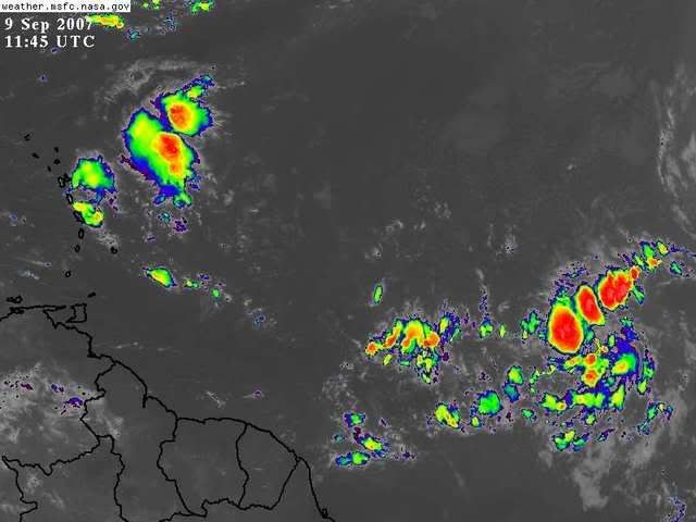
Re: Invest 91L East Atlantic-Discussions & Images
0 likes
-
seahawkjd
- S2K Supporter
- Posts: 632
- Joined: Wed Sep 10, 2003 4:12 pm
- Location: Morehead City, NC
- Contact:
Re: Invest 91L East Atlantic-Discussions & Images
Is that group of clouds near the Lesser Antilles anything and if so is there a thread? Sorry to offtopic, just want to keep up with everything thats out there lol.
0 likes
-
HURAKAN
- Professional-Met
- Posts: 46086
- Age: 37
- Joined: Thu May 20, 2004 4:34 pm
- Location: Key West, FL
- Contact:
Re: Invest 91L East Atlantic-Discussions & Images
seahawkjd wrote:Is that group of clouds near the Lesser Antilles anything and if so is there a thread? Sorry to offtopic, just want to keep up with everything thats out there lol.
An area of disturbed weather that is being watched for possible development.
viewtopic.php?f=31&t=97797&p=1626525#p1626525
0 likes
-
Fego
- S2K Supporter
- Posts: 767
- Age: 64
- Joined: Sun Apr 18, 2004 7:58 pm
- Location: San Juan, Puerto Rico
- Contact:
Re: Invest 91L East Atlantic-Discussions & Images
Cycloneye give me a call, as soon as you can.
0 likes
Who is online
Users browsing this forum: No registered users and 140 guests