UW - CIMSS
ADVANCED DVORAK TECHNIQUE
ADT-Version 7.2.1
Tropical Cyclone Intensity Algorithm
----- Current Analysis -----
Date : 14 SEP 2007 Time : 040000 UTC
Lat : 24:54:19 N Lon : 128:14:41 E
CI# /Pressure/ Vmax
5.0 / 953.8mb/ 90.0kt
6hr-Avg T# 3hr-Avg T# Adj T# Raw T#
4.8 5.0 5.7 6.1
Latitude bias adjustment to MSLP : -0.2mb
Estimated radius of max. wind based on IR : 9 km
Center Temp : -25.0C Cloud Region Temp : -71.5C
Scene Type : EYE
Positioning Method : SPIRAL ANALYSIS
Ocean Basin : WEST PACIFIC
Dvorak CI > MSLP Conversion Used : PACIFIC
Tno/CI Rules : Constraint Limits : 2.2T/6hr
Weakening Flag : OFF
Rapid Dissipation Flag : OFF
Tropical Storm NARI (0711) in WPAC
Moderator: S2k Moderators
-
Typhoon Hunter
- WesternPacificWeather.com

- Posts: 1215
- Age: 40
- Joined: Wed Oct 11, 2006 11:37 am
- Location: Hong Kong
- Contact:
Note for Admin - please can someone update the current storms info for Wpac, it's still listing Danas and Fitow which are history. Thanks.
Really impressive work by Nari, caught everyone off guard. Radar loop out of Naha is great too! JMA are doing hourly updates due to the close proximity of the storm to Okinawa.
Really impressive work by Nari, caught everyone off guard. Radar loop out of Naha is great too! JMA are doing hourly updates due to the close proximity of the storm to Okinawa.
0 likes
-
Coredesat

-
CherlynV
- Professional-Met

- Posts: 26
- Age: 40
- Joined: Fri Jul 13, 2007 7:26 am
- Location: Kadena Air Base, Okinawa, Japan
Re: Typhoon NARI (0711) in WPAC
Joy.
Although it makes sense... it is common knowledge here that typhoons only hit us on the weekends.
The feeder bands seem to weaken as they hit the island - the winds here are light, and there is no rain. Just overcast skies.
Although it makes sense... it is common knowledge here that typhoons only hit us on the weekends.
The feeder bands seem to weaken as they hit the island - the winds here are light, and there is no rain. Just overcast skies.
0 likes
-
CherlynV
- Professional-Met
- Posts: 26
- Age: 40
- Joined: Fri Jul 13, 2007 7:26 am
- Location: Kadena Air Base, Okinawa, Japan
Typhoon Nari Weathernews Radar
0 likes

-
wxmann_91

- Category 5

- Posts: 8013
- Age: 32
- Joined: Fri Jul 15, 2005 2:49 pm
- Location: Southern California
- Contact:
Re:
Typhoon Hunter wrote:Note for Admin - please can someone update the current storms info for Wpac, it's still listing Danas and Fitow which are history. Thanks.
Really impressive work by Nari, caught everyone off guard. Radar loop out of Naha is great too! JMA are doing hourly updates due to the close proximity of the storm to Okinawa.
We really should give one of the members here complete control in changing the Current storms list. I'd nominate Chacor.
0 likes
Right on the dot.
332
WTPQ20 RJTD 140600
RSMC TROPICAL CYCLONE ADVISORY
NAME TY 0711 NARI (0711)
ANALYSIS
PSTN 140600UTC 25.0N 128.1E GOOD
MOVE WNW 12KT
PRES 955HPA
MXWD 085KT
GUST 120KT
50KT 50NM
30KT 100NM
FORECAST
24HF 150600UTC 28.0N 126.6E 90NM 70%
MOVE N 08KT
PRES 950HPA
MXWD 090KT
GUST 130KT
48HF 160600UTC 32.0N 126.7E 150NM 70%
MOVE N 10KT
PRES 955HPA
MXWD 085KT
GUST 120KT
72HF 170600UTC 36.8N 129.6E 290NM 70%
MOVE NNE 13KT
PRES 985HPA
MXWD 050KT
GUST 070KT =
0 likes
-
Coredesat
Re: Re:
wxmann_91 wrote:Typhoon Hunter wrote:Note for Admin - please can someone update the current storms info for Wpac, it's still listing Danas and Fitow which are history. Thanks.
Really impressive work by Nari, caught everyone off guard. Radar loop out of Naha is great too! JMA are doing hourly updates due to the close proximity of the storm to Okinawa.
We really should give one of the members here complete control in changing the Current storms list. I'd nominate Chacor.
I'd do it, but apparently the board's technology prohibits the changing of forum descriptions by anyone but the admins.
0 likes
-
HurricaneBill
- Category 5
- Posts: 3420
- Joined: Sun Apr 11, 2004 5:51 pm
- Location: East Longmeadow, MA, USA
Re: Typhoon NARI (0711) in WPAC
This looks like it's going to take a path similar to (Super) Typhoon Maemi in 2003. Hopefully, Nari won't be of similar intensity.
0 likes
-
CherlynV
- Professional-Met
- Posts: 26
- Age: 40
- Joined: Fri Jul 13, 2007 7:26 am
- Location: Kadena Air Base, Okinawa, Japan
Re: Typhoon NARI (0711) in WPAC
HurricaneBill wrote:This looks like it's going to take a path similar to (Super) Typhoon Maemi in 2003. Hopefully, Nari won't be of similar intensity.
Yikes. I remember when that went through - I was up forecasting on mainland Japan at the time. Fortunately Kadena AB here on Okinawa only gusted up to 51kts.
0 likes
-
alan1961

- Category 2

- Posts: 767
- Joined: Mon Mar 20, 2006 11:58 am
- Location: Derby, Derbyshire, England
- Contact:
Re: Typhoon NARI (0711) in WPAC
CherlynV wrote:Joy.
Although it makes sense... it is common knowledge here that typhoons only hit us on the weekends.
The feeder bands seem to weaken as they hit the island - the winds here are light, and there is no rain. Just overcast skies.
yes cherlyn..they also always seem to hit in the overnight hours too
0 likes
-
CherlynV
- Professional-Met
- Posts: 26
- Age: 40
- Joined: Fri Jul 13, 2007 7:26 am
- Location: Kadena Air Base, Okinawa, Japan
Re: Typhoon NARI (0711) in WPAC
alan1961 wrote:CherlynV wrote:Joy.
Although it makes sense... it is common knowledge here that typhoons only hit us on the weekends.
The feeder bands seem to weaken as they hit the island - the winds here are light, and there is no rain. Just overcast skies.
yes cherlyn..they also always seem to hit in the overnight hours too
I know, right?!
It is dark here now, but the winds are roaring!
0 likes
-
CherlynV
- Professional-Met
- Posts: 26
- Age: 40
- Joined: Fri Jul 13, 2007 7:26 am
- Location: Kadena Air Base, Okinawa, Japan
Re: Typhoon NARI (0711) in WPAC
RODN 140955Z AUTO 07030G42KT 2900 -RA BR FEW001 BKN024 27/26 A2945 RMK AO2 PK WND 07042/0948 VIS 1100V8000 CIG 014V042 PRESFR SLP972 P0018 T02730256 TSNO
ROAH 140930Z 05026G43KT 4000 SHRA FEW010 BKN015 SCT020TCU 27/25 Q0995 RMK 2CU010 6CU015 4TCU020 A2938 TCU OHD-W MOV W
ROAH 140930Z 05026G43KT 4000 SHRA FEW010 BKN015 SCT020TCU 27/25 Q0995 RMK 2CU010 6CU015 4TCU020 A2938 TCU OHD-W MOV W
0 likes


-
Matt-hurricanewatcher

- Category 5
- Posts: 11649
- Age: 38
- Joined: Fri Nov 26, 2004 11:09 pm
- Location: Portland,OR
- Contact:
Re: Typhoon NARI (0711) in WPAC
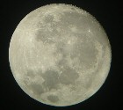
That eye looks like it is upper cat3 or lower cat4 at least. WOW.
0 likes
-
Matt-hurricanewatcher
- Category 5
- Posts: 11649
- Age: 38
- Joined: Fri Nov 26, 2004 11:09 pm
- Location: Portland,OR
- Contact:
Re: Typhoon NARI (0711) in WPAC
http://www.nrlmry.navy.mil/tc-bin/tc_ho ... &SIZE=full
I agree with lower 3 at least...This is a nice looking storm. The wind field is very tight likely.
I agree with lower 3 at least...This is a nice looking storm. The wind field is very tight likely.
0 likes
Who is online
Users browsing this forum: No registered users and 118 guests