

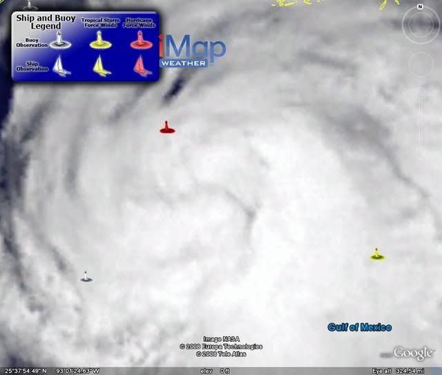
Galveston at 16.7, thats very close to the height of the sea wall, if the track is a little left of the forecast then the surge will top the sea wall.
The main surge however is a little to the east which looks like topping 20-25ft generally.
ATL: IKE Discussion
Moderator: S2k Moderators
Re: ATL IKE: Category 2 - Discussion
Portastorm wrote:Doesn't surprise me at all to see the landfall spot nudged a bit left at the 5 am advisory. Several of us last night saw the trough out in the Great Basin still digging and looking less deep as progged. Latest CIMSS steering flow suggests the same. Perhaps another nudge left or two is in store?
Many here have said when you're within 24 hours of landfall, it's time to throw out the TC models and use globals and real-time (radar, satellite). Are we there yet? Is that even a credible suggestion? I dunno.
And recon too not to mention tide gauges. I think we we're just about in real-time mode IMHO.
0 likes
-
Portastorm

- Storm2k Moderator

- Posts: 9955
- Age: 63
- Joined: Fri Jul 11, 2003 9:16 am
- Location: Round Rock, TX
- Contact:
Re: ATL IKE: Category 2 - Discussion
physicx07 wrote:Portastorm wrote:Doesn't surprise me at all to see the landfall spot nudged a bit left at the 5 am advisory. Several of us last night saw the trough out in the Great Basin still digging and looking less deep as progged. Latest CIMSS steering flow suggests the same. Perhaps another nudge left or two is in store?
Many here have said when you're within 24 hours of landfall, it's time to throw out the TC models and use globals and real-time (radar, satellite). Are we there yet? Is that even a credible suggestion? I dunno.
And recon too not to mention tide gauges. I think we we're just about in real-time mode IMHO.
Yeah, good point there! This is going to be real interesting. The GFS is further left/west than the Euro not only on landfall but also as the storm moves inland. Obviously this will have huge implications. Going to be interesting to see which one nails it, if any.
0 likes
-
JtSmarts

- S2K Supporter

- Posts: 1442
- Age: 40
- Joined: Thu Jul 10, 2003 1:29 pm
- Location: Columbia, South Carolina
Re: ATL IKE: Category 2 - Discussion
Wow, how far is that 91kt reading from the center, Hurakan?
0 likes
-
HURAKAN

- Professional-Met

- Posts: 46084
- Age: 39
- Joined: Thu May 20, 2004 4:34 pm
- Location: Key West, FL
- Contact:
Re: ATL IKE: Category 2 - Discussion
JtSmarts wrote:Wow, how far is that 91kt reading from the center, Hurakan?
To the NW of the center.
0 likes
-
AZRainman

- Tropical Storm

- Posts: 146
- Joined: Fri Sep 23, 2005 12:48 pm
- Location: Sonoran Desert
- Contact:
Re:
KWT wrote:Galveston at 16.7, thats very close to the height of the sea wall, if the track is a little left of the forecast then the surge will top the sea wall.
The main surge however is a little to the east which looks like topping 20-25ft generally.
I not sure if that those maps include actual wave crests or that's just the swell.
My guess is that it doesn't include wave crest height, so they should be slopping over the top quite a bit.
Last edited by AZRainman on Fri Sep 12, 2008 6:30 am, edited 1 time in total.
0 likes

Re: ATL IKE: Category 2 - Discussion
physicx07 wrote:
And recon too not to mention tide gauges. I think we we're just about in real-time mode IMHO.
Yeah we are, you can see the outer bands on radar plus the tide is already starting to increase in front of Ike in the Texas region and increasing very rapidly now in LA it seems.
Surge should rapidly increase in the Galveston Bay after 21z.
0 likes
-
Txdivermom
- Tropical Low

- Posts: 47
- Joined: Sun Aug 31, 2008 11:49 am
Re:
physicx07 wrote:KHOU feed showing water climbing up close to the streets on the west end of GLS not protected by the seawall. This is going to be scary when it gets even closer.
I think it is very likely there will be deaths if folks stay in Galveston. Water is already splashing over the seawall from waves and this is NOTHING. West Beach...areas like Jamaica Beach and Sea Isle are already flooding. They said the road out from Sea Isle is only one lane in some places.
This really looks scary to me. Not looking forward to it.
0 likes

Re:
HURAKAN wrote:
Station 42361 - Auger - Garden Banks 426
09 12 5:15 am NNE 91.3 - - - - - 28.83 - 80.6 - 75.2
91 knots!
That buoy is now reporting 95kts. The anenometer there is 122m high though.
http://ndbc.noaa.gov/station_page.php?station=42361
0 likes

Re: IKE / Obs / Preparations / Web Cams / Texas / SW Louisiana
I heard on the TV this morning that they have told residents in Houston to shelter in place and not evacuate. Can this be correct???
0 likes
Re: Re:
AZRainman wrote:
I not sure if that those maps include actual wave crests or that's just the swell.
My guess is that it doesn't include wave crest height, so they should be slopping over the top quit a bit.
Of course, the best case for Galveston has to be Ike taking a right wobble before landfall, surge is around 12ft on the western side. Still huge and its still going to cause huge amount of damage to properties near the coast and on the coast on the western side.
0 likes

Re: ATL IKE: Category 2 - Discussion
95.2kts = 109.8608 mph sustained wind even at 400ft is impressive that far from the center
0 likes
Re:
HURAKAN wrote:
Station 42361 - Auger - Garden Banks 426
Anemometer height: 122 m above site elevation
95.2 knots
Pretty decent winds there despite the elevation, will be interesting to see how much that will increase, what quadrant is that in?
0 likes
Re: ATL IKE: Category 2 - Discussion
Just a point on that Marine ob of 90+ kts--yes it's impressive, but it needs to be reduced. It's taken at 122 meters--not the meteorological standard of 10M. Here's description from NDBC:
Air temp height: 37 m above site elevation
Anemometer height: 122 m above site elevation
Barometer elevation: 37 m above mean sea level
Water depth: 872 m
edit: Looks like drezee beat me to this point. Sorry!
Air temp height: 37 m above site elevation
Anemometer height: 122 m above site elevation
Barometer elevation: 37 m above mean sea level
Water depth: 872 m
edit: Looks like drezee beat me to this point. Sorry!
0 likes
-
superfly
Re: ATL IKE: Category 2 - Discussion
drezee wrote:95.2kts = 109.8608 mph sustained wind even at 400ft is impressive that far from the center
The highest winds are away from the center.
0 likes
-
Deputy Van Halen
- Tropical Storm
- Posts: 104
- Joined: Thu Aug 03, 2006 12:00 am
- Location: Texas City, TX
Re: ATL IKE: Category 2 - Discussion
jabber wrote:IKE almost looks subtropical... especially with all the winds far from the center. I know hes not its just interseting
You stole my thunder. I was going to say the same thing. There should be a name for this kind of storm. Frances '04 was a similar kind of storm--only cat2 at landfall, but very wide wind swaths.
0 likes
Re:
KWT wrote:wjs3, of course but its still not going to be far off cat-2 status despite being a decent way away from the center.
Yes, it's an impressive ob. And yes, it's a long way from the center. What an unusual storm.
You mean cat 3, right? 95/96 kts=cat 2/3 border.
WJS3
0 likes
Who is online
Users browsing this forum: No registered users and 52 guests