ATL: Tropical Depression Fay

Moderator: S2k Moderators

Message
Author
User avatar
cheezyWXguy
Category 5
Category 5
Posts: 6108
Joined: Mon Feb 13, 2006 12:29 am
Location: Dallas, TX

Re: ATL: Invest 92L in Central Atlantic

#1721 Postby cheezyWXguy » Wed Aug 13, 2008 2:47 pm

vbhoutex wrote:Even though I do see the convection firing, I am also seeing or think I am shear out ahead of it that will diminish its' chances in the short term(1-2 days and I haven't looked at the shear maps so I could be all wrong). Once it is past that shear and/or it diminishes I have got to say that I do think this system is slowly organizing, as many have said it would, and could be a real problem within a week.

Boy do we remember Debby, don't we Tony? That was a freaking nightmare to try and figure out.

Interesting theory Aric.

Actually that shear is forecast to move away over the next 1-2 days as the TUTT moves away
0 likes   

User avatar
Blown Away
S2K Supporter
S2K Supporter
Posts: 10154
Joined: Wed May 26, 2004 6:17 am

Re:

#1722 Postby Blown Away » Wed Aug 13, 2008 2:49 pm

gatorcane wrote:I see some kind of LLC trying to form right underneath the ball of convection. What gives it a way is a band of low-level clouds streaming into the ball as seen here, I doubt we will see any more collapsing of convection that we saw previously.

http://metofis.rsmas.miami.edu/~dortt/s ... 1_loop.gif


I don't know about that 92L is following the same pattern as it did yesterday, big ball of convection displaced from the center. I can see that big convection ball dissipating tonight. I think the chances of convection refiring are better today than yesterday.
0 likes   

Aric Dunn
Category 5
Category 5
Posts: 21238
Age: 42
Joined: Sun Sep 19, 2004 9:58 pm
Location: Ready for the Chase.
Contact:

Re: ATL: Invest 92L in Central Atlantic

#1723 Postby Aric Dunn » Wed Aug 13, 2008 2:50 pm

tolakram wrote:Outflow Boundaries visible but also what appears to be new convection forming below the low pressure center.

Image


actually thats a very good point .. that is the area i have been watching all day to see if we can get some convection forming along that clound line/ feeder band to the south.. that is interesting as the development of a good solid band could be the extra little bit needed...
0 likes   

User avatar
gatorcane
S2K Supporter
S2K Supporter
Posts: 23692
Age: 47
Joined: Sun Mar 13, 2005 3:54 pm
Location: Boca Raton, FL

#1724 Postby gatorcane » Wed Aug 13, 2008 2:53 pm

well I have no doubt in my mind that the new LLC is trying to form right underneath the ball of convection -- once the old LLC to the west fizzles out and enough sustained convection is around this new LLC, we can see it upgraded to a depression.
0 likes   

gtsmith
Tropical Storm
Tropical Storm
Posts: 181
Joined: Fri Sep 24, 2004 7:05 am
Location: West Palm Beach, FL

#1725 Postby gtsmith » Wed Aug 13, 2008 2:54 pm

All I know is that I have 24 more hours to decide whether to keep my trip west as planned and abandon my wife here in S Fla or cancel it and reschedule for later in the season... :roll:

still on the fence...I have no more than 24 to decide...but i'm leaning to postponing...i guess better safe than sorry

Go USA! :flag:
0 likes   

User avatar
boca
Category 5
Category 5
Posts: 6368
Age: 60
Joined: Mon Dec 15, 2003 8:49 am
Location: Boca Raton,FL

Re: ATL: Invest 92L in Central Atlantic

#1726 Postby boca » Wed Aug 13, 2008 2:55 pm

Mabe this little train that could will get over the mountain with that feeder band along the south end of the convection ball.
0 likes   

User avatar
KWT
Category 5
Category 5
Posts: 31415
Joined: Tue Aug 17, 2004 11:02 am
Location: UK!!!

#1727 Postby KWT » Wed Aug 13, 2008 2:55 pm

Well I think eventually a circulation is much more likely to develop under that convection, I don't think that weak western circulation will survive the next 24hrs IMO.
0 likes   

User avatar
frederic79
Category 1
Category 1
Posts: 271
Joined: Sun Jul 18, 2004 8:48 pm
Location: Grand Bay, AL

Re: ATL: Invest 92L in Central Atlantic

#1728 Postby frederic79 » Wed Aug 13, 2008 2:56 pm

It looks to me like the last frame or two shows a distinct twisting near the southwest portion of the blob of convection. Also low level clouds appear to be streaming into this area from the south. Could it be a MLC working its way down to the surface?
0 likes   

User avatar
gatorcane
S2K Supporter
S2K Supporter
Posts: 23692
Age: 47
Joined: Sun Mar 13, 2005 3:54 pm
Location: Boca Raton, FL

#1729 Postby gatorcane » Wed Aug 13, 2008 2:57 pm

here is the link I am using to identify the new possible LLC under the ball of convection:

Judge for yourself but I say something is going on there.

http://metofis.rsmas.miami.edu/~dortt/s ... 1_loop.gif
0 likes   

User avatar
vbhoutex
Storm2k Executive
Storm2k Executive
Posts: 29113
Age: 73
Joined: Wed Oct 09, 2002 11:31 pm
Location: Cypress, TX
Contact:

Re: ATL: Invest 92L in Central Atlantic

#1730 Postby vbhoutex » Wed Aug 13, 2008 2:57 pm

cheezyWXguy wrote:
vbhoutex wrote:Even though I do see the convection firing, I am also seeing or think I am shear out ahead of it that will diminish its' chances in the short term(1-2 days and I haven't looked at the shear maps so I could be all wrong). Once it is past that shear and/or it diminishes I have got to say that I do think this system is slowly organizing, as many have said it would, and could be a real problem within a week.

Boy do we remember Debby, don't we Tony? That was a freaking nightmare to try and figure out.

Interesting theory Aric.

Actually that shear is forecast to move away over the next 1-2 days as the TUTT moves away


Well we may have a firing TC sooner than I expected then. This is going to/could get very interesting for ALL OF US witin the next week or so IMO.
0 likes   

User avatar
HURAKAN
Professional-Met
Professional-Met
Posts: 46086
Age: 38
Joined: Thu May 20, 2004 4:34 pm
Location: Key West, FL
Contact:

#1731 Postby HURAKAN » Wed Aug 13, 2008 2:57 pm

Image
0 likes   

User avatar
dizzyfish
S2K Supporter
S2K Supporter
Posts: 1519
Joined: Fri Sep 16, 2005 7:56 am
Location: New Port Richey, FL

Re: ATL: Invest 92L in Central Atlantic

#1732 Postby dizzyfish » Wed Aug 13, 2008 3:07 pm

From the Tampa NWS afternoon disco....
.LONG TERM (FRIDAY NIGHT - WEDNESDAY)...GFS/DGEX/ECMWF IN FAIRLY
GOOD AGREEMENT THROUGH THE WEEKEND. UPPER TROUGH OVER THE EASTERN
U.S. LIFTS UP NORTH AND NE AS RIDGING BUILDS FROM THE ATLANTIC
WESTWARD TO FL AND THE SE STATES. THIS ALLOWS A BROAD AND DIFFUSE
SURFACE RIDGE TO LIFT NORTHWARD ACROSS FL...TIGHTENING UP SOME AS
IT DOES. WESTERLY FLOW GIVES WAY TO EASTERLY AS THE WEEKEND ENDS.

FOR MON INTO WED...RIDGING BOTH ALOFT AND SURFACE CONTINUES NORTH
OF THE AREA WITH GENERALLY EASTERLY LOW LEVEL FLOW. HOWEVER...A WAVE
MOVING ALONG THE SOUTH SIDE OF THE RIDGE IS HANDLED DIFFERENTLY BY
MODELS. THE GFS MOVES AN EASTERLY WAVE ACROSS SOUTHERN FL INTO THE
GULF...THE DGEX TRACKS A MORE ROBUST SYSTEM UP EAST FL COASTAL
WATERS...AND THE ECMWF LIFTS A SYSTEM NORTH OVER THE EAST GULF
WATERS. WHILE THE ECMWF HAS BEEN FAVORED RECENTLY WILL TREND TOWARD
THE MORE CONSERVATIVE GFS FOR NOW AND CONTINUE THE ON GOING FORECAST
OF SCATTERED POPS WITH SLIGHTLY HIGHER VALUES ACROSS THE SOUTH.


http://www.crh.noaa.gov/product.php?sit ... glossary=1
0 likes   

User avatar
sfwx
Category 1
Category 1
Posts: 371
Age: 59
Joined: Thu Sep 04, 2003 1:53 pm
Location: Rural St. Lucie County, Fl

Re: ATL: Invest 92L in Central Atlantic

#1733 Postby sfwx » Wed Aug 13, 2008 3:09 pm

000
FXUS62 KMLB 131833
AFDMLB

AREA FORECAST DISCUSSION
NATIONAL WEATHER SERVICE MELBOURNE FL
233 PM EDT WED AUG 13 2008

.DISCUSSION...


SUN-TUE...WAVE CURRENTLY EAST OF THE ANTILLES CONTINUES TO SHOW A
POTENTIAL FOR FURTHER ORGANIZATION WHILE SKIRTING THE CARIBBEAN.
SATELLITE IMAGERY DURING THE PAST 4 TO 6 HOURS IS INDICATING MORE
PERSISTENT CONVECTION...WHICH HAD BEEN VERY DISORGANIZED OVERNIGHT
DUE TO AN UNFAVORABLE ENVIRONMENT. SHEAR IS EXPECTED TO LESSEN IN
THE AREA AND GLOBAL SOLNS CONTINUE TO INDICATE VARYING DEGREES OF
DEVELOPMENT WITH THE GFS/UKMET MAINTAINING WAVE STATUS OVER AT
LEAST THE NEXT 36 HOURS. ECMWF CONTINUES A MORE ROBUST TENDENCY IN
DEVELOPMENT. SYSTEM EXPECTED TO MAINTAIN SOME TYPE OF PRESENCE
EITHER AS A STRONG WAVE OR PERHAPS CLOSED LOW WHILE MOVING
GENERALLY TOWARD THE TURKS AND CAICOS BY SATURDAY. CURRENT HPC/NHC
COORD TRACK IN THE MEDIUM RANGE INDICATING A SPOT LOW NEAR THE FL
STRAITS JUSTIFIES CLOSE MONITORING SHOULD SYSTEM DEVELOP.

WILL SHOW ONSHORE CONDITIONS ASCD WITH LIGHT GRADIENT FLOW EARLY
IN THE WEEK WITH POPS INITIALLY LOW END SCT COVERAGE SUBJECT TO
PROXIMITY OF ABOVE SYSTEM. MEDIUM RANGE OUTLOOK WL REMAIN HIGHLY
UNCERTAIN FOR NOW.

.MARINE...OFFSHORE FLOW TO CONTINUE UNTIL THE WEKEEND. SFC TROUGH
SETTLING OVER THE WATERS SATURDAY WILL DECREASE WINDS/SEAS. WAS
TEMPTED TO EXTEND SCA THRU 08Z...BUT WILL DEFER TO MID SHIFT TO
SEE IF WINDS ACTUALLY DROP A BIT AFTER 06Z AS FCST. EVOLUTION TO
ONSHORE WINDS SUNDAY EXPECTEDTO CONTINUE EARLY NEXT WEEK SUBJECT
TO AFECTS FROM APPROACHING T-WAVE.


SHORT TERM...CRISTALDI
LONG TERM....PENDERGRAST
Last edited by sfwx on Wed Aug 13, 2008 3:12 pm, edited 1 time in total.
0 likes   

txag2005
Tropical Storm
Tropical Storm
Posts: 229
Joined: Thu Jul 17, 2008 1:16 am
Location: Houston, TX

Re: ATL: Invest 92L in Central Atlantic

#1734 Postby txag2005 » Wed Aug 13, 2008 3:11 pm

Is my completely amateur assumption correct that this storm is not going to be dead anytime soon? It seem like it keeps on spitting out signs of life.
0 likes   

User avatar
gatorcane
S2K Supporter
S2K Supporter
Posts: 23692
Age: 47
Joined: Sun Mar 13, 2005 3:54 pm
Location: Boca Raton, FL

#1735 Postby gatorcane » Wed Aug 13, 2008 3:12 pm

NWS Miami watching but staying conservative on the forecast (snippet):

RECENT SATELLITE IMAGERY CONTINUES TO INDICATE A TROPICAL WAVE EAST
OF THE LEEWARD ISLANDS. THE LATEST GUIDANCE INDICATES THAT THE
WAVE COULD APPROACH THE REGION EARLY NEXT WEEK WITH THE USUAL
UNCERTAINTY IN THE FORECAST.

http://www.srh.noaa.gov/fwd/productview ... &version=0
0 likes   

Brent
S2K Supporter
S2K Supporter
Posts: 38100
Age: 37
Joined: Sun May 16, 2004 10:30 pm
Location: Tulsa Oklahoma
Contact:

Re: ATL: Invest 92L in Central Atlantic

#1736 Postby Brent » Wed Aug 13, 2008 3:14 pm

txag2005 wrote:Is my completely amateur assumption correct that this storm is not going to be dead anytime soon? It seem like it keeps on spitting out signs of life.


I am certainly not declaring it dead, I just think it may take another couple of days.
0 likes   

MiamiensisWx

#1737 Postby MiamiensisWx » Wed Aug 13, 2008 3:16 pm

Excerpt from NWS Wilmington (ILM), North Carolina AFD:

000
FXUS62 KILM 131936
AFDILM

AREA FORECAST DISCUSSION
NATIONAL WEATHER SERVICE WILMINGTON NC
336 PM EDT WED AUG 13 2008

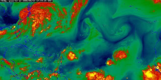
.LONG TERM /SATURDAY THROUGH WEDNESDAY/...
AS OF 3 PM WEDNESDAY...UPPER PATTERN IN THE MIDST OF CHANGE AS THE
PERIOD BEGINS WITH TRANSITION FROM 5H TROF ALONG THE EAST COAST TO
WEAK 5H RIDGING DEVELOPING IN RESPONSE TO CUTOFF LOW OVER THE
CENTRAL US. COMBO OF WEAK 5H RIDGE AND SFC HIGH TO THE N SHIFTING
OFFSHORE AND MORPHING INTO BERMUDA HIGH WILL KEEP CONDITIONS ACROSS
THE AREA RIGHT AROUND CLIMO. HIGHS RUN IN THE UPPER 80S TO LOW 90S
WITH SLGT CHC TO CHC POPS EACH AFTN...MAINLY ALONG THE SEA BREEZE.
DID NOT MAKE A LOT IN THE WAY OF CHANGES TO EXTENDED FORECAST AND
GRIDS. ON FEATURE TO NOTE WILL BE WAVE/SFC LOW PROGGED BY HPC TO
CROSS FL LATE IN THE PERIOD. GUIDANCE HAS BEEN VERY INCONSISTENT
WITH LOCATION/TIMING/STRENGTH OF THIS FEATURE.


&&

.AVIATION /18Z WEDNESDAY THROUGH MONDAY/...
CURRENT FORECAST REMAINS REASONABLY ON TRACK. LOW PRESSURE SYSTEM
WILL PUSH OFFSHORE LATE THIS AFTERNOON. WINDS WILL SHIFT FROM MAINLY
EASTERLY TO NORTHERLY. THIS SHOULD EFFECTIVELY SHUT OFF THE MAJORITY
OF THE PRECIP AROUND 22-24Z. LOW CEILINGS WILL LIKELY HANG AROUND
THROUGH A GOOD PORTION OF THE EVENING. MODELS WANT TO TAKE FLO DOWN
TO LIFR DUE TO FOG. THINK THIS SCENARIO MAY PLAY OUT...AS FLO IS
FARTHER AWAY FROM THE LOW...AND THE GRADIENT WEAKENS TO THE POINT TO
LET THE WINDS DECOUPLE TO CALM WITH GOOD LOW LEVEL MOISTURE. COASTAL
TERMINALS WILL LIKELY HAVE ENOUGH MIXING FOR ONLY LIGHT FOG TO
DEVELOP. BY 13Z...ALL TERMINALS WILL BE VFR WITH A LIGHT MAINLY
NORTHWEST WIND.

OUTLOOK THROUGH MONDAY...VFR CONDITIONS ARE EXPECTED THURSDAY
AFTERNOON AS THE LOW PULLS NORTHEAST AND OUT OF THE REGION. SHOULD
HAVE VFR CONDITIONS THURSDAY THROUGH MONDAY WITH ISOLATED
THUNDERSTORM ACTIVITY ALONG THE PIEDMONT TROUGH AND SEA BREEZE
BOUNDARIES. OVERALL HIGH PRESSURE WILL KEEP MOST OF THIS PERIOD DRY.

&&

.MARINE...
-- Changed Discussion --NEAR TERM /THROUGH 6 AM THURSDAY/...
AS OF 130 PM WEDNESDAY...AS STATED EARLIER THE EXACT TRACK OF THE
ONGOING STORM SYSTEM COULD LEAD TO CONSIDERABLE CHANGES IN THE
NEAR TERM FCST. STORM SYSTEM IS EXPECTED TO CONGEAL JUST OFF THE
COASTAL WATERS EARLY THIS AFTERNOON AND THEN PULL TO THE NE.
CURRENT EAST TO NE WINDS WILL BACK TO A MORE OFFSHORE
DIRECTION...DEPENDING ON HOW FLAT OR CIRCULAR THE WAVE ENDS UP
BEING. SMALL CRAFT ADVISORY MAY BE ABLE TO BE CANCELLED A LITTLE
EARLY AS THE STORM EXITS A LITTLE QUICKER THAN PREVIOUSLY THOUGHT.

SHORT TERM /THURSDAY THROUGH FRIDAY NIGHT/...
AS OF 3 PM WEDNESDAY...WEAK HIGH PRESSURE WILL BUILD OVERHEAD IN
THE WAKE OF TODAY`S STORMY WEATHER. WINDS WILL HAVE SIGNIFICANT
DIURNAL VARIATION WITH SEABREEZE/LANDBREEZE CYCLES EXPECTED TO
RESUME. SPEEDS SHOULD REMAIN 10 KT OR LESS. 3 FT SEAS IN THE WAKE
OF TODAY`S SYSTEM SHOULD DECREASE TO 2 FT OR LESS THURSDAY
AFTERNOON THROUGH FRIDAY NIGHT. THE ONLY CHANCES FOR PRECIPITATION
WILL EXIST FRIDAY AFTERNOON/EVENING WHERE ISOLATED THUNDERSTORMS
COULD DEVELOP ALONG THE SEABREEZE AND MOVE INTO THE COASTAL WATERS.

LONG TERM /SATURDAY THROUGH SUNDAY/...
AS OF 3 PM WEDNESDAY...SFC HIGH BUILDING IN FROM THE N SAT WILL
SHIFT OFFSHORE DURING THE PERIOD. GRADIENT REMAINS WEAK WITH
SPEEDS LESS THAN 15 KT THROUGH THE PERIOD. FLOW WILL INITIALLY BE
OFFSHORE BUT BECOME S TO SE AS HIGH TRANSITIONS OFFSHORE. SEAS
WILL RUN AROUND 2 FT OR LESS.-- End Changed Discussion --

&&

.ILM WATCHES/WARNINGS/ADVISORIES...
-- Changed Discussion --SC...NONE.
NC...NONE.
MARINE...SMALL CRAFT ADVISORY UNTIL 3 AM EDT THURSDAY FOR AMZ254-256.

SMALL CRAFT ADVISORY UNTIL 6 AM EDT THURSDAY FOR AMZ250-252.-- End Changed Discussion --

&&

$$

NEAR TERM...MBB
SHORT TERM...TRA
LONG TERM...III
AVIATION...MBB/DL

http://www.crh.noaa.gov/product.php?site=NWS&issuedby=ILM&product=AFD&format=CI&version=1&glossary=0&highlight=off
0 likes   

txag2005
Tropical Storm
Tropical Storm
Posts: 229
Joined: Thu Jul 17, 2008 1:16 am
Location: Houston, TX

Re: ATL: Invest 92L in Central Atlantic

#1738 Postby txag2005 » Wed Aug 13, 2008 3:18 pm

Just read the latest Jeff Masters blog post. It looks like potential changes in the steering currents will pull potential storms into the Gulf (he mentioned similar to the 04-05 seasons). Sounds like this will occur too late for 92L, but definitely something for all of us on the Gulf Coast to keep aware of.
0 likes   

O Town
S2K Supporter
S2K Supporter
Posts: 5205
Age: 52
Joined: Wed Sep 07, 2005 9:37 pm
Location: Orlando, Florida 28°35'35"N 81°22'55"W

Re: Re:

#1739 Postby O Town » Wed Aug 13, 2008 3:23 pm

gatorcane wrote:I see some kind of LLC trying to form right underneath the ball of convection. What gives it a way is a band of low-level clouds streaming into the ball as seen here, I doubt we will see any more collapsing of convection that we saw previously.

http://metofis.rsmas.miami.edu/~dortt/s ... 1_loop.gif


I was just checking in with 92L and noticed the same thing gatorcane.
It sure looks like those low level clouds are banding.
http://www.ssd.noaa.gov/goes/flt/t1/loop-vis.html
0 likes   

jlauderdal
S2K Supporter
S2K Supporter
Posts: 7185
Joined: Wed May 19, 2004 5:46 am
Location: NE Fort Lauderdale
Contact:

Re:

#1740 Postby jlauderdal » Wed Aug 13, 2008 3:24 pm

gatorcane wrote:NWS Miami watching but staying conservative on the forecast (snippet):

RECENT SATELLITE IMAGERY CONTINUES TO INDICATE A TROPICAL WAVE EAST
OF THE LEEWARD ISLANDS. THE LATEST GUIDANCE INDICATES THAT THE
WAVE COULD APPROACH THE REGION EARLY NEXT WEEK WITH THE USUAL
UNCERTAINTY IN THE FORECAST.

http://www.srh.noaa.gov/fwd/productview ... &version=0


they have been conservative for as long as i can remember, when they get bullish folks than watch out is all i will tell you after living here for 11 years
0 likes   


Return to “2008”

Who is online

Users browsing this forum: No registered users and 4 guests