track shift left on the 11AM advisory...only about 60-75 miles west of the Palm Beaches now (East Coast of Florida's eastern most point)..and a near landfall in NE FL....
too close for comfort for the East Coast of FL
ATL HANNA: Extratropical - Discussion
Moderator: S2k Moderators

Re: ATL: Tropical Storm Hanna in SE Bahamas
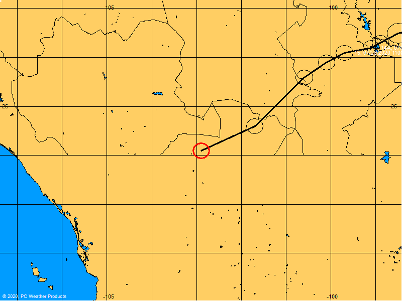
sanibel if that graphic for ike was true (it isn't) she would be crossing florida's longitude fri morn= not happening
0 likes
-
meteorologyman
- Category 2

- Posts: 541
- Joined: Wed Mar 15, 2006 6:48 pm
- Location: Florida, Kissimmee/St.CLoud
Re: ATL: Tropical Storm Hanna in SE Bahamas
Personal Forecast Disclaimer:
The posts in this forum are NOT official forecast and should not be used as such. They are just the opinion of the poster and may or may not be backed by sound meteorological data. They are NOT endorsed by any professional institution or storm2k.org. For official information, please refer to the NHC and NWS products.[/quote]
Uh folks I could be wrong but, if you look north of that shearing line you can see the clouds still having a good broad circular motion, I think that shear (line) cut off moisture for the norther 1/2 from circulation, thats why you dont see build up but I think once this shear line passes through she will be restrengthening.... I hope I'm wrong with this observation
Last edited by meteorologyman on Tue Sep 02, 2008 10:02 am, edited 1 time in total.
0 likes
-
captain east

- Tropical Storm

- Posts: 213
- Joined: Thu Aug 28, 2008 2:53 pm
- Location: South East Florida
Re: ATL: Tropical Storm Hanna in SE Bahamas
What's going on with Hanna? I haven't been watching her because I'm in school right now...
Wait BTW, Is this W to SW movement part of the track at all.
Wait BTW, Is this W to SW movement part of the track at all.
0 likes
-
HURAKAN

- Professional-Met

- Posts: 46084
- Age: 39
- Joined: Thu May 20, 2004 4:34 pm
- Location: Key West, FL
- Contact:
11 AM Discussion:
On the forecast track...Hanna is expected to
approach the East Coast of Florida... Georgia...or South Carolina
in 2 to 3 days. It should be stressed that the expected angle of
approach and track uncertainty make it impossible to narrow down
the potential impact area. Interests in the northwestern Bahamas
and along the entire southeastern United States coast should
closely monitor the progress of this system.
0 likes
Re: ATL: Tropical Storm Hanna in SE Bahamas
meteorologyman wrote:Personal Forecast Disclaimer:
The posts in this forum are NOT official forecast and should not be used as such. They are just the opinion of the poster and may or may not be backed by sound meteorological data. They are NOT endorsed by any professional institution or storm2k.org. For official information, please refer to the NHC and NWS products.
Uh folks I could be wrong but, if you look north of that shearing line you can see the clouds still having a good broad circular motion, I think that shear (line) cut off moisture for the norther 1/2 thats why you dont see build up but I think once this shear line passes through she will be restrengthening.... I hope I'm wrong with this observation
its a tuff one look just to the north of hanna at the base of the trough (25/72) looks like the shear has ramped up there about 10x fold and should this base sink much lower , she may be decapitated in the short term
http://www.ssd.noaa.gov/goes/east/nwatl/loop-wv.html
could be a close call between good contions and death shear (though it would not kill her just weaken her IMO as her llc will be around for awhile)
Last edited by cpdaman on Tue Sep 02, 2008 10:05 am, edited 1 time in total.
0 likes
Re: ATL: Tropical Storm Hanna in SE Bahamas
sanibel if that graphic for ike was true (it isn't) she would be crossing florida's longitude fri morn= not happening
Never thought about it being erroneous. Thanks.
0 likes
-
jlauderdal
- S2K Supporter

- Posts: 7240
- Joined: Wed May 19, 2004 5:46 am
- Location: NE Fort Lauderdale
- Contact:
Re: ATL: Tropical Storm Hanna in SE Bahamas
well they finally came a west a bit, i called for that sunday on this board, if only they would have listened to me, lol...if it survives, all interests from miami to NC better be ready to spring into action due to any deviation in that track, wobble watching will be required for this one, i hope the s2k servers are up to the task, in fact a wobble thread might be in order starting tomorrow
0 likes
Re:
gatorcane wrote::uarrow:
good point Hurakan...
I can tell you I sense no concern at all here in SE Florida on Hanna.....
but just a small shift left makes a HUGE difference in impacts.
gator two things.....this looks like a very important shift IMO it shows the angle turning left toward landfall, my opinion of where hanna will go just shifted from carolina's to CENTRAL florida, for now.
also gator look how far south the base of that trough is getting
someone can correct me but it seems there is little room between hanna having good conditions in the next 24 hours or horrible conditions, should the shear axis along the base of that trough drop another 150 miles or not.
Last edited by cpdaman on Tue Sep 02, 2008 10:09 am, edited 1 time in total.
0 likes

-
gatorcane

- S2K Supporter
- Posts: 23708
- Age: 48
- Joined: Sun Mar 13, 2005 3:54 pm
- Location: Boca Raton, FL
Re: ATL: Tropical Storm Hanna in SE Bahamas
CourierPR wrote:Hurakan, has that cone shifted west?
yes it has unfortunately for East Coast Floridians.
0 likes
Re:
gatorcane wrote::uarrow:
good point Hurakan...
I can tell you I sense no concern at all here in SE Florida on Hanna.....
but just a small shift left makes a HUGE difference in impacts.
gator - agreed...people at my work are totally complacent about it...they are all certain we will only see showers from her...they have no idea of what could possibly happen...
on another note...man the NHC forecast certainly likes a true NW motion from this point out...not convinced about that myself
0 likes

Re: ATL: Tropical Storm Hanna in SE Bahamas
If the base of that trough dips 100 miles further south than Hanna will be on life support or an open wave.
0 likes

Re: ATL: Tropical Storm Hanna in SE Bahamas
boca wrote:If the base of that trough dips 100 miles further south than Hanna will be on life support or an open wave.
ala Chris and his decapitation.....IMO...
0 likes
-
HURAKAN
- Professional-Met
- Posts: 46084
- Age: 39
- Joined: Thu May 20, 2004 4:34 pm
- Location: Key West, FL
- Contact:
Re: ATL: Tropical Storm Hanna in SE Bahamas
boca wrote:If the base of that trough dips 100 miles further south than Hanna will be on life support or an open wave.
Good point. Hanna has survived through a lot but the trough is putting her trough another difficult test.
0 likes

Who is online
Users browsing this forum: No registered users and 32 guests