ATL: IKE Discussion

Moderator: S2k Moderators

Message
Author
User avatar
Sabanic
Category 2
Category 2
Posts: 683
Age: 65
Joined: Wed Aug 01, 2007 7:01 am
Location: Mobile, AL
Contact:

Re: ATL IKE Category 3 - Discussion

#4861 Postby Sabanic » Sun Sep 07, 2008 5:55 pm

robbielyn wrote:
stormhorn wrote:
robbielyn wrote:why is that scary those are ts winds not hurricane winds maybe strong rip currents though.

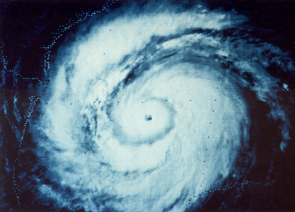
A hurricane that spans the entire Gulf is one Big A** hurricane :eek:


yeah i know but the majority of the wind field will still be ts winds. I just dont think this will be a real big deal to the e gom.


Meaning the SW coast of FL rl? It would definitely affect many parts of the NE, N, & Central coastal areas if it were to become that large.
0 likes   

Shoshana
Category 5
Category 5
Posts: 1414
Joined: Thu Sep 09, 2004 7:50 pm
Location: NE Austin

Re: Re:

#4862 Postby Shoshana » Sun Sep 07, 2008 5:59 pm

ConvergenceZone wrote:


The scariest part of what Jeff Masters says is the following

"Also of note...Ike will become a very large hurricane over the Gulf of Mexico likely expanding in size to nearly the entire Gulf as the interaction with Cuba broadens the wind field. " :eek:


Where can I find a list of the largest (sizewise) hurricanes in the Gulf of Mexico?

The biggest ones I can think of are Gilbert and Carla... but I can't find anything comparing hurricanes sizes (Tip vs Tracy)
0 likes   

fasterdisaster
Category 5
Category 5
Posts: 1868
Joined: Mon Sep 19, 2005 4:41 pm
Location: Miami, Florida

Re: Re:

#4863 Postby fasterdisaster » Sun Sep 07, 2008 6:01 pm

Shoshana wrote:
ConvergenceZone wrote:


The scariest part of what Jeff Masters says is the following

"Also of note...Ike will become a very large hurricane over the Gulf of Mexico likely expanding in size to nearly the entire Gulf as the interaction with Cuba broadens the wind field. " :eek:


Where can I find a list of the largest (sizewise) hurricanes in the Gulf of Mexico?

The biggest ones I can think of are Gilbert and Carla... but I can't find anything comparing hurricanes sizes (Tip vs Tracy)


Don't forget Katrina.
0 likes   

User avatar
robbielyn
Category 5
Category 5
Posts: 1298
Joined: Wed May 07, 2003 9:45 am
Location: brooksville, fl

Re: ATL IKE Category 3 - Discussion

#4864 Postby robbielyn » Sun Sep 07, 2008 6:02 pm

Meaning the SW coast of FL rl? It would definitely affect many parts of the NE, N, & Central coastal areas if it were to become that large.[/quote]
yeah pretty much mobile points westward if track pans out. of course im not including keys as they will no doubt be affected.
0 likes   

User avatar
gboudx
S2K Supporter
S2K Supporter
Posts: 4080
Joined: Thu Sep 04, 2003 1:39 pm
Location: Rockwall, Tx but from Harvey, La

Re: Re:

#4865 Postby gboudx » Sun Sep 07, 2008 6:03 pm

ConvergenceZone wrote:
oops my mistake. I guess I just get so use to his reports being posted here


Sorry, I should've clarified the correct "jeff". But the S2K "jeff" spells it all lowercase, so that's why I posted it that way. I'll be sure to clarify in future updates.
0 likes   

Shoshana
Category 5
Category 5
Posts: 1414
Joined: Thu Sep 09, 2004 7:50 pm
Location: NE Austin

Re: Re:

#4866 Postby Shoshana » Sun Sep 07, 2008 6:03 pm

fasterdisaster wrote:
Shoshana wrote:
ConvergenceZone wrote:
The scariest part of what Jeff Masters says is the following

"Also of note...Ike will become a very large hurricane over the Gulf of Mexico likely expanding in size to nearly the entire Gulf as the interaction with Cuba broadens the wind field. " :eek:


Where can I find a list of the largest (sizewise) hurricanes in the Gulf of Mexico?

The biggest ones I can think of are Gilbert and Carla... but I can't find anything comparing hurricanes sizes (Tip vs Tracy)


Don't forget Katrina.


True. I just can't figure out how big they were in relation to each other..
0 likes   

User avatar
jasons2k
Storm2k Executive
Storm2k Executive
Posts: 8245
Age: 51
Joined: Wed Jul 06, 2005 12:32 pm
Location: The Woodlands, TX

#4867 Postby jasons2k » Sun Sep 07, 2008 6:05 pm

Just to clarify, the update above is NOT Jeff Masters, it is Jeff Lindner - a local pro-met with the Harris County Flood Control District.
0 likes   

User avatar
Sabanic
Category 2
Category 2
Posts: 683
Age: 65
Joined: Wed Aug 01, 2007 7:01 am
Location: Mobile, AL
Contact:

Re:

#4868 Postby Sabanic » Sun Sep 07, 2008 6:06 pm

jasons wrote:Just to clarify, the update above is NOT Jeff Masters, it is Jeff Lindner - a local pro-met with the Harris County Flood Control District.


Thanks jason. Thought I was losing my mind there for a sec
0 likes   

User avatar
CronkPSU
S2K Supporter
S2K Supporter
Posts: 2014
Joined: Sun Aug 07, 2005 10:44 pm
Location: Avalon Park, FL

#4869 Postby CronkPSU » Sun Sep 07, 2008 6:08 pm

i've seen Tip superimposed onto a map of the us before and I believ it pretty much took up half of the lower 48...I am sure someone has that image handy
0 likes   

User avatar
Bunkertor
Category 5
Category 5
Posts: 3397
Joined: Tue May 09, 2006 3:48 pm

Re:

#4870 Postby Bunkertor » Sun Sep 07, 2008 6:10 pm

jasons wrote:Just to clarify, the update above is NOT Jeff Masters, it is Jeff Lindner - a local pro-met with the Harris County Flood Control District.


But it´s official ? :?:
0 likes   

ziggylee
Tropical Wave
Tropical Wave
Posts: 3
Age: 67
Joined: Wed Sep 21, 2005 11:48 pm
Location: Kingwood,TX
Contact:

Re: Re:

#4871 Postby ziggylee » Sun Sep 07, 2008 6:10 pm

Shoshana wrote:
ConvergenceZone wrote:


The scariest part of what Jeff Masters says is the following

"Also of note...Ike will become a very large hurricane over the Gulf of Mexico likely expanding in size to nearly the entire Gulf as the interaction with Cuba broadens the wind field. " :eek:


Where can I find a list of the largest (sizewise) hurricanes in the Gulf of Mexico?

The biggest ones I can think of are Gilbert and Carla... but I can't find anything comparing hurricanes sizes (Tip vs Tracy)


The largest one I remember was Allen in '80. Famous pic of it filling up the entire GOM.
Image
0 likes   

User avatar
AL Chili Pepper
Category 3
Category 3
Posts: 873
Joined: Thu Aug 12, 2004 1:15 pm
Location: Mobile, AL

Re:

#4872 Postby AL Chili Pepper » Sun Sep 07, 2008 6:10 pm

CronkPSU wrote:i've seen Tip superimposed onto a map of the us before and I believ it pretty much took up half of the lower 48...I am sure someone has that image handy

Image
0 likes   

6SpeedTA95
Category 5
Category 5
Posts: 1206
Joined: Wed Oct 19, 2005 3:25 pm
Location: Oklahoma
Contact:

Re:

#4873 Postby 6SpeedTA95 » Sun Sep 07, 2008 6:11 pm

CronkPSU wrote:i've seen Tip superimposed onto a map of the us before and I believ it pretty much took up half of the lower 48...I am sure someone has that image handy

I believe tip was 1400 miles across at its largest point which would be close to half of the lower 48.
0 likes   

6SpeedTA95
Category 5
Category 5
Posts: 1206
Joined: Wed Oct 19, 2005 3:25 pm
Location: Oklahoma
Contact:

Re: Re:

#4874 Postby 6SpeedTA95 » Sun Sep 07, 2008 6:12 pm

ziggylee wrote:
Where can I find a list of the largest (sizewise) hurricanes in the Gulf of Mexico?

The biggest ones I can think of are Gilbert and Carla... but I can't find anything comparing hurricanes sizes (Tip vs Tracy)


The largest one I remember was Allen in '80. Famous pic of it filling up the entire GOM.
Image[/quote]
holeeeeee crap
0 likes   

User avatar
wxman57
Moderator-Pro Met
Moderator-Pro Met
Posts: 22982
Age: 67
Joined: Sat Jun 21, 2003 8:06 pm
Location: Houston, TX (southwest)

Re: Re:

#4875 Postby wxman57 » Sun Sep 07, 2008 6:12 pm

Shoshana wrote:
Where can I find a list of the largest (sizewise) hurricanes in the Gulf of Mexico?

The biggest ones I can think of are Gilbert and Carla... but I can't find anything comparing hurricanes sizes (Tip vs Tracy)


Here's a graphic I put together in 2005. I know Georges wasn't a major hurricane, but I just wanted to compare it. I must have made it before Wilma (or forgot Wilma). Wilma's average 64kt radius was 81 miles.


Image
Last edited by wxman57 on Sun Sep 07, 2008 6:15 pm, edited 1 time in total.
0 likes   

User avatar
CronkPSU
S2K Supporter
S2K Supporter
Posts: 2014
Joined: Sun Aug 07, 2005 10:44 pm
Location: Avalon Park, FL

#4876 Postby CronkPSU » Sun Sep 07, 2008 6:13 pm

thanks al chili...so a little bit less than half of the US but still HUGE compared to atlantic storms
0 likes   

User avatar
El Nino
Category 1
Category 1
Posts: 454
Age: 47
Joined: Sun Oct 16, 2005 3:18 pm
Location: Lima - Miraflores (Peru)
Contact:

Re: ATL IKE Category 3 - Discussion

#4877 Postby El Nino » Sun Sep 07, 2008 6:15 pm

I was on the road for 3h. What was the last pressure measured and the windspeed ?
0 likes   

njweather
Tropical Storm
Tropical Storm
Posts: 169
Joined: Fri Aug 17, 2007 10:45 pm
Location: Washington, DC

Re: ATL IKE Category 3 - Discussion

#4878 Postby njweather » Sun Sep 07, 2008 6:17 pm

El Nino wrote:I was on the road for 3h. What was the last pressure measured and the windspeed ?


942.1 mb, 119 kts at flight level and at the surface
0 likes   

User avatar
El Nino
Category 1
Category 1
Posts: 454
Age: 47
Joined: Sun Oct 16, 2005 3:18 pm
Location: Lima - Miraflores (Peru)
Contact:

Re: ATL IKE Category 3 - Discussion

#4879 Postby El Nino » Sun Sep 07, 2008 6:18 pm

njweather wrote:
El Nino wrote:I was on the road for 3h. What was the last pressure measured and the windspeed ?


942.1 mb, 119 kts at flight level and at the surface


So, this is a cat3 not more !
0 likes   

fasterdisaster
Category 5
Category 5
Posts: 1868
Joined: Mon Sep 19, 2005 4:41 pm
Location: Miami, Florida

Re: ATL IKE Category 3 - Discussion

#4880 Postby fasterdisaster » Sun Sep 07, 2008 6:21 pm

El Nino wrote:
njweather wrote:
El Nino wrote:I was on the road for 3h. What was the last pressure measured and the windspeed ?


942.1 mb, 119 kts at flight level and at the surface


So, this is a cat3 not more !


It's going through an ERC, if it finishes before it hits Cuba (which could happen) it will likely re-strengthen.
0 likes   


Return to “2008”

Who is online

Users browsing this forum: No registered users and 5 guests