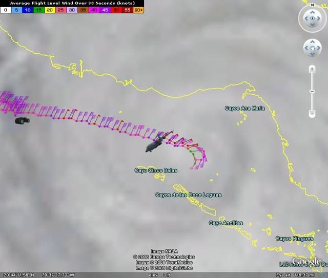
Hurricanewatcher2007 wrote:So far Ike appears to be a whole lot weaker then 100mph like the NHC has as its current strength. Highest FL winds are only 57kts with a pressure of about 968mb
968 mb though is close to the estimated(and quite low), and they haven't even sampled most of the storm yet. I suspect it's at least 85-90 mph still.