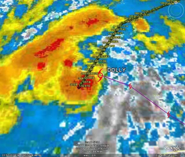
ATL: Tropical Depression Dolly

Moderator: S2k Moderators

Message
Author
User avatar
Ivanhater
Storm2k Moderator
Storm2k Moderator
Posts: 11162
Age: 38
Joined: Fri Jul 01, 2005 8:25 am
Location: Pensacola

Re: Re:

#5661 Postby Ivanhater » Mon Jul 21, 2008 5:48 pm

Air Force Met wrote:
KWT wrote:I think AFM we already seeing hints of that occuring with the development of the inner core and with it having very good bandings it may well strengthen pretty rapidly IMO, esp if it can gain some convection like its doing already.

FWIW the models all seem to agree that this won't really take off till a little further WNW, I think thats why the NHC doesn't call for much strengthening in the next 12-18hrs.


I agree. When I mean convectively getting its act together...I don't mean just some good thunderstorms and a steady drop in pressure...I mean hold on to your seats because the conditions are very good for explosive development and a big drop in pressure....and a nice cold CDO to go along with it.


Youve been spot on so far AFM..and I agree..she will be losing that outer band currently over the NW Caribbean and wrap up overnight...hope we have an overnight shift on at s2k!
0 likes   

Aric Dunn
Category 5
Category 5
Posts: 21238
Age: 42
Joined: Sun Sep 19, 2004 9:58 pm
Location: Ready for the Chase.
Contact:

Re: Re:

#5662 Postby Aric Dunn » Mon Jul 21, 2008 5:49 pm

Air Force Met wrote:
KWT wrote:I think AFM we already seeing hints of that occuring with the development of the inner core and with it having very good bandings it may well strengthen pretty rapidly IMO, esp if it can gain some convection like its doing already.

FWIW the models all seem to agree that this won't really take off till a little further WNW, I think thats why the NHC doesn't call for much strengthening in the next 12-18hrs.


I agree. When I mean convectively getting its act together...I don't mean just some good thunderstorms and a steady drop in pressure...I mean hold on to your seats because the conditions are very good for explosive development and a big drop in pressure....and a nice cold CDO to go along with it.


agreed.. especially as it begins to slow down some..
0 likes   

HurricaneHunter914
Category 5
Category 5
Posts: 4439
Age: 31
Joined: Fri Mar 10, 2006 7:36 pm
Location: College Station, TX

#5663 Postby HurricaneHunter914 » Mon Jul 21, 2008 5:49 pm

If she becomes a hurricane tonight, imagine how strong she could get tomorrow. I think a Cat-2 at landfall is not out of the question. Cat-3 is kinda pushing it.
0 likes   

txwatcher91
Category 5
Category 5
Posts: 1498
Joined: Tue Aug 02, 2005 2:29 pm

Re: Re:

#5664 Postby txwatcher91 » Mon Jul 21, 2008 5:49 pm

WmE wrote:
txwatcher91 wrote:IMO this will become a strong Cat 3 or low-end Cat 4 before landfall.


That's a bold prediction. your reasoning?

Outlflow is excellent, forward speed SHOULD decrease, higher TCHP ahead, better upper level conditions, more time for the core to organize, and the DMAX tomorrow morning will contribute to this strengthening pretty readily, althought this does not mean it will verify.
0 likes   

User avatar
hawkeh
Tropical Storm
Tropical Storm
Posts: 109
Joined: Thu Sep 09, 2004 7:35 pm
Location: Bahamas

Re: ATL: TS Dolly in Southern Gulf of Mexico

#5665 Postby hawkeh » Mon Jul 21, 2008 5:49 pm

Dolly sure is looking better on satellite, should be an interesting night.
0 likes   

Scorpion

#5666 Postby Scorpion » Mon Jul 21, 2008 5:50 pm

Down 6 mb since last VDM.. pretty good strengthening
0 likes   

RL3AO
Moderator-Pro Met
Moderator-Pro Met
Posts: 16308
Joined: Thu Jun 14, 2007 10:03 pm
Location: NC

#5667 Postby RL3AO » Mon Jul 21, 2008 5:50 pm

If the pressure is correct, thats a 6mb drop in two hours.
0 likes   

jhamps10

#5668 Postby jhamps10 » Mon Jul 21, 2008 5:50 pm

998mb pressure from recon.
0 likes   

User avatar
Nimbus
Category 5
Category 5
Posts: 5339
Joined: Mon Jul 19, 2004 10:54 am

#5669 Postby Nimbus » Mon Jul 21, 2008 5:50 pm

Its starting to pick up convection near the center now that it is moving away from the coast. Should look a lot different in 12 hours but its a July storm so it will probably top out at cat 2 even if it does go through RI.
0 likes   

User avatar
HURAKAN
Professional-Met
Professional-Met
Posts: 46086
Age: 38
Joined: Thu May 20, 2004 4:34 pm
Location: Key West, FL
Contact:

#5670 Postby HURAKAN » Mon Jul 21, 2008 5:51 pm

Image
0 likes   

CrazyC83
Professional-Met
Professional-Met
Posts: 34043
Joined: Tue Mar 07, 2006 11:57 pm
Location: Deep South, for the first time!

Re:

#5671 Postby CrazyC83 » Mon Jul 21, 2008 5:51 pm

RL3AO wrote:If the pressure is correct, thats a 6mb drop in two hours.


It may be a bit higher on the VDM (around 1000-1001) but still a significant drop in a short time period.
0 likes   

User avatar
KWT
Category 5
Category 5
Posts: 31415
Joined: Tue Aug 17, 2004 11:02 am
Location: UK!!!

#5672 Postby KWT » Mon Jul 21, 2008 5:52 pm

Yeah I know exactly the type of look your talking about AFM, the type that can a system increase 20-30kts in just 6-12hrs, convection still increasing and its getting a very impressive look to me, banding is so impressive right now IMO that if we do get that big convective blast its going to explode.
Last edited by KWT on Mon Jul 21, 2008 5:52 pm, edited 1 time in total.
0 likes   


User avatar
Tampa Bay Hurricane
Category 5
Category 5
Posts: 5597
Age: 37
Joined: Fri Jul 22, 2005 7:54 pm
Location: St. Petersburg, FL

Re:

#5674 Postby Tampa Bay Hurricane » Mon Jul 21, 2008 5:52 pm

RL3AO wrote:If the pressure is correct, thats a 6mb drop in two hours.


This could be the start of some explosive deepening given
high oceanic heat content and favorable shear-less conditions.
I was expecting a pressure drop of this magnitude, and forecast
it to continue.
0 likes   

User avatar
stormy1970al
Tropical Storm
Tropical Storm
Posts: 158
Age: 55
Joined: Sat May 31, 2008 12:54 pm
Location: Fairhope AL

Re: ATL: TS Dolly in Southern Gulf of Mexico

#5675 Postby stormy1970al » Mon Jul 21, 2008 5:52 pm

What are the chances that Dolly will hit Corpus Christe? My bf family lives there. Also we have family near South Padre Island.

Anyway I hope everyone in the path of Dolly is preparing. She looks like she is getting her act together....(just my personal opinion)
0 likes   

CrazyC83
Professional-Met
Professional-Met
Posts: 34043
Joined: Tue Mar 07, 2006 11:57 pm
Location: Deep South, for the first time!

#5676 Postby CrazyC83 » Mon Jul 21, 2008 5:52 pm

The winds haven't supported any increase though (still supporting 45 kt) but they have only been in one quadrant.
0 likes   

txwatcher91
Category 5
Category 5
Posts: 1498
Joined: Tue Aug 02, 2005 2:29 pm

Re:

#5677 Postby txwatcher91 » Mon Jul 21, 2008 5:53 pm

RL3AO wrote:If the pressure is correct, thats a 6mb drop in two hours.


Like I said, Cat 3/4 at landfall is VERY possible given the time it has over water. I have seen Katrina, Wilma, Rita, etc. before they underwent RI and this one has the appearance and conditions to support this. Not saying Cat 5, but RI is very possible. I am looking at Bertha of this year as a good analog as once it got going it developed quickly.
0 likes   

CrazyC83
Professional-Met
Professional-Met
Posts: 34043
Joined: Tue Mar 07, 2006 11:57 pm
Location: Deep South, for the first time!

Re: ATL: TS Dolly in Southern Gulf of Mexico

#5678 Postby CrazyC83 » Mon Jul 21, 2008 5:53 pm

stormy1970al wrote:What are the chances that Dolly will hit Corpus Christe? My bf family lives there. Also we have family near South Padre Island.

Anyway I hope everyone in the path of Dolly is preparing. She looks like she is getting her act together....(just my personal opinion)


Chances are one of those areas will be affected (if not both).
0 likes   

User avatar
TexWx
Category 1
Category 1
Posts: 370
Joined: Tue Aug 22, 2006 11:00 pm
Location: Pearland, Texas
Contact:

Re: ATL: TS Dolly in Southern Gulf of Mexico

#5679 Postby TexWx » Mon Jul 21, 2008 5:53 pm

http://www.ssd.noaa.gov/goes/east/gmex/loop-rgb.html

looking pretty good now.

I don't know if this thing will slow down, and I'm thinking south of Brownsville.
0 likes   

CrazyC83
Professional-Met
Professional-Met
Posts: 34043
Joined: Tue Mar 07, 2006 11:57 pm
Location: Deep South, for the first time!

Re: Re:

#5680 Postby CrazyC83 » Mon Jul 21, 2008 5:54 pm

txwatcher91 wrote:
RL3AO wrote:If the pressure is correct, thats a 6mb drop in two hours.


Like I said, Cat 3/4 at landfall is VERY possible given the time it has over water. I have seen Katrina, Wilma, Rita, etc. before they underwent RI and this one has the appearance and conditions to support this. Not saying Cat 5, but RI is very possible. I am looking at Bertha of this year as a good analog as once it got going it developed quickly.


The posts in this forum are NOT official forecast and should not be used as such. They are just the opinion of the poster and may or may not be backed by sound meteorological data. They are NOT endorsed by any professional institution or storm2k.org. For official information, please refer to the NHC and NWS products.

I'm in agreement with those saying RI. I predict 125 kt by early Wednesday, followed by slight weakening before landfall.
0 likes   


Return to “2008”

Who is online

Users browsing this forum: No registered users and 3 guests