ATL: IKE Discussion

Moderator: S2k Moderators

Message
Author
Air Force Met
Military Met
Military Met
Posts: 4372
Age: 56
Joined: Tue Jul 08, 2003 9:30 am
Location: Roan Mountain, TN

Re: ATL IKE: Category 1 - Discussion

#6241 Postby Air Force Met » Tue Sep 09, 2008 9:05 am

gatorcane wrote:
deltadog03 wrote:I see a weakness in the gom...We were talking about this earlier, there is part of the ridge just east of TX now, and the other is the big ridge in the ATL sprawled out. Models forecast a "weakness" for another 24-36 hours.


The 00 UTC GFS doesn't see the weakness as given by the 000 500MB Vort:


Yes it does. You don't see the COL on the image you posted?

See the dot? Thats the COL between the two highs. That's the weakness.
0 likes   

User avatar
HURAKAN
Professional-Met
Professional-Met
Posts: 46086
Age: 38
Joined: Thu May 20, 2004 4:34 pm
Location: Key West, FL
Contact:

#6242 Postby HURAKAN » Tue Sep 09, 2008 9:07 am

Image

Image

Sierra de los Órganos, Cuba
0 likes   

jlauderdal
S2K Supporter
S2K Supporter
Posts: 7184
Joined: Wed May 19, 2004 5:46 am
Location: NE Fort Lauderdale
Contact:

Re:

#6243 Postby jlauderdal » Tue Sep 09, 2008 9:08 am

Stormcenter wrote:If anyone wants to question the NHC's forecast track
for Ike just remember they NAILED Gustav's landfall 4 days out when he was still by Jamaica.


past performance is no guarantee of future results, this is a completely different setup..they did nail gustav but everyone did, it was very straightforward

i would be real concerned about intensity if i was in the cone, this doesn't look like a weakening gus
0 likes   

User avatar
hiflyer
S2K Supporter
S2K Supporter
Posts: 562
Joined: Wed Sep 08, 2004 11:24 am
Location: West Broward Florida

#6244 Postby hiflyer » Tue Sep 09, 2008 9:10 am

Frank...yup...fly me...grin. Benny Hill did the best spoof of it..

Last position plot upthread shows a right turn towards the flat plain...seen a lot of storms try to do that over the 25 years of living down in SoFla...some manage to pull it off. Watervapor suggest a top heavy config building...which lead some to think a more northerly track is coming.

My last storm for awhile...off to San Jose Calif next week for at least a few months working...can't see quakes from a water vapor loop...no fun. sigh.

Folks in Turks/Caicos got slammed...local tv station webcasting...had 2 hrs of really good video last night of the destruction on Grand Turk... http://www.mogulus.com/wiv4# which was close to the track. From the damage looks like some meso's rolled thru there along with the eyewall.
0 likes   

jlauderdal
S2K Supporter
S2K Supporter
Posts: 7184
Joined: Wed May 19, 2004 5:46 am
Location: NE Fort Lauderdale
Contact:

Re: ATL IKE: Category 1 - Discussion

#6245 Postby jlauderdal » Tue Sep 09, 2008 9:10 am

Air Force Met wrote:
gatorcane wrote:
deltadog03 wrote:I see a weakness in the gom...We were talking about this earlier, there is part of the ridge just east of TX now, and the other is the big ridge in the ATL sprawled out. Models forecast a "weakness" for another 24-36 hours.


The 00 UTC GFS doesn't see the weakness as given by the 000 500MB Vort:


Yes it does. You don't see the COL on the image you posted?

See the dot? Thats the COL between the two highs. That's the weakness.


COL= cut off low
0 likes   

tolakram
Admin
Admin
Posts: 20012
Age: 62
Joined: Sun Aug 27, 2006 8:23 pm
Location: Florence, KY (name is Mark)

Re:

#6246 Postby tolakram » Tue Sep 09, 2008 9:11 am


It's simply beautiful down there, thanks.
0 likes   

User avatar
setxweathergal
Tropical Low
Tropical Low
Posts: 39
Joined: Sun Nov 05, 2006 2:50 pm
Location: Beaumont/Lumberton

Re: ATL IKE: Category 1 - Discussion

#6247 Postby setxweathergal » Tue Sep 09, 2008 9:13 am

I am fascinated watching these storms unfold, yet I am terrified of them happening near or around me!! Probably what is making me more nervous than anything is the wait and see game. Hmmmm, lets see what all of the models do today then in the morning at 8am if they've shifted further north we'll all be headed north in a huge convoy! I know there's no sure way of knowing anything about this unpredictable storm...but someone give me an idea of just how far north it *could* curve if it does. Please!!
0 likes   

User avatar
haml8
Tropical Storm
Tropical Storm
Posts: 188
Age: 49
Joined: Sun Aug 19, 2007 10:03 pm
Location: Katy, Texas
Contact:

Re: ATL IKE: Category 1 - Discussion

#6248 Postby haml8 » Tue Sep 09, 2008 9:15 am

15 hours previous 300-850

Image


Latest:

Image

It is the lack of concentration of the lines near brownsville that I am looking at, is that the right thing to look at when reviewing the strength of the steering currents and the high?
0 likes   

User avatar
KWT
Category 5
Category 5
Posts: 31415
Joined: Tue Aug 17, 2004 11:02 am
Location: UK!!!

#6249 Postby KWT » Tue Sep 09, 2008 9:18 am

The land is reasonably flat though there are some decent heights around the region where Ike should exit however given conditions are far more condusive in the region then what Gus was about to enter I don't think Ike is going to have quite the same issues as Gustav did, it will weaken and its eye will probably be totally gone, but nothing a good 12-18hrs over warm waters in the loop current can't fix.
0 likes   

Air Force Met
Military Met
Military Met
Posts: 4372
Age: 56
Joined: Tue Jul 08, 2003 9:30 am
Location: Roan Mountain, TN

Re: ATL IKE: Category 1 - Discussion

#6250 Postby Air Force Met » Tue Sep 09, 2008 9:20 am

jlauderdal wrote: See the dot? Thats the COL between the two highs. That's the weakness.


COL= cut off low[/quote]

A COL is a saddlepoint or a neutral point in the wind field where two ridges or two trof meet...or all four meet.
0 likes   

jlauderdal
S2K Supporter
S2K Supporter
Posts: 7184
Joined: Wed May 19, 2004 5:46 am
Location: NE Fort Lauderdale
Contact:

Re: ATL IKE: Category 1 - Discussion

#6251 Postby jlauderdal » Tue Sep 09, 2008 9:22 am

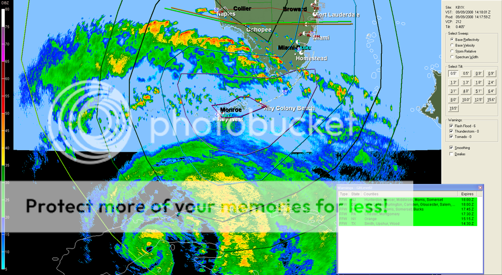
tight eye on the general, lets see what cooba does to ike, its moving right along so i think this is a major at landfall unlike a weakened gus


Image
0 likes   

User avatar
VeniceInlet
Tropical Depression
Tropical Depression
Posts: 92
Joined: Sun Jun 11, 2006 10:12 pm
Location: Nokomis, FL

Re: ATL IKE: Category 1 - Discussion

#6252 Postby VeniceInlet » Tue Sep 09, 2008 9:23 am

setxweathergal wrote:I am fascinated watching these storms unfold, yet I am terrified of them happening near or around me!! Probably what is making me more nervous than anything is the wait and see game. Hmmmm, lets see what all of the models do today then in the morning at 8am if they've shifted further north we'll all be headed north in a huge convoy! I know there's no sure way of knowing anything about this unpredictable storm...but someone give me an idea of just how far north it *could* curve if it does. Please!!


Keep watching this track and reading the NHC discussions. Nobody really knows that yet.

http://www.nhc.noaa.gov/refresh/graphic ... y#contents
Last edited by VeniceInlet on Tue Sep 09, 2008 9:28 am, edited 1 time in total.
0 likes   

User avatar
deltadog03
Professional-Met
Professional-Met
Posts: 3580
Joined: Tue Jul 05, 2005 6:16 pm
Location: Macon, GA

Re: ATL IKE: Category 1 - Discussion

#6253 Postby deltadog03 » Tue Sep 09, 2008 9:25 am

COL dosn't mean cut off low...COL is an area btwn 2 highs....You can clearly see the weakness. Now, once this starts to strengthen it should pick up steam and head right towards that weakness...
0 likes   

jlauderdal
S2K Supporter
S2K Supporter
Posts: 7184
Joined: Wed May 19, 2004 5:46 am
Location: NE Fort Lauderdale
Contact:

Re: ATL IKE: Category 1 - Discussion

#6254 Postby jlauderdal » Tue Sep 09, 2008 9:26 am

Air Force Met wrote:
jlauderdal wrote: See the dot? Thats the COL between the two highs. That's the weakness.


COL= cut off low


A COL is a saddlepoint or a neutral point in the wind field where two ridges or two trof meet...or all four meet.[/quote]

cut-off low—A cold low that has grown out of a trough and become displaced out of the basic westerly current and lies equatorward of this current.


we need a separate thread to discuss cut off lows :roll: . they actually are a big deal in the overall setup, at least around florida and the gulf they are.
0 likes   

jlauderdal
S2K Supporter
S2K Supporter
Posts: 7184
Joined: Wed May 19, 2004 5:46 am
Location: NE Fort Lauderdale
Contact:

Re: ATL IKE: Category 1 - Discussion

#6255 Postby jlauderdal » Tue Sep 09, 2008 9:31 am

Air Force Met wrote:
jlauderdal wrote: See the dot? Thats the COL between the two highs. That's the weakness.


COL= cut off low


A COL is a saddlepoint or a neutral point in the wind field where two ridges or two trof meet...or all four meet.[/quote]

were you referring to a cut off low?
0 likes   

User avatar
HURAKAN
Professional-Met
Professional-Met
Posts: 46086
Age: 38
Joined: Thu May 20, 2004 4:34 pm
Location: Key West, FL
Contact:

#6256 Postby HURAKAN » Tue Sep 09, 2008 9:31 am

Image

Inland.
0 likes   

User avatar
jasons2k
Storm2k Executive
Storm2k Executive
Posts: 8245
Age: 51
Joined: Wed Jul 06, 2005 12:32 pm
Location: The Woodlands, TX

Re:

#6257 Postby jasons2k » Tue Sep 09, 2008 9:31 am

gboudx wrote:Jeff Lidner's Tuesday AM update.

viewtopic.php?f=29&t=103096


I encourage anyone on the TX coast to read this.

I agree with Jeff - and I still cannot shake Rita. I think the models have bottomed-out to the left and will now gradually shift right. This is what AFM laid out yesterday and I'm sticking to my guns for now.

Side note: wow, those pics are beautiful. If only we could visit there....
0 likes   

jlauderdal
S2K Supporter
S2K Supporter
Posts: 7184
Joined: Wed May 19, 2004 5:46 am
Location: NE Fort Lauderdale
Contact:

Re: ATL IKE: Category 1 - Discussion

#6258 Postby jlauderdal » Tue Sep 09, 2008 9:33 am

deltadog03 wrote:COL dosn't mean cut off low...COL is an area btwn 2 highs....You can clearly see the weakness. Now, once this starts to strengthen it should pick up steam and head right towards that weakness...


we need to get this clear for the board, maybe afm was referring to something else, whats your definition of COL

The structure and evolution of an intense tropical cut-off low (COL)
0 likes   

Ed Mahmoud

Re: ATL IKE: Category 1 - Discussion

#6259 Postby Ed Mahmoud » Tue Sep 09, 2008 9:36 am

JB says near CRP, but he had Ike hitting NYC last week, and CRP just happens to be the biggest city between Tampico and Houston.


He could be right.
0 likes   

User avatar
KWT
Category 5
Category 5
Posts: 31415
Joined: Tue Aug 17, 2004 11:02 am
Location: UK!!!

#6260 Postby KWT » Tue Sep 09, 2008 9:37 am

Yep Hurakan Ike is making its final trek across land for the next few days, I expect the eye will close up totally pretty soon but once its cleared from Cuba for about 12hrs then everything look inplace for some good solid strengthening, tomorrow is going to be a relaly interesting day and I suspect when Ike may get back upto major again but we shall see.

jlauderdal, yep tight little inner core there on that radar, keep em coming for as long as is possible please!
0 likes   


Return to “2008”

Who is online

Users browsing this forum: No registered users and 2 guests