

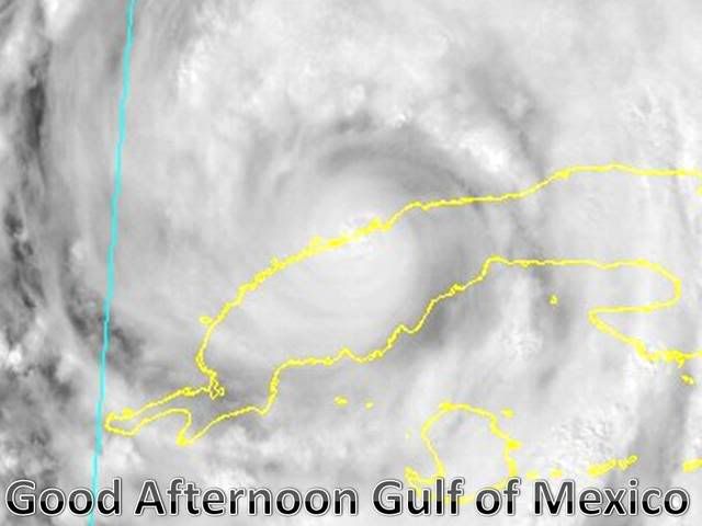
Cool pic of Ike coming off Cuba after first hit... (or second hit if you cound Inagua)
http://rapidfire.sci.gsfc.nasa.gov/gallery/?2008252-0908/Ike.A2008252.1905.1km.jpg
ATL: IKE Discussion
Moderator: S2k Moderators
-
Stormcenter
- S2K Supporter

- Posts: 6689
- Joined: Wed Sep 03, 2003 11:27 am
- Location: Houston, TX
-
jasons2k

- Storm2k Executive

- Posts: 8290
- Age: 52
- Joined: Wed Jul 06, 2005 12:32 pm
- Location: The Woodlands, TX
He is a pro met with the Harris County Flood Control District. He issues flood warnings and what not. But he knows his tropical meteorology and occasionally posts in the analysis forum.
He is held in such "high esteem" because he posts/emails very detailed information that pertains to the local area.
He's also not afraid to tell you what he's really thinking. Sometimes that works in his favor, sometimes it doesn't.
He is held in such "high esteem" because he posts/emails very detailed information that pertains to the local area.
He's also not afraid to tell you what he's really thinking. Sometimes that works in his favor, sometimes it doesn't.
0 likes


-
VeniceInlet

- Tropical Depression

- Posts: 92
- Joined: Sun Jun 11, 2006 10:12 pm
- Location: Nokomis, FL
-
ColdFusion

- S2K Supporter
- Posts: 452
- Joined: Wed Feb 13, 2008 3:46 pm
- Location: Addison, TX
Re:
0 likes

Re:
if you get winds above 111 mph...a portable radio may be the only news source at that point....you will have to catch up on s2k after the fact when power is restored and fill in the blanks of what went down!
it is always a bit eerie when a storm is making landfall and that an area is under the gun when only a few...if any...posts are coming out of the region on this board.
it was fascinating to finally read the posts on wilma during the day of the storm when i got power back 2 weeks later.
it is always a bit eerie when a storm is making landfall and that an area is under the gun when only a few...if any...posts are coming out of the region on this board.
it was fascinating to finally read the posts on wilma during the day of the storm when i got power back 2 weeks later.
mattpetre wrote:OK, so I found a weather station with an anemometer rated up to about 111 mph... I guess at that point I'll just rely on what the pros tell me the speed is up to. I'm going to keep charts here in MO City, TX for the next 5 days and I'll post them after the storm if they seem interesting. I've got a feeling this is going to be a very long weekend around all of Coastal TX from Corpus northward.
0 likes

Looks like Ike is finally coming off Cuba now, the core seems to have weakened somewhat in the last hour looking at the sat.imagery but the overall structure is still very good right now, I fully expect this will strengthen quite quickly after it reaches the Gulf and fully gets away from land...give it 6hrs after that then we shall see Ike make strides...
0 likes
-
dixiebreeze

- S2K Supporter
- Posts: 5140
- Joined: Wed Sep 03, 2003 5:07 pm
- Location: crystal river, fla.
Re:
KWT wrote:Sabanic, the last advisory was shifted about 50 miles north, they may have to shift it a little north yet again based on the models tonight as well, the other issue is how high do they decide to go...
I think given the small inner core and eye still being evident depsite it being overland we are looking very likely at a major hurricane pretty quickly I reckon...will be interesting to see what recon shows when it reaches Ike's northgern quadrant, thats not been sampled for a while now...think winds won't be all that impressive given its been on land for a long time now, unlike the eye...
Key question is "poleward?"
0 likes
-
gboudx

- S2K Supporter
- Posts: 4090
- Joined: Thu Sep 04, 2003 1:39 pm
- Location: Rockwall, Tx but from Harvey, La
Re:
jasons wrote:He is a pro met with the Harris County Flood Control District. He issues flood warnings and what not. But he knows his tropical meteorology and occasionally posts in the analysis forum.
He is held in such "high esteem" because he posts/emails very detailed information that pertains to the local area.
He's also not afraid to tell you what he's really thinking. Sometimes that works in his favor, sometimes it doesn't.
I'll just add that posters can decide to use jeff's opinions like they would with AFM, wxman57, Ortt and other pro's that post here. He's not "the" answer in tropical weather, but he's a cool mofo that offered his phone number to me in case I needed to ask him a question about Gustav and now Ike. I trust his word more than my local TV guys that's for sure.
0 likes
-
Stormcenter
- S2K Supporter
- Posts: 6689
- Joined: Wed Sep 03, 2003 11:27 am
- Location: Houston, TX
Re: Re:
ColdFusion wrote:
1k Visible says nope.
http://hadar.cira.colostate.edu/ramsdis/online/trop_ge_storm_relative_0.html
Looks like he "may" be missing his NHC forecast points.
0 likes
Re:
jasons wrote:He is a pro met with the Harris County Flood Control District. He issues flood warnings and what not. But he knows his tropical meteorology and occasionally posts in the analysis forum.
He is held in such "high esteem" because he posts/emails very detailed information that pertains to the local area.
He's also not afraid to tell you what he's really thinking. Sometimes that works in his favor, sometimes it doesn't.
thanks
0 likes
-
Stormcenter
- S2K Supporter
- Posts: 6689
- Joined: Wed Sep 03, 2003 11:27 am
- Location: Houston, TX
Re: Re:
gboudx wrote:jasons wrote:He is a pro met with the Harris County Flood Control District. He issues flood warnings and what not. But he knows his tropical meteorology and occasionally posts in the analysis forum.
He is held in such "high esteem" because he posts/emails very detailed information that pertains to the local area.
He's also not afraid to tell you what he's really thinking. Sometimes that works in his favor, sometimes it doesn't.
I'll just add that posters can decide to use jeff's opinions like they would with AFM, wxman57, Ortt and other pro's that post here. He's not "the" answer in tropical weather, but he's a cool mofo that offered his phone number to me in case I needed to ask him a question about Gustav and now Ike. I trust his word more than my local TV guys that's for sure.
He whatever rocks ones boat. We all have an opinion right?
0 likes
-
gboudx
- S2K Supporter
- Posts: 4090
- Joined: Thu Sep 04, 2003 1:39 pm
- Location: Rockwall, Tx but from Harvey, La
Re: Re:
Stormcenter wrote:gboudx wrote:jasons wrote:He is a pro met with the Harris County Flood Control District. He issues flood warnings and what not. But he knows his tropical meteorology and occasionally posts in the analysis forum.
He is held in such "high esteem" because he posts/emails very detailed information that pertains to the local area.
He's also not afraid to tell you what he's really thinking. Sometimes that works in his favor, sometimes it doesn't.
I'll just add that posters can decide to use jeff's opinions like they would with AFM, wxman57, Ortt and other pro's that post here. He's not "the" answer in tropical weather, but he's a cool mofo that offered his phone number to me in case I needed to ask him a question about Gustav and now Ike. I trust his word more than my local TV guys that's for sure.
He whatever rocks ones boat. We all have an opinion right?
That we do. And I prefer the opinion of someone educated and skilled in the profession. But that's just me. :thumbsup:
0 likes
Re: ATL IKE: Category 1 - Discussion
Could this be right? Pinecrest area in Miami weather station just shows a wind gust 0f 104 mph! I would think that is bogus but that is the exact part of Miami-Dade under a tornado warning.
http://www.wunderground.com/weatherstation/WXDailyHistory.asp?ID=KFLPINEC2
http://www.wunderground.com/weatherstation/WXDailyHistory.asp?ID=KFLPINEC2
0 likes
-
mattpetre
- Category 2

- Posts: 510
- Age: 54
- Joined: Mon Sep 19, 2005 3:20 pm
- Location: Missouri City,TX & Galleria
- Contact:
Re: ATL IKE: Category 1 - Discussion
jinftl wrote:Could this be right? Pinecrest area in Miami weather station just shows a wind gust 0f 104 mph! I would think that is bogus but that is the exact part of Miami-Dade under a tornado warning.
http://www.wunderground.com/weatherstation/WXDailyHistory.asp?ID=KFLPINEC2
Looks like something happened there (big downdraft perhaps?), look at that temp drop that occured at the same time. Pretty amazing...
0 likes
Re: ATL IKE: Category 1 - Discussion
In the section with the charts, you see how there was that huge spike to 100 mph and then back down...not like suspect info coming out of there all day eithe
mattpetre wrote:jinftl wrote:Could this be right? Pinecrest area in Miami weather station just shows a wind gust 0f 104 mph! I would think that is bogus but that is the exact part of Miami-Dade under a tornado warning.
http://www.wunderground.com/weatherstation/WXDailyHistory.asp?ID=KFLPINEC2
Looks like something happened there (big downdraft perhaps?), look at that temp drop that occured at the same time. Pretty amazing...
0 likes
Re:
What is odd is there was a 10 degree drop in temp, a 5 degree drop in dewpt at time gust reported. They were under a tornado warning at the time of all this.....who knows!
KWT wrote:jinftl, unless a tornado went over it its probably bogus!
Anyway looks like those models that were south yesterday have trended back north again...
Circulation is almost over water, we may see some term stabalisation then after thats done...well you know the drill!
0 likes
Who is online
Users browsing this forum: No registered users and 8 guests