ATL: Tropical Depression Fay
Moderator: S2k Moderators

Re: ATL: Tropical Storm Fay South of Cuba
Its probably slowing because the LLC is trying to get tucked under that deep convection to the west. Radar and Satellite imagery really doesn't suggest a NW movement, still WNW. And there is no argument to whether or not it is deepening, pressure has been falling with Fay today.
Last edited by Normandy on Sun Aug 17, 2008 3:27 pm, edited 1 time in total.
0 likes
-
Aric Dunn
- Category 5

- Posts: 21238
- Age: 43
- Joined: Sun Sep 19, 2004 9:58 pm
- Location: Ready for the Chase.
- Contact:
Re: ATL: Tropical Storm Fay South of Cuba
NEXRAD wrote:The problem with Fay forming new sustained convection to the west of its LLC is caused in part by suppressing upper level convergence between the ULL and upper level ridging. If the upper low shifts a bit more towards the south (or Fay to the north) then this should become less of an issue.
- Jay
agreed.. there is clearly an interation with weakening upper low
0 likes

gatorcane, problem is conveciton is no closer to the center than it was before and whilst it is probably helping to keep the system going recon is finding if anything slightly lower winds than earlier.
Once I see a big convective blow up over the center then I will jump onto the strengthening train.
I think the set-up should worsen anymore for Fay now though, esp if the gap between the ULL and Fay should now be starting to increase.
Once I see a big convective blow up over the center then I will jump onto the strengthening train.
I think the set-up should worsen anymore for Fay now though, esp if the gap between the ULL and Fay should now be starting to increase.
Last edited by KWT on Sun Aug 17, 2008 3:27 pm, edited 1 time in total.
0 likes


Re: ATL: Tropical Storm Fay South of Cuba
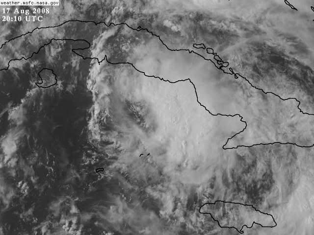
those low islands extending toward the east side of the circulation are cetainly getting inundated with rain.
0 likes

-
DESTRUCTION5

- Category 5
- Posts: 4430
- Age: 44
- Joined: Wed Sep 03, 2003 11:25 am
- Location: Stuart, FL

Re: ATL: Tropical Storm Fay South of Cuba
So, the upshot is that as the ULL scoots westward, conditions will wax a bit more favorable for intensification?
0 likes
Re:
shortwave wrote:One thing I have noticed is how large of an area this system seems to encompass. Though obviously it has a lot of room for improvement, it looks like it has a larger than average area of effect.
that could be good news
considering small storms are the one's we really have to watch for intensifying rapidly and w/o warning, bigger one's take more time, and need more open water to see a lot of intensification
0 likes
-
Evil Jeremy

- S2K Supporter

- Posts: 5463
- Age: 32
- Joined: Mon Apr 10, 2006 2:10 pm
- Location: Los Angeles, CA
at 5 PM EDT...2100 UTC...the Hurricane Watch on the West Coast of
Florida is extended northward to Tarpon Springs. A Hurricane
Watch is in now effect for the Florida Keys from south of Ocean
Reef to Key West...including the Dry Tortugas and Florida Bay...and
along the Florida Mainland from Card Sound bridge westward to Tarpon
Springs. A Hurricane Watch means that hurricane conditions
are possible within the watch area...generally within 36 hours.
0 likes
-
Evil Jeremy
- S2K Supporter
- Posts: 5463
- Age: 32
- Joined: Mon Apr 10, 2006 2:10 pm
- Location: Los Angeles, CA

Re: ATL: Tropical Storm Fay South of Cuba
BigA wrote:So, the upshot is that as the ULL scoots westward, conditions will wax a bit more favorable for intensification?
Yes, they'll become a bit better, but not for too long. Once Fay starts to move into the Florida Straits, quick westerlies aloft ahead of the storm should hinder the system's western quadrants, or at least the northwest region. The result will likely be a sheared system with most convection displaced close to and east of the center.
- Jay
0 likes
Re: ATL: Tropical Storm Fay South of Cuba
Yes shortwave I agree. If Fay gets an opportunity to strengthen once north of Cuba, she would actually be quite a large system - much larger than Charlie (not comparing them in any other way). So JB is taking her into Ft. Myers as a Cat 1 huh. He is stubborn - but not necessarily wrong.....yet.
0 likes


Re: ATL: Tropical Storm Fay South of Cuba
BigA wrote:So, the upshot is that as the ULL scoots westward, conditions will wax a bit more favorable for intensification?
Perhaps. At least, that is the forecast. However, this 12z GFS 200mb output shows what looks like an UL trof over the SE Gulf tomorrow -- possibly the result of an ULL opening up. I don't think that would be a favorable regime for intensification, but maybe a pro met will comment on it.

Last edited by ekal on Sun Aug 17, 2008 3:38 pm, edited 1 time in total.
0 likes
-
cycloneye

- Admin

- Posts: 149413
- Age: 69
- Joined: Thu Oct 10, 2002 10:54 am
- Location: San Juan, Puerto Rico
Re: ATL: Tropical Storm Fay South of Cuba
3 forecast points aa a hurricane at 5 PM Advisory
FORECAST VALID 19/0600Z 25.3N 83.1W
MAX WIND 65 KT...GUSTS 80 KT.
64 KT... 25NE 25SE 0SW 0NW.
50 KT... 50NE 50SE 30SW 30NW.
34 KT...120NE 120SE 60SW 60NW.
FORECAST VALID 19/1800Z 27.0N 83.2W
MAX WIND 75 KT...GUSTS 90 KT.
50 KT... 60NE 60SE 40SW 40NW.
34 KT...125NE 125SE 75SW 75NW.
FORECAST VALID 20/1800Z 30.0N 83.0W...INLAND
MAX WIND 65 KT...GUSTS 80 KT.
50 KT... 45NE 45SE 25SW 25NW.
34 KT...125NE 125SE 75SW 75NW.
0 likes
-
Evil Jeremy
- S2K Supporter
- Posts: 5463
- Age: 32
- Joined: Mon Apr 10, 2006 2:10 pm
- Location: Los Angeles, CA
Who is online
Users browsing this forum: No registered users and 44 guests