wxman57 wrote:The forecast is for hurricane force winds to extend out only 30nm from the center at landfall. A typical size for hurricanes.
Is that 30 nm in each direction from the center, or 30 nm in total diameter?
Moderator: S2k Moderators


wxman57 wrote:The forecast is for hurricane force winds to extend out only 30nm from the center at landfall. A typical size for hurricanes.


Cape Verde wrote:wxman57 wrote:The forecast is for hurricane force winds to extend out only 30nm from the center at landfall. A typical size for hurricanes.
Is that 30 nm in each direction from the center, or 30 nm in total diameter?
cpdaman wrote:while most people argue about N or S i'd like to ask if people think Dolly will or will not be West of her forecast postion of 96.4 (be it North or South) at 06Z. or 1 am CDT
in other words what are forecasters confidence that this will slow down or could this hit in the wee hours?

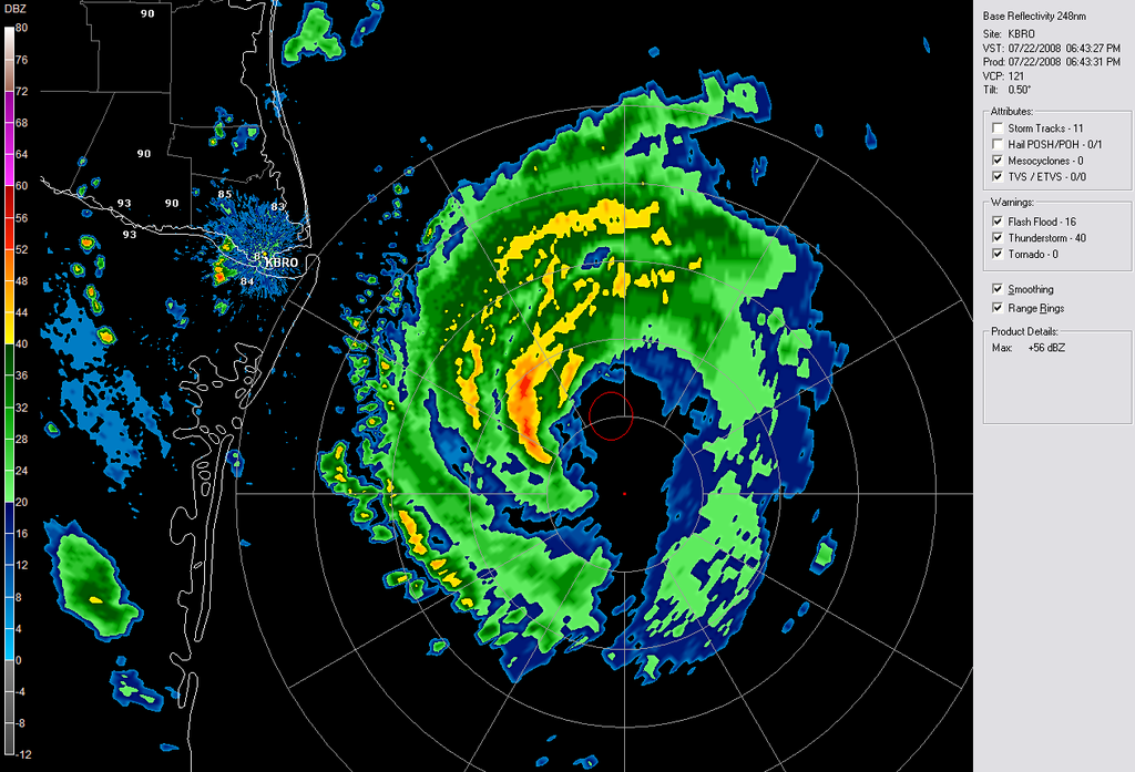
Ivanhater wrote:Still moving NW to NNW looks like...


wxman57 wrote:Ivanhater wrote:Still moving NW to NNW looks like...
I'm still measuring 295-300 using 3-hr radar imagery in GARP. That's WNW-NW. It is a bit hard to see the exact center even with radar, though. Recon may not be fixing the exact same spot in the eye each time, so a 0.1 degree variance could make for a big difference when using these points to estimate a movement.

Texashawk wrote:http://radar.weather.gov/radar.php?rid=BRO&product=N0Z&overlay=11111111&loop=yes
Maybe I'm really missing something, but this doesn't really seem to be making a beeline for Mexico/Brownsville. Could somebody please explain what I am obviously not seeing, because I see the top of a eye wall that is only about 20-30 miles south of Brownsville as it is, and over 130 miles offshore, and appearing to move pretty much N to NNW.
Please enlighten!!
Ivanhater wrote:wxman57 wrote:Ivanhater wrote:Still moving NW to NNW looks like...
I'm still measuring 295-300 using 3-hr radar imagery in GARP. That's WNW-NW. It is a bit hard to see the exact center even with radar, though. Recon may not be fixing the exact same spot in the eye each time, so a 0.1 degree variance could make for a big difference when using these points to estimate a movement.
Yeah, its hard to tell for sure, but I think if she continues the direction she is moving now, this is certainly a U.S landfall...North of Brownsville is my best bet...
wxman57 wrote:
I'd go with a landfall about 10nm north of the TX border, I think. But the eye will be wobbling around as it moves inland. Just a matter of timing.


Ivanhater wrote:I cant remember the member who always posts the radar images with where the center has gone on radar when a hurricane is approaching..would be nice to have that tonight
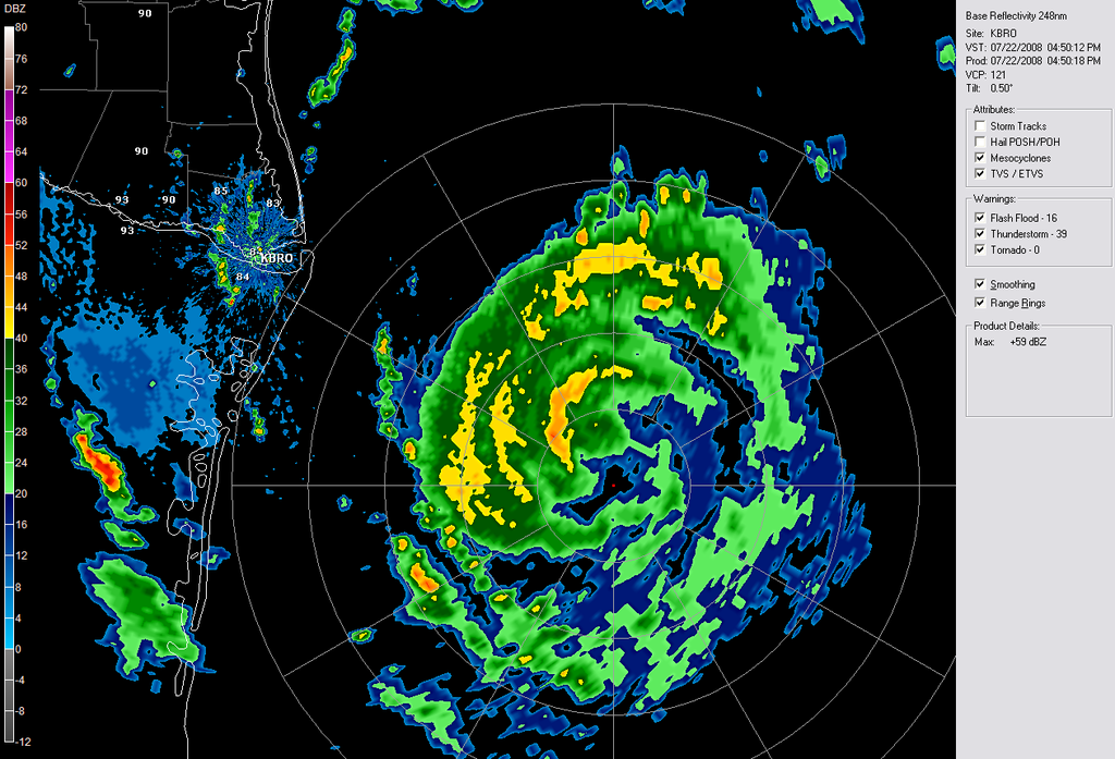
paintplaye wrote:Texashawk wrote:http://radar.weather.gov/radar.php?rid=BRO&product=N0Z&overlay=11111111&loop=yes
Maybe I'm really missing something, but this doesn't really seem to be making a beeline for Mexico/Brownsville. Could somebody please explain what I am obviously not seeing, because I see the top of a eye wall that is only about 20-30 miles south of Brownsville as it is, and over 130 miles offshore, and appearing to move pretty much N to NNW.
Please enlighten!!
It does look that way doesn't it.
Users browsing this forum: No registered users and 20 guests


