ATL: Tropical Depression Fay
Moderator: S2k Moderators
-
mattpetre
- Category 2

- Posts: 510
- Age: 54
- Joined: Mon Sep 19, 2005 3:20 pm
- Location: Missouri City,TX & Galleria
- Contact:
Re: ATL: Tropical Storm Fay in Florida Straits
Looks like the ridge may be finally building back in. Just a question now as to whether it was too little too late (i.e. Fay goes into the ATL or if the building actually does push her back into the GOM. As far as a NNE turn based on a trough in MS/AL/GA, there really doesn't seem to be much left of the trough finally, but Fay could still head NNE on on the top of that building ridge. In my opinion about 50/50 right now.
0 likes
-
Derek Ortt
Re: ATL: Tropical Storm Fay in Florida Straits
GreenSky wrote:Fay is not forecast to even become a hurricane now!
Just a plain old tropical storm now...not that big a deal...Edouard looked better than this pathetic lop-sided sheared dry-air entrained hybrid looking storm
you are severely misinformed
1. They still do forecast a hurricane
2. There is ALMOST NO DIFFERENCE BETWEEN 60 AND 65KT!
0 likes
-
gatorcane

- S2K Supporter

- Posts: 23708
- Age: 48
- Joined: Sun Mar 13, 2005 3:54 pm
- Location: Boca Raton, FL
Hey FCI but NWS is forecasting up to 55mph gusts for Palm Beach County tomorrow and if Fay takes the right side of the cone -- which keep creeping east then Palm Beach County should get some nasty weather tomorrow in my opinion and those gusts could be even higher. Right now Palm Beach County is in a lull but that should change later on tonight.
Personally I think Palm Beach County school should be closed.
0 likes

Re:
Evil Jeremy wrote:Disco tibits:
IT SHOULD BE NOTED THAT A TCU
WAS ISSUED NOTING LANDFALL WHEN THE WINDS AT KEY WEST WENT CALM AT
3 PM. LATER DATA SUGGESTS THIS WAS DUE TO A MESOSCALE FEATURE
ROTATING AROUND THE LARGER CENTER OF THE STORM...AND THE TRUE
CENTER OF FAY IS OVER KEY WEST NOW.
THE NEW FORECAST TRACK CALLS FOR A SLOWER AND MORE
WESTWARD MOTION AFTER 72 HR. THE EARLIER PART OF THE TRACK...WHICH
CALLS FOR LANDFALL IN SOUTHWESTERN FLORIDA IN ABOUT 18 HR FOLLOWED
BY A TRACK OVER THE FLORIDA PENINSULA...IS SHIFTED A LITTLE TO THE
EAST AND LIES NEAR THE MODEL CONSENSUS.
HILE FAY REMAINS IN A MODERATE SOUTHWESTERLY VERTICAL SHEAR
ENVIRONMENT AND IS BATTLING DRY AIR ENTRAINMENT...THESE CONDITIONS
ARE NOT SEVERE ENOUGH TO PREVENT STRENGTHENING. THUS...THE
INTENSITY FORECAST CALLS FOR STRENGTHENING UNTIL LANDFALL. WHILE
NOT EXPLICITLY A FORECAST POINT...IT IS LIKELY THAT FAY WILL MAKE
LANDFALL AT OR NEAR HURRICANE STRENGTH.
IT SHOULD BE NOTED THAT...SIMILAR TO CHARLEY IN 2004...SMALL
DEVIATIONS FROM THE FORECAST TRACK COULD MAKE LARGE DIFFERENCES IN
WHEN AND WHERE THE CENTER OF FAY MAKES LANDFALL ON THE FLORIDA
COAST.
if that's the case she looks to be almost stalled according to this webcam -
http://mycampage.com/keywestcam
and thanks to whomever posted the link eralier. I did steal it!
0 likes

Re: ATL: Tropical Storm Fay in Florida Straits
GreenSky wrote:Fay is not forecast to even become a hurricane now!
Just a plain old tropical storm now...not that big a deal...Edouard looked better than this pathetic lop-sided sheared dry-air entrained hybrid looking storm
It actually is forecast to become a hurricane, according to NHC director Bill Reed... it just doesn't show up because in 12 hours it will still be a tropical storm and in 24 hours it will be over land, but in between they expect it to be a hurricane.
0 likes

-
Air Force Met
- Military Met

- Posts: 4372
- Age: 57
- Joined: Tue Jul 08, 2003 9:30 am
- Location: Roan Mountain, TN
Re:
RL3AO wrote:That was a great discussion from the NHC.
Yep...and it contained the most frequently heard of ALL NHC lines:
"...AND LIES NEAR THE MODEL CONSENSUS."
0 likes
-
mattpetre
- Category 2
- Posts: 510
- Age: 54
- Joined: Mon Sep 19, 2005 3:20 pm
- Location: Missouri City,TX & Galleria
- Contact:
Re: Re:
gatorcane wrote:gatorcane wrote:The posts in this forum are NOT official forecast and should not be used as such. They are just the opinion of the poster and may or may not be backed by sound meteorological data. They are NOT endorsed by any professional institution or storm2k.org. For official information, please refer to the NHC and NWS products
I think she is about to go NNE within the next 6 hours ago. As soon as the trough axis racing through Miss/Georgia passes the longitude Fay is over, it should happen. I think Fay winds up moving up the state East of Ft.Myers and Naples by anywhere from 25-50 miles and favors the eastern side of the NHC cone (another track nudge East may happen at the 11pm EST advisory).
bump for member comment.

From looking at Steering analysis and looping of this WV imagery, the trough appears relatively weak over the SE US at this point. I'd say the ridge is the deciding factor as to where Fay winds up and at this point it is still pretty difficult to say for sure.
0 likes
-
storms in NC

- S2K Supporter
- Posts: 2338
- Joined: Thu Jul 28, 2005 2:58 pm
- Location: Wallace,NC 40 miles NE of Wilm
- Contact:
-
johngaltfla

- Category 5

- Posts: 2073
- Joined: Sun Jul 10, 2005 9:17 pm
- Location: Sarasota County, FL
- Contact:
Re:
RL3AO wrote:That was a great discussion from the NHC.
I concur. This part caught my attention as they really are indicating a large degree of uncertainty when you read it:
It should be noted that...similar to Charley in 2004...small
deviations from the forecast track could make large differences in
when and where the center of Fay makes landfall on the Florida
coast.
$$
forecaster Beven
0 likes
-
Evil Jeremy

- S2K Supporter
- Posts: 5463
- Age: 32
- Joined: Mon Apr 10, 2006 2:10 pm
- Location: Los Angeles, CA
-
TCmet
- Professional-Met

- Posts: 106
- Age: 45
- Joined: Sat Jul 14, 2007 4:00 pm
- Location: New York, NY
- Contact:
Re: ATL: Tropical Storm Fay in Florida Straits
artist wrote:what is this new thing from the NHC areas with hurricane warnings yet they are not in the cone? Does not make sense to me at all.NEXRAD wrote:RL3AO wrote:
The NHC is still probalby thinking it will be a hurricane. But since landfall will occur between forecast points, it doesn't show it.
The overall impacts of a strong tropical storm or weak Category 1 hurricane are about the same. The difference between 65 or 70 mph winds versus 75 or 80 mph winds is not too substantial for land impacts.
- Jay
The windfield where potential hurricane scale impacts might be felt extends well away from the center. the cone only tracks the probability of the center passing over a given point. thus, warnings can be justified for a location outside the cone.
0 likes
-
AL Chili Pepper

- Category 3

- Posts: 873
- Joined: Thu Aug 12, 2004 1:15 pm
- Location: Mobile, AL
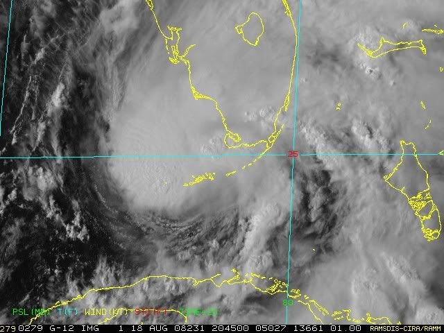
Fay needs to get over land soon. She's starting to take on a decidedly healthier look. West and SW section of the storm is looking much better.
Last edited by AL Chili Pepper on Mon Aug 18, 2008 4:21 pm, edited 1 time in total.
0 likes


Re:
KWT wrote:Looks like the center is really wrapping around the LLC now looking at the radar. pretty decent presentation now and also I agree the foward motion has really slowed down in a big way, have no doubt this is ahead of a slight change in motion IMO.
KWT, nice posts, quite informative as always. My take is that the steering flow is weakening - the influence of the trough is waning (which helped pull Fay N-NW across Cuba last night). Fay is slowing and moving now along the orientation of the west end of the Atlantic ridge. I look for a stair-step pattern N-NW and then all N tomorrow. She is also organizing which may also be lead to slowing. All in all - a night to be glued to RAD to watch every twist and turn.
0 likes
-
tolakram
- Admin

- Posts: 20183
- Age: 62
- Joined: Sun Aug 27, 2006 8:23 pm
- Location: Florence, KY (name is Mark)
Re: ATL: Tropical Storm Fay South of FT Myers
I think Key West might be in the 'eye' all night. 

/clears throat
That's not a jog east is it?
/clears throat
That's not a jog east is it?
Last edited by tolakram on Mon Aug 18, 2008 4:21 pm, edited 1 time in total.
0 likes
Who is online
Users browsing this forum: No registered users and 15 guests