Here is the new invest for the EPAC.
BEGIN
NHC
invest_ep972008.invest
FSTDA
R
U
040
010
0000
200807021748
NONE
NOTIFY=ATRP
END
INVEST, EP, E, , , , , 97, 2008, DB, O, 2008070212, 9999999999, , , , , , METWATCH, , EP972008
EP, 97, 2008070212, , BEST, 0, 102N, 937W, 25, 0, DB, 0, , 0, 0, 0, 0,
Tropical Depression Five-E in EPAC
Moderator: S2k Moderators


-
cycloneye

- Admin

- Posts: 139153
- Age: 67
- Joined: Thu Oct 10, 2002 10:54 am
- Location: San Juan, Puerto Rico
Re: INVEST 97E in EPAC
000
ABPZ20 KNHC 021737
TWOEP
TROPICAL WEATHER OUTLOOK
NWS TPC/NATIONAL HURRICANE CENTER MIAMI FL
1100 AM PDT WED JUL 2 2008
FOR THE EASTERN NORTH PACIFIC...EAST OF 140 DEGREES WEST LONGITUDE..
THE NATIONAL HURRICANE CENTER IS ISSUING ADVISORIES ON HURRICANE
BORIS...CENTERED ABOUT 1210 MILES WEST-SOUTHWEST OF THE SOUTHERN
TIP OF BAJA CALIFORNIA...AND ON RECENTLY-UPGRADED TROPICAL STORM
DOUGLAS...LOCATED ABOUT 245 MILES WEST-SOUTHWEST OF MANZANILLO
MEXICO.
AN AREA OF DISTURBED WEATHER HAS FORMED ABOUT 400 MILES SOUTH OF THE
GULF OF TEHUANTEPEC. ENVIRONMENTAL CONDITIONS APPEAR FAVORABLE FOR
DEVELOPMENT AND THIS SYSTEM COULD BECOME A TROPICAL DEPRESSION
DURING THE NEXT COUPLE OF DAYS AS IT MOVES SLOWLY WEST-
NORTHWESTWARD.
ELSEWHERE...TROPICAL CYCLONE FORMATION IS NOT EXPECTED DURING THE
NEXT 48 HOURS.
$$
FORECASTER BROWN
0 likes


-
cycloneye
- Admin
- Posts: 139153
- Age: 67
- Joined: Thu Oct 10, 2002 10:54 am
- Location: San Juan, Puerto Rico
Re: INVEST 97E in EPAC
WHXX01 KMIA 021847
CHGE77
TROPICAL CYCLONE GUIDANCE MESSAGE
NWS TPC/NATIONAL HURRICANE CENTER MIAMI FL
1847 UTC WED JUL 2 2008
DISCLAIMER...NUMERICAL MODELS ARE SUBJECT TO LARGE ERRORS.
PLEASE REFER TO NHC OFFICIAL FORECASTS FOR TROPICAL CYCLONE
AND SUBTROPICAL CYCLONE INFORMATION.
EAST PACIFIC OBJECTIVE AIDS FOR
DISTURBANCE INVEST (EP972008) 20080702 1800 UTC
...00 HRS... ...12 HRS... ...24 HRS. .. ...36 HRS...
080702 1800 080703 0600 080703 1800 080704 0600
LAT LON LAT LON LAT LON LAT LON
BAMS 10.0N 93.5W 10.2N 94.3W 10.6N 95.0W 11.2N 95.7W
BAMD 10.0N 93.5W 10.4N 94.9W 10.9N 96.3W 11.5N 97.8W
BAMM 10.0N 93.5W 10.5N 94.7W 11.2N 96.0W 12.0N 97.1W
LBAR 10.0N 93.5W 10.3N 94.5W 11.0N 96.2W 12.1N 98.6W
SHIP 25KTS 34KTS 44KTS 53KTS
DSHP 25KTS 34KTS 44KTS 53KTS
...48 HRS... ...72 HRS... ...96 HRS. .. ..120 HRS...
080704 1800 080705 1800 080706 1800 080707 1800
LAT LON LAT LON LAT LON LAT LON
BAMS 12.1N 96.4W 13.7N 97.5W 14.9N 98.8W 15.5N 100.3W
BAMD 12.2N 99.2W 13.8N 101.8W 15.4N 104.4W 17.0N 107.2W
BAMM 12.9N 98.2W 14.6N 100.1W 15.9N 102.0W 16.9N 104.1W
LBAR 13.1N 101.2W 15.7N 106.5W 19.2N 110.8W 22.6N 113.8W
SHIP 60KTS 65KTS 68KTS 71KTS
DSHP 60KTS 65KTS 68KTS 71KTS
...INITIAL CONDITIONS...
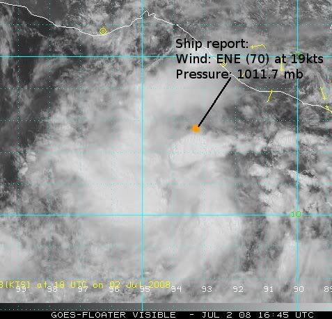
LATCUR = 10.0N LONCUR = 93.5W DIRCUR = 300DEG SPDCUR = 3KT
LATM12 = 9.6N LONM12 = 92.9W DIRM12 = 297DEG SPDM12 = 3KT
LATM24 = 9.4N LONM24 = 92.1W
WNDCUR = 25KT RMAXWD = 0NM WNDM12 = 25KT
CENPRS = 1007MB OUTPRS = 1011MB OUTRAD = 175NM SDEPTH = M
RD34NE = 0NM RD34SE = 0NM RD34SW = 0NM RD34NW = 0NM
$$
CHGE77
TROPICAL CYCLONE GUIDANCE MESSAGE
NWS TPC/NATIONAL HURRICANE CENTER MIAMI FL
1847 UTC WED JUL 2 2008
DISCLAIMER...NUMERICAL MODELS ARE SUBJECT TO LARGE ERRORS.
PLEASE REFER TO NHC OFFICIAL FORECASTS FOR TROPICAL CYCLONE
AND SUBTROPICAL CYCLONE INFORMATION.
EAST PACIFIC OBJECTIVE AIDS FOR
DISTURBANCE INVEST (EP972008) 20080702 1800 UTC
...00 HRS... ...12 HRS... ...24 HRS. .. ...36 HRS...
080702 1800 080703 0600 080703 1800 080704 0600
LAT LON LAT LON LAT LON LAT LON
BAMS 10.0N 93.5W 10.2N 94.3W 10.6N 95.0W 11.2N 95.7W
BAMD 10.0N 93.5W 10.4N 94.9W 10.9N 96.3W 11.5N 97.8W
BAMM 10.0N 93.5W 10.5N 94.7W 11.2N 96.0W 12.0N 97.1W
LBAR 10.0N 93.5W 10.3N 94.5W 11.0N 96.2W 12.1N 98.6W
SHIP 25KTS 34KTS 44KTS 53KTS
DSHP 25KTS 34KTS 44KTS 53KTS
...48 HRS... ...72 HRS... ...96 HRS. .. ..120 HRS...
080704 1800 080705 1800 080706 1800 080707 1800
LAT LON LAT LON LAT LON LAT LON
BAMS 12.1N 96.4W 13.7N 97.5W 14.9N 98.8W 15.5N 100.3W
BAMD 12.2N 99.2W 13.8N 101.8W 15.4N 104.4W 17.0N 107.2W
BAMM 12.9N 98.2W 14.6N 100.1W 15.9N 102.0W 16.9N 104.1W
LBAR 13.1N 101.2W 15.7N 106.5W 19.2N 110.8W 22.6N 113.8W
SHIP 60KTS 65KTS 68KTS 71KTS
DSHP 60KTS 65KTS 68KTS 71KTS
...INITIAL CONDITIONS...
LATCUR = 10.0N LONCUR = 93.5W DIRCUR = 300DEG SPDCUR = 3KT
LATM12 = 9.6N LONM12 = 92.9W DIRM12 = 297DEG SPDM12 = 3KT
LATM24 = 9.4N LONM24 = 92.1W
WNDCUR = 25KT RMAXWD = 0NM WNDM12 = 25KT
CENPRS = 1007MB OUTPRS = 1011MB OUTRAD = 175NM SDEPTH = M
RD34NE = 0NM RD34SE = 0NM RD34SW = 0NM RD34NW = 0NM
$$
0 likes
-
cycloneye
- Admin
- Posts: 139153
- Age: 67
- Joined: Thu Oct 10, 2002 10:54 am
- Location: San Juan, Puerto Rico
Re: INVEST 97E in EPAC
And this one moving pararell to the coast can deviate to the right and be a problem to those who live in that area.

0 likes
-
Tampa_God

- Category 1

- Posts: 333
- Age: 34
- Joined: Wed May 31, 2006 7:27 pm
- Location: New Port Richey/Trinity, FL
Re:
RL3AO wrote:Should be able to organize quicker than Douglas. Could be looking at a possible future hurricane. Don't want to throw the word "major" out there, but you never know.
Considering how this is more concentrated than Douglas was as an Invest/Depression, I have to agree. This will certainly be a tropical storm and can't rule out a hurricane from this. Major storm, well, it's just too early to say. It has the timeline to reach major status, it just matters if it can get it's poop together so early.
0 likes
Problem is will the outflow of Douglas eventually shear this system, thats quite possible and something we have to watch. As has been mentioned its forming a good deal faster then Douglas right now and its far enough SE to have a good shot at becoming a fairly strong system as long as Douglas doesn't throw a spanner in the works...
0 likes
-
Matt-hurricanewatcher

- Category 5

- Posts: 11649
- Age: 38
- Joined: Fri Nov 26, 2004 11:09 pm
- Location: Portland,OR
- Contact:
Re: INVEST 97E in EPAC
Douglas seems to be getting the living hell shear out of him at the moment, with the MLC decoupling from the LLC the last few frames. So it will be a short lived storm anyways maybe 3-4 more advisories. This will be a compact system with about 48-60 hours of favorable warm water! If things work out this could be the second hurricane.
0 likes
Agreed Matt this is a good looking system, of course the question has to be in the long run will it suffer the same fate as douglas as it probably will only be a couple of days behind it in terms of movement and track?
I see no reason at the moment why this at least doesn't have a real good chance at eventually becoming a hurricane as long as the shear doesn't extend southwards too much.
I see no reason at the moment why this at least doesn't have a real good chance at eventually becoming a hurricane as long as the shear doesn't extend southwards too much.
0 likes
-
Ad Novoxium
- Category 1
- Posts: 348
- Age: 33
- Joined: Sat May 03, 2008 2:12 am
Who is online
Users browsing this forum: No registered users and 59 guests