ATL: Invest 97L in Central Atlantic
Moderator: S2k Moderators
- cycloneye
- Admin

- Posts: 139087
- Age: 67
- Joined: Thu Oct 10, 2002 10:54 am
- Location: San Juan, Puerto Rico
Re: ATL: Invest 97L in Central Atlantic
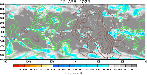
The dry MJO has kicked into the Atlantic.Its possible that this factor is one of the causes that is affecting the development of 97L.The members can look at more information about the MJO factor in the Madden Julian Occillation thread at Talking Tropics.


0 likes
- DESTRUCTION5
- Category 5

- Posts: 4391
- Age: 42
- Joined: Wed Sep 03, 2003 11:25 am
- Location: Stuart, FL
- cycloneye
- Admin

- Posts: 139087
- Age: 67
- Joined: Thu Oct 10, 2002 10:54 am
- Location: San Juan, Puerto Rico
Re: ATL: Invest 97L in Central Atlantic
ABNT20 KNHC 261757
TWOAT
TROPICAL WEATHER OUTLOOK...CORRECTED
NWS TPC/NATIONAL HURRICANE CENTER MIAMI FL
200 PM EDT SAT JUL 26 2008
...CORRECTION FOR THE SPEED OF THE WAVE...15 TO 20 MPH
FOR THE NORTH ATLANTIC...CARIBBEAN SEA AND THE GULF OF MEXICO...
THE HYDROMETEOROLOGICAL PREDICTION CENTER IS ISSUING PUBLIC
ADVISORIES ON THE REMNANTS OF TROPICAL DEPRESSION DOLLY...LOCATED
INLAND ABOUT 20 MILES SOUTH OF EL PASO TEXAS.
A WELL-DEFINED TROPICAL WAVE LOCATED ABOUT 1000 MILES EAST OF THE
NORTHERN LEEWARD ISLANDS IS PRODUCING DISORGANIZED SHOWERS AND
THUNDERSTORMS. UPPER-LEVEL WINDS ARE NOT FAVORABLE FOR DEVELOPMENT
AT THIS TIME...BUT COULD BECOME MORE CONDUCIVE IN A DAY OR TWO AS
THE SYSTEM MOVES TO THE NORTHWEST AT 15 TO 20 MPH.
ELSEWHERE...TROPICAL CYCLONE FORMATION IS NOT EXPECTED DURING THE
NEXT 48 HOURS.
$$
FORECASTER AVILA
0 likes
-
MiamiensisWx
Re: ATL: Invest 97L in Central Atlantic
cycloneye wrote:The dry MJO has kicked into the Atlantic.Its possible that this factor is one of the causes that is affecting the development of 97L.The members can look at more information about the MJO factor in the Madden Julian Occillation thread at Talking Tropics.
Firstly, I believe it is well documented that "dry" and "wet" MJO does not exist. "Pulses" is the correct description.
Secondly, I believe strong upper level shear and mid level dry air are the primary inhibiting factors for 97L.
Last edited by MiamiensisWx on Sat Jul 26, 2008 2:01 pm, edited 1 time in total.
0 likes
-
SapphireSea
- Category 1

- Posts: 430
- Joined: Wed Aug 24, 2005 12:13 pm
- Location: Miami, FL
Re: ATL: Invest 97L in Central Atlantic
I would put this wave in the. "Development is not expected and any will be slow to occur." Category. I think it's time we call for NEXT, since this has little to no future threat or potential to anyone in the future.
0 likes
Re: ATL: Invest 97L in Central Atlantic
cycloneye wrote:ABNT20 KNHC 261757
TWOAT
TROPICAL WEATHER OUTLOOK...CORRECTED
NWS TPC/NATIONAL HURRICANE CENTER MIAMI FL
200 PM EDT SAT JUL 26 2008
...CORRECTION FOR THE SPEED OF THE WAVE...15 TO 20 MPH
FOR THE NORTH ATLANTIC...CARIBBEAN SEA AND THE GULF OF MEXICO...
THE HYDROMETEOROLOGICAL PREDICTION CENTER IS ISSUING PUBLIC
ADVISORIES ON THE REMNANTS OF TROPICAL DEPRESSION DOLLY...LOCATED
INLAND ABOUT 20 MILES SOUTH OF EL PASO TEXAS.
A WELL-DEFINED TROPICAL WAVE LOCATED ABOUT 1000 MILES EAST OF THE
NORTHERN LEEWARD ISLANDS IS PRODUCING DISORGANIZED SHOWERS AND
THUNDERSTORMS. UPPER-LEVEL WINDS ARE NOT FAVORABLE FOR DEVELOPMENT
AT THIS TIME...BUT COULD BECOME MORE CONDUCIVE IN A DAY OR TWO AS
THE SYSTEM MOVES TO THE NORTHWEST AT 15 TO 20 MPH.
ELSEWHERE...TROPICAL CYCLONE FORMATION IS NOT EXPECTED DURING THE
NEXT 48 HOURS.
$$
FORECASTER AVILA
Next week may be interesting.We could be watching a TD forming.Since this is developing slowing, isn't it more likely to impact on the US East coast or Florida?
0 likes
- cycloneye
- Admin

- Posts: 139087
- Age: 67
- Joined: Thu Oct 10, 2002 10:54 am
- Location: San Juan, Puerto Rico
Re: ATL: Invest 97L in Central Atlantic
canegrl04 wrote:cycloneye wrote:ABNT20 KNHC 261757
TWOAT
TROPICAL WEATHER OUTLOOK...CORRECTED
NWS TPC/NATIONAL HURRICANE CENTER MIAMI FL
200 PM EDT SAT JUL 26 2008
...CORRECTION FOR THE SPEED OF THE WAVE...15 TO 20 MPH
FOR THE NORTH ATLANTIC...CARIBBEAN SEA AND THE GULF OF MEXICO...
THE HYDROMETEOROLOGICAL PREDICTION CENTER IS ISSUING PUBLIC
ADVISORIES ON THE REMNANTS OF TROPICAL DEPRESSION DOLLY...LOCATED
INLAND ABOUT 20 MILES SOUTH OF EL PASO TEXAS.
A WELL-DEFINED TROPICAL WAVE LOCATED ABOUT 1000 MILES EAST OF THE
NORTHERN LEEWARD ISLANDS IS PRODUCING DISORGANIZED SHOWERS AND
THUNDERSTORMS. UPPER-LEVEL WINDS ARE NOT FAVORABLE FOR DEVELOPMENT
AT THIS TIME...BUT COULD BECOME MORE CONDUCIVE IN A DAY OR TWO AS
THE SYSTEM MOVES TO THE NORTHWEST AT 15 TO 20 MPH.
ELSEWHERE...TROPICAL CYCLONE FORMATION IS NOT EXPECTED DURING THE
NEXT 48 HOURS.
$$
FORECASTER AVILA
Next week may be interesting.We could be watching a TD forming.Since this is developing slowing, isn't it more likely to impact on the US East coast or Florida?
No,its likely to recurve out to sea without bothering anyone,exept shipping lanes.See models thread for the tracks from them.
0 likes
If it doesn't develop, it won't recurve. Models are too strong too quick IMO. If it does form eventually, it probably won't be a threat to land though.
I'm still holding to my development near the Bahamas theory that wxman57 says won't happen.
I'm still holding to my development near the Bahamas theory that wxman57 says won't happen.
Last edited by RL3AO on Sat Jul 26, 2008 3:18 pm, edited 1 time in total.
0 likes
-
SapphireSea
- Category 1

- Posts: 430
- Joined: Wed Aug 24, 2005 12:13 pm
- Location: Miami, FL
Re: ATL: Invest 97L in Central Atlantic
cycloneye wrote:canegrl04 wrote:cycloneye wrote:ABNT20 KNHC 261757
TWOAT
TROPICAL WEATHER OUTLOOK...CORRECTED
NWS TPC/NATIONAL HURRICANE CENTER MIAMI FL
200 PM EDT SAT JUL 26 2008
...CORRECTION FOR THE SPEED OF THE WAVE...15 TO 20 MPH
FOR THE NORTH ATLANTIC...CARIBBEAN SEA AND THE GULF OF MEXICO...
THE HYDROMETEOROLOGICAL PREDICTION CENTER IS ISSUING PUBLIC
ADVISORIES ON THE REMNANTS OF TROPICAL DEPRESSION DOLLY...LOCATED
INLAND ABOUT 20 MILES SOUTH OF EL PASO TEXAS.
A WELL-DEFINED TROPICAL WAVE LOCATED ABOUT 1000 MILES EAST OF THE
NORTHERN LEEWARD ISLANDS IS PRODUCING DISORGANIZED SHOWERS AND
THUNDERSTORMS. UPPER-LEVEL WINDS ARE NOT FAVORABLE FOR DEVELOPMENT
AT THIS TIME...BUT COULD BECOME MORE CONDUCIVE IN A DAY OR TWO AS
THE SYSTEM MOVES TO THE NORTHWEST AT 15 TO 20 MPH.
ELSEWHERE...TROPICAL CYCLONE FORMATION IS NOT EXPECTED DURING THE
NEXT 48 HOURS.
$$
FORECASTER AVILA
Next week may be interesting.We could be watching a TD forming.Since this is developing slowing, isn't it more likely to impact on the US East coast or Florida?
No,its likely to recurve out to sea without bothering anyone,exept shipping lanes.See models thread for the tracks from them.
Agreed, it's already making the move. Near 19.5N/20N and already moving NW, this one is out of here.
0 likes
-
Derek Ortt
-
Ed Mahmoud
Re:
Derek Ortt wrote:let me say it again
weak does not mean west. I fail to understand why many here repeat that mantra, when it is 100% incorrect
weak and exposed means traveling with the low level flow
But as if often the case, low level flow is generally to the West...
Edited to Delete
Deleted- exact same picture posted upstairs of low level steering....
Last edited by Ed Mahmoud on Sat Jul 26, 2008 4:12 pm, edited 1 time in total.
0 likes
-
Ed Mahmoud
Re: ATL: Invest 97L in Central Atlantic
The double post warning device failed to activate before I posted the same thing RL3AO posted.
0 likes
-
Ed Mahmoud
Re: ATL: Invest 97L in Central Atlantic
This time yesterday the exposed low level swirl was about 18º, today it is about 19ºN. Or this isn't gaining latitude in any huge hurry.
Also looks like it'll be in dry air for a few days more. I won't push my luck, but I still have about 2 days left on my no development unofficial prediction so boldy posted on Thursday.
Also looks like it'll be in dry air for a few days more. I won't push my luck, but I still have about 2 days left on my no development unofficial prediction so boldy posted on Thursday.
0 likes
Re: ATL: Invest 97L in Central Atlantic
I am thinking that the convection may break from the wave.
MIMIC-TPW is showing that the area north of 20N is organizing and moving away from the axis.
http://cimss.ssec.wisc.edu/tropic/real- ... /main.html
QSAT still shows a Surface Low, now at 13N 44W.
The remaining relatively high Theta-E air in the wave could support the surfce low as it moves west.
It could then begin to fire convection as it starts to move under the Sub-Equatorial Ridge which today is centered at 13N 61W.


0 likes
-
Derek Ortt
-
Ed Mahmoud
Re: ATL: Invest 97L in Central Atlantic
cycloneye wrote:The latest ATCF Best Track at 18:00 UTC:
AL, 97, 2008072518, , BEST, 0, 183N, 422W, 25, 1010, DB, 34, NEQ, 0, 0, 0, 0, 1012, 120, 25, 0, 0,
Yesterday, 27 hours ago.
Today, about 19.5ºN, 47.5ºW
One degree in latitude gained (or maybe 1.2º, not sure if best track is minutes or decimals) for five degrees in longitude. About.
Longer term trend seems more W to WNW.
But it may have turned more today, I slept in.
0 likes
Who is online
Users browsing this forum: No registered users and 107 guests


