I consider everything before August 15th as the appetizer, and we've had a lot of breadsticks, crab stuffed mushrooms and shrimp cocktail, with Bertha, Cristobal, Dolly and Edouard, so we're not even to the main course yet, and people complain they are hungry?
Lets hope the dessert, October 15 through the end of the year, isn't too rich and filling.
Ex Invest 93L in Central Atlantic
Moderator: S2k Moderators

-
tolakram
- Admin

- Posts: 19167
- Age: 60
- Joined: Sun Aug 27, 2006 8:23 pm
- Location: Florence, KY (name is Mark)
Re: ATL: Invest 93L in East Atlantic
We have flotation, though not everything has caught up yet. (edit - browser refresh does wonders)


http://www.ssd.noaa.gov/PS/TROP/floaters.html
Visible loop:
http://www.ssd.noaa.gov/goes/flt/t2/loop-vis.html
http://www.ssd.noaa.gov/PS/TROP/floaters.html
Visible loop:
http://www.ssd.noaa.gov/goes/flt/t2/loop-vis.html
0 likes
-
Stormcenter
- S2K Supporter

- Posts: 6617
- Joined: Wed Sep 03, 2003 11:27 am
- Location: Houston, TX
Re:
KWT wrote:You can see the way the convective bands curve in there is some sort of circulation at the very least at higher elevation still. Saying that not much convection over the central parts of this system but its very early days and the fact there is plenty of juice is interesting.
It looks like a train wreck to me right now....not well organized at all even for a disturbance.
0 likes
-
Stormcenter
- S2K Supporter
- Posts: 6617
- Joined: Wed Sep 03, 2003 11:27 am
- Location: Houston, TX
Re: ATL: Invest 93L in East Atlantic
Ed Mahmoud wrote:I consider everything before August 15th as the appetizer, and we've had a lot of breadsticks, crab stuffed mushrooms and shrimp cocktail, with Bertha, Cristobal, Dolly and Edouard, so we're not even to the main course yet, and people complain they are hungry?
Lets hope the dessert, October 15 through the end of the year, isn't too rich and filling.
I'm NOT hungry. I personally can do without the "main course". Personally speaking I had enough "main courses" back into 2004 & 2005 to last me for awhile.
0 likes
-
UpTheCreek

- Category 1

- Posts: 397
- Age: 60
- Joined: Tue Aug 31, 2004 5:28 pm
- Location: Vassalboro, Maine
Re: ATL: Invest 93L in East Atlantic
Ed Mahmoud wrote:I consider everything before August 15th as the appetizer, and we've had a lot of breadsticks, crab stuffed mushrooms and shrimp cocktail, with Bertha, Cristobal, Dolly and Edouard, so we're not even to the main course yet, and people complain they are hungry?
Lets hope the dessert, October 15 through the end of the year, isn't too rich and filling.
Really good analogy......although I now have a sudden urge to see what's in the fridge!
0 likes
-
Weatherfreak14

- Category 5

- Posts: 1383
- Joined: Sat Sep 24, 2005 3:40 pm
- Location: Beaufort, SC
- Contact:
Re: ATL: Invest 93L in East Atlantic
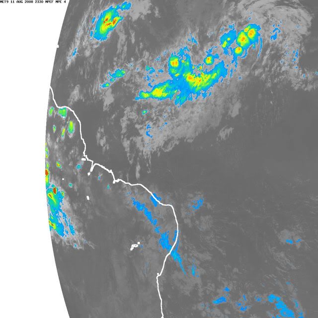
Looks like convextion maybe starting to pop up in the center

0 likes
-
HurricaneRobert
- Category 3

- Posts: 812
- Joined: Fri May 18, 2007 9:31 pm
-
Aquawind

- Category 5
- Posts: 6714
- Age: 60
- Joined: Mon Jun 16, 2003 10:41 pm
- Location: Salisbury, NC
- Contact:
Re: ATL: Invest 93L in East Atlantic
HurricaneRobert wrote:Is this a threat to Bermuda??
From the looks of things it's chances are better than 92L but it's still along way off and really a matter of timing whether the ridge is in place or not.
0 likes

Re: ATL: Invest 93L in East Atlantic
Way too far off to tell if it will be or not. BTW, are you from Bermuda? My next door neighbor is Bermudian. She used to be a Senator there (Norma Astwood).HurricaneRobert wrote:Is this a threat to Bermuda??
0 likes
-
Weatherfreak14
- Category 5
- Posts: 1383
- Joined: Sat Sep 24, 2005 3:40 pm
- Location: Beaufort, SC
- Contact:


-
cycloneye

- Admin
- Posts: 139222
- Age: 67
- Joined: Thu Oct 10, 2002 10:54 am
- Location: San Juan, Puerto Rico
Re: ATL: Invest 93L in East Atlantic
ABNT20 KNHC 112342
TWOAT
TROPICAL WEATHER OUTLOOK
NWS TPC/NATIONAL HURRICANE CENTER MIAMI FL
800 PM EDT MON AUG 11 2008
FOR THE NORTH ATLANTIC...CARIBBEAN SEA AND THE GULF OF MEXICO...
A BROAD AREA OF LOW PRESSURE ASSOCIATED WITH A TROPICAL WAVE IS
LOCATED OVER THE CENTRAL ATLANTIC OCEAN ABOUT 825 MILES EAST OF
THE LESSER ANTILLES. THE ASSOCIATED SHOWER ACTIVITY IS GRADUALLY
BECOMING BETTER ORGANIZED...AND A TROPICAL DEPRESSION COULD FORM
DURING THE NEXT DAY OR SO AS THE SYSTEM MOVES WEST-NORTHWESTWARD
ABOUT 15 MPH. AN AIR FORCE RESERVE HURRICANE HUNTER AIRCRAFT IS
SCHEDULED TO INVESTIGATE THE SYSTEM ON TUESDAY...IF NECESSARY.
 A LARGE AND COMPLEX AREA OF DISTURBED WEATHER EXTENDS FROM NEAR THE
CAPE VERDE ISLANDS WEST-SOUTHWESTWARD FOR SEVERAL HUNDRED MILES.
THIS SYSTEM CONTINUES TO SHOW SIGNS OF ORGANIZATION...AND A
TROPICAL DEPRESSION COULD FORM DURING THE NEXT DAY OR TWO AS IT
MOVES WESTWARD AT ABOUT 10 MPH.
AN AREA OF SHOWERS AND THUNDERSTORMS...ASSOCIATED WITH A TROPICAL
WAVE...HAS DEVELOPED OVER THE SOUTHWESTERN CARIBBEAN SEA. THERE
ARE NO SIGNS OF ORGANIZATION AND ADDITIONAL DEVELOPMENT IS NOT
EXPECTED AT THIS TIME.
ELSEWHERE.. TROPICAL CYCLONE FORMATION IS NOT EXPECTED DURING THE
NEXT 48 HOURS.
$$
FORECASTER BEVEN
TWOAT
TROPICAL WEATHER OUTLOOK
NWS TPC/NATIONAL HURRICANE CENTER MIAMI FL
800 PM EDT MON AUG 11 2008
FOR THE NORTH ATLANTIC...CARIBBEAN SEA AND THE GULF OF MEXICO...
A BROAD AREA OF LOW PRESSURE ASSOCIATED WITH A TROPICAL WAVE IS
LOCATED OVER THE CENTRAL ATLANTIC OCEAN ABOUT 825 MILES EAST OF
THE LESSER ANTILLES. THE ASSOCIATED SHOWER ACTIVITY IS GRADUALLY
BECOMING BETTER ORGANIZED...AND A TROPICAL DEPRESSION COULD FORM
DURING THE NEXT DAY OR SO AS THE SYSTEM MOVES WEST-NORTHWESTWARD
ABOUT 15 MPH. AN AIR FORCE RESERVE HURRICANE HUNTER AIRCRAFT IS
SCHEDULED TO INVESTIGATE THE SYSTEM ON TUESDAY...IF NECESSARY.
CAPE VERDE ISLANDS WEST-SOUTHWESTWARD FOR SEVERAL HUNDRED MILES.
THIS SYSTEM CONTINUES TO SHOW SIGNS OF ORGANIZATION...AND A
TROPICAL DEPRESSION COULD FORM DURING THE NEXT DAY OR TWO AS IT
MOVES WESTWARD AT ABOUT 10 MPH.
AN AREA OF SHOWERS AND THUNDERSTORMS...ASSOCIATED WITH A TROPICAL
WAVE...HAS DEVELOPED OVER THE SOUTHWESTERN CARIBBEAN SEA. THERE
ARE NO SIGNS OF ORGANIZATION AND ADDITIONAL DEVELOPMENT IS NOT
EXPECTED AT THIS TIME.
ELSEWHERE.. TROPICAL CYCLONE FORMATION IS NOT EXPECTED DURING THE
NEXT 48 HOURS.
$$
FORECASTER BEVEN
0 likes
-
HURAKAN

- Professional-Met

- Posts: 46086
- Age: 37
- Joined: Thu May 20, 2004 4:34 pm
- Location: Key West, FL
- Contact:
TROPICAL WEATHER DISCUSSION
NWS TPC/NATIONAL HURRICANE CENTER MIAMI FL
805 PM EDT MON AUG 11 2008
BASED ON 1800 UTC SURFACE ANALYSIS AND SATELLITE IMAGERY THROUGH
2315 UTC.
...SPECIAL FEATURES..
A 1009 MB BROAD LOW PRES AREA IS LOCATED OVER THE EASTERN
ATLANTIC NEAR 11N29W MOVING W AT 10 KT. SAT IMAGERY SHOWS SOME
SIGNS OF BANDING...INDICATING THAT THE SYSTEM HAS BECOME A
LITTLE BETTER ORGANIZED. A LARGE AREA OF SHOWERS AND
THUNDERSTORMS ACCOMPANIES THIS LOW...AND A TROPICAL DEPRESSION
COULD FORM DURING THE NEXT DAY OR TWO.
0 likes
-
Ivanhater

- Storm2k Moderator

- Posts: 10852
- Age: 37
- Joined: Fri Jul 01, 2005 8:25 am
- Location: Pensacola
Re: ATL: Invest 93L in East Atlantic
Getting to what looks to be a CDO now(just along the line break)..I expect this to be upgraded tomorrow morning...

0 likes
Who is online
Users browsing this forum: No registered users and 21 guests