Ex Invest 93L in Central Atlantic

Moderator: S2k Moderators

Message
Author
Ed Mahmoud

Re: ATL: Invest 93L in East Atlantic

#121 Postby Ed Mahmoud » Tue Aug 12, 2008 10:28 pm

IMHO, 93L has been battling stable air, as shown by strato-cu, coming in from the North for a couple of days. But as SSTs get warmer, it can generate deeper storms, and better mix out the dry stable air. It is popping decent convection tonight, and the overall size of the circulation is large, so while it has been delayed getting its act together, if/when it finally organizes, it could be of large areal extent, and potentially intense.


Joe Bastardi mentioned 92L and 93L at Connie and Dianne.

Image
0 likes   

User avatar
ROCK
Category 5
Category 5
Posts: 9254
Age: 52
Joined: Tue Aug 17, 2004 7:30 am
Location: Kemah, Texas

Re: ATL: Invest 93L in East Atlantic

#122 Postby ROCK » Tue Aug 12, 2008 10:40 pm

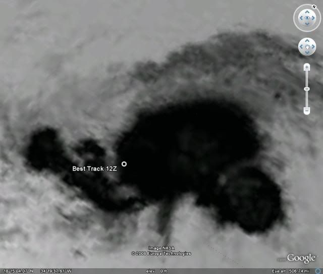
Ed Mahmoud wrote:IMHO, 93L has been battling stable air, as shown by strato-cu, coming in from the North for a couple of days. But as SSTs get warmer, it can generate deeper storms, and better mix out the dry stable air. It is popping decent convection tonight, and the overall size of the circulation is large, so while it has been delayed getting its act together, if/when it finally organizes, it could be of large areal extent, and potentially intense.


Joe Bastardi mentioned 92L and 93L at Connie and Dianne.

Image


He also went on to mention 2 or 3 possible landfalls in Aug, FL and northward and cannot rule out the GOM........
0 likes   

Derek Ortt

#123 Postby Derek Ortt » Tue Aug 12, 2008 11:08 pm

would not be surprised at all to see a depression within the next 24-48 hours from this system
0 likes   

User avatar
blp
Category 5
Category 5
Posts: 2805
Age: 45
Joined: Thu Sep 09, 2004 7:51 pm
Location: Miami, FL
Contact:

Re:

#124 Postby blp » Tue Aug 12, 2008 11:17 pm

Derek Ortt wrote:would not be surprised at all to see a depression within the next 24-48 hours from this system


Seems like there is a buzzsaw when this gets to the Antillies. Most of the GFS runs earlier today have this dissipating once it gets closer to the chain. I guess we need to enjoy it while it lasts. I just want something to track.
0 likes   

User avatar
GeneratorPower
S2K Supporter
S2K Supporter
Posts: 1648
Age: 44
Joined: Sun Dec 18, 2005 11:48 pm
Location: Huntsville, AL

#125 Postby GeneratorPower » Wed Aug 13, 2008 12:45 am

Wow. Check out that convective burst right over the center.

http://www.ssd.noaa.gov/goes/east/tatl/loop-avn.html
0 likes   

RL3AO
Moderator-Pro Met
Moderator-Pro Met
Posts: 16308
Joined: Thu Jun 14, 2007 10:03 pm
Location: NC

Re: ATL: Invest 93L in East Atlantic

#126 Postby RL3AO » Wed Aug 13, 2008 12:48 am

TROPICAL WEATHER OUTLOOK
NWS TPC/NATIONAL HURRICANE CENTER MIAMI FL
200 AM EDT WED AUG 13 2008

FOR THE NORTH ATLANTIC...CARIBBEAN SEA AND THE GULF OF MEXICO...

A TROPICAL WAVE LOCATED ABOUT 400 MILES EAST OF THE LESSER ANTILLES
CONTINUES TO PRODUCE DISORGANIZED SHOWERS AND THUNDERSTORMS.
HOWEVER...ENVIRONMENTAL CONDITIONS APPEAR SOMEWHAT CONDUCIVE FOR
DEVELOPMENT AND A TROPICAL DEPRESSION MAY FORM DURING THE NEXT DAY
OR TWO AS THE SYSTEM MOVES WEST-NORTHWESTWARD AT 10 TO 15 MPH. AN
AIR FORCE RESERVE UNIT HURRICANE HUNTER AIRCRAFT IS SCHEDULED TO
INVESTIGATE THIS SYSTEM TOMORROW...IF NECESSARY.

A DISORGANIZED LOW PRESSURE AREA...ASSOCIATED WITH A TROPICAL
WAVE...IS LOCATED OVER THE EASTERN TROPICAL ATLANTIC ABOUT 650
MILES WEST-SOUTHWEST OF THE CAPE VERDE ISLANDS. ANY DEVELOPMENT OF
THIS SYSTEM IS EXPECTED TO BE SLOW TO OCCUR DURING THE NEXT COUPLE
OF DAYS AS IT MOVES WEST-NORTHWESTWARD AT 10 TO 15 MPH.


ELSEWHERE.. TROPICAL CYCLONE FORMATION IS NOT EXPECTED DURING THE
NEXT 48 HOURS.

$$
FORECASTER BLAKE

http://www.nhc.noaa.gov/text/refresh/MIATWOAT+shtml/130540.shtml

Down to yellow...somehow.
0 likes   

User avatar
KWT
Category 5
Category 5
Posts: 31390
Joined: Tue Aug 17, 2004 11:02 am
Location: UK!!!

#127 Postby KWT » Wed Aug 13, 2008 3:49 am

God know why its down to yellow, looks a heck of a lot better then 92L now and I agree with Derek trhis will likely be a depression enough, good job its also going to go out to sea in all likelyhood.
0 likes   

User avatar
carolina_73
Tropical Storm
Tropical Storm
Posts: 148
Joined: Wed Jul 23, 2008 1:30 am

Re: ATL: Invest 93L in East Atlantic

#128 Postby carolina_73 » Wed Aug 13, 2008 4:18 am

Nice convection!!! :eek: Looks a little better this morning.

Image
0 likes   

User avatar
Meso
Category 5
Category 5
Posts: 1608
Age: 37
Joined: Mon Aug 09, 2004 12:14 pm
Location: South Africa
Contact:

#129 Postby Meso » Wed Aug 13, 2008 5:01 am

Image

Some dry air ahead, but looks good
0 likes   

User avatar
KWT
Category 5
Category 5
Posts: 31390
Joined: Tue Aug 17, 2004 11:02 am
Location: UK!!!

#130 Postby KWT » Wed Aug 13, 2008 5:02 am

Looks like any center will form a good deal north of the current best track, looks highly likely this is going to go fishing with only a possible risk to Bermuda.

Odds for development are many times greater for this in the next 24-48hrs then 92L.
0 likes   

RL3AO
Moderator-Pro Met
Moderator-Pro Met
Posts: 16308
Joined: Thu Jun 14, 2007 10:03 pm
Location: NC

Re: ATL: Invest 93L in East Atlantic

#131 Postby RL3AO » Wed Aug 13, 2008 6:42 am

TROPICAL WEATHER OUTLOOK
NWS TPC/NATIONAL HURRICANE CENTER MIAMI FL
800 AM EDT WED AUG 13 2008

FOR THE NORTH ATLANTIC...CARIBBEAN SEA AND THE GULF OF MEXICO...

SHOWERS AND THUNDERSTORMS REMAIN DISORGANIZED IN ASSOCIATION WITH A
BROAD AREA OF LOW PRESSURE AND A TROPICAL WAVE LOCATED ABOUT 300
MILES EAST OF THE LESSER ANTILLES...AND THE AIR FORCE RESERVE UNIT
HURRICANE HUNTER AIRCRAFT MISSION SCHEDULED FOR TODAY HAS BEEN
CANCELED. ENVIRONMENTAL CONDITIONS ARE ONLY MARGINALLY FAVORABLE
FOR DEVELOPMENT AND THE POTENTIAL FOR TROPICAL CYCLONE FORMATION
DURING THE NEXT DAY OR TWO HAS DECREASED. THIS SYSTEM WILL
CONTINUED TO BE MONITORED AS IT MOVES WEST-NORTHWESTWARD AT 10 TO
15 MPH.

SHOWER ACTIVITY ASSOCIATED WITH A BROAD LOW PRESSURE AREA LOCATED
ABOUT 700 MILES WEST OF THE CAPE VERDE ISLANDS HAS BECOME A LITTLE
MORE CONCENTRATED THIS MORNING. SOME ADDITIONAL DEVELOPMENT OF THIS
SYSTEM IS POSSIBLE DURING THE NEXT COUPLE OF DAYS AS IT MOVES
WESTWARD AT 10 TO 15 MPH.


ELSEWHERE.. TROPICAL CYCLONE FORMATION IS NOT EXPECTED DURING THE
NEXT 48 HOURS.

$$
FORECASTER BROWN/PASCH

http://www.nhc.noaa.gov/text/refresh/MIATWOAT+shtml/131139.shtml
0 likes   

HurricaneHunter914
Category 5
Category 5
Posts: 4439
Age: 30
Joined: Fri Mar 10, 2006 7:36 pm
Location: College Station, TX

#132 Postby HurricaneHunter914 » Wed Aug 13, 2008 6:57 am

http://www.ssd.noaa.gov/goes/flt/t2/loop-avn.html

It looks good, but the convection appears to be sheared to the north.
0 likes   

User avatar
cycloneye
Admin
Admin
Posts: 139082
Age: 67
Joined: Thu Oct 10, 2002 10:54 am
Location: San Juan, Puerto Rico

Re: ATL: Invest 93L in East Atlantic

#133 Postby cycloneye » Wed Aug 13, 2008 7:41 am

Best track for 93L.

AL, 93, 2008081312, , BEST, 0, 161N, 350W, 25, 1009, DB, 34, NEQ, 0, 0, 0, 0, 1012, 200, 60,
0 likes   

User avatar
HURAKAN
Professional-Met
Professional-Met
Posts: 46086
Age: 37
Joined: Thu May 20, 2004 4:34 pm
Location: Key West, FL
Contact:

#134 Postby HURAKAN » Wed Aug 13, 2008 7:42 am

Image
0 likes   

User avatar
cycloneye
Admin
Admin
Posts: 139082
Age: 67
Joined: Thu Oct 10, 2002 10:54 am
Location: San Juan, Puerto Rico

Re: ATL: Invest 93L in East Atlantic

#135 Postby cycloneye » Wed Aug 13, 2008 7:55 am

It looks like this will eventually be Fay in a few days as is much more organized than 92L.
0 likes   

User avatar
gatorcane
S2K Supporter
S2K Supporter
Posts: 23499
Age: 46
Joined: Sun Mar 13, 2005 3:54 pm
Location: Boca Raton, FL

Re:

#136 Postby gatorcane » Wed Aug 13, 2008 8:13 am

KWT wrote:Looks like any center will form a good deal north of the current best track, looks highly likely this is going to go fishing with only a possible risk to Bermuda.

Odds for development are many times greater for this in the next 24-48hrs then 92L.


I would definitely not predict fish at this point with this one. Look where TAFB has it in 72 hours:

Plenty of ridging for this one.

Image
0 likes   

User avatar
HURAKAN
Professional-Met
Professional-Met
Posts: 46086
Age: 37
Joined: Thu May 20, 2004 4:34 pm
Location: Key West, FL
Contact:

Re: ATL: Invest 93L in East Atlantic

#137 Postby HURAKAN » Wed Aug 13, 2008 8:55 am

cycloneye wrote:It looks like this will eventually be Fay in a few days as is much more organized than 92L.


They switch every day. Two days ago 93L looked better than 92L. Yesterday it was the opposite. Today 93L looks better. At the end, I don't see any of them becoming a depression in the next 24 hrs.

Personal Forecast Disclaimer:
The posts in this forum are NOT official forecast and should not be used as such. They are just the opinion of the poster and may or may not be backed by sound meteorological data. They are NOT endorsed by any professional institution or storm2k.org. For official information, please refer to the NHC and NWS products.
0 likes   

User avatar
Cookiely
S2K Supporter
S2K Supporter
Posts: 3211
Age: 73
Joined: Fri Aug 13, 2004 7:31 am
Location: Tampa, Florida

Re: ATL: Invest 93L in East Atlantic

#138 Postby Cookiely » Wed Aug 13, 2008 10:58 am

HURAKAN wrote:
cycloneye wrote:It looks like this will eventually be Fay in a few days as is much more organized than 92L.


They switch every day. Two days ago 93L looked better than 92L. Yesterday it was the opposite. Today 93L looks better. At the end, I don't see any of them becoming a depression in the next 24 hrs.

Personal Forecast Disclaimer:
The posts in this forum are NOT official forecast and should not be used as such. They are just the opinion of the poster and may or may not be backed by sound meteorological data. They are NOT endorsed by any professional institution or storm2k.org. For official information, please refer to the NHC and NWS products.

Thats what worries me because they simply keep coming slowly but surely, and as Emeril says BAM then they start consolidating and intensifying.
The posts in this forum are NOT official forecast and should not be used as such. They are just the opinion of the poster and may or may not be backed by sound meteorological data. They are NOT endorsed by any professional institution or storm2k.org. For official information, please refer to the NHC and NWS products
0 likes   

User avatar
KWT
Category 5
Category 5
Posts: 31390
Joined: Tue Aug 17, 2004 11:02 am
Location: UK!!!

#139 Postby KWT » Wed Aug 13, 2008 12:30 pm

Now at 16.1N at only 35W, should track only a little north of west once it reaches about 20N as the high is pretty strong, after that have to have a flip as to what track it will take.
0 likes   

User avatar
cycloneye
Admin
Admin
Posts: 139082
Age: 67
Joined: Thu Oct 10, 2002 10:54 am
Location: San Juan, Puerto Rico

Re: ATL: Invest 93L in East Atlantic

#140 Postby cycloneye » Wed Aug 13, 2008 12:38 pm

387
ABNT20 KNHC 131735
TWOAT
TROPICAL WEATHER OUTLOOK
NWS TPC/NATIONAL HURRICANE CENTER MIAMI FL
200 PM EDT WED AUG 13 2008

FOR THE NORTH ATLANTIC...CARIBBEAN SEA AND THE GULF OF MEXICO...

SHOWERS AND THUNDERSTORMS REMAIN DISORGANIZED IN ASSOCIATION WITH A
BROAD AREA OF LOW PRESSURE AND A TROPICAL WAVE LOCATED ABOUT 200
MILES EAST OF THE LEEWARD ISLANDS. ALTHOUGH THIS SYSTEM HAS CHANGED
LITTLE SINCE YESTERDAY...UPPER-LEVEL WINDS ARE FORECAST TO BECOME
MORE CONDUCIVE FOR DEVELOPMENT IN A COUPLE OF DAYS. SHOWERS AND
GUSTY WINDS COULD SPREAD OVER PORTIONS OF THE NORTHERN LEEWARD
ISLANDS DURING THE NEXT DAY OR SO AS THE DISTURBANCE MOVES
WEST-NORTHWESTWARD AT 10 TO 15 MPH.

:rarrow: THE BROAD LOW PRESSURE AREA LOCATED ABOUT 700 MILES WEST OF THE
CAPE VERDE ISLANDS HAS CHANGED LITTLE IN ORGANIZATION TODAY. SOME
GRADUAL DEVELOPMENT OF THIS SYSTEM IS POSSIBLE DURING THE NEXT
COUPLE OF DAYS AS IT MOVES SLOWLY WESTWARD.

ELSEWHERE.. TROPICAL CYCLONE FORMATION IS NOT EXPECTED DURING THE
NEXT 48 HOURS.

$$
FORECASTER BROWN/PASCH
0 likes   


Return to “2008”

Who is online

Users browsing this forum: No registered users and 116 guests