WPAC SINLAKU: Severe Tropical Storm - Discussion

Moderator: S2k Moderators

Message
Author
Ed Mahmoud

Re:

#161 Postby Ed Mahmoud » Wed Sep 17, 2008 3:01 pm

Harry Cane wrote:Amazing James. Great video. Congratulations.
And notice how the lights are still on...
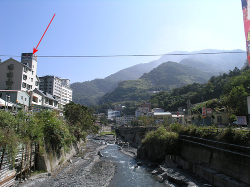
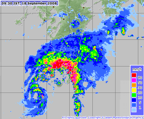
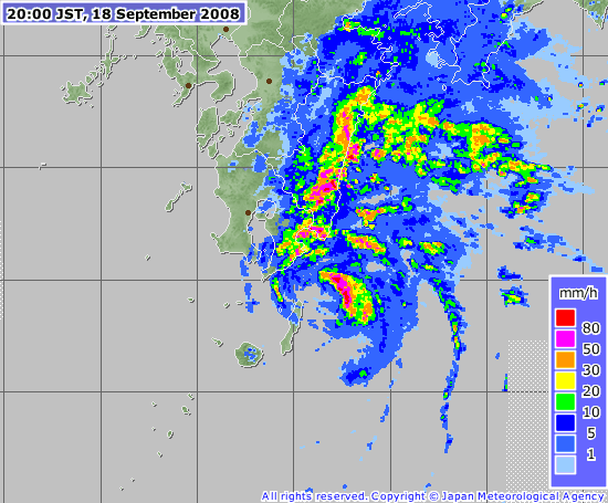
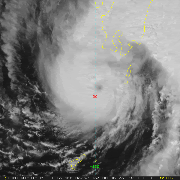
In the US a cat. 2 hurricane brings armaggedon to the fourth largest city in the country, and in Taiwan, they get hit by a cat. 3 typhoon and it's almost business as usual
Asia rule!


Well, this isn't Taiwan's first typhoon this year. I imagine if you're engineering the electrical distribution grid for a typhoon magnet like Taiwan, it is going to be pretty storm resistant.

I hear people on the radio complaining about how the electric lines aren't underground, but Ike was the first serious hurricane in the HOU metro area since Alicia in 1983, and cost/benefit analysis probably suggests that the low risk of hurricanes doesn't justify the expense of a hurricane resistant power grid.
0 likes   

tim_in_ga
Tropical Storm
Tropical Storm
Posts: 125
Joined: Fri Jun 10, 2005 9:30 pm
Location: Buford, GA

Re: WPAC SINLAKU: Severe Tropical Storm - Discussion

#162 Postby tim_in_ga » Wed Sep 17, 2008 3:38 pm

Some video from the BBC website:

http://news.bbc.co.uk/2/hi/south_asia/7618946.stm

The beginning and ending scenes were shot in Lushan, a little hot-springs resort area in the mountainous region of central Taiwan. The tall hotel you see fallen over at the beginning is shown with an arrow in this photo I took there back in 2004:

Image

In the video it's pretty apparent that there is not much of a foundation. I wonder if the hotel we stayed in is even there any more.
0 likes   

User avatar
HURAKAN
Professional-Met
Professional-Met
Posts: 46086
Age: 37
Joined: Thu May 20, 2004 4:34 pm
Location: Key West, FL
Contact:

#163 Postby HURAKAN » Wed Sep 17, 2008 5:52 pm

Image
0 likes   

CrazyC83
Professional-Met
Professional-Met
Posts: 33393
Joined: Tue Mar 07, 2006 11:57 pm
Location: Deep South, for the first time!

Re:

#164 Postby CrazyC83 » Wed Sep 17, 2008 6:09 pm

HURAKAN wrote:Image


Looks like it is almost back to a typhoon if it isn't already there.
0 likes   

User avatar
HURAKAN
Professional-Met
Professional-Met
Posts: 46086
Age: 37
Joined: Thu May 20, 2004 4:34 pm
Location: Key West, FL
Contact:

Re: WPAC SINLAKU: Severe Tropical Storm - Discussion

#165 Postby HURAKAN » Wed Sep 17, 2008 7:49 pm

0 likes   

User avatar
Chacor
Category 5
Category 5
Posts: 10229
Joined: Mon Oct 02, 2006 10:43 pm
Location: Singapore

#166 Postby Chacor » Wed Sep 17, 2008 8:38 pm

WTPQ20 RJTD 180000
RSMC TROPICAL CYCLONE ADVISORY
NAME STS 0813 SINLAKU (0813)
ANALYSIS
PSTN 180000UTC 30.0N 129.0E FAIR
MOVE N 06KT
PRES 985HPA
MXWD 055KT
GUST 080KT
50KT 30NM
30KT 150NM EAST 90NM WEST
FORECAST
24HF 190000UTC 32.6N 133.0E 85NM 70%
MOVE NE 12KT
PRES 985HPA
MXWD 050KT
GUST 070KT
48HF 200000UTC 35.0N 139.2E 160NM 70%
MOVE ENE 14KT
PRES 996HPA
MXWD 040KT
GUST 060KT
72HF 210000UTC 38.6N 148.2E 250NM 70% EXTRATROPICAL LOW =
0 likes   

CrazyC83
Professional-Met
Professional-Met
Posts: 33393
Joined: Tue Mar 07, 2006 11:57 pm
Location: Deep South, for the first time!

#167 Postby CrazyC83 » Wed Sep 17, 2008 10:31 pm

Clearly see an eye now. I'd say 65-70 kt for the current intensity (1-min).
0 likes   

User avatar
Chacor
Category 5
Category 5
Posts: 10229
Joined: Mon Oct 02, 2006 10:43 pm
Location: Singapore

Re:

#168 Postby Chacor » Wed Sep 17, 2008 10:47 pm

CrazyC83 wrote:Clearly see an eye now. I'd say 65-70 kt for the current intensity (1-min).


On visible, yes:
Image

But IR disagrees.
Image
0 likes   

User avatar
Chacor
Category 5
Category 5
Posts: 10229
Joined: Mon Oct 02, 2006 10:43 pm
Location: Singapore

#169 Postby Chacor » Wed Sep 17, 2008 11:19 pm

JTWC has re-issued its 0300z warning, upping intensity from 45 kt to a 65-kt typhoon based on recon.
0 likes   

User avatar
Chacor
Category 5
Category 5
Posts: 10229
Joined: Mon Oct 02, 2006 10:43 pm
Location: Singapore

#170 Postby Chacor » Wed Sep 17, 2008 11:24 pm

WTPQ20 RJTD 180300
RSMC TROPICAL CYCLONE ADVISORY
NAME STS 0813 SINLAKU (0813)
ANALYSIS
PSTN 180300UTC 30.1N 129.9E FAIR
MOVE ENE 09KT
PRES 980HPA
MXWD 060KT
GUST 085KT
50KT 30NM
30KT 150NM EAST 90NM WEST
FORECAST
24HF 190300UTC 32.5N 133.9E 85NM 70%
MOVE NE 12KT
PRES 985HPA
MXWD 050KT
GUST 070KT
45HF 200000UTC 35.0N 139.2E 160NM 70%
MOVE ENE 14KT
PRES 996HPA
MXWD 040KT
GUST 060KT
69HF 210000UTC 38.6N 148.2E 250NM 70% EXTRATROPICAL LOW =
0 likes   

User avatar
HURAKAN
Professional-Met
Professional-Met
Posts: 46086
Age: 37
Joined: Thu May 20, 2004 4:34 pm
Location: Key West, FL
Contact:

#171 Postby HURAKAN » Thu Sep 18, 2008 6:24 am

Image

Image

Image from a few hours ago.
0 likes   

User avatar
Chacor
Category 5
Category 5
Posts: 10229
Joined: Mon Oct 02, 2006 10:43 pm
Location: Singapore

#172 Postby Chacor » Thu Sep 18, 2008 7:02 am

Tanegashima, the thin island near the eye in that JMA radar image, reported 25 m/s (48 kt) winds an hour ago.
0 likes   

Typhoon Hunter
WesternPacificWeather.com
Posts: 1215
Age: 40
Joined: Wed Oct 11, 2006 11:37 am
Location: Hong Kong
Contact:

Re: WPAC SINLAKU: Severe Tropical Storm - Discussion

#173 Postby Typhoon Hunter » Thu Sep 18, 2008 10:45 am

We made it to Lushan today in central Taiwan. The town has been completely innundated by land slides and flash floods - a sad scene:

Image

Image

Image

Image
0 likes   

tim_in_ga
Tropical Storm
Tropical Storm
Posts: 125
Joined: Fri Jun 10, 2005 9:30 pm
Location: Buford, GA

Re: WPAC SINLAKU: Severe Tropical Storm - Discussion

#174 Postby tim_in_ga » Thu Sep 18, 2008 11:31 am

Thanks for posting those pics. It is really sad. Out of all those hotels there, only a few are actually legal. Be careful out there – still probably lots of loose ground and you never know when the next earthquake will hit.
0 likes   

HurricaneBill
Category 5
Category 5
Posts: 3420
Joined: Sun Apr 11, 2004 5:51 pm
Location: East Longmeadow, MA, USA

Re: WPAC SINLAKU: Severe Tropical Storm - Discussion

#175 Postby HurricaneBill » Thu Sep 18, 2008 5:51 pm

Reports of 12 dead and 12 missing in Taiwan because of Sinlaku.
0 likes   

User avatar
Chacor
Category 5
Category 5
Posts: 10229
Joined: Mon Oct 02, 2006 10:43 pm
Location: Singapore

#176 Postby Chacor » Thu Sep 18, 2008 10:05 pm

WTPQ20 RJTD 190000
RSMC TROPICAL CYCLONE ADVISORY
NAME STS 0813 SINLAKU (0813)
ANALYSIS
PSTN 190000UTC 32.5N 134.1E FAIR
MOVE NE 14KT
PRES 980HPA
MXWD 060KT
GUST 085KT
50KT 30NM
30KT 130NM EAST 90NM WEST
FORECAST
24HF 200000UTC 35.2N 140.8E 85NM 70%
MOVE ENE 18KT
PRES 992HPA
MXWD 045KT
GUST 065KT
48HF 210000UTC 36.9N 148.0E 180NM 70% EXTRATROPICAL LOW =

JTWC has re-upgraded to a 70 kt typhoon.
0 likes   

User avatar
Chacor
Category 5
Category 5
Posts: 10229
Joined: Mon Oct 02, 2006 10:43 pm
Location: Singapore

#177 Postby Chacor » Thu Sep 18, 2008 10:52 pm

WTPQ20 RJTD 190300
RSMC TROPICAL CYCLONE ADVISORY
NAME STS 0813 SINLAKU (0813)
ANALYSIS
PSTN 190300UTC 32.7N 134.9E FAIR
MOVE ENE 15KT
PRES 980HPA
MXWD 060KT
GUST 085KT
50KT 30NM
30KT 130NM EAST 90NM WEST
FORECAST
24HF 200300UTC 35.5N 141.5E 85NM 70%
MOVE ENE 17KT
PRES 992HPA
MXWD 045KT
GUST 065KT
45HF 210000UTC 36.9N 148.0E 180NM 70% EXTRATROPICAL LOW =
0 likes   

User avatar
Chacor
Category 5
Category 5
Posts: 10229
Joined: Mon Oct 02, 2006 10:43 pm
Location: Singapore

#178 Postby Chacor » Fri Sep 19, 2008 4:04 am

Image

JTWC still has this as a 65-kt typhoon.
0 likes   

User avatar
HURAKAN
Professional-Met
Professional-Met
Posts: 46086
Age: 37
Joined: Thu May 20, 2004 4:34 pm
Location: Key West, FL
Contact:

#179 Postby HURAKAN » Fri Sep 19, 2008 8:25 am

Image
0 likes   

Ed Mahmoud

Re: WPAC SINLAKU: Severe Tropical Storm - Discussion

#180 Postby Ed Mahmoud » Fri Sep 19, 2008 8:30 am

Looks like transition to an extra-tropical cyclone is well underway.

Image
0 likes   


Return to “2008”

Who is online

Users browsing this forum: No registered users and 69 guests