ATL : TROPICAL DEPRESSION ERIKA (06L)

Moderator: S2k Moderators

Message
Author
User avatar
gatorcane
S2K Supporter
S2K Supporter
Posts: 23692
Age: 47
Joined: Sun Mar 13, 2005 3:54 pm
Location: Boca Raton, FL

Re:

#1481 Postby gatorcane » Mon Aug 31, 2009 11:20 am

gatorcane wrote:models are diverging at this point. Seems that the CMC and MM5 models recurve it out to sea. But the GFDL/ECMWF/NOGAPS models move it towards the SE Bahamas as a somewhat weaker entity and maybe into Florida. The difference lies partly in how strong they make 94L but how they handle the potential for a High pressure system to move off the Eastern CONUS into the Western Atlantic in the long-range. The latter models think a Bermuda High will builds while the former think that it will not. The long-term future of this invest and whether it impacts the CONUS is still uncertain. I would have to lean towards a recurve but if I did, that would be going with the percentages as most systems do recurve anyway.


Well the 12Z GFS is now in the GFDL/ECMWF/NOGAPS camp bringing this into the Bahamas, albeit not as a hurricane though but some kind of low pressure.

Image
Last edited by gatorcane on Mon Aug 31, 2009 11:22 am, edited 2 times in total.
0 likes   

User avatar
Evil Jeremy
S2K Supporter
S2K Supporter
Posts: 5463
Age: 32
Joined: Mon Apr 10, 2006 2:10 pm
Location: Los Angeles, CA

Re: Re:

#1482 Postby Evil Jeremy » Mon Aug 31, 2009 11:20 am

x-y-no wrote:
Evil Jeremy wrote:Is it me, or is the GFS running slowly this afternoon? It has been about 45 minutes since it should of started I think, and it is only up to 42 hours.


I've noticed this a lot this year - in the past it would dribble out two or three frames at a time - now it seems to come in big chunks. So one winds up waiting a long time between updates.


Yep, it spat out hours 48-120 all at once lol.
0 likes   

User avatar
vacanechaser
Category 5
Category 5
Posts: 1461
Joined: Wed Dec 03, 2003 9:34 pm
Location: Portsmouth, Va
Contact:

Re: ATL : INVEST 94L - Computer Models

#1483 Postby vacanechaser » Mon Aug 31, 2009 11:20 am

finally out to 120hrs... barely a hump on the isobars.. north of Dominican Republic..


Image


Jesse V. Bass III
http://www.vastormphoto.com
Hurricane Intercept Research Team
0 likes   

User avatar
ronjon
Category 5
Category 5
Posts: 4823
Joined: Fri Aug 19, 2005 5:17 pm
Location: Hernando Beach, FL

Re: ATL : INVEST 94L

#1484 Postby ronjon » Mon Aug 31, 2009 11:23 am

whats all this talk of shear? Dr Masters indicates along with SHIPs only 5-10 kts the next 5 days. The southerly shear seen on the west side of 94L is due to the clockwise motion of the upper high currently centered over the deepest convection. If this anticyclone moves in tandem with the LLC, then shear will not be an issue.
Last edited by ronjon on Mon Aug 31, 2009 11:25 am, edited 1 time in total.
0 likes   

Sanibel
Category 5
Category 5
Posts: 10375
Joined: Mon Aug 30, 2004 11:06 pm
Location: Offshore SW Florida

Re: ATL : INVEST 94L

#1485 Postby Sanibel » Mon Aug 31, 2009 11:24 am

Admittedly that crummy structure would be a hard sell and this one is still ulgy.
0 likes   

Aric Dunn
Category 5
Category 5
Posts: 21238
Age: 42
Joined: Sun Sep 19, 2004 9:58 pm
Location: Ready for the Chase.
Contact:

Re: ATL : INVEST 94L - Computer Models

#1486 Postby Aric Dunn » Mon Aug 31, 2009 11:24 am

vacanechaser wrote:finally out to 120hrs... barely a hump on the isobars.. north of Dominican Republic..


Image


Jesse V. Bass III
http://www.vastormphoto.com
Hurricane Intercept Research Team


its over the turks and caicos heading wnw to west which is a huge shift from 00z
0 likes   

User avatar
vacanechaser
Category 5
Category 5
Posts: 1461
Joined: Wed Dec 03, 2003 9:34 pm
Location: Portsmouth, Va
Contact:

Re: ATL : INVEST 94L - Computer Models

#1487 Postby vacanechaser » Mon Aug 31, 2009 11:25 am

on the upper air, looks like building heights up in the great lakes region.... makes sense as a trough is expected to pick up jumena in the west... so, no energy digging in to pick this up.. now, does it come in as a system, or as a wave as the 120hr shows..

edit: not to mention the 594 ridge near bermuda


Image


Jesse V. Bass III
http://www.vastormphoto.com
Hurricane Intercept Research Team
Last edited by vacanechaser on Mon Aug 31, 2009 11:26 am, edited 1 time in total.
0 likes   

User avatar
gatorcane
S2K Supporter
S2K Supporter
Posts: 23692
Age: 47
Joined: Sun Mar 13, 2005 3:54 pm
Location: Boca Raton, FL

#1488 Postby gatorcane » Mon Aug 31, 2009 11:25 am

:uarrow: yep its more with the ECMWF moving it more West.

Pretty significant change in its thinking if you ask me. Previously it just sent it off out to sea around 60W
0 likes   

Stormcenter
S2K Supporter
S2K Supporter
Posts: 6684
Joined: Wed Sep 03, 2003 11:27 am
Location: Houston, TX

#1489 Postby Stormcenter » Mon Aug 31, 2009 11:26 am

Hmmmmm....I believe the shear issue will pop up later in the forecast and not in the short term.
0 likes   

User avatar
artist
Category 5
Category 5
Posts: 9792
Joined: Mon Jun 06, 2005 3:26 pm
Location: West Palm

Re:

#1490 Postby artist » Mon Aug 31, 2009 11:28 am

Stormcenter wrote:Hmmmmm....I believe the shear issue will pop up later in the forecast and not in the short term.

can you tell me what you reasoning is so I can try to understand?
0 likes   

User avatar
Evil Jeremy
S2K Supporter
S2K Supporter
Posts: 5463
Age: 32
Joined: Mon Apr 10, 2006 2:10 pm
Location: Los Angeles, CA

#1491 Postby Evil Jeremy » Mon Aug 31, 2009 11:28 am

TD at 5, calling it now. I already have my crow in the oven cooking just in case though lol.
0 likes   

User avatar
KWT
Category 5
Category 5
Posts: 31415
Joined: Tue Aug 17, 2004 11:02 am
Location: UK!!!

Re: ATL : INVEST 94L

#1492 Postby KWT » Mon Aug 31, 2009 11:28 am

ronjon wrote:whats all this talk of shear? Dr Masters indicates along with SHIPs only 5-10 kts the next 5 days. The southerly shear seen on the west side of 94L is due to the clockwise motion of the upper high currently centered over the deepest convection. If this anticyclone moves in tandem with the LLC, then shear will not be an issue.


Its westerly shear ronjon being clearly caused by the powerful jet streak going round the ULL to its north. Whilst there is a Anti-cyclone over the convection the center is now decent west of the convection and the lower levels is outrunning the upper high and looknig at the shear maps now under about 15-20kts of shear.
0 likes   

Aric Dunn
Category 5
Category 5
Posts: 21238
Age: 42
Joined: Sun Sep 19, 2004 9:58 pm
Location: Ready for the Chase.
Contact:

Re:

#1493 Postby Aric Dunn » Mon Aug 31, 2009 11:28 am

gatorcane wrote::uarrow: yep its more with the ECMWF moving it more West.

Pretty significant change in its thinking if you ask me. Previously it just sent it off out to sea around 60W


nogaps in with the euro as well.. but has a substantial system in the central bahamas..
0 likes   

User avatar
Ivanhater
Storm2k Moderator
Storm2k Moderator
Posts: 11162
Age: 38
Joined: Fri Jul 01, 2005 8:25 am
Location: Pensacola

Re: ATL : INVEST 94L - Computer Models

#1494 Postby Ivanhater » Mon Aug 31, 2009 11:30 am

Looks like the GFS comes in line with the Euro. Euro looking good this season
0 likes   

User avatar
BensonTCwatcher
Category 5
Category 5
Posts: 1046
Joined: Sat Aug 28, 2004 10:11 pm
Location: Southport NC

#1495 Postby BensonTCwatcher » Mon Aug 31, 2009 11:32 am

I think the center will firm up in the NE part of the overall circ as the convection persists. No real convection is going to happen on the SW side with the shear over it
0 likes   

Stormcenter
S2K Supporter
S2K Supporter
Posts: 6684
Joined: Wed Sep 03, 2003 11:27 am
Location: Houston, TX

#1496 Postby Stormcenter » Mon Aug 31, 2009 11:32 am

The key thing to note is no significant system out there during this run (again)which makes you wonder what will eventually kill off 94L.....Mr. Shear maybe? It reminds me of Ana. It will develop then eventually get hacked by the shear.
0 likes   

User avatar
x-y-no
Category 5
Category 5
Posts: 8359
Age: 65
Joined: Wed Aug 11, 2004 12:14 pm
Location: Fort Lauderdale, FL

Re: ATL : INVEST 94L

#1497 Postby x-y-no » Mon Aug 31, 2009 11:33 am

KWT wrote:
ronjon wrote:whats all this talk of shear? Dr Masters indicates along with SHIPs only 5-10 kts the next 5 days. The southerly shear seen on the west side of 94L is due to the clockwise motion of the upper high currently centered over the deepest convection. If this anticyclone moves in tandem with the LLC, then shear will not be an issue.


Its westerly shear ronjon being clearly caused by the powerful jet streak going round the ULL to its north. Whilst there is a Anti-cyclone over the convection the center is now decent west of the convection and the lower levels is outrunning the upper high and looknig at the shear maps now under about 15-20kts of shear.


Yeah, but the question is why is the convective blob trailing the low-level cusp so much ... I think there may be some mid-level shear responsible for that.
0 likes   

User avatar
Bocadude85
Category 5
Category 5
Posts: 2991
Age: 38
Joined: Mon Apr 18, 2005 2:20 pm
Location: Honolulu,Hi

Re:

#1498 Postby Bocadude85 » Mon Aug 31, 2009 11:33 am

Evil Jeremy wrote:Is it me, or is 94L slowing down and making more of a NW jog in the last few frames?

http://www.ssd.noaa.gov/goes/flt/t2/loop-vis.html


Not sure I see a NW motion.. might just be the convection expanding
0 likes   

User avatar
gatorcane
S2K Supporter
S2K Supporter
Posts: 23692
Age: 47
Joined: Sun Mar 13, 2005 3:54 pm
Location: Boca Raton, FL

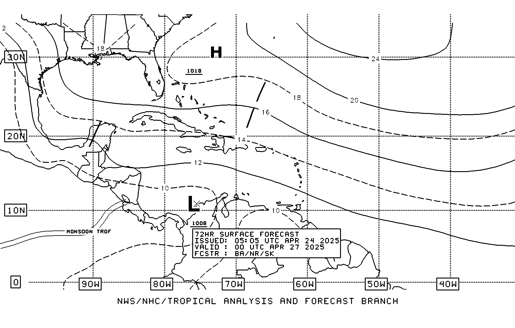
#1499 Postby gatorcane » Mon Aug 31, 2009 11:35 am

TAFB has shifted south, notice the wave/trough impacting FL. Low is now in the Caribbean heading WNW near Puerto Rico, but not as a cyclone yet (possible)

Image
0 likes   

User avatar
artist
Category 5
Category 5
Posts: 9792
Joined: Mon Jun 06, 2005 3:26 pm
Location: West Palm

Re:

#1500 Postby artist » Mon Aug 31, 2009 11:37 am

Stormcenter wrote:The key thing to note is no significant system out there during this run (again)which makes you wonder what will eventually kill off 94L.....Mr. Shear maybe? It reminds me of Ana. It will develop then eventually get hacked by the shear.

stormcenter is that just a guess or do you have some reasoning behind it. I am just trying to learn here. Thanks
0 likes   


Return to “2009”

Who is online

Users browsing this forum: No registered users and 19 guests