ATL: TROPICAL DEPRESSION ANA (02L)

Moderator: S2k Moderators

Message
Author
User avatar
expat2carib
S2K Supporter
S2K Supporter
Posts: 458
Joined: Tue Jul 22, 2008 1:44 pm
Location: Sint Maarten

Re: ATL : INVEST 99L

#161 Postby expat2carib » Sun Aug 09, 2009 7:27 pm

Phoenix's Song wrote:The eighth was yesterday (EDT time)


Ohhh Sh.t Then i lost all my money, my house, my wife and more :x

I placed all I own at my bookie. Ana the eight of august. This site is evil :grrr: LOL
Last edited by expat2carib on Sun Aug 09, 2009 7:28 pm, edited 1 time in total.
0 likes   

User avatar
cycloneye
Admin
Admin
Posts: 145277
Age: 68
Joined: Thu Oct 10, 2002 10:54 am
Location: San Juan, Puerto Rico

Re: ATL : INVEST 99L

#162 Postby cycloneye » Sun Aug 09, 2009 7:27 pm

Strait West

DATE/TIME LAT LON CLASSIFICATION STORM
09/2345 UTC 14.2N 22.9W T1.5/1.5 99L
09/1745 UTC 14.2N 22.4W T1.5/1.5 99L
09/1330 UTC 14.2N 21.8W T1.5/1.5 99L

http://www.ssd.noaa.gov/PS/TROP/tdpositions.html
0 likes   

User avatar
cycloneye
Admin
Admin
Posts: 145277
Age: 68
Joined: Thu Oct 10, 2002 10:54 am
Location: San Juan, Puerto Rico

Re: ATL: Invest 99L Models

#163 Postby cycloneye » Sun Aug 09, 2009 7:38 pm

309
WHXX01 KWBC 100036
CHGHUR
TROPICAL CYCLONE GUIDANCE MESSAGE
NWS TPC/NATIONAL HURRICANE CENTER MIAMI FL
0036 UTC MON AUG 10 2009

DISCLAIMER...NUMERICAL MODELS ARE SUBJECT TO LARGE ERRORS.
PLEASE REFER TO NHC OFFICIAL FORECASTS FOR TROPICAL CYCLONE
AND SUBTROPICAL CYCLONE INFORMATION.

ATLANTIC OBJECTIVE AIDS FOR

DISTURBANCE INVEST (AL992009) 20090810 0000 UTC

...00 HRS... ...12 HRS... ...24 HRS. .. ...36 HRS...
090810 0000 090810 1200 090811 0000 090811 1200

LAT LON LAT LON LAT LON LAT LON
BAMS 14.4N 23.2W 15.4N 26.2W 16.2N 29.1W 16.7N 31.8W
BAMD 14.4N 23.2W 15.4N 24.9W 16.6N 26.5W 17.8N 28.0W
BAMM 14.4N 23.2W 15.5N 25.7W 16.6N 28.0W 17.5N 30.2W
LBAR 14.4N 23.2W 15.6N 25.2W 17.1N 27.0W 18.8N 28.4W
SHIP 25KTS 29KTS 33KTS 37KTS
DSHP 25KTS 29KTS 33KTS 37KTS

...48 HRS... ...72 HRS... ...96 HRS. .. ..120 HRS...
090812 0000 090813 0000 090814 0000 090815 0000

LAT LON LAT LON LAT LON LAT LON
BAMS 16.8N 34.1W 17.1N 38.7W 18.7N 43.3W 22.1N 48.2W
BAMD 19.1N 29.5W 21.8N 32.1W 23.4N 32.6W 22.1N 32.7W
BAMM 18.4N 32.2W 20.4N 36.7W 22.7N 41.3W 25.8N 44.4W
LBAR 20.6N 29.4W 25.2N 31.4W 27.7N 34.2W 27.8N 35.3W
SHIP 40KTS 44KTS 43KTS 36KTS
DSHP 40KTS 44KTS 43KTS 36KTS

...INITIAL CONDITIONS...
LATCUR = 14.4N LONCUR = 23.2W DIRCUR = 295DEG SPDCUR = 13KT
LATM12 = 13.4N LONM12 = 21.0W DIRM12 = 293DEG SPDM12 = 16KT
LATM24 = 12.3N LONM24 = 18.1W
WNDCUR = 25KT RMAXWD = 30NM WNDM12 = 25KT
CENPRS = 1008MB OUTPRS = 1010MB OUTRAD = 130NM SDEPTH = M
RD34NE = 0NM RD34SE = 0NM RD34SW = 0NM RD34NW = 0NM

Image
0 likes   

Derek Ortt

#164 Postby Derek Ortt » Sun Aug 09, 2009 7:48 pm

where is the evidence of a completely closed surface circulation? Just looked at the QS and I do not see a closed circulation. Microwave also does not suggest much surface organization at this time.

http://manati.orbit.nesdis.noaa.gov/dat ... Bds124.png

not quite there yet... it is close. Needs a few SE winds to the NE of the center. That we are kind of missing
0 likes   

CrazyC83
Professional-Met
Professional-Met
Posts: 34002
Joined: Tue Mar 07, 2006 11:57 pm
Location: Deep South, for the first time!

#165 Postby CrazyC83 » Sun Aug 09, 2009 7:59 pm

Center seems to be around 13.8N 23.3W on that graphic.
0 likes   

User avatar
HurricaneMaster_PR
Category 2
Category 2
Posts: 795
Joined: Tue Jul 22, 2003 6:23 pm
Location: San Juan, Puerto Rico

Re:

#166 Postby HurricaneMaster_PR » Sun Aug 09, 2009 8:02 pm

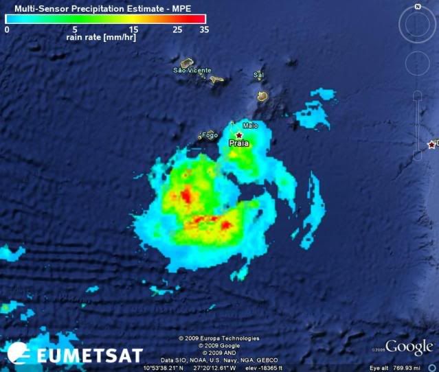
CrazyC83 wrote:Center seems to be around 13.8N 23.3W on that graphic.


I completely agreee, I do not understand why the models and the Dvorak numbers place the system north of 14.0
0 likes   

User avatar
Blown Away
S2K Supporter
S2K Supporter
Posts: 10145
Joined: Wed May 26, 2004 6:17 am

Re: ATL: Invest 99L Models

#167 Postby Blown Away » Sun Aug 09, 2009 8:16 pm

:uarrow: Looking at those models it seems there is no doubt this will be a fish storm with a slight possibility of Bermuda. The problem I have is almost all those models have 99L moving WNW to NW rate now and it is clearly moving almost due west.
0 likes   

User avatar
cycloneye
Admin
Admin
Posts: 145277
Age: 68
Joined: Thu Oct 10, 2002 10:54 am
Location: San Juan, Puerto Rico

Re: ATL: Invest 99L Models

#168 Postby cycloneye » Sun Aug 09, 2009 8:20 pm

NOGAPS is the only model that has a westward track towards the Lesser Antilles.The question is if this model may turn to be the right one trackwise,or the other fish bunch prevails.
0 likes   

Aric Dunn
Category 5
Category 5
Posts: 21238
Age: 42
Joined: Sun Sep 19, 2004 9:58 pm
Location: Ready for the Chase.
Contact:

Re:

#169 Postby Aric Dunn » Sun Aug 09, 2009 8:28 pm

Derek Ortt wrote:where is the evidence of a completely closed surface circulation? Just looked at the QS and I do not see a closed circulation. Microwave also does not suggest much surface organization at this time.

http://manati.orbit.nesdis.noaa.gov/dat ... Bds124.png

not quite there yet... it is close. Needs a few SE winds to the NE of the center. That we are kind of missing


yeah derek.. not sure of a well defined closed surface circ yet either.. still some evidence of a leading convergence boundary which would limit the low closing off on the west ands SW side .. but morning visible will tell more as it will be in goes view with a floater hopefully.
0 likes   

User avatar
HURAKAN
Professional-Met
Professional-Met
Posts: 46086
Age: 38
Joined: Thu May 20, 2004 4:34 pm
Location: Key West, FL
Contact:

#170 Postby HURAKAN » Sun Aug 09, 2009 8:38 pm

Image

Tomorrow should be a great day.
0 likes   

User avatar
gatorcane
S2K Supporter
S2K Supporter
Posts: 23691
Age: 47
Joined: Sun Mar 13, 2005 3:54 pm
Location: Boca Raton, FL

#171 Postby gatorcane » Sun Aug 09, 2009 8:42 pm

well it doesn't surpise me it is code orange at all. I would have left it at that code. GFS certainly is not bullish on developing it into anything more than a border TD/TS then eventually poofs it down the road with no impact to any land.

Another 24 hours of good organization though and you bet NHC will move it code red. At this point its a bit premature with only marginal SSTs and some lingering SAL.
0 likes   

User avatar
lester
S2K Supporter
S2K Supporter
Posts: 1305
Age: 36
Joined: Sat Aug 27, 2005 5:21 pm
Location: Washington, DC
Contact:

#172 Postby lester » Sun Aug 09, 2009 8:44 pm

Image
0 likes   

User avatar
Blown Away
S2K Supporter
S2K Supporter
Posts: 10145
Joined: Wed May 26, 2004 6:17 am

Re: ATL: Invest 99L Models

#173 Postby Blown Away » Sun Aug 09, 2009 8:44 pm

If I'm reading correctly, the 18z HWRF has 99L as a TS rate now. Maybe these NW tracked models are developing 99L to quickly. I guess a shallower 99L goes farther W. :cheesy:
0 likes   

User avatar
storm92405
Tropical Low
Tropical Low
Posts: 16
Age: 52
Joined: Sun Aug 31, 2008 3:45 pm
Location: Hackberry, LA
Contact:

Re: ATL : INVEST 99L

#174 Postby storm92405 » Sun Aug 09, 2009 9:14 pm

Does anyone know if the CV Islands have a Weather Radar system? That would be helpful.
0 likes   

User avatar
ExBailbonds
Tropical Storm
Tropical Storm
Posts: 142
Joined: Wed Sep 06, 2006 12:03 am
Location: Homestead,Fl
Contact:

Re: ATL : INVEST 99L

#175 Postby ExBailbonds » Sun Aug 09, 2009 9:16 pm

wxman57 wrote:
jinftl wrote:If it continues to look this good, I would expect an upgrade to 'code red' on the 8pm....2am at the latest....tropical weather outlooks put out by the nhc...and an upgrade to a depression shortly thereafter


I agree. This could be Ana tomorrow. OK, so I was 2 days early with my May prediction of August 8th.


Pretty impressive there Wxman57.
0 likes   

User avatar
MGC
S2K Supporter
S2K Supporter
Posts: 5898
Joined: Sun Mar 23, 2003 9:05 pm
Location: Pass Christian MS, or what is left.

Re: ATL : INVEST 99L

#176 Postby MGC » Sun Aug 09, 2009 9:49 pm

99L continues to hold its own. I would not be surprised if 99L is upgraded to TD sometime Monday.....MGC
0 likes   

Ed Mahmoud

Re: ATL: Invest 99L Models

#177 Postby Ed Mahmoud » Sun Aug 09, 2009 10:31 pm

Best of the globals, Euro, says fish

Image
0 likes   

jinftl
Category 5
Category 5
Posts: 4312
Joined: Tue Aug 31, 2004 4:47 pm
Location: fort lauderdale, fl

Re: ATL: Invest 99L Models

#178 Postby jinftl » Sun Aug 09, 2009 10:54 pm

Several models forecast we will be talking about Ana tomorrow night/Tuesday (35kt = 40mph)

Image
0 likes   

User avatar
HURAKAN
Professional-Met
Professional-Met
Posts: 46086
Age: 38
Joined: Thu May 20, 2004 4:34 pm
Location: Key West, FL
Contact:

#179 Postby HURAKAN » Sun Aug 09, 2009 11:06 pm

Image

Continues to look good
0 likes   

User avatar
Annie Oakley
Category 5
Category 5
Posts: 1103
Joined: Tue Jul 31, 2007 12:54 pm
Location: Texas

Re:

#180 Postby Annie Oakley » Mon Aug 10, 2009 12:05 am

HURAKAN wrote:Image

Continues to look good

And so starts the unsurpassed beauty of Cyclogenesis so well depicted by Huracan...
0 likes   


Return to “2009”

Who is online

Users browsing this forum: No registered users and 2 guests