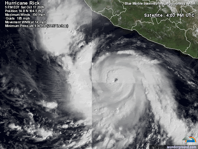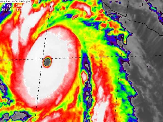
WOW
Moderator: S2k Moderators

CrazyC83 wrote:For all we know, it might be a Cat 5 if Recon were available.
ozonepete wrote:CrazyC83 wrote:For all we know, it might be a Cat 5 if Recon were available.
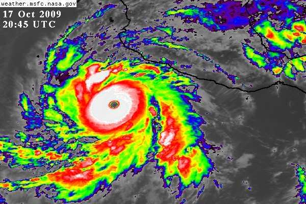
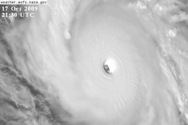
I'm with you, CrazyC83 and Hurakan. At this point it's really hard to tell for sure, but I would say it's a five. It just looks almost perfect.
CrazyC83 wrote:ozonepete wrote:CrazyC83 wrote:For all we know, it might be a Cat 5 if Recon were available.
I'm with you, CrazyC83 and Hurakan. At this point it's really hard to tell for sure, but I would say it's a five. It just looks almost perfect.
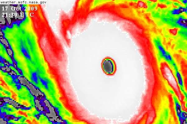
I'd have gone with 135 kt at the advisory since I have just enough suspicion to prevent going over that psychological barrier. The next SAB update is at about 2345Z, so if we were to see a special advisory, the most likely time is around 0000Z (5 pm PDT), unless a special analysis is done.


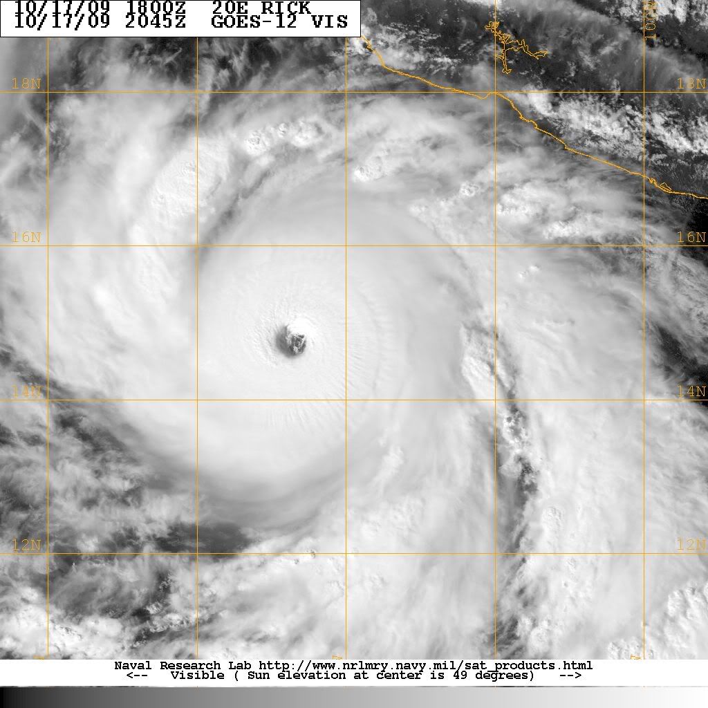
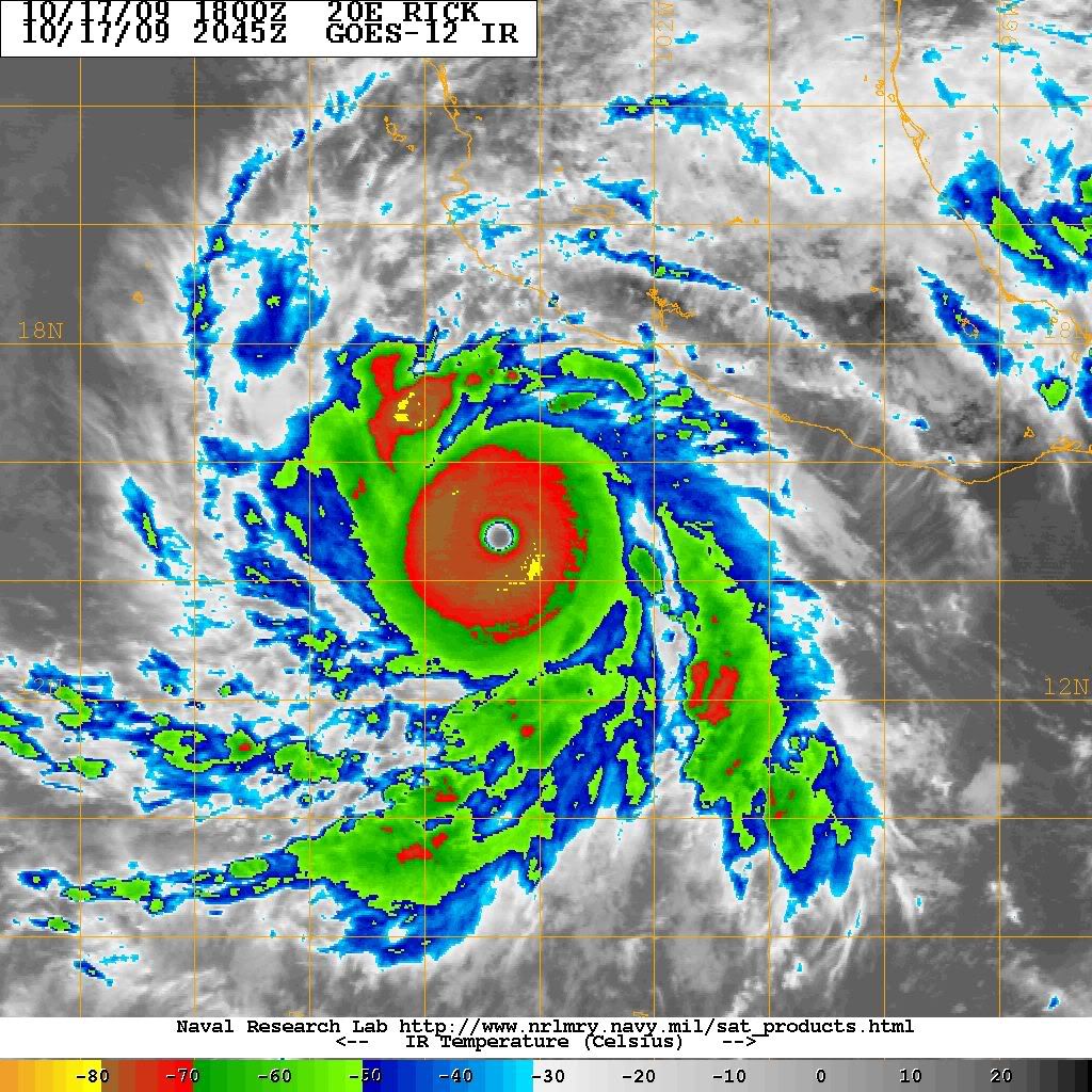
Macrocane wrote:If this is not upgraded on the next advisory to a cat 5 then we will have to wait for re-analysis because it surely looks perfect (Jimena may be upgraded too).
CrazyC83 wrote:Macrocane wrote:If this is not upgraded on the next advisory to a cat 5 then we will have to wait for re-analysis because it surely looks perfect (Jimena may be upgraded too).
Barring a special advisory (very possible), the next advisory is a bit over 5 hours away.
If they analyze it at T7.5 at the next estimate, then a special advisory is a given for sure.
Users browsing this forum: No registered users and 35 guests