WPAC : TROPICAL DEPRESSION MIRINAE (23W)

Moderator: S2k Moderators

Message
Author
User avatar
metenthusiast
Category 1
Category 1
Posts: 271
Age: 48
Joined: Sun Oct 18, 2009 1:09 am
Location: Manila, Phllippines
Contact:

Re: WPAC : TROPICAL DEPRESSION (TS 23W)

#221 Postby metenthusiast » Mon Oct 26, 2009 9:42 am

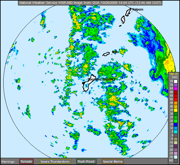
JTE50 wrote:Latest wind distrubition graphic from NWSO Guam
Image


Thanks for that image, Jim! By the way, saw you at the documentary of GMA News. Very nice! :D
0 likes   

User avatar
HURAKAN
Professional-Met
Professional-Met
Posts: 46086
Age: 38
Joined: Thu May 20, 2004 4:34 pm
Location: Key West, FL
Contact:

#222 Postby HURAKAN » Mon Oct 26, 2009 10:14 am

26/0830 UTC 13.7N 149.9E T2.5/2.5 NONAME -- West Pacific

Dvorak - 35 knots
0 likes   

ricmood

#223 Postby ricmood » Mon Oct 26, 2009 10:16 am

Wow! TS23 is going straight to Metro Manila!!!
0 likes   

User avatar
HURAKAN
Professional-Met
Professional-Met
Posts: 46086
Age: 38
Joined: Thu May 20, 2004 4:34 pm
Location: Key West, FL
Contact:

Re:

#224 Postby HURAKAN » Mon Oct 26, 2009 10:17 am

ricmood wrote:Wow! TS23 is going straight to Metro Manila!!!


Too early to tell. Remember that Lupit was supposed to make landfall in Luzon
0 likes   

dexterlabio
Category 5
Category 5
Posts: 3468
Joined: Sat Oct 24, 2009 11:50 pm

Re: WPAC : TROPICAL DEPRESSION (TS 23W)

#225 Postby dexterlabio » Mon Oct 26, 2009 10:23 am

probably it can shift some more to the north. or it might continue moving west or w/ a sw motion. reming of 2006 was also forecasted to track wnw towards ncr but it continued westward towards mindoro area.

i think the forecast on wednesday will be more accurate. let's see if 23W's current track is going well with the forecast.
0 likes   
Personal Forecast Disclaimer:
The posts in this forum are NOT official forecast and should not be used as such. They are just the opinion of the poster and may or may not be backed by sound meteorological data. They are NOT endorsed by any professional institution or storm2k.org. For official information, please refer to the NHC and NWS products.

oaba09
S2K Supporter
S2K Supporter
Posts: 1496
Age: 38
Joined: Thu Oct 01, 2009 10:02 am
Location: Valenzuela, Philippines
Contact:

#226 Postby oaba09 » Mon Oct 26, 2009 10:23 am

darn it....I can't sleep.......my carbuncle hurts.......I guess I still won't be going to work tomorrow...

Image
0 likes   

oaba09
S2K Supporter
S2K Supporter
Posts: 1496
Age: 38
Joined: Thu Oct 01, 2009 10:02 am
Location: Valenzuela, Philippines
Contact:

#227 Postby oaba09 » Mon Oct 26, 2009 10:24 am

I can't find the eye of this thing...........
0 likes   

User avatar
HURAKAN
Professional-Met
Professional-Met
Posts: 46086
Age: 38
Joined: Thu May 20, 2004 4:34 pm
Location: Key West, FL
Contact:

#228 Postby HURAKAN » Mon Oct 26, 2009 10:26 am

Image

Latest
0 likes   

ricmood

#229 Postby ricmood » Mon Oct 26, 2009 10:33 am

What forces/systems are there that makes it go westward and not northwest or north?
0 likes   

oaba09
S2K Supporter
S2K Supporter
Posts: 1496
Age: 38
Joined: Thu Oct 01, 2009 10:02 am
Location: Valenzuela, Philippines
Contact:

Re:

#230 Postby oaba09 » Mon Oct 26, 2009 10:36 am

ricmood wrote:What forces/systems are there that makes it go westward and not northwest or north?


I believe there's a HPA to the north...
0 likes   

dexterlabio
Category 5
Category 5
Posts: 3468
Joined: Sat Oct 24, 2009 11:50 pm

Re: WPAC : TROPICAL DEPRESSION (TS 23W)

#231 Postby dexterlabio » Mon Oct 26, 2009 10:37 am

I wonder what it will look like tomorrow. hmmmm.
0 likes   
Personal Forecast Disclaimer:
The posts in this forum are NOT official forecast and should not be used as such. They are just the opinion of the poster and may or may not be backed by sound meteorological data. They are NOT endorsed by any professional institution or storm2k.org. For official information, please refer to the NHC and NWS products.

dexterlabio
Category 5
Category 5
Posts: 3468
Joined: Sat Oct 24, 2009 11:50 pm

Re: WPAC : TROPICAL DEPRESSION (TS 23W)

#232 Postby dexterlabio » Mon Oct 26, 2009 10:41 am

newest satfix bulletin from jtwc

TPPN10 PGTW 261520

A. TROPICAL STORM 23W (E OF GUAM)

B. 26/1430Z

C. 12.9N

D. 147.5E

E. SIX/MTSAT

F. N/A

G. IR/EIR

H. REMARKS: 38A/PBO SBC/ANMTN.

I. ADDITIONAL POSITIONS:
26/1132Z 12.7N 148.6E TRMM


UEHARA

it is moving westwards swiftly. seems like it really wanted to get into our halloween treat here in the philippines on time O_O i wonder if it is also intensifying quickly as it crosses the pacific ocean.
0 likes   
Personal Forecast Disclaimer:
The posts in this forum are NOT official forecast and should not be used as such. They are just the opinion of the poster and may or may not be backed by sound meteorological data. They are NOT endorsed by any professional institution or storm2k.org. For official information, please refer to the NHC and NWS products.

User avatar
Infdidoll
Category 2
Category 2
Posts: 667
Age: 47
Joined: Thu Oct 01, 2009 8:39 pm
Location: Temecula, CA

Re: WPAC : TROPICAL DEPRESSION (TS 23W)

#233 Postby Infdidoll » Mon Oct 26, 2009 10:49 am

In my oh-so-uninformed opinion, the track they are forecasting actually looks pretty good based on CURRENT conditions...but you know how that goes. Lupit's conditions kept changing pretty consistently. If things stay stable as they are, the track could prove correct. I wonder if this one might prove as predictable as Lupit was unpredictable? Again, however, only time will tell.

Image

Image

So will that trough to the NW combined with favorable water conditions likely keep this from moving poleward at all? To a novice, the JTWC prediction looks solid.

*The posts in this forum are NOT official forecast and should not be used as such. They are just the opinion of the poster and may or may not be backed by sound meteorological data. They are NOT endorsed by any professional institution or storm2k.org. For official information, please refer to the NHC and NWS products.*
0 likes   

oaba09
S2K Supporter
S2K Supporter
Posts: 1496
Age: 38
Joined: Thu Oct 01, 2009 10:02 am
Location: Valenzuela, Philippines
Contact:

Re: WPAC : TROPICAL DEPRESSION (TS 23W)

#234 Postby oaba09 » Mon Oct 26, 2009 10:59 am

Infdidoll wrote:In my oh-so-uninformed opinion, the track they are forecasting actually looks pretty good based on CURRENT conditions...but you know how that goes. Lupit's conditions kept changing pretty consistently. If things stay stable as they are, the track could prove correct. I wonder if this one might prove as predictable as Lupit was unpredictable? Again, however, only time will tell.

Image

Image

So will that trough to the NW combined with favorable water conditions likely keep this from moving poleward at all? To a novice, the JTWC prediction looks solid.

*The posts in this forum are NOT official forecast and should not be used as such. They are just the opinion of the poster and may or may not be backed by sound meteorological data. They are NOT endorsed by any professional institution or storm2k.org. For official information, please refer to the NHC and NWS products.*


Seems like a solid forecast to me I don't see any conditions that can affect it's direction....Don't take my word though, I'm a total noob at this.......
0 likes   

User avatar
Macrocane
Category 5
Category 5
Posts: 4218
Age: 36
Joined: Sun May 24, 2009 5:35 pm
Location: El Salvador

Re: WPAC : TROPICAL DEPRESSION (TS 23W)

#235 Postby Macrocane » Mon Oct 26, 2009 11:19 am

The posts in this forum are NOT official forecast and should not be used as such. They are just the opinion of the poster and may or may not be backed by sound meteorological data. They are NOT endorsed by any professional institution or storm2k.org. For official information, please refer to the NHC and NWS products.

Dry air to its west could be the only factor that may inhibit strengthening in the short term, but if it grows enough to moisten its own way then we will see a gradual intensification.
0 likes   

ozonepete
Professional-Met
Professional-Met
Posts: 4743
Joined: Mon Sep 07, 2009 3:23 pm
Location: From Ozone Park, NYC / Now in Brooklyn, NY

Re:

#236 Postby ozonepete » Mon Oct 26, 2009 11:53 am

oaba09 wrote:I can't find the eye of this thing...........


That's because there isn't one. Normal sized tropical cyclones in this environment don't form an eye until around 77 knots or so.
0 likes   

User avatar
metenthusiast
Category 1
Category 1
Posts: 271
Age: 48
Joined: Sun Oct 18, 2009 1:09 am
Location: Manila, Phllippines
Contact:

Re: Re:

#237 Postby metenthusiast » Mon Oct 26, 2009 11:58 am

ozonepete wrote:
oaba09 wrote:I can't find the eye of this thing...........


That's because there isn't one. Normal sized tropical cyclones in this environment don't form an eye until around 77 knots or so.


That is so. I guess we could see eye development in the coming hours. Based of the forecast, this one could be a real howler.
0 likes   

User avatar
metenthusiast
Category 1
Category 1
Posts: 271
Age: 48
Joined: Sun Oct 18, 2009 1:09 am
Location: Manila, Phllippines
Contact:

Re: WPAC : TROPICAL DEPRESSION (TS 23W)

#238 Postby metenthusiast » Mon Oct 26, 2009 11:59 am

Image

Latest
0 likes   

Derek Ortt

#239 Postby Derek Ortt » Mon Oct 26, 2009 12:02 pm

well... they do form an eye. You just won't see it on conventional sat imagery until ~75KT

if this intensifies quickly, you may see the eye on the Guam NWS radar starting at ~50KT. I'm looking at the long range now and there is no eye yet (as we'd expect given a 35KT cyclone)

center looks north of Guam. Track may be near Saipan, however
0 likes   

User avatar
cycloneye
Admin
Admin
Posts: 145270
Age: 68
Joined: Thu Oct 10, 2002 10:54 am
Location: San Juan, Puerto Rico

Re: WPAC : TROPICAL DEPRESSION (TS 23W)

#240 Postby cycloneye » Mon Oct 26, 2009 12:08 pm

WTPQ52 PGUM 261608
TCEPQ2

TROPICAL STORM 23W POSITION ESTIMATE
NATIONAL WEATHER SERVICE TIYAN GU
200 AM CHST TUE OCT 27 2009

AT 159 AM CHST...1559Z...THE POORLY DEFINED CENTER OF TROPICAL STORM
23W WAS LOCATED BY RADAR NEAR LATITUDE 13.1 DEGREES NORTH AND
LONGITUDE 147.4 DEGREES EAST.

THIS IS ABOUT 180 MILES EAST OF THE GUAM WSR-88D RADAR AT AN
ELEVATION OF 24000 FEET. THIS IS ALSO 163 MILES EAST-SOUTHEAST OF
ROTA AND 177 MILES SOUTHEAST OF TINIAN AND SAIPAN.

$$

ZIOBRO

0 likes   
Visit the Caribbean-Central America Weather Thread where you can find at first post web cams,radars
and observations from Caribbean basin members Click Here


Return to “2009”

Who is online

Users browsing this forum: No registered users and 11 guests