ATL : TROPICAL DEPRESSION ERIKA (06L)

Moderator: S2k Moderators

Message
Author
User avatar
Comanche
Category 1
Category 1
Posts: 381
Age: 53
Joined: Wed Jul 06, 2005 9:33 am
Location: Clear Lake City Texas

Re: ATL : TROPICAL STORM ERIKA (06L)

#2421 Postby Comanche » Tue Sep 01, 2009 4:17 pm

CronkPSU wrote:
Comanche wrote:"It's going to hit Texas!" "NO, Iit's going to hit Florida!"

There, I thought I'd get that out of the way early! Hehehe

:lol:


it's going to hit both!!!! :spam:


Hopefully, the Texas vs. Florida TC crowd can finally have it settled with a national championship this year, Colt McCoy vs. Tim Tebow!!

I know, I know, back on topic!

0 likes   

User avatar
southerngale
Retired Staff
Retired Staff
Posts: 27418
Joined: Thu Oct 10, 2002 1:27 am
Location: Southeast Texas (Beaumont area)

Re: Re:

#2422 Postby southerngale » Tue Sep 01, 2009 4:18 pm

AdamFirst wrote:
Stormcenter wrote:You can tell things have been slow this season. Look at all of the excitement for a TS. :)


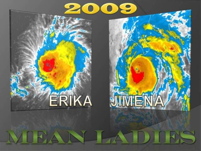
Maybe it's the board's Atlantic bias...there's a monster named Jimena in the West Pacific and it's a safe bet that a bunch of people here aren't interested in it :wink:


Well, of course. I doubt many people here could potentially be affected by Jimena, and probably don't have many (or any) friends and family who could be affected, either. There's a small group of people who are mainly interested in the science, tracking, etc. Most people start paying attention when they, or their loved ones, could possibly be affected by a tropical system. This isn't unusual.
0 likes   

RL3AO
Moderator-Pro Met
Moderator-Pro Met
Posts: 16308
Joined: Thu Jun 14, 2007 10:03 pm
Location: NC

#2423 Postby RL3AO » Tue Sep 01, 2009 4:20 pm

URNT15 KNHC 012116
AF305 01BBA INVEST HDOB 31 20090901
210700 1634N 05633W 9643 00393 0086 +230 +197 213034 035 030 000 00
210730 1635N 05635W 9645 00391 0085 +231 +197 211033 036 031 000 00
210800 1636N 05636W 9640 00396 0085 +230 +198 207036 037 033 000 03
210830 1637N 05637W 9647 00388 0084 +232 +198 206036 037 999 999 03
210900 1638N 05638W 9648 00386 0083 +227 +198 209035 036 034 000 03
210930 1640N 05639W 9637 00395 0081 +230 +197 209032 033 999 999 03
211000 1641N 05641W 9647 00385 0079 +234 +196 215031 033 033 000 03
211030 1642N 05642W 9645 00386 0078 +235 +196 213031 032 999 999 03
211100 1643N 05643W 9640 00389 0077 +234 +197 214029 030 033 000 03
211130 1644N 05644W 9646 00383 0077 +232 +199 214029 030 033 000 03
211200 1645N 05645W 9647 00383 0076 +235 +199 218028 028 031 000 03
211230 1646N 05646W 9643 00386 0077 +235 +200 219027 027 031 000 03
211300 1647N 05648W 9646 00382 0076 +231 +201 221025 026 032 000 00
211330 1649N 05649W 9646 00382 0077 +219 +201 221025 026 035 004 00
211400 1650N 05650W 9645 00383 0076 +229 +198 223025 026 032 003 03
211430 1651N 05651W 9642 00385 0075 +230 +196 224025 026 027 000 03
211500 1652N 05652W 9651 00376 0074 +234 +195 230023 025 999 999 03
211530 1653N 05653W 9642 00384 0073 +235 +195 234020 021 026 000 03
211600 1654N 05654W 9645 00381 0072 +235 +197 236019 020 999 999 03
211630 1655N 05655W 9645 00380 0072 +235 +198 236018 019 999 999 03
$$
;
0 likes   

User avatar
HURAKAN
Professional-Met
Professional-Met
Posts: 46086
Age: 38
Joined: Thu May 20, 2004 4:34 pm
Location: Key West, FL
Contact:

#2424 Postby HURAKAN » Tue Sep 01, 2009 4:22 pm

Image
0 likes   

Aric Dunn
Category 5
Category 5
Posts: 21238
Age: 42
Joined: Sun Sep 19, 2004 9:58 pm
Location: Ready for the Chase.
Contact:

#2425 Postby Aric Dunn » Tue Sep 01, 2009 4:22 pm

wonder why they keep avoiding the deep convection.. lol
0 likes   

User avatar
Lurker
Tropical Storm
Tropical Storm
Posts: 176
Joined: Fri May 01, 2009 8:14 am
Location: Miami, Fl

Re: Re:

#2426 Postby Lurker » Tue Sep 01, 2009 4:23 pm

southerngale wrote:
AdamFirst wrote:
Stormcenter wrote:You can tell things have been slow this season. Look at all of the excitement for a TS. :)


Maybe it's the board's Atlantic bias...there's a monster named Jimena in the West Pacific and it's a safe bet that a bunch of people here aren't interested in it :wink:


Well, of course. I doubt many people here could potentially be affected by Jimena, and probably don't have many (or any) friends and family who could be affected, either. There's a small group of people who are mainly interested in the science, tracking, etc. Most people start paying attention when they, or their loved ones, could possibly be affected by a tropical system. This isn't unusual.


Very well said. Post of the month (it's early in the month :lol: )

:clap:
0 likes   

User avatar
Lurker
Tropical Storm
Tropical Storm
Posts: 176
Joined: Fri May 01, 2009 8:14 am
Location: Miami, Fl

Re:

#2427 Postby Lurker » Tue Sep 01, 2009 4:25 pm

Hybridstorm_November2001 wrote:NHC has been outstanding with the tracks this season, even the five day ones. I'm going with them all the way on Erika, not even looking at models.


Yeah but 4-5 days out is a little tricky. From the NHC:

NOTE...ERRORS FOR TRACK HAVE AVERAGED NEAR 225 NM
ON DAY 4 AND 300 NM ON DAY 5...AND FOR INTENSITY NEAR 20 KT EACH DAY
0 likes   

User avatar
StormTracker
S2K Supporter
S2K Supporter
Posts: 2903
Age: 59
Joined: Thu Jun 29, 2006 6:06 am
Location: Quail Heights(Redlands), FL.

Re: ATL : TROPICAL STORM ERIKA - Computer Models

#2428 Postby StormTracker » Tue Sep 01, 2009 4:26 pm

:uarrow: :uarrow: :uarrow:
Image
Image
0 likes   

Aric Dunn
Category 5
Category 5
Posts: 21238
Age: 42
Joined: Sun Sep 19, 2004 9:58 pm
Location: Ready for the Chase.
Contact:

#2429 Postby Aric Dunn » Tue Sep 01, 2009 4:28 pm

I still do not see a motion of 300 .. lol
if this goes north of the islands i will be surprised..
0 likes   

Air Force Met
Military Met
Military Met
Posts: 4372
Age: 56
Joined: Tue Jul 08, 2003 9:30 am
Location: Roan Mountain, TN

Re:

#2430 Postby Air Force Met » Tue Sep 01, 2009 4:31 pm

Aric Dunn wrote:wonder why they keep avoiding the deep convection.. lol


Yep. Always wonder that. They seem to do it a lot in these cases.
0 likes   

rrm
Tropical Depression
Tropical Depression
Posts: 65
Joined: Fri May 15, 2009 2:05 pm

Re:

#2431 Postby rrm » Tue Sep 01, 2009 4:32 pm

Aric Dunn wrote:I still do not see a motion of 300 .. lol
if this goes north of the islands i will be surprised..


do you think more of a westerly track and possibly slipping under pr
0 likes   

User avatar
HURAKAN
Professional-Met
Professional-Met
Posts: 46086
Age: 38
Joined: Thu May 20, 2004 4:34 pm
Location: Key West, FL
Contact:

#2432 Postby HURAKAN » Tue Sep 01, 2009 4:32 pm

Image
0 likes   

Dean4Storms
S2K Supporter
S2K Supporter
Posts: 6358
Age: 62
Joined: Sun Aug 31, 2003 1:01 pm
Location: Miramar Bch. FL

#2433 Postby Dean4Storms » Tue Sep 01, 2009 4:32 pm

It could have been a TD a day or so ago! Funny that even the latest Qscat detected no closed circulation.
0 likes   

RL3AO
Moderator-Pro Met
Moderator-Pro Met
Posts: 16308
Joined: Thu Jun 14, 2007 10:03 pm
Location: NC

#2434 Postby RL3AO » Tue Sep 01, 2009 4:33 pm

URNT15 KNHC 012126
AF305 01BBA INVEST HDOB 32 20090901
211700 1656N 05657W 9648 00377 0071 +236 +200 236018 019 025 000 03
211730 1657N 05658W 9641 00383 0071 +238 +201 238017 018 024 000 03
211800 1658N 05659W 9643 00382 0071 +238 +203 238016 017 999 999 03
211830 1700N 05700W 9645 00381 0071 +237 +204 235015 016 999 999 03
211900 1701N 05701W 9645 00380 0072 +237 +205 235013 014 999 999 03
211930 1702N 05702W 9647 00378 0072 +235 +206 241011 012 019 000 03
212000 1703N 05703W 9640 00385 0073 +225 +206 246007 010 023 001 03
212030 1705N 05704W 9654 00373 0072 +232 +205 266005 006 020 001 03
212100 1706N 05704W 9641 00383 0071 +233 +203 236000 003 999 999 03
212130 1708N 05705W 9651 00374 0072 +230 +203 303002 003 999 999 03
212200 1709N 05706W 9642 00382 0071 +235 +202 347002 003 999 999 03
212230 1710N 05707W 9645 00381 0072 +235 +201 038004 005 017 000 03
212300 1711N 05708W 9645 00380 0072 +235 +201 042004 004 999 999 03
212330 1712N 05709W 9642 00383 0072 +237 +202 038003 003 018 000 03
212400 1713N 05710W 9643 00383 0072 +240 +203 036005 005 999 999 03
212430 1713N 05710W 9643 00383 0072 +240 +204 035006 006 999 999 03
212500 1715N 05713W 9645 00381 0071 +241 +205 037006 007 999 999 03
212530 1716N 05714W 9645 00380 0071 +241 +206 045007 007 999 999 03
212600 1718N 05715W 9645 00381 0072 +239 +207 047011 012 999 999 03
212630 1719N 05716W 9643 00382 0072 +236 +208 054012 013 999 999 03
$$
;
0 likes   

User avatar
webke
S2K Supporter
S2K Supporter
Posts: 290
Age: 70
Joined: Sun Sep 05, 2004 12:39 pm
Location: North Myrtle Beach SC

Re: ATL : TROPICAL STORM ERIKA - RECON

#2435 Postby webke » Tue Sep 01, 2009 4:33 pm

Might be because of the turbulance and the downdrafts.
0 likes   

Jimsot
Tropical Storm
Tropical Storm
Posts: 157
Age: 77
Joined: Sat Sep 09, 2006 1:31 pm
Location: Upstate SC

Re:

#2436 Postby Jimsot » Tue Sep 01, 2009 4:33 pm

Aric Dunn wrote:I still do not see a motion of 300 .. lol
if this goes north of the islands i will be surprised..


We are counting on that, but will take all necessary precautions tomorrow anyway. Does not look like a 'shutter' event.
0 likes   

User avatar
deltadog03
Professional-Met
Professional-Met
Posts: 3580
Joined: Tue Jul 05, 2005 6:16 pm
Location: Macon, GA

#2437 Postby deltadog03 » Tue Sep 01, 2009 4:34 pm

Looks like the llc has barely moved since recon has been in there. MAybe a bit back towards the deep convection.
0 likes   

User avatar
storms NC
Tropical Storm
Tropical Storm
Posts: 247
Age: 69
Joined: Tue Sep 14, 2004 2:41 pm
Location: Coast of NC & southwest coast of Fla

Re:

#2438 Postby storms NC » Tue Sep 01, 2009 4:35 pm

Aric Dunn wrote:I still do not see a motion of 300 .. lol
if this goes north of the islands i will be surprised..


JMO It will just will pass to the north of the Island. They will get some rain and windy. But I don't know how much of the tropical winds they will get. All depends how close she will come to the Islands and how big her wind spand is.JMO
0 likes   

User avatar
HURAKAN
Professional-Met
Professional-Met
Posts: 46086
Age: 38
Joined: Thu May 20, 2004 4:34 pm
Location: Key West, FL
Contact:

#2439 Postby HURAKAN » Tue Sep 01, 2009 4:43 pm

Image
0 likes   

RL3AO
Moderator-Pro Met
Moderator-Pro Met
Posts: 16308
Joined: Thu Jun 14, 2007 10:03 pm
Location: NC

#2440 Postby RL3AO » Tue Sep 01, 2009 4:44 pm

URNT15 KNHC 012136
AF305 01BBA INVEST HDOB 33 20090901
212700 1720N 05717W 9645 00381 0073 +235 +209 059013 013 999 999 03
212730 1721N 05719W 9643 00384 0073 +237 +209 065013 013 999 999 03
212800 1722N 05720W 9645 00384 0075 +231 +209 069013 014 999 999 03
212830 1723N 05721W 9646 00383 0075 +236 +208 066016 018 999 999 03
212900 1724N 05722W 9642 00386 0075 +234 +208 063019 019 999 999 03
212930 1725N 05723W 9646 00384 0076 +234 +208 063021 022 999 999 03
213000 1727N 05724W 9644 00386 0077 +235 +208 065027 028 999 999 03
213030 1728N 05726W 9645 00386 0078 +232 +207 067026 027 999 999 03
213100 1729N 05727W 9644 00389 0079 +232 +207 068026 026 999 999 03
213130 1730N 05728W 9644 00389 0080 +235 +207 069026 026 023 000 03
213200 1731N 05729W 9645 00387 0080 +238 +206 073027 028 999 999 03
213230 1732N 05731W 9645 00389 0082 +236 +206 074026 028 022 000 03
213300 1734N 05732W 9644 00391 0082 +237 +207 073026 027 022 000 03
213330 1735N 05733W 9644 00391 0082 +240 +207 072026 026 019 000 00
213400 1736N 05734W 9643 00392 0083 +237 +207 075025 026 020 000 00
213430 1737N 05736W 9647 00389 0084 +235 +208 073024 024 023 000 00
213500 1738N 05737W 9642 00394 0084 +232 +208 075025 025 024 000 00
213530 1739N 05738W 9646 00391 0086 +230 +208 077026 027 021 001 00
213600 1741N 05739W 9646 00391 0086 +230 +207 075027 027 025 000 03
213630 1742N 05741W 9646 00392 0087 +230 +206 075028 028 024 000 00
$$
;
0 likes   


Return to “2009”

Who is online

Users browsing this forum: No registered users and 3 guests