145
URNT15 KNHC 012346
AF305 01BBA INVEST HDOB 46 20090901
233700 1813N 05638W 8428 01597 0128 +165 +145 115043 043 042 000 00
233730 1814N 05640W 8432 01591 0127 +165 +145 116044 045 041 000 03
233800 1814N 05642W 8425 01597 0127 +165 +144 115044 045 041 000 03
233830 1814N 05644W 8430 01592 0127 +165 +144 114045 046 044 000 03
233900 1814N 05646W 8429 01593 0127 +165 +143 113044 045 042 000 03
233930 1815N 05648W 8427 01592 0124 +164 +142 111044 045 044 000 03
234000 1815N 05650W 8431 01589 0128 +160 +141 111046 047 043 000 00
234030 1815N 05652W 8432 01591 0128 +160 +139 113047 048 045 000 03
234100 1816N 05654W 8426 01594 0127 +162 +138 113046 046 045 000 03
234130 1816N 05656W 8433 01587 0125 +164 +136 115045 045 044 000 03
234200 1816N 05658W 8426 01593 0125 +160 +136 111046 046 999 999 03
234230 1816N 05700W 8431 01592 0130 +161 +136 110045 046 999 999 03
234300 1815N 05701W 8428 01593 0126 +161 +136 111042 043 037 000 03
234330 1813N 05701W 8431 01587 0124 +165 +136 110041 042 999 999 03
234400 1812N 05701W 8430 01588 0123 +164 +136 113040 040 999 999 03
234430 1810N 05701W 8429 01590 0124 +163 +136 115041 042 038 000 03
234500 1809N 05701W 8430 01589 0123 +164 +136 117043 044 038 000 03
234530 1807N 05701W 8430 01587 0122 +165 +137 117043 044 038 000 03
234600 1806N 05701W 8432 01585 0119 +166 +137 117042 043 037 000 03
234630 1804N 05701W 8429 01589 0118 +169 +138 120042 042 038 000 03
$$
;
ATL : TROPICAL DEPRESSION ERIKA (06L)
Moderator: S2k Moderators
-
MGC

- S2K Supporter

- Posts: 5940
- Joined: Sun Mar 23, 2003 9:05 pm
- Location: Pass Christian MS, or what is left.
Re: ATL : TROPICAL STORM ERIKA (06L)
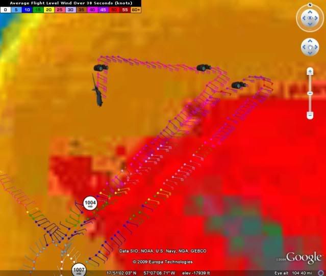
According to the latest VDM, the center of Erika is .2 degrees north of the last fix and about the same longitude. So, looks like the center is reforming to the north perhaps...pressure at 1004mb. Don't see much in the way of shear so Erika should intensify in the sort term. I would not be surprised if Erika is a bit stronger than the NHC have forecast.....MGC
Of course the above is the opinion of MGC and not an official forecast.
Of course the above is the opinion of MGC and not an official forecast.
0 likes

-
cycloneye

- Admin

- Posts: 149239
- Age: 69
- Joined: Thu Oct 10, 2002 10:54 am
- Location: San Juan, Puerto Rico
Re: ATL : TROPICAL STORM ERIKA - Computer Models
18z GFDL is more west.Reaches cat 2 intensity.
http://moe.met.fsu.edu/cgi-bin/gfdltc2. ... =Animation
http://moe.met.fsu.edu/cgi-bin/gfdltc2. ... =Animation
0 likes
-
Derek Ortt
-
DESTRUCTION5

- Category 5

- Posts: 4430
- Age: 44
- Joined: Wed Sep 03, 2003 11:25 am
- Location: Stuart, FL
Re: ATL : TROPICAL STORM ERIKA - Computer Models
cycloneye wrote:18z GFDL is more west.Reaches cat 2 intensity.
http://moe.met.fsu.edu/cgi-bin/gfdltc2. ... =Animation
The 18z HWRF Bends back west twards the end as well...
0 likes
-
cycloneye
- Admin
- Posts: 149239
- Age: 69
- Joined: Thu Oct 10, 2002 10:54 am
- Location: San Juan, Puerto Rico
Re:
Derek Ortt wrote:I am not ready to officially sound the recurve sirens.
I wish GFDL would stop shifting left!
You saw the west shift that I posted at models thread.HWRF is similar with the west shift.
0 likes
-
DESTRUCTION5
- Category 5
- Posts: 4430
- Age: 44
- Joined: Wed Sep 03, 2003 11:25 am
- Location: Stuart, FL
Re: Re:
cycloneye wrote:Derek Ortt wrote:I am not ready to officially sound the recurve sirens.
I wish GFDL would stop shifting left!
You saw the west shift that I posted at models thread.HWRF is similar with the west shift.
HWRF is more of a left turn than a shift W...
0 likes
-
Evil Jeremy

- S2K Supporter
- Posts: 5463
- Age: 32
- Joined: Mon Apr 10, 2006 2:10 pm
- Location: Los Angeles, CA
-
HURAKAN

- Professional-Met

- Posts: 46084
- Age: 39
- Joined: Thu May 20, 2004 4:34 pm
- Location: Key West, FL
- Contact:
954
URNT15 KNHC 012356
AF305 01BBA INVEST HDOB 47 20090901
234700 1803N 05701W 8429 01587 0118 +166 +139 121042 043 036 001 00
234730 1801N 05701W 8428 01587 0113 +172 +140 119041 042 038 000 00
234800 1800N 05701W 8431 01582 0114 +167 +141 116045 046 037 000 00
234830 1759N 05701W 8429 01583 0113 +169 +142 115045 046 039 000 00
234900 1757N 05701W 8429 01583 0113 +169 +143 113046 046 040 000 03
234930 1756N 05701W 8428 01583 0109 +172 +143 113046 046 040 001 00
235000 1754N 05701W 8429 01583 0107 +175 +144 112044 045 042 000 00
235030 1753N 05701W 8429 01581 0109 +168 +145 112045 045 041 000 00
235100 1751N 05701W 8430 01578 0109 +167 +146 110043 045 043 000 00
235130 1750N 05701W 8430 01578 0107 +171 +146 108040 041 043 001 00
235200 1748N 05701W 8430 01578 0105 +170 +146 107037 037 042 000 00
235230 1747N 05702W 8429 01576 0107 +167 +145 109037 039 036 001 03
235300 1745N 05702W 8435 01570 0110 +161 +144 120042 043 036 001 00
235330 1744N 05702W 8428 01575 0102 +170 +142 124043 044 039 001 00
235400 1742N 05703W 8433 01569 0096 +179 +142 125042 045 042 003 03
235430 1741N 05703W 8425 01578 0100 +167 +141 132042 043 042 004 00
235500 1739N 05704W 8429 01569 0102 +159 +141 133039 041 046 009 00
235530 1738N 05704W 8436 01560 0096 +164 +140 133040 042 046 006 00
235600 1737N 05705W 8424 01567 0090 +170 +139 129038 040 049 006 03
235630 1735N 05706W 8380 01612 0093 +158 +138 129041 043 050 011 00
$$
;
0 likes
-
BensonTCwatcher

- Category 5
- Posts: 1050
- Joined: Sat Aug 28, 2004 10:11 pm
- Location: Southport NC
-
Aric Dunn
- Category 5
- Posts: 21238
- Age: 43
- Joined: Sun Sep 19, 2004 9:58 pm
- Location: Ready for the Chase.
- Contact:
Re:
Evil Jeremy wrote:Will be interesting to see if the rest of the models also turn more west. We shall know soon.
I imagine they will .. they all seem to follow each other pretty closely.. with the gfs bringing to florida and the bam models way west along with the NAM .. we should see things shif.
but its mostly because it has not moved much today and the timing has now changed so the trough is being able to move out before Erika get near the bahamas
0 likes


Re: ATL : TROPICAL STORM ERIKA - Computer Models
Wow, that HWRF track and intensity is starting to look like 1992 all over. 
0 likes
-
CYCLONE MIKE
- Category 5
- Posts: 2183
- Joined: Tue Aug 31, 2004 6:04 pm
- Location: Gonzales, LA
Re: ATL : TROPICAL STORM ERIKA - Computer Models
What's more important, what are they doing with the high? Are they showing a stronger/expanding high or weaker/eroding high moving to the east being replaced by a deepening trough?
0 likes
Re: Re:
Aric Dunn wrote:Evil Jeremy wrote:Will be interesting to see if the rest of the models also turn more west. We shall know soon.
I imagine they will .. they all seem to follow each other pretty closely.. with the gfs bringing to florida and the bam models way west along with the NAM .. we should see things shif.
but its mostly because it has not moved much today and the timing has now changed so the trough is being able to move out before Erika get near the bahamas
Also, I think the key will be how strong high pressure nosing south from New England gets to be and how progressive it is. I tried searching for the synoptics for Andrew earlier today on the web but couldn't find it. It was a similar setup with a trough lifting out and high pressure building from the north. I'm sure with Andrew the high pressure was much stronger though then this high.
0 likes
Who is online
Users browsing this forum: No registered users and 122 guests