ATL : TROPICAL DEPRESSION IDA
Moderator: S2k Moderators
-
cycloneye

- Admin

- Posts: 149230
- Age: 69
- Joined: Thu Oct 10, 2002 10:54 am
- Location: San Juan, Puerto Rico
Re: ATL : HURRICANE IDA - Recon
I have to go now so who wants to continue posting the obs?
0 likes
Visit the Caribbean-Central America Weather Thread where you can find at first post web cams,radars
and observations from Caribbean basin members Click Here
and observations from Caribbean basin members Click Here

Re: ATL : HURRICANE IDA
I think even if the landfall is over Dauphin Island, or even MS, Pensacola is going to be in for a wild ride come Tuesday. I am ok with a landfall over AL as the areas east of MObile bay are not as surge sensative, but if it hits MS with a cat 2 surge, then life just isnt fair. Really though, I am doubting surge will be a huge issue unless this grows to a cat 3 over the gulf. If it comes at the coast in a SW to NE fashion as most of the models have it, surge potential isnt maximized. Now if it hits MS from due south Eastern Jackson County and MObile county/Mobile bay areas of Baldwin could get nice surge, if not short lived...as the quick NE movement would prevent a prolonged pile up of water in the bays...like with Katrina and George where the South wind persisted for hours and hours in those areas.
EDIT: and unfortunately I think its just too early to tell how strong/tropical this thing will be at landfall, which plays a big part in surge obviously. Extra tropical storms can and do produce large surges, just ask the folks along the bays along Rhode Island and Massachusettes.
EDIT: and unfortunately I think its just too early to tell how strong/tropical this thing will be at landfall, which plays a big part in surge obviously. Extra tropical storms can and do produce large surges, just ask the folks along the bays along Rhode Island and Massachusettes.
0 likes
-
Dean4Storms
- S2K Supporter

- Posts: 6358
- Age: 63
- Joined: Sun Aug 31, 2003 1:01 pm
- Location: Miramar Bch. FL
Re: ATL : HURRICANE IDA
Ivanhater wrote:Ivanhater wrote:I noticed the Hurricane watch only extends to the MS/AL border. Is that supposed to extend east as it gets closer cause landfall is still showing the Pensacola area?
Anybody know? lol
I think the watches go east later today. The LA Grand Isles jut a good distance southward so likely they would go under H Watches first being in the 36hr window.
0 likes
-
Sabanic

- Category 2

- Posts: 683
- Age: 66
- Joined: Wed Aug 01, 2007 7:01 am
- Location: Mobile, AL
- Contact:
Re: ATL : HURRICANE IDA
Interesting development for November for sure.
0 likes
"I can do all things through Christ which strengtheneth me" - Philippians 4:13

Re: ATL : HURRICANE IDA
I don't know if this is the right place to post this: Ida affected El Salvador with rains in Wednesday and Thursday and 96 E during Friday and Saturday and the worst scenario occured.
This is unbelievable, yesterday 96-E made landfall in El Salvador and produced very heavy rains. The highest amount of rainfall was 355mm (14 inches) in just 24 hours and the national accumulation of rain from Ida and 96 E is more than 500 mm (20 inches) more than 500 mm that's the same rainfall that Mitch and Stan produced. National emergency may be declared. It's a tragedy the first reports indicate that at least 54 people are dead and 5000 homeless this numbers may rise in the coming hours, this is the worst disaster for El Salvador since Stan. My best wishes are with all the affected and I hope that Ida won't ba that bad as this situation. Here is a link if you can read spanish:
Disaster in El Salvador
This is the map of the accumulated rain between 7:00 am saturday and 7:00 am today

I'm not sure if I have to make a new thread to post updates of this disaster an if so where do I have to start it please let me know.
This is unbelievable, yesterday 96-E made landfall in El Salvador and produced very heavy rains. The highest amount of rainfall was 355mm (14 inches) in just 24 hours and the national accumulation of rain from Ida and 96 E is more than 500 mm (20 inches) more than 500 mm that's the same rainfall that Mitch and Stan produced. National emergency may be declared. It's a tragedy the first reports indicate that at least 54 people are dead and 5000 homeless this numbers may rise in the coming hours, this is the worst disaster for El Salvador since Stan. My best wishes are with all the affected and I hope that Ida won't ba that bad as this situation. Here is a link if you can read spanish:
Disaster in El Salvador
This is the map of the accumulated rain between 7:00 am saturday and 7:00 am today
I'm not sure if I have to make a new thread to post updates of this disaster an if so where do I have to start it please let me know.
0 likes
-
Aric Dunn
- Category 5

- Posts: 21238
- Age: 43
- Joined: Sun Sep 19, 2004 9:58 pm
- Location: Ready for the Chase.
- Contact:
Re: ATL : HURRICANE IDA
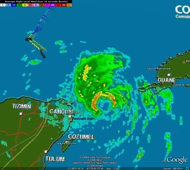
Hey look there is that pretty little eye i was talking about coming back shortly.. recon could find a moderate cat here shortly..

0 likes

-
HURAKAN

- Professional-Met

- Posts: 46084
- Age: 39
- Joined: Thu May 20, 2004 4:34 pm
- Location: Key West, FL
- Contact:
Re: ATL : HURRICANE IDA - Recon
cycloneye wrote:I have to go now so who wants to continue posting the obs?
I can do it!
0 likes
-
HURAKAN
- Professional-Met
- Posts: 46084
- Age: 39
- Joined: Thu May 20, 2004 4:34 pm
- Location: Key West, FL
- Contact:
670
URNT15 KNHC 081641
AF309 0411A IDA HDOB 13 20091108
163330 2311N 08805W 6260 04066 0111 +035 -139 078021 022 024 000 00
163400 2309N 08807W 6426 03854 0114 +047 -126 078021 022 024 000 03
163430 2307N 08807W 6613 03625 0117 +060 -113 081024 026 999 999 03
163500 2305N 08806W 6793 03392 0105 +076 -100 085024 025 024 000 03
163530 2304N 08804W 6949 03204 0107 +083 -086 085020 020 023 000 00
163600 2303N 08803W 6968 03179 0110 +080 -071 084020 021 020 000 00
163630 2302N 08801W 6967 03179 0112 +076 -058 082020 021 018 001 00
163700 2300N 08759W 6982 03169 0114 +080 -047 081020 021 015 000 00
163730 2259N 08758W 6961 03189 0109 +081 -040 080020 020 019 000 00
163800 2258N 08756W 6966 03183 0110 +080 -034 081021 022 019 001 00
163830 2257N 08755W 6970 03179 0104 +084 -028 077022 022 015 001 00
163900 2256N 08754W 6967 03177 0101 +085 -024 075020 021 013 000 00
163930 2255N 08752W 6969 03177 0102 +085 -020 077021 021 012 001 00
164000 2254N 08751W 6967 03180 0102 +085 -015 079022 022 012 000 00
164030 2253N 08749W 6966 03181 0098 +085 -011 077023 023 018 000 00
164100 2252N 08748W 6967 03179 0098 +085 -007 075022 022 018 000 00
164130 2251N 08747W 6963 03185 0095 +086 -003 074023 023 018 000 00
164200 2250N 08745W 6966 03176 0098 +083 -001 074023 024 020 000 00
164230 2249N 08744W 6967 03177 0098 +083 +000 075024 024 021 000 00
164300 2247N 08742W 6965 03179 0093 +084 +002 073023 024 021 000 00
$$
;
0 likes
-
wxman57

- Moderator-Pro Met

- Posts: 23171
- Age: 68
- Joined: Sat Jun 21, 2003 8:06 pm
- Location: Houston, TX (southwest)
Re: ATL : HURRICANE IDA
Ivanhater wrote:Ivanhater wrote:I noticed the Hurricane watch only extends to the MS/AL border. Is that supposed to extend east as it gets closer cause landfall is still showing the Pensacola area?
Anybody know? lol
I'm clueless. Makes no sense to me to have a watch out for west of the track.
0 likes
-
Ivanhater

- Storm2k Moderator

- Posts: 11221
- Age: 39
- Joined: Fri Jul 01, 2005 8:25 am
- Location: Pensacola
Re: ATL : HURRICANE IDA
wxman57 wrote:Ivanhater wrote:Ivanhater wrote:I noticed the Hurricane watch only extends to the MS/AL border. Is that supposed to extend east as it gets closer cause landfall is still showing the Pensacola area?
Anybody know? lol
I'm clueless. Makes no sense to me to have a watch out for west of the track.
Lol, I saw the track then the watch and was like ok? I expect it to extend later today
0 likes
Michael
-
bombarderoazul
- Tropical Storm

- Posts: 186
- Joined: Tue Sep 20, 2005 4:12 pm
Re: ATL : HURRICANE IDA
There are reports of villages being buried by mudslides in El Salvador.
0 likes
Re: ATL : HURRICANE IDA
I imagine it has to do with there operational definitions and such. Seems like it landfall occurs east of there it will be a little later. I suspect there will be watch out for AL/MS like to Destin later today. Also seems like it were to take the expess route MS landfall could occur in around 36 hours.
0 likes
-
mzcocoapuf
- Tropical Wave

- Posts: 9
- Joined: Sun Nov 08, 2009 11:45 am
Re: ATL : HURRICANE IDA - Models
I DONT KNW WHAT HAPPEN LAST WEEK THEY SAID WE SHOULDNT BE CONCERNED NOW THE STORM WILL BE A CAT 1 POSSIBLY 2 AND NOW HITTING LAND THATS CRAZY TALK!!!! LOL
0 likes
-
stormy1970al

- Tropical Storm
- Posts: 158
- Age: 56
- Joined: Sat May 31, 2008 12:54 pm
- Location: Fairhope AL
Re: ATL : HURRICANE IDA
PTPatrick wrote:I think even if the landfall is over Dauphin Island, or even MS, Pensacola is going to be in for a wild ride come Tuesday. I am ok with a landfall over AL as the areas east of MObile bay are not as surge sensative, but if it hits MS with a cat 2 surge, then life just isnt fair. Really though, I am doubting surge will be a huge issue unless this grows to a cat 3 over the gulf. If it comes at the coast in a SW to NE fashion as most of the models have it, surge potential isnt maximized. Now if it hits MS from due south Eastern Jackson County and MObile county/Mobile bay areas of Baldwin could get nice surge, if not short lived...as the quick NE movement would prevent a prolonged pile up of water in the bays...like with Katrina and George where the South wind persisted for hours and hours in those areas.
EDIT: and unfortunately I think its just too early to tell how strong/tropical this thing will be at landfall, which plays a big part in surge obviously. Extra tropical storms can and do produce large surges, just ask the folks along the bays along Rhode Island and Massachusettes.
I kind of disagree with your comment about it not being a problem over Mobile Bay and local areas. I live in these areas and they do flood. If you live near the bay or the rivers it can mean disaster for those folks. One day I need to post the pictures that were taken over Mobile Bay during Katrina. I know this is not a Katrina storm but this area can be affected by storm surge.
0 likes

-
carolina_73

- Tropical Storm
- Posts: 148
- Joined: Wed Jul 23, 2008 1:30 am
Re: ATL : HURRICANE IDA
I guess the only reason they did that is because they are expecting the W areas to experience hurricane conditions before Ida turns more to the E. You would think they would need to be extended E as well though.
0 likes
-
HURAKAN
- Professional-Met
- Posts: 46084
- Age: 39
- Joined: Thu May 20, 2004 4:34 pm
- Location: Key West, FL
- Contact:
055
URNT15 KNHC 081651
AF309 0411A IDA HDOB 14 20091108
164330 2246N 08741W 6968 03173 0089 +088 +003 084022 022 022 000 00
164400 2245N 08739W 6969 03172 0086 +089 +005 078022 023 023 000 00
164430 2244N 08738W 6967 03176 0085 +090 +006 070026 026 022 000 00
164500 2243N 08736W 6967 03168 0090 +086 +007 072024 027 021 000 00
164530 2241N 08734W 6965 03178 0094 +082 +008 082021 022 021 000 00
164600 2240N 08733W 6969 03170 0089 +085 +009 086020 020 021 000 00
164630 2239N 08731W 6966 03173 0088 +085 +008 091019 019 021 000 00
164700 2238N 08730W 6966 03173 0089 +085 +008 090019 020 021 000 00
164730 2237N 08728W 6966 03172 0087 +085 +009 085021 021 023 000 00
164800 2235N 08727W 6967 03169 0090 +082 +009 078021 021 021 000 00
164830 2234N 08725W 6967 03170 0092 +080 +009 078020 020 023 000 00
164900 2233N 08724W 6967 03168 0093 +080 +009 080021 022 024 000 00
164930 2232N 08722W 6969 03168 0095 +080 +008 084022 022 027 000 00
165000 2231N 08721W 6967 03167 0096 +079 +007 082023 023 028 000 00
165030 2230N 08719W 6956 03183 0091 +076 +007 080024 025 029 000 00
165100 2228N 08717W 6967 03165 0091 +075 +006 077025 026 028 000 00
165130 2227N 08716W 6963 03164 0090 +075 +007 074023 024 029 000 00
165200 2226N 08714W 6968 03161 0088 +077 +008 081022 023 030 000 00
165230 2224N 08712W 6965 03161 0085 +077 +010 086026 028 030 000 00
165300 2223N 08710W 6967 03158 0087 +075 +011 081028 028 030 000 00
$$
;
0 likes
Who is online
Users browsing this forum: No registered users and 6 guests