ATL : TROPICAL DEPRESSION ERIKA (06L)
Moderator: S2k Moderators

Re: Re:
wxman57 wrote:Evil Jeremy wrote:promets, what do you think Erika's path could be like now? Where do you see Erika in 5 days?
I'll let you know when I figure out where it'll be for the next advisory at 10am CDT. Maybe the GFS will turn out to be correct. Very weak system moving into south FL?
What about us in the Leewards? Is it almost a certainty we are going to get a direct hit?
0 likes


-
O Town
- S2K Supporter

- Posts: 5205
- Age: 52
- Joined: Wed Sep 07, 2005 9:37 pm
- Location: Orlando, Florida 28°35'35"N 81°22'55"W
Re: Re:
robbielyn wrote:Derek Ortt wrote:hopefully the GFS solution and not the GFDL
what does the gfdl say intensity and track wise?
http://moe.met.fsu.edu/tcgengifs/
Make sure you pick Erika from the drop down menu and click submit.
0 likes
-
storms NC

- Tropical Storm

- Posts: 247
- Age: 70
- Joined: Tue Sep 14, 2004 2:41 pm
- Location: Coast of NC & southwest coast of Fla
I wrote this yesterday at 5:30 on page 85. I guess I was far off.
{Aric Dunn wrote:
I still do not see a motion of 300 .. lol
if this goes north of the islands i will be surprised..}
JMO It will just will pass to the north of the Island. They will get some rain and windy. But I don't know how much of the tropical winds they will get. All depends how close she will come to the Islands and how big her wind spand is.JMO
0 likes
-
Stormcenter
- S2K Supporter
- Posts: 6689
- Joined: Wed Sep 03, 2003 11:27 am
- Location: Houston, TX
Re: ATL : TROPICAL STORM ERIKA (06L)
Erika at the moment does not look as well as she did yesterday.
This may end up being another Ana type system when all is said and
done.
This may end up being another Ana type system when all is said and
done.
0 likes
-
Hurricanewatcher2007

- Category 2

- Posts: 578
- Joined: Sat Jul 05, 2008 8:10 pm
Re:
storms NC wrote:I wrote this yesterday at 5:30 on page 85. I guess I was far off.
{Aric Dunn wrote:
I still do not see a motion of 300 .. lol
if this goes north of the islands i will be surprised..}
JMO It will just will pass to the north of the Island. They will get some rain and windy. But I don't know how much of the tropical winds they will get. All depends how close she will come to the Islands and how big her wind spand is.JMO
Like I posted this morning unless she starts gaining latitude quickly there's pretty much no way she will miss the islands. But again that's just what I think. (no one can say I am -removed- because I live way up in Maine no where near those islands!)
0 likes
-
hurricanetrack

- HurricaneTrack.com

- Posts: 1781
- Joined: Tue Dec 02, 2003 10:46 pm
- Location: Wilmington, NC
- Contact:
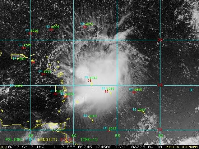
SHIPS makes it a hurricane. GFDL and HWRF make it a major hurricane. Conditions look like they will be favorable in THOSE models. The storm is holding on quite well despite the overwhelming amount of apparent dry air all around it. Look at the WV pic: http://www.ssd.noaa.gov/goes/east/tatl/wv-l.jpg
Nothing but dry air surrounding this thing. It is my guess that the intensity models are not aware of this and assume everything else to be quite ripe so up they go with intensity. Can someone post the SHIPS shear output again? Seems to me that if it were not going to survive it would have died by now. It's not moving west at 28 mph like Ana. It's not weak and half-baked like Danny, it's not Ingrid in 2007 with 750 mph winds over the top of it (joke of course). It has made it this far and is doing quite well against a pattern that is not favorable for strengthening. Get it to 70W or beyond and let's see what happens. The trend has been for this to get better organized and strengthen every day since we first started tracking it. Why would it stop now? Folks in the Bahamas had better hope those intensity models are clueless otherwise a lot of people are in for a rude awakening down the road.
Nothing but dry air surrounding this thing. It is my guess that the intensity models are not aware of this and assume everything else to be quite ripe so up they go with intensity. Can someone post the SHIPS shear output again? Seems to me that if it were not going to survive it would have died by now. It's not moving west at 28 mph like Ana. It's not weak and half-baked like Danny, it's not Ingrid in 2007 with 750 mph winds over the top of it (joke of course). It has made it this far and is doing quite well against a pattern that is not favorable for strengthening. Get it to 70W or beyond and let's see what happens. The trend has been for this to get better organized and strengthen every day since we first started tracking it. Why would it stop now? Folks in the Bahamas had better hope those intensity models are clueless otherwise a lot of people are in for a rude awakening down the road.
0 likes
Re: Re:
O Town wrote:robbielyn wrote:Derek Ortt wrote:hopefully the GFS solution and not the GFDL
what does the gfdl say intensity and track wise?
http://moe.met.fsu.edu/tcgengifs/
Make sure you pick Erika from the drop down menu and click submit.
Thanks otown. That shows up to 126 hrs do we have one going beyond that?
0 likes
Re: ATL : TROPICAL STORM ERIKA (06L)
BobHarlem wrote:xironman wrote:That little vort max shows up nicely if you animate the radar http://www.meteo.fr/temps/domtom/antilles/pack-public/animation/animMOSAIC2.html
Even easier to see it here http://flhurricane.com/imageanimator.php?69 (Longer term radar loop)
Cool loop. Definitely shows that little vort max being pulled around a larger circulation.
0 likes

Re:
hurricanetrack wrote:SHIPS makes it a hurricane. GFDL and HWRF make it a major hurricane. Conditions look like they will be favorable in THOSE models. The storm is holding on quite well despite the overwhelming amount of apparent dry air all around it. Look at the WV pic: http://www.ssd.noaa.gov/goes/east/tatl/wv-l.jpg
Nothing but dry air surrounding this thing. It is my guess that the intensity models are not aware of this and assume everything else to be quite ripe so up they go with intensity. Can someone post the SHIPS shear output again? Seems to me that if it were not going to survive it would have died by now. It's not moving west at 28 mph like Ana. It's not weak and half-baked like Danny, it's not Ingrid in 2007 with 750 mph winds over the top of it (joke of course). It has made it this far and is doing quite well against a pattern that is not favorable for strengthening. Get it to 70W or beyond and let's see what happens. The trend has been for this to get better organized and strengthen every day since we first started tracking it. Why would it stop now? Folks in the Bahamas had better hope those intensity models are clueless otherwise a lot of people are in for a rude awakening down the road.
Was watching the news last night and they were talking to Max Mayfield about "hurricane control". Max had a brilliant idea one which I support 100% - that is instead of investing all this money into controlling the weather lets redirect these funds into building better hurricane forecasting models. There is a lot of room for improvement there.
0 likes

-
OuterBanker
- S2K Supporter
- Posts: 1761
- Joined: Wed Feb 26, 2003 10:53 am
- Location: Nags Head, NC
- Contact:
Re: ATL : TROPICAL STORM ERIKA (06L)
dekeoy wrote:seems she's got our NWS office's attention to a point.
AREA FORECAST DISCUSSION
NATIONAL WEATHER SERVICE WILMINGTON NC
742 AM EDT WED SEP 2 2009
.LONG TERM /SATURDAY THROUGH TUESDAY/...
AS OF 3 AM WEDNESDAY...THE MID LEVEL FLOW REMAINS FROM THE SOUTHWEST
THROUGHOUT THE PERIOD WHICH GENERALLY MEANS A MOIST AND UNSETTLED
FLOW. HOWEVER...A SECOND ROUND OF STRONG WEDGING IS BEING
ADVERTISED BY THE GFS FOR LATE SUNDAY INTO MONDAY AS MID LEVEL
CONFLUENCE STRENGTHENS OVER THE NORTHEAST. OVERALL...HAVE TRENDED
DOWN ON THE POPS A BIT FOR SUNDAY INTO MONDAY VIA THE DRY SURFACE
HIGH BUILDING IN ONCE AGAIN...WITH NO OTHER CHANGES. TEMPERATURE
TRENDS LOOK GOOD WITH A BRIEF RETURN TO SEASONAL VALUES SATURDAY
INTO SUNDAY TRENDING DOWN ONCE AGAIN EARLY NEXT WEEK. IT APPEARS
AT THIS POINT TROPICAL STORM ERIKA...WITH HER SLOW MOVEMENT...WILL
NOT BE AN IMMEDIATE CONCERN THROUGH THIS TIME FRAME.
This a good thing, that it is of no concern through monday. But a little misleading, it means that it won't affect us through Monday.
That statement will mean that we won't have to worry about any hype keeping tourists away this weekend, also a good thing.
If the CMC comes true she will track down the center of the Bahamas and off Miami failrly strong, most others are slightly north. GFDL is still on drugs and too strong I think.
0 likes

Re: ATL : TROPICAL STORM ERIKA (06L)
Another big blowup going on a bit to the east of the progged NHC center. Should be interesting to see how big this one gets.
0 likes

Re: ATL : TROPICAL STORM ERIKA - Computer Models
9/2/09 00Z 3 model grand global ensemble (GFS, CMC, ECMWF) (NA: UKMET). With the center location in doubt, these might not be very useful this morning, but from the 00Z initialization, ensemble cluster favors a track on the S side of consensus with >50% probability of passing within 150km of Puerto Rico.

0 likes
-
lrak

- S2K Supporter
- Posts: 1770
- Age: 59
- Joined: Thu Jun 21, 2007 2:48 pm
- Location: Corpus Christi, TX
Re: ATL : TROPICAL STORM ERIKA (06L)
WOW...this baby is looking like a Jupiter storm...eek I hope a bunch of fish take cover.
WX guys and gals please stop your real jobs and stay on this forum 24/7 with an update at least every 5 minutes. I'm a fair man wouldn't you say? Just PM me for a week long supply of coffee or Red Bull which should help with the creative updates and or scenarios.
WX guys and gals please stop your real jobs and stay on this forum 24/7 with an update at least every 5 minutes. I'm a fair man wouldn't you say? Just PM me for a week long supply of coffee or Red Bull which should help with the creative updates and or scenarios.
0 likes
-
Blown Away

- S2K Supporter
- Posts: 10253
- Joined: Wed May 26, 2004 6:17 am
Re: ATL : TROPICAL STORM ERIKA - Computer Models

For now, the "All Clear For Florida" has been discontinued.
0 likes
-
Gustywind

- Category 5
- Posts: 12334
- Joined: Mon Sep 03, 2007 7:29 am
- Location: Baie-Mahault, GUADELOUPE
Re: Re:
msbee wrote:HURAKAN wrote:
Latest
yea, we already got the first light feeder band blow through here
I can see it on that image.
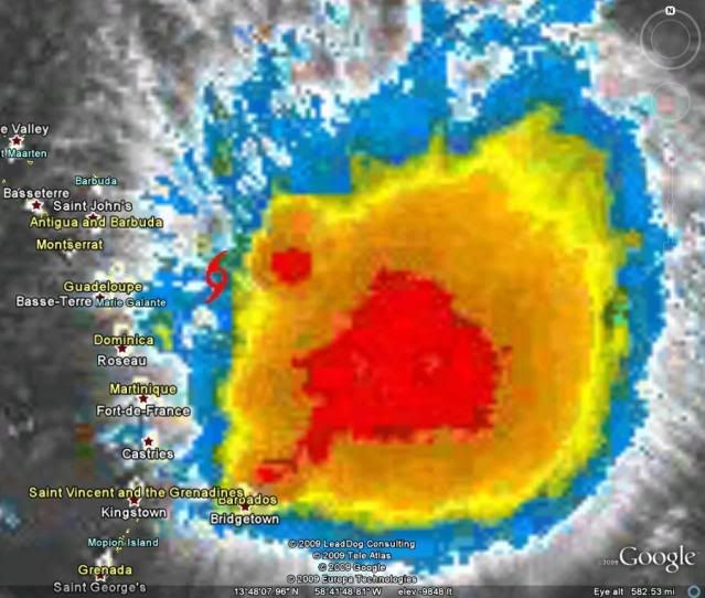
One of our member from Barbados Abajan has let this interresting observation in our thread, so i post it, it's about this Fat Lady Erika:
Things have eased up quite a bit since earlier this morning when I had to shut down my computer as a precautionary measure due to frequent (sometimes LOUD) peals of thunder. I would never have thought that a system so far to our north could have affected us this way. Normally, when storms pass that far north, the most we can expect is localized afternoon thunderstorms. Erika is a different creature altogether. Besides the sharp lightning and thunder, we got some heavy rain accompanied by pretty strong south-southwesterly wind gusts and as I drove along the streets, I noticed a few tree limbs down.
You guys further north had better buckle up for a rough ride! (Don't let Erika's weak maximum sustained winds lull fool you. She's definitely packing a punch.)
0 likes
Who is online
Users browsing this forum: No registered users and 53 guests