Ivanhater wrote:Evil Jeremy wrote:12z GFS sending Erika up FL's west coast as a closed system at 180 hours. This is after passing through the FL straits at 144 hours (http://www.nco.ncep.noaa.gov/pmb/nwprod ... n_144l.gif)
Into the gulf..looks like this recurve scenario is becoming less likely. GFS stronger on this run as well
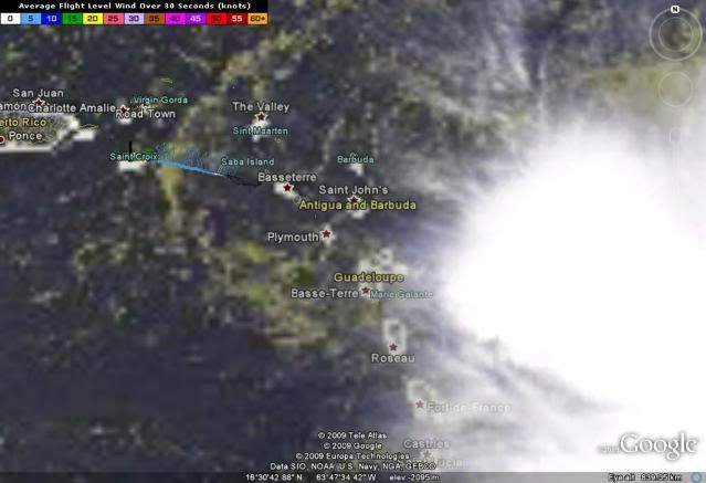
ATL : TROPICAL DEPRESSION ERIKA (06L)
Moderator: S2k Moderators
-
Stormcenter
- S2K Supporter

- Posts: 6689
- Joined: Wed Sep 03, 2003 11:27 am
- Location: Houston, TX
Re: Re:
Ivanhater remember this is the same GFS model that had a major hurricane (Bill I believe) hitting N.O. as a Cat.4-5 hurricane so I would worry too much just yet.

0 likes
-
gatorcane

- S2K Supporter
- Posts: 23708
- Age: 48
- Joined: Sun Mar 13, 2005 3:54 pm
- Location: Boca Raton, FL
Re: Re:
wxman57 wrote:CrazyC83 wrote:If it stays really weak, could it just move due west into the Caribbean Sea?
That would be its death,then. I do think that if there is still a center by Friday, then it'll pass south of PR, probably right over the DR. At that point, though, it may just be an area of thunderstorms. I did mention some pretty heavy rainfall across PR and the DR on Friday/Saturday in my forecasts. No significant wind, though. NHC will probably adjust their track another 30-50 miles left on the next advisory.
Still anything with a low-level surface feature in the Caribbean Sea in September needs watching in my book.....
Personally I'd rather it had developed and start its NW motion out to sea by now. In other words I am seeing the situation more negatively now that it is not developing meaning it can pose a threat down the road.
Last edited by gatorcane on Wed Sep 02, 2009 11:54 am, edited 1 time in total.
0 likes
-
Aric Dunn
- Category 5

- Posts: 21238
- Age: 43
- Joined: Sun Sep 19, 2004 9:58 pm
- Location: Ready for the Chase.
- Contact:
URNT15 KNHC 021648
AF309 0306A ERIKA HDOB 04 20090902
163830 1735N 06403W 4854 06154 0365 -062 +999 008006 007 999 999 05
163900 1735N 06401W 4855 06154 0365 -062 +999 008007 007 030 000 05
163930 1734N 06359W 4919 06056 0361 -060 +999 005005 007 032 000 01
164000 1734N 06357W 5109 05757 0340 -048 -048 037005 005 032 000 03
164030 1734N 06355W 5315 05437 0319 -029 -041 001007 008 032 000 03
164100 1733N 06353W 5508 05155 0111 -005 -043 352007 008 999 999 03
164130 1733N 06351W 5658 04926 0102 +013 -046 340008 009 036 000 03
164200 1732N 06349W 5806 04728 0100 +026 -046 341008 009 033 000 00
164230 1732N 06347W 5962 04498 0107 +033 -043 358007 009 030 000 00
164300 1731N 06345W 6125 04302 0132 +045 -040 025006 006 029 000 00
164330 1731N 06343W 6187 04217 0125 +050 -035 027006 007 030 000 03
164400 1730N 06341W 6193 04206 0125 +050 -030 035005 006 030 000 03
164430 1730N 06339W 6192 04210 0125 +050 -026 032004 004 030 000 03
164500 1730N 06337W 6193 04207 0124 +050 -023 029004 004 030 000 00
164530 1729N 06335W 6193 04207 0130 +050 -021 032005 005 029 000 00
164600 1729N 06333W 6192 04210 0128 +050 -020 035005 005 029 000 03
164630 1728N 06332W 6194 04209 0129 +050 -019 022005 006 028 000 03
164700 1728N 06330W 6192 04208 0129 +050 -018 023007 007 999 999 03
164730 1727N 06328W 6193 04205 0128 +050 -018 020007 008 999 999 03
164800 1727N 06326W 6191 04209 0123 +050 -018 024008 008 999 999 03
$$
;
0 likes
-
DESTRUCTION5

- Category 5
- Posts: 4430
- Age: 44
- Joined: Wed Sep 03, 2003 11:25 am
- Location: Stuart, FL
Re: Re:
wxman57 wrote:Tropics_Dude83 wrote:
So conditions are not favorable at all in the Carribbean 57? Or did you just mean that a DR ht would kill it?
We've had dry, sinking air (along with accelerating easterly low-level winds) in the Caribbean all season. Every wave moving through has lost its convection. And interacting with the DR won't help Erika. Looks like a rainmaker. However, JB is still forecasting a large and dangerous hurricane in the Bahamas late this weekend. He does have a strong east coast hurricane hit bias, though.
No Not JB
0 likes
-
cycloneye

- Admin

- Posts: 149225
- Age: 69
- Joined: Thu Oct 10, 2002 10:54 am
- Location: San Juan, Puerto Rico
Re: ATL : TROPICAL STORM ERIKA (06L)
57,the biggest threat for Puerto Rico will be the precipitation amounts that may fall here by whatever this system is.We haved many massive flooding and mudslide events in the past from strong waves moving thru the island.I am not worried about the winds.
0 likes
-
Air Force Met
- Military Met

- Posts: 4372
- Age: 57
- Joined: Tue Jul 08, 2003 9:30 am
- Location: Roan Mountain, TN
Re: Re:
wxman57 wrote: He does have a strong east coast hurricane hit bias, though.
Now THAT is about the only thing we can forecast correctly concerning Erika.
0 likes


-
wxman57

- Moderator-Pro Met

- Posts: 23171
- Age: 68
- Joined: Sat Jun 21, 2003 8:06 pm
- Location: Houston, TX (southwest)
Re: ATL : TROPICAL STORM ERIKA - Computer Models
12Z GFS actually has a weak low approaching the FL Keys then turning northward as an upper trof across the SE U.S. approaches. It has high pressure (500mb) across the Gulf, high pressure east of the Bahamas and a trof southward through Florida next Tue/Wed.
0 likes
-
gatorcane
- S2K Supporter
- Posts: 23708
- Age: 48
- Joined: Sun Mar 13, 2005 3:54 pm
- Location: Boca Raton, FL
Re: ATL : TROPICAL STORM ERIKA - Computer Models
wxman57 wrote:12Z GFS actually has a weak low approaching the FL Keys then turning northward as an upper trof across the SE U.S. approaches. It has high pressure (500mb) across the Gulf, high pressure east of the Bahamas and a trof southward through Florida next Tue/Wed.
who would have thought this could be a Florida storm at this point? Unbelievable.
Looked like a shoe-in recurve east of the Bahamas yesterday. What will be track tomorrow?
0 likes
-
Ivanhater

- Storm2k Moderator

- Posts: 11221
- Age: 39
- Joined: Fri Jul 01, 2005 8:25 am
- Location: Pensacola
Re: ATL : TROPICAL STORM ERIKA - Computer Models
gatorcane wrote:wxman57 wrote:12Z GFS actually has a weak low approaching the FL Keys then turning northward as an upper trof across the SE U.S. approaches. It has high pressure (500mb) across the Gulf, high pressure east of the Bahamas and a trof southward through Florida next Tue/Wed.
who would have thought this could be a Florida storm at this point? Unbelievable.
Looked like a shoe-in recurve east of the Bahamas yesterday. What will be track tomorrow?
Gator, there were many signs that this may not recurve east of Florida, many were pointing out that scenario, though some were not listening
0 likes
-
Air Force Met
- Military Met
- Posts: 4372
- Age: 57
- Joined: Tue Jul 08, 2003 9:30 am
- Location: Roan Mountain, TN
Re: ATL : TROPICAL STORM ERIKA (06L)
Undercutting shear looks to be getting stronger. Some of the tops to the rainshowers near Guadeloupe are getting blown pretty quickly off to the ENE.
0 likes
-
southerngale

- Retired Staff

- Posts: 27418
- Joined: Thu Oct 10, 2002 1:27 am
- Location: Southeast Texas (Beaumont area)
Looks like an outflow boundary too - all of the above makes for a weakening system:
http://www.ssd.noaa.gov/goes/flt/t2/vis-l.jpg
http://www.ssd.noaa.gov/goes/flt/t2/vis-l.jpg
0 likes
-
HURRICANELONNY
- Category 5
- Posts: 1390
- Joined: Wed May 07, 2003 6:48 am
- Location: HOLLYWOOD.FL
Re: ATL : TROPICAL STORM ERIKA (06L)
So let me get this straight. As per NHC discussion. Most of the Global models show increasing shear. but take it to Hurricane strength. NHC of course doesn't agree with a Hurricane and says Erika could dissapate. Which will be right. The shear or a Hurricane????
0 likes
-
Ivanhater
- Storm2k Moderator
- Posts: 11221
- Age: 39
- Joined: Fri Jul 01, 2005 8:25 am
- Location: Pensacola
Re:
Frank2 wrote:Looks like an outflow boundary too - all of the above makes for a weakening system:
http://www.ssd.noaa.gov/goes/flt/t2/vis-l.jpg
Yesterday when someone said she spat out 4 outflow boundaries, she exploded. Let's just watch
0 likes
-
Bocadude85

- Category 5
- Posts: 2991
- Age: 39
- Joined: Mon Apr 18, 2005 2:20 pm
- Location: Honolulu,Hi
Re: ATL : TROPICAL STORM ERIKA - Computer Models
Yup Ivanhater has been talking about the building ridge of the SE Coast for awhile now...
0 likes
-
Dave

- Retired Staff
- Posts: 13442
- Age: 75
- Joined: Tue Aug 01, 2006 3:57 pm
- Location: Milan Indiana
- Contact:
000
URNT15 KNHC 021658
AF309 0306A ERIKA HDOB 05 20090902
164830 1727N 06324W 6193 04204 0124 +050 -018 033009 009 999 999 03
164900 1726N 06322W 6195 04204 0125 +049 -018 032009 010 999 999 03
164930 1726N 06320W 6193 04205 0127 +050 -018 040010 010 999 999 03
165000 1725N 06318W 6193 04209 0125 +050 -019 048010 010 031 000 03
165030 1725N 06317W 6192 04205 0128 +050 -019 046011 011 032 000 03
165100 1725N 06315W 6192 04213 0127 +050 -020 045010 011 029 000 03
165130 1724N 06313W 6195 04208 0122 +051 -020 050010 011 029 000 00
165200 1724N 06311W 6193 04207 0119 +055 -021 049011 012 028 000 00
165230 1723N 06309W 6192 04206 0120 +055 -021 047012 012 031 000 03
165300 1723N 06307W 6193 04213 0121 +055 -021 054012 013 030 000 03
165330 1722N 06305W 6193 04211 0118 +055 -021 052012 012 030 000 03
165400 1722N 06304W 6193 04209 0114 +055 -021 049010 010 032 000 00
165430 1722N 06302W 6193 04205 0110 +057 -021 044010 011 031 000 00
165500 1721N 06300W 6192 04207 0117 +055 -021 058010 011 026 001 03
165530 1722N 06258W 6196 04204 0112 +055 -020 062011 011 032 000 00
165600 1723N 06256W 6234 04154 0122 +056 -019 064008 010 032 000 00
165630 1723N 06255W 6466 03856 0137 +065 -012 092005 006 033 000 00
165700 1724N 06253W 6659 03607 0123 +087 -007 059009 011 035 000 03
165730 1725N 06251W 6846 03372 0110 +108 -002 048013 015 999 999 03
165800 1726N 06249W 7041 03134 0109 +120 +005 048016 017 999 999 03
$$
;
0 likes
-
tolakram
- Admin
- Posts: 20176
- Age: 62
- Joined: Sun Aug 27, 2006 8:23 pm
- Location: Florence, KY (name is Mark)
Re: ATL : TROPICAL STORM ERIKA (06L)
I would term this violently disorganized!
Loop: http://rammb.cira.colostate.edu/product ... 012015.GIF

Loop: http://rammb.cira.colostate.edu/product ... 012015.GIF
0 likes
Who is online
Users browsing this forum: No registered users and 145 guests