ATL : TROPICAL DEPRESSION ERIKA (06L)

Moderator: S2k Moderators

Message
Author
User avatar
vbhoutex
Storm2k Executive
Storm2k Executive
Posts: 29113
Age: 73
Joined: Wed Oct 09, 2002 11:31 pm
Location: Cypress, TX
Contact:

Re: Re:

#3521 Postby vbhoutex » Wed Sep 02, 2009 5:30 pm

fci wrote:
Stormcenter wrote:I just got back from a long meeting and read the NHC discussion. I wouldn't bet too much on Erika doing too much more (as things look now) then a heavy rain maker. I cannot ever recall reading such a doom and gloom discussion from the NHC concerning any named tropical system. Erika like it's siblings is fighting a losing battle with shear. I personally cannot see any reason to argue any of their (NHC) points. This of course is just my opinion based on how things stand currently. By the way yes I do know that even a TS can cause death and destruction so I'm not down playing her potential.


Thank you.

You put it clearly and hope many read it.

The NHC rarely forecasts the demise of a system like this.
One that is racing out into the North Atlantic, yeah.
But not one in the tropics like this, in September; at the height of the season (I know 9/10 is statistically the "height" of the season).
So, Erika looks like toast as it relates to being a destructive wind storm.

But, as stormcenter put it, this is not to minimize the destruction that a rainmaker can be on The Islands.
This has the potential to be severe for the rain aspect as opposed to the wind of a hurricane.
Like Luis has said, waves and disturbed areas can be horrific for the islands for the flooding, mudslides and misery they can cause.

Good luck to our friends in The Islands.
For those here in Florida and GOM'ers, yes; this could be a problem down the road and, yes; there have been systems that have done so in the past; BUT; if this goes as the NHC predicts and is a remnant low in 5 days; you should direct your interests elsewhere.

Just my $.02

First of all I am hoping for pure and complete poofication of Erika. That is what our friends in the Islands need right now. However, I am realistic enough to watch Erika until there isn't even enough energy left to light up the letter r in remnant low. IF Erika or her remains make it to the GOM it is still expected to be a harsh environment and I hope it stays that way. We are enjoying very pleasant almost fall like weather here in Houston and even though that doesn't stop TC's from forming it usually makes it a lot harder for one to get to us, Ike notwithstanding(we hadn't had any weather even near this last year when Ike visited). IOW, someone please take away all of Erika's energy so we don't have to deal with this down the road-preferably take it away right now.
0 likes   

User avatar
Dave
Retired Staff
Retired Staff
Posts: 13442
Age: 74
Joined: Tue Aug 01, 2006 3:57 pm
Location: Milan Indiana
Contact:

#3522 Postby Dave » Wed Sep 02, 2009 5:32 pm

Image
0 likes   

User avatar
Evil Jeremy
S2K Supporter
S2K Supporter
Posts: 5463
Age: 32
Joined: Mon Apr 10, 2006 2:10 pm
Location: Los Angeles, CA

Re: ATL : TROPICAL STORM ERIKA - Computer Models

#3523 Postby Evil Jeremy » Wed Sep 02, 2009 5:34 pm

Bocadude85 wrote:18z GFS wave makes landfall in S Fl in 6days

http://www.nco.ncep.noaa.gov/pmb/nwprod/analysis/namer/gfs/18/images/gfs_ten_132l.gif


It actually seems to meander in the FL straits going nowhere for 24 hours from 126 hours (http://www.nco.ncep.noaa.gov/pmb/nwprod ... n_126l.gif) to 144 hours (http://www.nco.ncep.noaa.gov/pmb/nwprod ... n_144l.gif)
0 likes   

User avatar
knotimpaired
Category 1
Category 1
Posts: 495
Joined: Fri May 20, 2005 4:14 am
Location: Vieques, PR
Contact:

Re: ATL : TROPICAL STORM ERIKA - Computer Models

#3524 Postby knotimpaired » Wed Sep 02, 2009 5:35 pm

Just in from Coast Guard San Juan Sector

Captain of the Port sets Port Condition YANKEE for the U.S. Virgin Islands
“Tropical Storm Erika Update 2"

SAN JUAN, Puerto Rico – The Coast Guard Sector San Juan Captain of the Port, Capt. Eduardo Pino, set Port Condition YANKEE Wednesday at 6p.m. for all the ports in Saint Croix and at 8p.m. for all the ports in Saint John and Saint Thomas, U.S. Virgin Islands due to the expectation that gale force winds generated by Tropical Storm Erika will arrive within 24 hours.
Ferry operations in the U.S. Virgin Islands are allowed during Port Condition YANKEE.

The ports in Puerto Rico remain at Port Condition X-RAY subject to changes in Erika's storm track or strength.

"WARNING"
During Port Condition YANKEE all ports are closed to inbound vessel traffic greater than 200 Gross Tons. All vessels greater than 200 gross tons without permission to remain in port should have departed or be prepared to depart prior to the setting of Port Condition ZULU.
During Port Condition X-RAY waterfront facilities should be removing potential flying debris, hazardous materials and pollutants from dockside areas. All oceangoing commercial vessels greater than 200 gross tons must prepare to depart the port and shall depart immediately upon setting and increasing port conditions to YANKEE. Vessels unable to depart the port must contact the Captain of the Port and submit a safe mooring plan in writing when requesting and prior to receiving permission to remain in port. Inbound vessels that will be unable to depart the port upon the setting of port condition YANKEE are advised to seek an alternate destination.
0 likes   

User avatar
Dave
Retired Staff
Retired Staff
Posts: 13442
Age: 74
Joined: Tue Aug 01, 2006 3:57 pm
Location: Milan Indiana
Contact:

#3525 Postby Dave » Wed Sep 02, 2009 5:40 pm

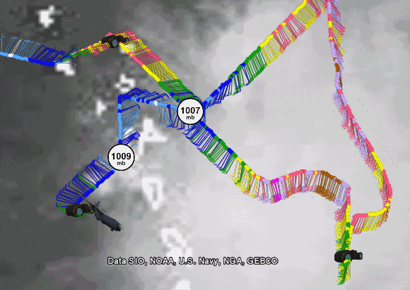
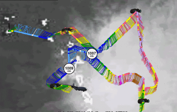
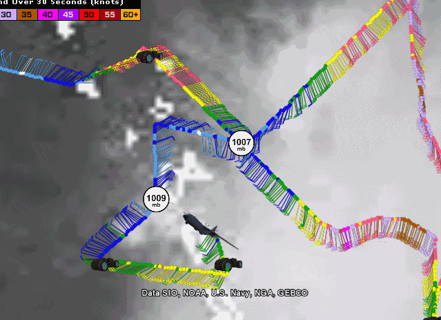
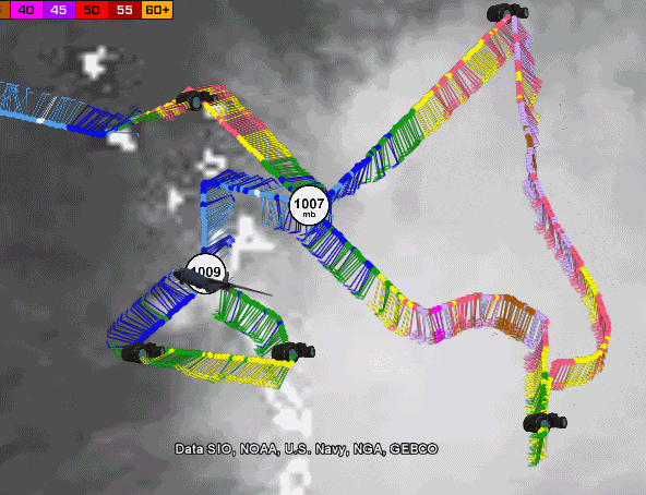
URNT15 KNHC 022238
AF309 0306A ERIKA HDOB 39 20090902
222830 1509N 06137W 8432 01584 0100 +187 +154 216019 020 024 000 00
222900 1509N 06135W 8428 01583 0101 +185 +155 217022 022 025 000 03
222930 1509N 06133W 8430 01580 0106 +175 +157 222022 022 023 000 03
223000 1509N 06132W 8432 01579 0107 +175 +158 225021 022 023 000 03
223030 1509N 06130W 8430 01582 0106 +174 +158 228021 022 027 000 00
223100 1508N 06128W 8443 01566 0109 +167 +159 229015 016 032 002 00
223130 1508N 06126W 8429 01582 0109 +168 +157 222020 022 034 005 00
223200 1508N 06124W 8426 01585 0110 +168 +154 225022 022 029 000 00
223230 1508N 06123W 8433 01577 0108 +175 +151 228020 020 027 000 00
223300 1508N 06121W 8428 01583 0109 +171 +149 223021 021 027 000 03
223330 1507N 06119W 8430 01581 0111 +170 +149 223022 023 027 001 00
223400 1507N 06117W 8429 01581 0110 +170 +150 226023 023 027 004 00
223430 1507N 06115W 8433 01580 0109 +170 +150 226022 022 027 003 00
223500 1507N 06114W 8428 01583 0108 +175 +150 226021 022 026 004 00
223530 1507N 06112W 8429 01581 0109 +172 +150 226023 024 025 002 00
223600 1506N 06110W 8430 01582 0110 +170 +151 223024 024 022 002 00
223630 1506N 06108W 8429 01584 0111 +170 +152 222023 023 021 003 00
223700 1506N 06106W 8432 01584 0113 +169 +152 222022 022 023 003 03
223730 1506N 06105W 8430 01581 0110 +170 +152 226021 021 024 001 00
223800 1505N 06103W 8432 01583 0113 +171 +152 221021 022 021 002 00
$$
;
0 likes   

User avatar
AdamFirst
S2K Supporter
S2K Supporter
Posts: 2491
Age: 36
Joined: Thu Aug 14, 2008 10:54 am
Location: Port Saint Lucie, FL

#3526 Postby AdamFirst » Wed Sep 02, 2009 5:42 pm

One of my local TV mets has given the proverbial "all-clear"...said Erika is nothing to worry about.
0 likes   

User avatar
Dave
Retired Staff
Retired Staff
Posts: 13442
Age: 74
Joined: Tue Aug 01, 2006 3:57 pm
Location: Milan Indiana
Contact:

#3527 Postby Dave » Wed Sep 02, 2009 5:42 pm

Image
0 likes   

User avatar
Dave
Retired Staff
Retired Staff
Posts: 13442
Age: 74
Joined: Tue Aug 01, 2006 3:57 pm
Location: Milan Indiana
Contact:

#3528 Postby Dave » Wed Sep 02, 2009 5:50 pm

URNT15 KNHC 022248
AF309 0306A ERIKA HDOB 40 20090902
223830 1506N 06101W 8425 01598 0122 +167 +153 213021 021 999 999 03
223900 1507N 06101W 8432 01582 0117 +166 +154 205019 020 015 003 03
223930 1509N 06101W 8425 01589 0115 +166 +154 208019 019 025 000 00
224000 1511N 06102W 8430 01585 0115 +167 +153 209019 020 024 001 00
224030 1512N 06103W 8431 01582 0114 +166 +153 212020 020 025 002 00
224100 1514N 06103W 8429 01586 0113 +170 +152 215019 019 026 001 00
224130 1516N 06104W 8430 01584 0114 +165 +152 214019 020 024 003 00
224200 1517N 06104W 8429 01582 0112 +168 +152 213020 021 025 002 00
224230 1519N 06105W 8425 01585 0116 +159 +151 208018 019 024 004 00
224300 1521N 06105W 8432 01577 0116 +159 +149 230016 017 027 006 00
224330 1522N 06106W 8429 01580 0111 +169 +146 233016 018 024 004 00
224400 1524N 06106W 8434 01579 0110 +173 +145 226018 018 027 001 00
224430 1525N 06107W 8429 01585 0109 +175 +144 220018 018 024 002 00
224500 1527N 06107W 8429 01584 0108 +176 +145 217017 018 023 002 00
224530 1529N 06108W 8432 01582 0112 +170 +148 215014 015 012 003 00
224600 1530N 06108W 8428 01583 0108 +175 +149 207017 017 012 002 00
224630 1532N 06109W 8433 01580 0107 +177 +149 213017 018 999 999 03
224700 1533N 06111W 8429 01578 0102 +179 +150 210015 016 014 000 03
224730 1534N 06112W 8429 01578 0101 +179 +152 215017 017 007 001 00
224800 1535N 06113W 8426 01584 0103 +179 +153 215017 018 008 001 00
$$
;
0 likes   

User avatar
cinlfla
Category 2
Category 2
Posts: 687
Joined: Mon Aug 16, 2004 7:16 pm
Location: Titusville, Florida on the Spacecoast

Re: ATL : TROPICAL STORM ERIKA (06L)

#3529 Postby cinlfla » Wed Sep 02, 2009 5:50 pm

I heard the same thing, I think they are saying this because if she does pull herself together she may take a more southern route and then there won't be much left of her if anything at all.
0 likes   

Aric Dunn
Category 5
Category 5
Posts: 21238
Age: 42
Joined: Sun Sep 19, 2004 9:58 pm
Location: Ready for the Chase.
Contact:

Re: ATL : TROPICAL STORM ERIKA (06L)

#3530 Postby Aric Dunn » Wed Sep 02, 2009 5:52 pm

well... recon found no circ near the previous vortex..
but the last vortex was the circ near Guadalupe

Image
0 likes   

User avatar
gatorcane
S2K Supporter
S2K Supporter
Posts: 23691
Age: 47
Joined: Sun Mar 13, 2005 3:54 pm
Location: Boca Raton, FL

Re: ATL : TROPICAL STORM ERIKA (06L)

#3531 Postby gatorcane » Wed Sep 02, 2009 5:52 pm

SouthFLTropics wrote:I wouldn't right off Erika just yet...If the shear and the islands do get her then so be it...but she has a lot of convection to work with and if her LLC keeps shifting around she may just hang on. Furthermore I remember another system a couple of years ago that looked terrible until it got into the Bahamas...We all know what happened then...Hopefully the shear will stay strong along the entire route...

SFT


Considering it September and where it is now headed, you bet I wouldn't write this off. I really hoped it had bombed out and turned NNW away from the islands and CONUS already....oh well. Now more watching and hoping it doesn't have a window of opportunity upstream. I will be watching.
0 likes   

User avatar
Dave
Retired Staff
Retired Staff
Posts: 13442
Age: 74
Joined: Tue Aug 01, 2006 3:57 pm
Location: Milan Indiana
Contact:

#3532 Postby Dave » Wed Sep 02, 2009 5:53 pm

Image
0 likes   

User avatar
ronjon
Category 5
Category 5
Posts: 4822
Joined: Fri Aug 19, 2005 5:17 pm
Location: Hernando Beach, FL

Re: ATL : TROPICAL STORM ERIKA (06L)

#3533 Postby ronjon » Wed Sep 02, 2009 5:56 pm

Here's my take on Erika today - the LLC decoupled from the MLC and raced west out of the main convection while the MLC was left behind and can currently be seen migrating off to the north to the NE of the main convection. This was due to some zonal SW shear at 300-500 mb. At present, the LLC has slowed to near stationary position while the convection is now firing on its SE side while the main body of convection is being pulled west toward the LLC. Shear now looks to have died down which will probably allow Erika to intensify and rebuild her structure overnight - in fact there may be a period of deepening over the next 24-36 hrs, depending on the forward speed of the LLC.

Zonal shear is forecast to be high over Hispanola by the ECM in the 72-120 hr period which the NHC is betting on ripping Erika apart. However, if a LLC can remain intact, conditions are forecast to improve dramtically in the SE bahamas and FL straits in 5 days so we may have to watch for regeneration at that point.

http://www.ssd.noaa.gov/goes/flt/t2/sloop-vis.html
Last edited by ronjon on Wed Sep 02, 2009 6:02 pm, edited 1 time in total.
0 likes   

SapphireSea
Category 1
Category 1
Posts: 430
Joined: Wed Aug 24, 2005 12:13 pm
Location: Miami, FL

Re: ATL : TROPICAL STORM ERIKA (06L)

#3534 Postby SapphireSea » Wed Sep 02, 2009 5:58 pm

gatorcane wrote:
SouthFLTropics wrote:I wouldn't right off Erika just yet...If the shear and the islands do get her then so be it...but she has a lot of convection to work with and if her LLC keeps shifting around she may just hang on. Furthermore I remember another system a couple of years ago that looked terrible until it got into the Bahamas...We all know what happened then...Hopefully the shear will stay strong along the entire route...

SFT


Considering it September and where it is now headed, you bet I wouldn't write this off. I really hoped it had bombed out and turned NNW away from the islands and CONUS already....oh well. Now more watching and hoping it doesn't have a window of opportunity upstream. I will be watching.


I don't think its going to have much oppourtunity upstream. If it stays weak and disorganized it should continue west with the current low level flow. Infact it may be strong enough to unfortunately cause problems in DR/Haiti with rainfall, but that should finish the job at killing this. The Carrib looks just as hostile as it is in right now, if not more. There could be development in the West Carrib, which is actually a good climo spot too normally, but by then Mexico is in the way, and the gulf is very hostile, and doesn't look like it will change. I believe most of the pain and suffering will be from the rain this produces, which is #2 IMO in killing/deadliness next to surge in Tropical Cyclones.
0 likes   

User avatar
Dave
Retired Staff
Retired Staff
Posts: 13442
Age: 74
Joined: Tue Aug 01, 2006 3:57 pm
Location: Milan Indiana
Contact:

#3535 Postby Dave » Wed Sep 02, 2009 6:00 pm

URNT15 KNHC 022258
AF309 0306A ERIKA HDOB 41 20090902
224830 1536N 06115W 8429 01580 0105 +178 +153 215018 018 017 000 00
224900 1536N 06116W 8429 01583 0103 +181 +154 219012 015 017 000 00
224930 1537N 06118W 8427 01583 0100 +185 +155 220015 017 016 001 00
225000 1538N 06119W 8428 01581 0101 +181 +156 220019 020 009 001 00
225030 1539N 06121W 8429 01576 0096 +185 +157 217017 018 014 000 00
225100 1540N 06122W 8438 01569 0097 +185 +158 222017 017 012 001 00
225130 1541N 06124W 8428 01580 0102 +177 +159 216016 017 007 002 00
225200 1541N 06125W 8429 01582 0106 +175 +159 210016 016 012 001 00
225230 1542N 06127W 8435 01574 0111 +170 +159 212016 017 016 002 00
225300 1543N 06128W 8431 01582 0109 +171 +159 207017 019 018 002 00
225330 1544N 06129W 8428 01582 0106 +175 +159 205017 018 022 004 00
225400 1545N 06131W 8422 01587 0111 +166 +158 190018 020 025 005 00
225430 1546N 06132W 8422 01591 0108 +172 +156 198014 016 029 008 00
225500 1546N 06134W 8429 01580 0103 +182 +153 204016 017 021 002 00
225530 1547N 06135W 8430 01583 0105 +179 +151 204017 017 020 003 00
225600 1548N 06137W 8428 01583 0106 +177 +152 199017 017 021 001 00
225630 1549N 06138W 8436 01576 0099 +186 +153 197017 017 021 001 00
225700 1550N 06140W 8429 01582 0098 +188 +155 188018 019 017 003 00
225730 1551N 06141W 8429 01580 0099 +185 +156 186018 019 021 000 00
225800 1552N 06143W 8425 01585 0102 +181 +158 185016 018 020 002 00
$$
;
0 likes   

User avatar
lrak
S2K Supporter
S2K Supporter
Posts: 1770
Age: 58
Joined: Thu Jun 21, 2007 2:48 pm
Location: Corpus Christi, TX

Re: ATL : TROPICAL STORM ERIKA (06L)

#3536 Postby lrak » Wed Sep 02, 2009 6:02 pm

GOM, WTH are you guys talking about? I thought this was Florida or East Coast event if anything at all. Mexico? :double:

I saw a few days ago the LBAR having this thing cruise towards MEX but someone said the LBAR is on crack.
0 likes   

User avatar
storms NC
Tropical Storm
Tropical Storm
Posts: 247
Age: 69
Joined: Tue Sep 14, 2004 2:41 pm
Location: Coast of NC & southwest coast of Fla

#3537 Postby storms NC » Wed Sep 02, 2009 6:06 pm

Mr Skip Water just said that it wouldn't make it after it goes over the Mt's of the Island. That is would dissipate after that nothing to track. That was a bold statement if you ask me. But it is so the People will go to the beach's. A big weekend for them. They have lost money on the last few weekends. first Bill then Danny.
0 likes   

SapphireSea
Category 1
Category 1
Posts: 430
Joined: Wed Aug 24, 2005 12:13 pm
Location: Miami, FL

Re: ATL : TROPICAL STORM ERIKA (06L)

#3538 Postby SapphireSea » Wed Sep 02, 2009 6:07 pm

lrak wrote:GOM, WTH are you guys talking about? I thought this was Florida or East Coast event if anything at all. Mexico? :double:

I saw a few days ago the LBAR having this thing cruise towards MEX but someone said the LBAR is on crack.


Everyone was basing their forcasts on a strengthening Erika. Some more modest than others, also the other models who kept Erika or devolved into an open wave still had some troughiness in the short term and I believed moved it too far N too fast. The LBAR also did move it fairly far N then dived back SW, likely wouldve been wrong had we seen a Cat 1 Erika.

Also to add; This system has not kept a 100% verifiable LLC. The NHC has strongly adjusted the LLC position various times thanks to recon. This thing's disorganization is a nightmare for forcasting and modeling.
Last edited by SapphireSea on Wed Sep 02, 2009 6:10 pm, edited 1 time in total.
0 likes   

User avatar
Dave
Retired Staff
Retired Staff
Posts: 13442
Age: 74
Joined: Tue Aug 01, 2006 3:57 pm
Location: Milan Indiana
Contact:

#3539 Postby Dave » Wed Sep 02, 2009 6:07 pm

Image
0 likes   

HURRICANELONNY
Category 5
Category 5
Posts: 1383
Joined: Wed May 07, 2003 6:48 am
Location: HOLLYWOOD.FL

Re: ATL : TROPICAL STORM ERIKA (06L)

#3540 Postby HURRICANELONNY » Wed Sep 02, 2009 6:08 pm

Here's is my take. It's a big thunderstorm. Probably all it will be. I'll eat crow but I'm already looking out east at the waves ready to exit. Erika to me is old news. :oops:
0 likes   


Return to “2009”

Who is online

Users browsing this forum: No registered users and 7 guests