WPAC : TROPICAL DEPRESSION MIRINAE (23W)

Moderator: S2k Moderators

Message
Author
User avatar
metenthusiast
Category 1
Category 1
Posts: 271
Age: 48
Joined: Sun Oct 18, 2009 1:09 am
Location: Manila, Phllippines
Contact:

Re: WPAC : TROPICAL DEPRESSION (TS 23W)

#381 Postby metenthusiast » Tue Oct 27, 2009 3:37 am

cebuboy wrote:
metenthusiast wrote:It's already 4:30 PM here in Manila but it's still stifling hot and the sun's beating down like it's the middle of March. If I were not here discussing this weather system with you guys, I wouldn't have a clue to the surprise coming on my way this weekend... :roll:


Agree, I also watch TV channels coming from Manila, seems to have guys are having a lot of fun (wowowie) and other entertainment channels. I think there is something Manila and Luzon guys to spend time with in the coming days instead of having a Halloween Party :(

Glad Cebu is always hot as it always been. Thank you my God.


Me, I'm just thankful I caught interest in these tropical cyclones and found out about this site when I did. I've never been much of a TV or leisure person and is more inclined to be on things I could glean knowledge and learn something useful.

You'll never know when it would come handy... 8-)
0 likes   

User avatar
ManilaTC
WesternPacificWeather.com
Posts: 593
Age: 47
Joined: Mon Oct 26, 2009 5:13 am
Location: Mandaluyong City, Philippines
Contact:

Re: WPAC : TROPICAL DEPRESSION (TS 23W)

#382 Postby ManilaTC » Tue Oct 27, 2009 3:39 am

AT 300 PM CHST...0500Z...THE CENTER OF TROPICAL STORM 23W WAS
LOCATED BY DOPPLER RADAR NEAR LATITUDE 15.0 DEGREES NORTH AND
LONGITUDE 143.9 DEGREES EAST AT AN ELEVATION OF 13300 FEET.


AT 400 PM CHST...0600Z...THE POORLY DEFINED CENTER OF TROPICAL STORM
23W WAS LOCATED BY DOPPLER RADAR NEAR LATITUDE 15.0 DEGREES NORTH
AND LONGITUDE 143.8 DEGREES EAST AT AN ELEVATION OF 13900 FEET.


AT 600 PM CHST...0800Z...THE POORLY DEFINED CENTER OF TROPICAL STORM
23W WAS LOCATED BY DOPPLER RADAR NEAR LATITUDE 15.0 DEGREES NORTH
AND LONGITUDE 143.3 DEGREES EAST AT AN ELEVATION OF 17800 FEET.

- if this is not west then what is?
0 likes   
The above post is NOT official and should not be used as such. It is my opinion and may or may not be backed by sound meteorological data. It is not endorsed by any professional institution or storm2k.org. Please refer to your official national weather agency.

WEB http://goo.gl/JDiKXB | FB https://goo.gl/N5sIle | @ManilaTC

oaba09
S2K Supporter
S2K Supporter
Posts: 1496
Age: 38
Joined: Thu Oct 01, 2009 10:02 am
Location: Valenzuela, Philippines
Contact:

Re: WPAC : TROPICAL DEPRESSION (TS 23W)

#383 Postby oaba09 » Tue Oct 27, 2009 3:41 am

ClarkEligue wrote:AT 300 PM CHST...0500Z...THE CENTER OF TROPICAL STORM 23W WAS
LOCATED BY DOPPLER RADAR NEAR LATITUDE 15.0 DEGREES NORTH AND
LONGITUDE 143.9 DEGREES EAST AT AN ELEVATION OF 13300 FEET.


AT 400 PM CHST...0600Z...THE POORLY DEFINED CENTER OF TROPICAL STORM
23W WAS LOCATED BY DOPPLER RADAR NEAR LATITUDE 15.0 DEGREES NORTH
AND LONGITUDE 143.8 DEGREES EAST AT AN ELEVATION OF 13900 FEET.


AT 600 PM CHST...0800Z...THE POORLY DEFINED CENTER OF TROPICAL STORM
23W WAS LOCATED BY DOPPLER RADAR NEAR LATITUDE 15.0 DEGREES NORTH
AND LONGITUDE 143.3 DEGREES EAST AT AN ELEVATION OF 17800 FEET.

- if this is not west then what is?


Yup...

As I said....it's moving more west than wsw..........It's currently below the forecast track......JMA also has it currently moving west.....
0 likes   

User avatar
metenthusiast
Category 1
Category 1
Posts: 271
Age: 48
Joined: Sun Oct 18, 2009 1:09 am
Location: Manila, Phllippines
Contact:

Re: WPAC : TROPICAL DEPRESSION (TS 23W)

#384 Postby metenthusiast » Tue Oct 27, 2009 3:41 am

cebuboy wrote:
drdavisjr wrote:
metenthusiast wrote:It's already 4:30 PM here in Manila but it's still stifling hot and the sun's beating down like it's the middle of March. If I were not here discussing this weather system with you guys, I wouldn't have a clue to the surprise coming on my way this weekend... :roll:


Yes, PAGASA said this morning that the affected areas would be Eastern Visayas, Samar and Leyte.


This is just confusing, it against the consensus. The track to the storm will pass Luzon. Why they say the Visayas are affected?


Huh? I don't get that either. If the forecast models pushes through, the shores of the Bicol region and Quezon would seem more probable before making its westward march.
0 likes   

User avatar
metenthusiast
Category 1
Category 1
Posts: 271
Age: 48
Joined: Sun Oct 18, 2009 1:09 am
Location: Manila, Phllippines
Contact:

Re: WPAC : TROPICAL DEPRESSION (TS 23W)

#385 Postby metenthusiast » Tue Oct 27, 2009 3:42 am

Image

DVORAK imagery
0 likes   

User avatar
metenthusiast
Category 1
Category 1
Posts: 271
Age: 48
Joined: Sun Oct 18, 2009 1:09 am
Location: Manila, Phllippines
Contact:

Re: WPAC : TROPICAL DEPRESSION (TS 23W)

#386 Postby metenthusiast » Tue Oct 27, 2009 3:44 am

This is from typhoon2000:

+ Forecast Outlook: 23W is expected to continue tracking WNW within the next 1-2 days. It will reach Typhoon intensity tomorrow evening. The 2 to 5-day Long-Range Forecast shows the system entering the Philippine Area of Responsibility (PAR) on a Westerly track on Thursday morning Oct 29...will be approaching the eastern coast of Luzon on Saturday morning, Oct 31 as a Category 4 Typhoon (215 kph) more or less 200 km. North of Camarines Sur...making landfall near Baler, Aurora on Saturday evening - crossing Central Luzon via Nueva Ecija, Tarlac, Pampanga and Zambales during the night. It will exit the South China Sea on All Saint's Day, November 01. *Alternate Forecast Scenario (AFS): The latest ECMWF Extended Forecast issued at 8PM last night, showed the system passing very close to Camarines Norte, passing over Polillo Island and traversing Northern Quezon, Rizal and Metro Manila beginning Saturday evening until Sunday morning (Oct 30-Nov 01). This AFS track may happen if the High Pressure Steering Ridge off SE China and Taiwan strengthens more. Please be reminded that the Forecast Outlook changes every 6 hours, so a turn to the left or right of its future track and other conditions must be considered.
0 likes   

User avatar
metenthusiast
Category 1
Category 1
Posts: 271
Age: 48
Joined: Sun Oct 18, 2009 1:09 am
Location: Manila, Phllippines
Contact:

Re: WPAC : TROPICAL DEPRESSION (TS 23W)

#387 Postby metenthusiast » Tue Oct 27, 2009 4:01 am

I know you guys remember STY Angela (Rosing) that hit Luzon November 1995

Image
Image
Image
0 likes   

User avatar
drdavisjr
Category 1
Category 1
Posts: 428
Age: 57
Joined: Mon Oct 12, 2009 7:07 am
Location: Marilao, Bulacan, Philippines
Contact:

#388 Postby drdavisjr » Tue Oct 27, 2009 4:02 am

0 likes   

User avatar
metenthusiast
Category 1
Category 1
Posts: 271
Age: 48
Joined: Sun Oct 18, 2009 1:09 am
Location: Manila, Phllippines
Contact:

Re: WPAC : TROPICAL DEPRESSION (TS 23W)

#389 Postby metenthusiast » Tue Oct 27, 2009 4:07 am

Latest from jtwc. Track is higher than the one issued at 00z. Path is now at central luzon (nueva ecija, pangasinan, zambales region)

Image
Last edited by metenthusiast on Tue Oct 27, 2009 4:10 am, edited 1 time in total.
0 likes   

User avatar
drdavisjr
Category 1
Category 1
Posts: 428
Age: 57
Joined: Mon Oct 12, 2009 7:07 am
Location: Marilao, Bulacan, Philippines
Contact:

#390 Postby drdavisjr » Tue Oct 27, 2009 4:08 am

I removed latest JTWC Track...already posted.
Last edited by drdavisjr on Tue Oct 27, 2009 4:11 am, edited 1 time in total.
0 likes   

oaba09
S2K Supporter
S2K Supporter
Posts: 1496
Age: 38
Joined: Thu Oct 01, 2009 10:02 am
Location: Valenzuela, Philippines
Contact:

Re: WPAC : TROPICAL DEPRESSION (TS 23W)

#391 Postby oaba09 » Tue Oct 27, 2009 4:09 am

Image

WTPN32 PGTW 270900
MSGID/GENADMIN/NAVMARFCSTCEN PEARL HARBOR HI/JTWC//
SUBJ/TROPICAL CYCLONE WARNING//
RMKS/
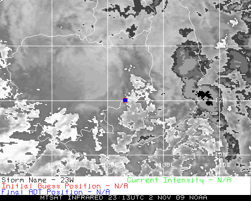
1. TROPICAL STORM 23W (TWENTYTHREE) WARNING NR 006
01 ACTIVE TROPICAL CYCLONE IN NORTHWESTPAC
MAX SUSTAINED WINDS BASED ON ONE-MINUTE AVERAGE
WIND RADII VALID OVER OPEN WATER ONLY
---
WARNING POSITION:
270600Z --- NEAR 14.8N 143.7E
MOVEMENT PAST SIX HOURS - 295 DEGREES AT 18 KTS
POSITION ACCURATE TO WITHIN 060 NM
POSITION BASED ON CENTER LOCATED BY SATELLITE
PRESENT WIND DISTRIBUTION:
MAX SUSTAINED WINDS - 040 KT, GUSTS 050 KT
WIND RADII VALID OVER OPEN WATER ONLY
RADIUS OF 034 KT WINDS - 035 NM NORTHEAST QUADRANT
040 NM SOUTHEAST QUADRANT
045 NM SOUTHWEST QUADRANT
045 NM NORTHWEST QUADRANT
REPEAT POSIT: 14.8N 143.7E
---
FORECASTS:
12 HRS, VALID AT:
271800Z --- 15.6N 140.8E
MAX SUSTAINED WINDS - 050 KT, GUSTS 065 KT
WIND RADII VALID OVER OPEN WATER ONLY
RADIUS OF 034 KT WINDS - 075 NM NORTHEAST QUADRANT
075 NM SOUTHEAST QUADRANT
080 NM SOUTHWEST QUADRANT
085 NM NORTHWEST QUADRANT
VECTOR TO 24 HR POSIT: 285 DEG/ 14 KTS
---
24 HRS, VALID AT:
280600Z --- 16.2N 137.9E
MAX SUSTAINED WINDS - 060 KT, GUSTS 075 KT
WIND RADII VALID OVER OPEN WATER ONLY
RADIUS OF 050 KT WINDS - 030 NM NORTHEAST QUADRANT
030 NM SOUTHEAST QUADRANT
035 NM SOUTHWEST QUADRANT
035 NM NORTHWEST QUADRANT
RADIUS OF 034 KT WINDS - 100 NM NORTHEAST QUADRANT
095 NM SOUTHEAST QUADRANT
105 NM SOUTHWEST QUADRANT
110 NM NORTHWEST QUADRANT
VECTOR TO 36 HR POSIT: 280 DEG/ 13 KTS
---
36 HRS, VALID AT:
281800Z --- 16.6N 135.2E
MAX SUSTAINED WINDS - 070 KT, GUSTS 085 KT
WIND RADII VALID OVER OPEN WATER ONLY
RADIUS OF 064 KT WINDS - 025 NM NORTHEAST QUADRANT
020 NM SOUTHEAST QUADRANT
025 NM SOUTHWEST QUADRANT
025 NM NORTHWEST QUADRANT
RADIUS OF 050 KT WINDS - 045 NM NORTHEAST QUADRANT
045 NM SOUTHEAST QUADRANT
045 NM SOUTHWEST QUADRANT
045 NM NORTHWEST QUADRANT
RADIUS OF 034 KT WINDS - 115 NM NORTHEAST QUADRANT
110 NM SOUTHEAST QUADRANT
115 NM SOUTHWEST QUADRANT
125 NM NORTHWEST QUADRANT
VECTOR TO 48 HR POSIT: 275 DEG/ 12 KTS
---
EXTENDED OUTLOOK:
48 HRS, VALID AT:
290600Z --- 16.8N 132.6E
MAX SUSTAINED WINDS - 080 KT, GUSTS 100 KT
WIND RADII VALID OVER OPEN WATER ONLY
RADIUS OF 064 KT WINDS - 030 NM NORTHEAST QUADRANT
030 NM SOUTHEAST QUADRANT
030 NM SOUTHWEST QUADRANT
030 NM NORTHWEST QUADRANT
RADIUS OF 050 KT WINDS - 055 NM NORTHEAST QUADRANT
055 NM SOUTHEAST QUADRANT
055 NM SOUTHWEST QUADRANT
055 NM NORTHWEST QUADRANT
RADIUS OF 034 KT WINDS - 125 NM NORTHEAST QUADRANT
120 NM SOUTHEAST QUADRANT
125 NM SOUTHWEST QUADRANT
130 NM NORTHWEST QUADRANT
VECTOR TO 72 HR POSIT: 270 DEG/ 13 KTS
---
72 HRS, VALID AT:
300600Z --- 16.7N 127.2E
MAX SUSTAINED WINDS - 100 KT, GUSTS 125 KT
WIND RADII VALID OVER OPEN WATER ONLY
RADIUS OF 064 KT WINDS - 040 NM NORTHEAST QUADRANT
040 NM SOUTHEAST QUADRANT
040 NM SOUTHWEST QUADRANT
040 NM NORTHWEST QUADRANT
RADIUS OF 050 KT WINDS - 065 NM NORTHEAST QUADRANT
065 NM SOUTHEAST QUADRANT
065 NM SOUTHWEST QUADRANT
065 NM NORTHWEST QUADRANT
RADIUS OF 034 KT WINDS - 130 NM NORTHEAST QUADRANT
125 NM SOUTHEAST QUADRANT
130 NM SOUTHWEST QUADRANT
135 NM NORTHWEST QUADRANT
VECTOR TO 96 HR POSIT: 260 DEG/ 12 KTS
---
LONG RANGE OUTLOOK:
NOTE...ERRORS FOR TRACK HAVE AVERAGED NEAR 250 NM
ON DAY 4 AND 350 NM ON DAY 5... AND FOR INTENSITY
NEAR 20 KT EACH DAY.
---
96 HRS, VALID AT:
310600Z --- 16.0N 122.3E
MAX SUSTAINED WINDS - 105 KT, GUSTS 130 KT
WIND RADII VALID OVER OPEN WATER ONLY
VECTOR TO 120 HR POSIT: 265 DEG/ 10 KTS
---
120 HRS, VALID AT:
010600Z --- 15.6N 118.0E
MAX SUSTAINED WINDS - 070 KT, GUSTS 085 KT
WIND RADII VALID OVER OPEN WATER ONLY
---
REMARKS:
270900Z POSITION NEAR 15.0N 143.0E.
TROPICAL STORM 23W (TWENTYTHREE), LOCATED APPROXIMATELY 115 NM
NORTHWEST OF GUAM, HAS TRACKED WEST-NORTHWESTWARD AT 18 KNOTS OVER
THE PAST SIX HOURS. THE CYCLONE HAS SINCE MOVED WEST OF THE MARIANAS
ISLAND CHAIN AND HAS CONTINUED TO STRENGTHEN. DVORAK ESTIMATES FROM
PGTW, KNES, AND RJTD SUPPORT A 30 TO 50 KNOT SYSTEM. A 062331Z ASCAT
IMAGE SUPPORTS THE LOWER END OF THESE ESTIMATES WITH 35 TO 40 KNOT
UNFLAGGED WINDS NEAR THE CENTER. THE INITIAL POSITION IS BASED ON
RADAR FIXES FROM PHIK (USING PGUA RADAR), AS WELL AS POSITION FIXES
FROM THE AGENCIES INDENTIFIED IN THE PREVIOUS SENTENCE. THERE HAS
BEEN NO CHANGE IN THE FORECAST PHILOSOPHY SINCE THE PREVIOUS
FORECAST. MODEL GUIDANCE IS STILL CLOSELY PACKED AROUND THE
CONSENSUS, WITH THE EXCEPTION OF WBAR, WHICH CONTINUES TO BE A
NORTHERN OUTLIER. THE STORM IS POSITIONED TO INTENSIFY STEADILY OVER
THE NEXT FEW DAYS AS A TRANSITORY LONGWAVE TROUGH TO THE NORTH
ENHANCES POLEWARD OUTFLOW. AS THIS TROUGH PULLS OUT OF THE TROPICS,
THE MID-LEVEL SUBTROPICAL RIDGE WILL STRENGTHEN TO THE NORTH OF THE
STORM, FACILITATING A GENERALLY WEST TO NORTHWESTWARD TRACK OVER THE
NEXT 5 DAYS. MAXIMUM SIGNIFICANT WAVE HEIGHT AT 270600Z IS 13 FEET.
NEXT WARNINGS AT 271500Z, 272100Z, 280300Z AND 280900Z.//
NNNN
0 likes   

User avatar
metenthusiast
Category 1
Category 1
Posts: 271
Age: 48
Joined: Sun Oct 18, 2009 1:09 am
Location: Manila, Phllippines
Contact:

Re: WPAC : TROPICAL DEPRESSION (TS 23W)

#392 Postby metenthusiast » Tue Oct 27, 2009 4:15 am

Rare satellite imagery and track of Typhoon Patsy (Yoling). One of the "Straight Runners" that hit the Philippine Archipelago in Nov. 1970.

Image
0 likes   

Weather_boi
Tropical Low
Tropical Low
Posts: 22
Joined: Sun Oct 18, 2009 6:40 am

Re: WPAC : TROPICAL DEPRESSION (TS 23W)

#393 Postby Weather_boi » Tue Oct 27, 2009 4:18 am

This is just confusing, it against the consensus. The track to the storm will pass Luzon. Why they say the Visayas are affected?[/quote]

Huh? I don't get that either. If the forecast models pushes through, the shores of the Bicol region and Quezon would seem more probable before making its westward march.[/quote]

I just hope PAGASA will be humble enough to accept any error in its forecast track for Santi should it follow what majority of the international models depicts. Many lives are at stake here so it's but proper for them to present all possible scenarios. I think the problem with PAGASA is that more often than not, it tries to stick with its own forecast philosophy even if it means going against the consensus of other weather agencies. Just my two cents worth.
0 likes   

User avatar
drdavisjr
Category 1
Category 1
Posts: 428
Age: 57
Joined: Mon Oct 12, 2009 7:07 am
Location: Marilao, Bulacan, Philippines
Contact:

#394 Postby drdavisjr » Tue Oct 27, 2009 4:38 am

My own two cents:

It appears that the mid-lattitude trough has passed over the center of 23W. I doubt we will see the storm move much higher in lattitude now. Now we wait to see what the STR does.

Personal Forecast Disclaimer:
The posts in this forum are NOT official forecast and should not be used as such. They are just the opinion of the poster and may or may not be backed by sound meteorological data. They are NOT endorsed by any professional institution or storm2k.org. For official information, please refer to the NHC and NWS products.
0 likes   

oaba09
S2K Supporter
S2K Supporter
Posts: 1496
Age: 38
Joined: Thu Oct 01, 2009 10:02 am
Location: Valenzuela, Philippines
Contact:

Re:

#395 Postby oaba09 » Tue Oct 27, 2009 4:52 am

drdavisjr wrote:My own two cents:

It appears that the mid-lattitude trough has passed over the center of 23W. I doubt we will see the storm move much higher in lattitude now. Now we wait to see what the STR does.

Personal Forecast Disclaimer:
The posts in this forum are NOT official forecast and should not be used as such. They are just the opinion of the poster and may or may not be backed by sound meteorological data. They are NOT endorsed by any professional institution or storm2k.org. For official information, please refer to the NHC and NWS products.


Question, do you have a link showing the location of the mid latitude trough? I've been looking for it all day...
0 likes   

dexterlabio
Category 5
Category 5
Posts: 3468
Joined: Sat Oct 24, 2009 11:50 pm

Re: WPAC : TROPICAL DEPRESSION (TS 23W)

#396 Postby dexterlabio » Tue Oct 27, 2009 5:02 am

Just like what I am thinking. The tracks are little by little shifting to the north. Both JTWC and JMA forecast Mirinae to hit Central Luzon via Aurora province.
0 likes   
Personal Forecast Disclaimer:
The posts in this forum are NOT official forecast and should not be used as such. They are just the opinion of the poster and may or may not be backed by sound meteorological data. They are NOT endorsed by any professional institution or storm2k.org. For official information, please refer to the NHC and NWS products.

User avatar
drdavisjr
Category 1
Category 1
Posts: 428
Age: 57
Joined: Mon Oct 12, 2009 7:07 am
Location: Marilao, Bulacan, Philippines
Contact:

Re: Re:

#397 Postby drdavisjr » Tue Oct 27, 2009 5:03 am

oaba09 wrote:
drdavisjr wrote:My own two cents:

It appears that the mid-lattitude trough has passed over the center of 23W. I doubt we will see the storm move much higher in lattitude now. Now we wait to see what the STR does.

Personal Forecast Disclaimer:
The posts in this forum are NOT official forecast and should not be used as such. They are just the opinion of the poster and may or may not be backed by sound meteorological data. They are NOT endorsed by any professional institution or storm2k.org. For official information, please refer to the NHC and NWS products.


Question, do you have a link showing the location of the mid latitude trough? I've been looking for it all day...


http://www.ssd.noaa.gov/mtsat/nwpac/flash-wv.html
0 likes   

oaba09
S2K Supporter
S2K Supporter
Posts: 1496
Age: 38
Joined: Thu Oct 01, 2009 10:02 am
Location: Valenzuela, Philippines
Contact:

Re: WPAC : TROPICAL DEPRESSION (TS 23W)

#398 Postby oaba09 » Tue Oct 27, 2009 5:04 am

dexterlabio wrote:Just like what I am thinking. The tracks are little by little shifting to the north. Both JTWC and JMA forecast Mirinae to hit Central Luzon via Aurora province.


Just like ketsana.........
0 likes   

User avatar
ManilaTC
WesternPacificWeather.com
Posts: 593
Age: 47
Joined: Mon Oct 26, 2009 5:13 am
Location: Mandaluyong City, Philippines
Contact:

Re: WPAC : TROPICAL DEPRESSION (TS 23W)

#399 Postby ManilaTC » Tue Oct 27, 2009 5:06 am

Image

Here is the latest water vapor imagery. the very strong subtropical ridges are the orange streaks to the southeast of china extending into luzon (this is why its hot today) and another one to the northeast.

the mid latitude trough is very much way past (remnants of lupit/ramil)
0 likes   
The above post is NOT official and should not be used as such. It is my opinion and may or may not be backed by sound meteorological data. It is not endorsed by any professional institution or storm2k.org. Please refer to your official national weather agency.

WEB http://goo.gl/JDiKXB | FB https://goo.gl/N5sIle | @ManilaTC

oaba09
S2K Supporter
S2K Supporter
Posts: 1496
Age: 38
Joined: Thu Oct 01, 2009 10:02 am
Location: Valenzuela, Philippines
Contact:

Re: WPAC : TROPICAL DEPRESSION (TS 23W)

#400 Postby oaba09 » Tue Oct 27, 2009 5:09 am

ClarkEligue wrote:Image

Here is the latest water vapor imagery. the very strong subtropical ridges are the orange streaks to the southeast of china extending into luzon (this is why its hot today) and another one to the northeast.

the mid latitude trough is very much way past (remnants of lupit/ramil)


So basically, this is it? It won't gain any more latitude? If that's the case, the track might be lower than what the forecasts are saying..........
0 likes   


Return to “2009”

Who is online

Users browsing this forum: No registered users and 9 guests