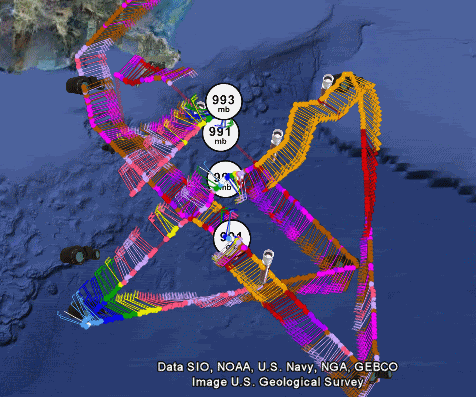
ozonepete wrote:Wxman57, Aric, you wanna hazard a guess on the center? I seem to see a littl jog to the NNE on the radar and satellite but could be temporary (or my imagination).
Surface obs suggest 28.9N/88.4W. New VDM has 28.8N/88.5W. No guarantee that's in the middle of the center, though. Center is tough to locate on radar, as radar is looking WAY up above the center from this far out.
Winds in the region aren't a lot different from 24-36 hours ago. Strong pressure gradient with the high to the northeast. Note the cool, dry air wrapping into Ida's western side. Dew points in the low 60s.
Also note that there's not a lot of flow INTO the center from the SW-NW.