ATL : TROPICAL DEPRESSION ERIKA (06L)

Moderator: S2k Moderators

Message
Author
User avatar
HURAKAN
Professional-Met
Professional-Met
Posts: 46086
Age: 38
Joined: Thu May 20, 2004 4:34 pm
Location: Key West, FL
Contact:

#581 Postby HURAKAN » Sat Aug 29, 2009 1:18 pm

Image

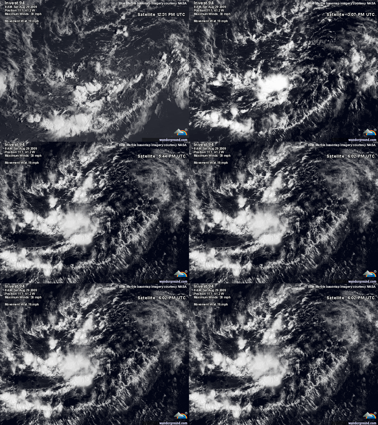
Looking good
0 likes   

clfenwi
Category 5
Category 5
Posts: 3331
Joined: Thu Jun 09, 2005 12:54 pm

Re: ATL : INVEST 94L

#582 Postby clfenwi » Sat Aug 29, 2009 1:19 pm

29/1745 UTC 10.3N 44.1W T1.0/1.0 94L -- Atlantic

First classification from SAB that was not "Too weak".
0 likes   

Sanibel
Category 5
Category 5
Posts: 10375
Joined: Mon Aug 30, 2004 11:06 pm
Location: Offshore SW Florida

Re: ATL : INVEST 94L

#583 Postby Sanibel » Sat Aug 29, 2009 1:20 pm

Like many waves before it 94L sputtered in the unfavorable mid-Atlantic negativity that still seems to be there.


I think this one is possibly bouncing back quickly so people who say "Next" etc should be more careful.


This could burst under better SST's that could then become a problem.
0 likes   

CrazyC83
Professional-Met
Professional-Met
Posts: 34002
Joined: Tue Mar 07, 2006 11:57 pm
Location: Deep South, for the first time!

#584 Postby CrazyC83 » Sat Aug 29, 2009 1:20 pm

Up to T1.0 now, so it is a bit better now.
0 likes   

User avatar
cycloneye
Admin
Admin
Posts: 145323
Age: 68
Joined: Thu Oct 10, 2002 10:54 am
Location: San Juan, Puerto Rico

Re: ATL : INVEST 94L

#585 Postby cycloneye » Sat Aug 29, 2009 1:21 pm

:uarrow: That is interesting to see,that 94L gets T Numbers.It means,is not dead as some said earlier today.
0 likes   

HUC
Category 2
Category 2
Posts: 590
Joined: Fri Oct 03, 2003 3:48 pm
Location: Basse-Terre Guadeloupe

#586 Postby HUC » Sat Aug 29, 2009 1:21 pm

ALWAYS WATCHING. A number of storms formed and/or developped after passing 45 or 50°West...Cleo,Inez,for exemple!
0 likes   

Aric Dunn
Category 5
Category 5
Posts: 21238
Age: 42
Joined: Sun Sep 19, 2004 9:58 pm
Location: Ready for the Chase.
Contact:

Re: ATL : INVEST 94L

#587 Postby Aric Dunn » Sat Aug 29, 2009 1:21 pm

vbhoutex wrote:I was wondering in the amateur ramblings of my head if the proximity to the ITCZ was still an inhibiting factor. So if I am understanding what is being said that is somewhat correct?

Right the itcz in a way steals the convergence..

or in another word blocks inflow. So yesterday all the convection was primarily associated with the broken itcz. there are still pieces of it withing the broad circulation but it is slowly breaking down. today however we have convection firing in areas where the itzc is not present
0 likes   

User avatar
HurricaneMaster_PR
Category 2
Category 2
Posts: 795
Joined: Tue Jul 22, 2003 6:23 pm
Location: San Juan, Puerto Rico

Re: ATL : INVEST 94L

#588 Postby HurricaneMaster_PR » Sat Aug 29, 2009 1:22 pm

Some people are gonna be left eating crow if this thing finally develops...
0 likes   

User avatar
KWT
Category 5
Category 5
Posts: 31415
Joined: Tue Aug 17, 2004 11:02 am
Location: UK!!!

#589 Postby KWT » Sat Aug 29, 2009 1:23 pm

Very interesting system this one, I do see what Derek is saying about the northern part of the wave but it must have more convection then it has around that area if its going to do anything anytime soon.
0 likes   

Sanibel
Category 5
Category 5
Posts: 10375
Joined: Mon Aug 30, 2004 11:06 pm
Location: Offshore SW Florida

Re: ATL : INVEST 94L

#590 Postby Sanibel » Sat Aug 29, 2009 1:24 pm

Normally the center should form in the northern end of the elongated center, but this one appears to be grabbing more around the 10-11N area.

Should pass through the 45W longitude later today and begin climbing in Sea Surface Temperatures (SST's).
0 likes   

User avatar
KWT
Category 5
Category 5
Posts: 31415
Joined: Tue Aug 17, 2004 11:02 am
Location: UK!!!

#591 Postby KWT » Sat Aug 29, 2009 1:27 pm

Hard to say Sanibel though as Derek rightly said I can see some sort of turning further north. Next 12hrs should give a much better idea in that regard I think as we will see whether the northern convection develops more or not.

Not dead yet though!
0 likes   

Aric Dunn
Category 5
Category 5
Posts: 21238
Age: 42
Joined: Sun Sep 19, 2004 9:58 pm
Location: Ready for the Chase.
Contact:

Re: ATL : INVEST 94L

#592 Postby Aric Dunn » Sat Aug 29, 2009 1:27 pm

Aric Dunn wrote:
vbhoutex wrote:I was wondering in the amateur ramblings of my head if the proximity to the ITCZ was still an inhibiting factor. So if I am understanding what is being said that is somewhat correct?

Right the itcz in a way steals the convergence..

or in another word blocks inflow. So yesterday all the convection was primarily associated with the broken itcz. there are still pieces of it withing the broad circulation but it is slowly breaking down. today however we have convection firing in areas where the itzc is not present


red lines showing left over itcz. run the loop at look and the flow on the south side if the boundary vs. the north side.

Image
0 likes   

clfenwi
Category 5
Category 5
Posts: 3331
Joined: Thu Jun 09, 2005 12:54 pm

Re: ATL : INVEST 94L

#593 Postby clfenwi » Sat Aug 29, 2009 1:30 pm

Best track:
AL, 94, 2009082918, , BEST, 0, 106N, 420W, 25, 1010, DB, 34, NEQ, 0, 0, 0, 0, 1012, 150, 75, 0, 0, L, 0, , 0, 0, INVEST, M,
0 likes   

User avatar
KWT
Category 5
Category 5
Posts: 31415
Joined: Tue Aug 17, 2004 11:02 am
Location: UK!!!

#594 Postby KWT » Sat Aug 29, 2009 1:32 pm

Looks like the best track is still following the southern region which would be near the deeper convection. Trough now elongated SW-NE as well from the looks of things.
0 likes   

User avatar
HurricaneMaster_PR
Category 2
Category 2
Posts: 795
Joined: Tue Jul 22, 2003 6:23 pm
Location: San Juan, Puerto Rico

Re: ATL : INVEST 94L - Computer Models

#595 Postby HurricaneMaster_PR » Sat Aug 29, 2009 1:33 pm

Image
0 likes   

HurricaneHunter914
Category 5
Category 5
Posts: 4439
Age: 31
Joined: Fri Mar 10, 2006 7:36 pm
Location: College Station, TX

#596 Postby HurricaneHunter914 » Sat Aug 29, 2009 1:35 pm

:uarrow: I wonder what the gfs is seeing that the other models aren't to take a track like that.
0 likes   

Derek Ortt

#597 Postby Derek Ortt » Sat Aug 29, 2009 1:39 pm

as weak as the storm is in the GFS, its likely the vortex tracker acting up
0 likes   

User avatar
cycloneye
Admin
Admin
Posts: 145323
Age: 68
Joined: Thu Oct 10, 2002 10:54 am
Location: San Juan, Puerto Rico

Re: ATL : INVEST 94L - Computer Models

#598 Postby cycloneye » Sat Aug 29, 2009 1:39 pm

18 UTC Bam Models

SHIP contines very bullish on intensity.


WHXX01 KWBC 291821
CHGHUR
TROPICAL CYCLONE GUIDANCE MESSAGE
NWS TPC/NATIONAL HURRICANE CENTER MIAMI FL
1821 UTC SAT AUG 29 2009

DISCLAIMER...NUMERICAL MODELS ARE SUBJECT TO LARGE ERRORS.
PLEASE REFER TO NHC OFFICIAL FORECASTS FOR TROPICAL CYCLONE
AND SUBTROPICAL CYCLONE INFORMATION.

ATLANTIC OBJECTIVE AIDS FOR

DISTURBANCE INVEST (AL942009) 20090829 1800 UTC

...00 HRS... ...12 HRS... ...24 HRS. .. ...36 HRS...
090829 1800 090830 0600 090830 1800 090831 0600

LAT LON LAT LON LAT LON LAT LON
BAMS 10.6N 42.0W 12.1N 43.8W 13.5N 45.9W 14.7N 47.8W
BAMD 10.6N 42.0W 11.7N 44.4W 13.0N 46.6W 14.0N 48.5W
BAMM 10.6N 42.0W 11.6N 44.2W 12.8N 46.4W 13.7N 48.3W
LBAR 10.6N 42.0W 11.4N 44.6W 12.4N 47.5W 13.4N 50.0W
SHIP 25KTS 32KTS 39KTS 49KTS
DSHP 25KTS 32KTS 39KTS 49KTS

...48 HRS... ...72 HRS... ...96 HRS. .. ..120 HRS...
090831 1800 090901 1800 090902 1800 090903 1800

LAT LON LAT LON LAT LON LAT LON
BAMS 15.5N 49.6W 17.0N 52.4W 18.2N 54.7W 19.6N 57.4W
BAMD 14.7N 50.1W 15.3N 53.1W 15.8N 56.4W 17.0N 59.6W
BAMM 14.5N 49.9W 15.2N 52.7W 15.7N 55.5W 16.4N 58.5W
LBAR 14.3N 52.4W 15.3N 56.4W 15.8N 59.4W 16.9N 61.6W
SHIP 58KTS 76KTS 88KTS 90KTS
DSHP 58KTS 76KTS 88KTS 90KTS

...INITIAL CONDITIONS...
LATCUR = 10.6N LONCUR = 42.0W DIRCUR = 270DEG SPDCUR = 14KT
LATM12 = 10.7N LONM12 = 39.2W DIRM12 = 268DEG SPDM12 = 14KT
LATM24 = 10.8N LONM24 = 36.0W
WNDCUR = 25KT RMAXWD = 75NM WNDM12 = 25KT
CENPRS = 1010MB OUTPRS = 1012MB OUTRAD = 150NM SDEPTH = M
RD34NE = 0NM RD34SE = 0NM RD34SW = 0NM RD34NW = 0NM

$$
0 likes   

User avatar
HurricaneMaster_PR
Category 2
Category 2
Posts: 795
Joined: Tue Jul 22, 2003 6:23 pm
Location: San Juan, Puerto Rico

Re: ATL : INVEST 94L

#599 Postby HurricaneMaster_PR » Sat Aug 29, 2009 1:41 pm

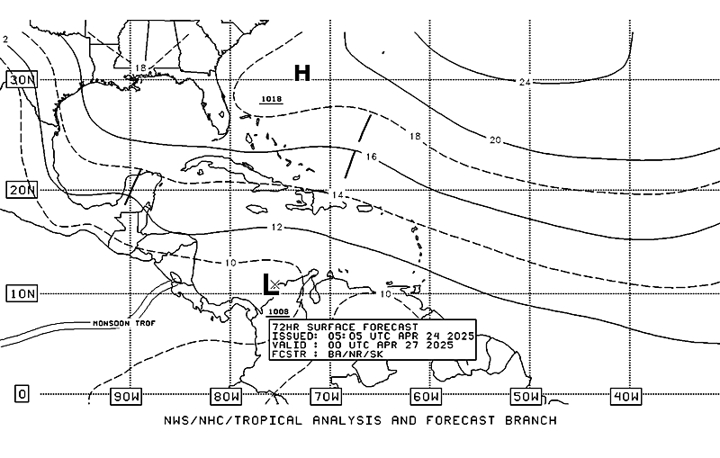
Latest TAFB 72 hour Surface Analysis forecast a general track to the NE Caribbean

Image
0 likes   

User avatar
cycloneye
Admin
Admin
Posts: 145323
Age: 68
Joined: Thu Oct 10, 2002 10:54 am
Location: San Juan, Puerto Rico

Re: ATL : INVEST 94L - Computer Models

#600 Postby cycloneye » Sat Aug 29, 2009 1:41 pm

Yes Derek about GFS vortex.

Code: Select all

GFS VTEX (KT)     12    13    11    11    10     9     9     9     9     9     9     7     7
0 likes   


Return to “2009”

Who is online

Users browsing this forum: No registered users and 1 guest